
Photo: Wikipedia
Strategic Assessment of Hancock County
Meaningful friction. Expect exposure to either population pressure, blast zones, or natural disaster risk. Consider buying a retreat property.
What does the Strategic Assessment tell us?
Our Strategic Assessment grades tactical survivability of an area. Major population centers, military targets, fallout zones, natural disasters, and border exposure all drive risk — lower exposure means a more defensible position in a crisis.
This is heavily inspired by Joel Skousen's Strategic Relocation book. Highly recommended you checkout the book ($)What does this tell us?
Our Strategic Assessment grades tactical survivability of an area. Major population centers, military targets, fallout zones, natural disasters, and border exposure all drive risk — lower exposure means a more defensible position in a crisis.
This is heavily inspired by Joel Skousen's Strategic Relocation book. Highly recommended you checkout the book ($)Strategic Pillars

Key Distances
Strategic Assessment Analysis
Hancock County, Maine offers a compelling mix of geographic isolation and practical self-sufficiency that appeals to relocators prioritizing resilience and preparedness. Anchored by the city of Ellsworth and the coastal town of Bar Harbor, the county sits far from major metropolitan targets while retaining access to essential infrastructure, making it a strong candidate for those seeking a defensible, low-risk location in the Northeast. Its position on the Downeast coast provides natural buffers, a cold-weather climate that deters many threats, and a community culture that values independence and resourcefulness.
Geographic position and natural advantages for long-term security
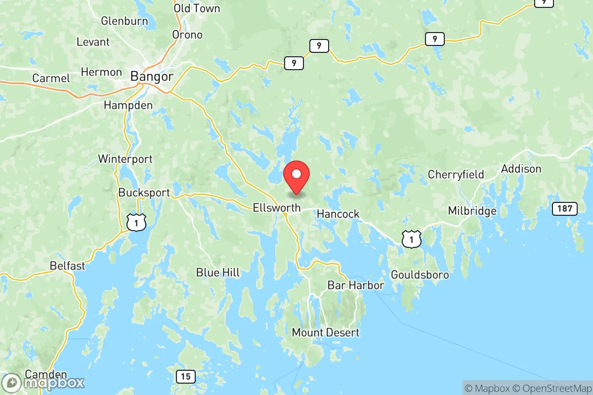
Hancock County's location is its primary strategic asset. It lies roughly 200 miles northeast of Portland and over 250 miles from Boston, placing it well outside the immediate fallout zones or secondary shockwaves of any major urban or military target in the Northeast Corridor. The county is bounded by the Atlantic Ocean to the south and vast stretches of forest to the north and west, with the Blue Hill Peninsula and Mount Desert Island forming natural barriers that limit approach vectors. The interior is dominated by the Donnell Pond Unit and the sprawling 3,500-square-mile Downeast Lakes region, which provide abundant freshwater resources and game. The closest city of any strategic significance is Bangor, about 30 miles west of Ellsworth, which hosts Bangor International Airport (a former Air Force base and current alternate landing site for Air Force One) and the Maine Army National Guard's Bangor Air National Guard Base. While Bangor is a moderate risk due to its military aviation role, Hancock County's distance and the intervening terrain of the Maine Highlands reduce the likelihood of direct exposure. The county's coastline is rugged and deeply indented, with few deepwater ports that would attract naval attention — the port of Searsport in neighboring Waldo County is the nearest significant shipping hub, but Hancock County itself lacks major industrial maritime targets.
Risks, exposures, and proximity to fallout-relevant landmarks
No location is risk-free, and Hancock County has specific exposures that a relocator should weigh. The most notable nearby landmark with fallout relevance is the Maine Yankee nuclear site in Wiscasset, roughly 80 miles southwest — a decommissioned plant with spent fuel stored on-site, though the risk of a catastrophic release is low given its cold status. More immediate is the aforementioned Bangor Air National Guard Base, which could be a secondary target in a conflict involving strategic airlift or refueling assets. The county also lies within 100 miles of the Portsmouth Naval Shipyard in Kittery, a nuclear submarine maintenance facility that is a high-value target, but the distance and prevailing winds from the southwest reduce direct fallout risk. Natural hazards are more tangible: the region experiences Nor'easters that can dump several feet of snow and knock out power for days, and the coastal areas face storm surge risks from hurricanes that occasionally track up the Gulf of Maine. However, Hancock County is not in a seismic zone, has no active volcanoes, and is far from the wildfire-prone regions of the West. The primary man-made risk is economic isolation — the county's population of roughly 55,000 is spread thin, and a prolonged disruption to fuel or food supply chains could strain local resources, especially in winter.
Practical resilience for a relocator: food, water, energy, and defensibility
For someone serious about self-sufficiency, Hancock County offers strong fundamentals. Freshwater is abundant: the county contains hundreds of lakes and ponds, including Graham Lake, Branch Lake, and the Union River, which supplies Ellsworth's municipal water. Most residential wells in rural areas tap into reliable groundwater at depths of 50 to 200 feet, and surface water is plentiful for non-potable use. The growing season is short — roughly 120 days between last and first frost — but the soil in the river valleys and coastal plains is workable for cold-hardy crops like potatoes, root vegetables, and brassicas. The Gulf of Maine's waters provide year-round access to lobster, crab, and groundfish, and the inland forests support deer, moose, and small game. For energy, the county is served by Emera Maine's grid, which is vulnerable to storm outages, but the prevalence of wood stoves and pellet boilers means most rural homes already have a backup heat source. Solar potential is moderate — about 4.2 peak sun hours per day — but battery storage is becoming more common. Defensibility is a mixed picture: the county's low population density and limited road network (primarily US Route 1 and State Route 3) make it easy to monitor access points, but the long coastline and numerous islands create many potential entry points for maritime threats. The community culture in towns like Blue Hill, Deer Isle, and Stonington is insular and self-reliant, with strong local networks that can be an asset for mutual aid but may be slow to trust newcomers.
The overall strategic picture for Hancock County is one of moderate-to-high resilience with manageable trade-offs. It avoids the high-risk zones near major cities, military complexes, and industrial corridors that dominate the Mid-Atlantic and Northeast, while offering abundant natural resources and a climate that naturally limits many threats. The trade-offs are real: a short growing season, winter isolation, and dependence on a fragile road network for resupply. But for a relocator who values geographic buffer, access to clean water, and a community that already lives with a degree of self-reliance, Hancock County ranks as one of the more defensible and sustainable options in the eastern United States. The key is to arrive prepared — with stored supplies, renewable energy capacity, and a willingness to integrate into a culture that prizes competence and discretion over convenience.

* Values derived from national, state, county, city and local statistics and may differ in a specific area. Last updated: 2026-07-10T22:35:32.000Z
Narrative content on this page is AI-generated and may contain mistakes. Verify any details that matter before acting on them.
ReloMaps may earn a commission from affiliate links at no extra cost to you.

