
Photo: Wikipedia
Strategic Assessment of Irvington, NY
High tactical risk. This location is likely close to major population centers, strategic targets, or sits in a high-disaster corridor. A retreat property and careful exit planning is required.
What does the Strategic Assessment tell us?
Our Strategic Assessment grades tactical survivability of an area. Major population centers, military targets, fallout zones, natural disasters, and border exposure all drive risk — lower exposure means a more defensible position in a crisis.
This is heavily inspired by Joel Skousen's Strategic Relocation book. Highly recommended you checkout the book ($)What does this tell us?
Our Strategic Assessment grades tactical survivability of an area. Major population centers, military targets, fallout zones, natural disasters, and border exposure all drive risk — lower exposure means a more defensible position in a crisis.
This is heavily inspired by Joel Skousen's Strategic Relocation book. Highly recommended you checkout the book ($)Strategic Pillars

Key Distances
Regional Safe Places
Below is our recommended "safe zones" in New York and the surrounding area based on our strategic heuristics. For most people, it's unrealistic to live in a “safe zone” full-time due to work, family or other personal reasons. They tend to be more rural. However, many of these areas are perfect for second homes and retreat properties that double as a vacation home or even a short-term rental.




Important Note: For informational purposes only. This does not mean nothing bad ever happens in the green zones. Please use common sense. This is based on public data and modeled with AI. We tried to take a conservative approach but mistakes happen. We update this regularly as new information becomes available.
Solar Generator Recommendations
Backup power matters more here than in safer locations. We've picked three solar generators across budgets and capacity tiers — start with the budget unit if you only need a few essentials, or step up if you want to run a fridge and HVAC for days at a time.

Jackery Portable Power Station Explorer 300
Budget OptionPower on the Go: Weighing only 11 lbs, it's convenient to set up and store with book-sized foldable solar panels

BLUETTI Portable Power Station AC180
Designed for both indoor and outdoor scenarios, AC180 is highly capable as it has a robost capacity and continuous output power.

EF ECOFLOW DELTA Pro Ultra Power Station
Upgraded PickEcoFlow DELTA Pro Ultra is a whole-home energy system designed to grow with your family. Integrated with the Smart Home Panel 2, it scales to meet your evolving energy needs — keeping your home powered, intelligent, and secure through every stage of life.
We earn a commission, at no additional cost to you.
Strategic Assessment Analysis
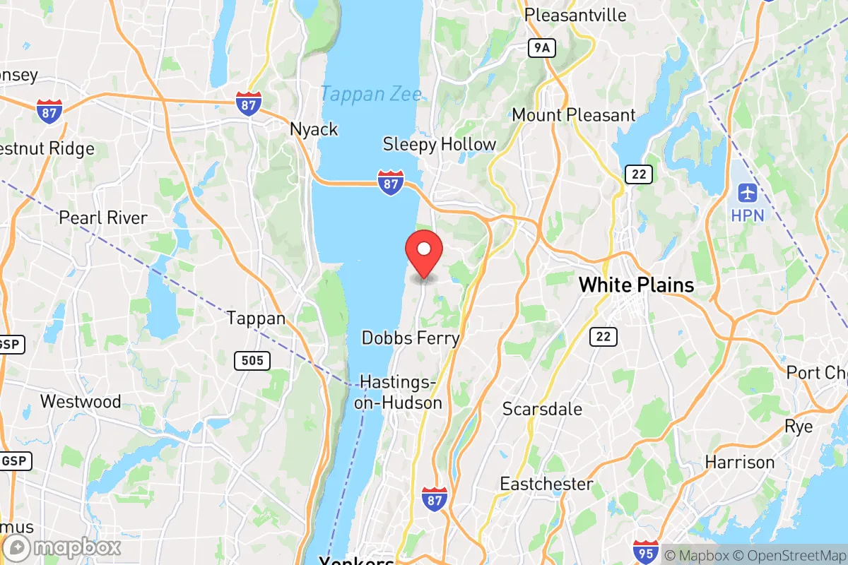
From a strategic resilience perspective, Irvington, NY presents a mixed picture for the relocator who values self-sufficiency and disaster readiness. Its position roughly 20 miles north of midtown Manhattan along the Hudson River offers a buffer from the densest urban chaos without removing you from the region’s economic and infrastructure backbone. That proximity cuts both ways: you gain access to above-average medical resources and supply chains, but you also remain within the shadow of a high-value target zone. A thoughtful assessment must weigh the natural advantages of the terrain and water access against the man-made vulnerabilities of living in a well-connected suburban corridor.
How Irvington's Hudson River location and terrain shape its natural resilience
Irvington sits on the eastern bank of the Hudson River in a stretch of Westchester County characterized by steep, wooded hills and deep ravines. The village itself climbs from the riverfront up into ridges that offer natural elevation advantages—flood waters from the Hudson are typically contained to the narrow shoreline and the Metro-North rail corridor, leaving the majority of residential neighborhoods on higher ground. That elevation also provides line-of-sight advantages and makes the area less prone to storm surge than coastal communities. The surrounding landscape is thickly forested with oak, maple, and hickory; that cover can serve as a thermal and visual shield, slowing wind speeds in severe weather and offering natural resources for heat in a prolonged outage. The Hudson itself is a massive, perennial water source—but drawing and treating it for drinking requires filtration and boiling, since it's brackish near the tidal zone and carries silt and industrial runoff. The village's hilly layout creates natural choke points on the few roads that connect neighborhoods to the main arteries (Broadway/US 9 and the Sprain Brook Parkway), which could complicate evacuation but also slow the movement of unwanted traffic into the area.
Exposure to natural disasters and man-made fallout risks from nearby urban centers
Westchester County is not prone to the most dramatic natural disasters. Earthquakes are rare and mild; tornadoes are infrequent and generally weak. The primary natural threats are winter ice storms that can down power lines for days, and the occasional inland flooding from intense thunderstorms—both manageable with generator and sump-pump preparation. The more serious concerns are man-made. Irvington lies within the plausible fallout plume corridor for a nuclear detonation at the Indian Point facility site, even though the plant is permanently shuttered. More critically, its proximity to New York City (~20 miles south) places it within a zone where a ground-level blast in Manhattan could deposit fallout depending on wind direction. The prevailing westerlies would typically carry radioactive debris east over Long Island and the Atlantic, but a shift to southerly winds could push contamination north along the Hudson Valley. The village is also within easy missile or drone range of the NYC metro area's hardened targets—military installations, financial district, government centers—which elevates the statistical risk of being caught in a cascading infrastructure collapse. Power grids serving southern Westchester are heavily dependent on the same substations and transmission lines that feed the city, making long-duration blackouts a realistic scenario after a cyber or physical attack. The Cuomo Bridge (Tappan Zee) and the Lincoln Tunnel are both critical chokepoints for evacuation or supply movement, and either could be rendered impassable in a crisis.
Practical self-sufficiency for a relocator: food, water, energy, and community defensibility
Irvington is a village of about 6,500 residents with a compact, walkable downtown—a mixed advantage. On one hand, you can reach a grocery store, pharmacy, and hardware store on foot or by bike. On the other, the village relies on just-in-time deliveries from larger distribution centers in the region. Long-term food security would require building a home garden, which is possible on many lots (typical quarter-acre to half-acre), but the heavy shade from mature trees limits sun exposure in some yards. Small livestock (chickens) are permitted under village code, but larger animals are not, so meat and dairy self-sufficiency is unrealistic within village limits. Water is the strongest natural asset: the Hudson is abundant, and many older homes in the area still have private wells that can be fitted with hand pumps or solar-powered lift systems. The village water supply comes from New York City's Catskill/Delaware system, which is vulnerable to contamination or shutdown—so a well is a significant resilience upgrade. Energy: the grid is above-average reliability for the Northeast (underground lines in newer subdivisions), but an ice storm or cyberattack can knock it out for a week. Solar panels with battery backup are practical given the hilly terrain and southern exposures on many roofs; a gas generator is the cheaper fallback. Defensibility is moderate. The village police department is small (about 20 officers), and backup from county or state police can be delayed if regional emergencies pull them elsewhere. The volunteer fire company is well-trained but equipment is standard. Neighborhood watch culture exists but is informal. The winding, dead-end roads found in the hillside sections of Irvington (e.g., areas near Ardsley Park) create natural defensible pockets where a small group of prepared residents could effectively monitor access points. That same geography, however, can isolate you from help.
The overall strategic picture for Irvington is one of trade-offs. It offers genuine geographic protections—elevation, water access, tree cover, and moderate distance from the densest urban target—that place it ahead of most inner-ring suburbs on a resilience checklist. The practical ability to stockpile, garden, and store water is better than in a city apartment but worse than in a rural homestead. The community culture is engaged but not prepper-oriented; your neighbors will probably not be ready for a month-long grid outage. For the relocator who needs to remain within commuting distance of a New York City job but wants a defensible, resource-rich base in a crisis, Irvington is a plausible choice—provided you invest seriously in your own power, water, and food reserves. If you can go farther north, you gain lower population density and more land. If you cannot, Irvington is one of the better compromises in the lower Hudson Valley.

* Values derived from national, state, county, city and local statistics and may differ in a specific area. Last updated: 2026-06-20T16:23:44.000Z
Narrative content on this page is AI-generated and may contain mistakes. Verify any details that matter before acting on them.
ReloMaps may earn a commission from affiliate links at no extra cost to you.

