
Strategic Assessment of Suffolk City County
Meaningful friction. Expect exposure to either population pressure, blast zones, or natural disaster risk. Consider buying a retreat property.
What does the Strategic Assessment tell us?
Our Strategic Assessment grades tactical survivability of an area. Major population centers, military targets, fallout zones, natural disasters, and border exposure all drive risk — lower exposure means a more defensible position in a crisis.
This is heavily inspired by Joel Skousen's Strategic Relocation book. Highly recommended you checkout the book ($)What does this tell us?
Our Strategic Assessment grades tactical survivability of an area. Major population centers, military targets, fallout zones, natural disasters, and border exposure all drive risk — lower exposure means a more defensible position in a crisis.
This is heavily inspired by Joel Skousen's Strategic Relocation book. Highly recommended you checkout the book ($)Strategic Pillars

Key Distances
Strategic Assessment Analysis
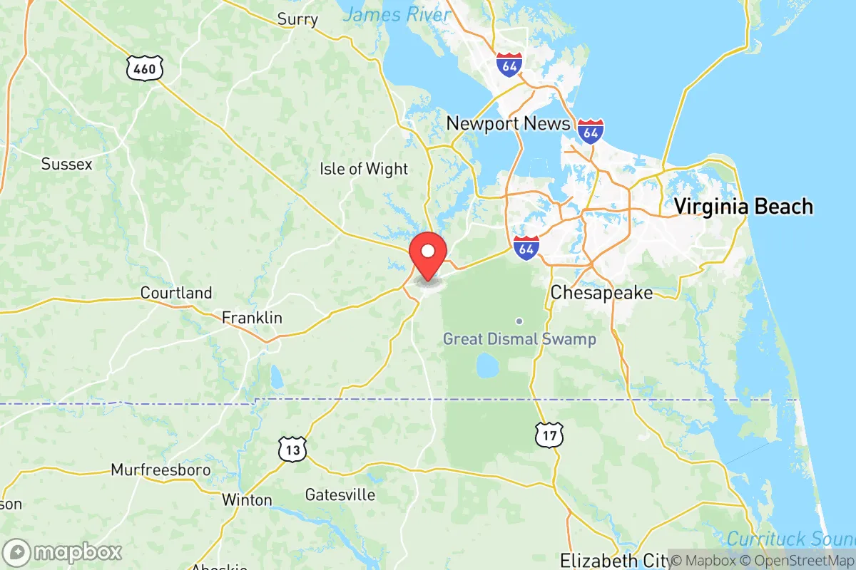
Suffolk City County, Virginia, occupies a strategic position in the Hampton Roads region that offers a blend of geographic insulation and logistical connectivity, making it a serious consideration for relocation-minded individuals and families focused on resilience and self-sufficiency. As Virginia’s largest city by land area, Suffolk provides significant buffer from the denser urban cores of Norfolk and Virginia Beach while still granting access to critical infrastructure. Its location along the Nansemond River and proximity to the Atlantic Intracoastal Waterway, combined with a lower population density than neighboring cities, creates a foundation for a more defensible and resource-independent lifestyle.
Geographic position and natural advantages for long-term stability
Suffolk’s geography is defined by its position at the convergence of the Nansemond River, the Great Dismal Swamp, and the expansive agricultural and forested lands of western Hampton Roads. This location offers natural barriers to urban sprawl and provides a degree of physical separation from the region’s major military and industrial targets. The city sits roughly 20 miles west of Norfolk Naval Station, the world’s largest naval base, and about 30 miles from the Port of Virginia’s major terminals in Norfolk and Newport News. While this proximity carries risk, the intervening rural and swampy terrain of western Suffolk and neighboring Isle of Wight County offers a natural buffer that denser suburban corridors lack. The Great Dismal Swamp National Wildlife Refuge, spanning over 112,000 acres along Suffolk’s southern border, functions as a massive undeveloped green space that limits approach vectors and provides a potential resource zone for those with backcountry skills. The city’s elevation, averaging 30 to 50 feet above sea level, is higher than much of coastal Virginia, reducing flood risk relative to Chesapeake or Virginia Beach, though low-lying areas near the Nansemond River remain vulnerable to storm surge from major hurricanes.
Risks, exposures, and proximity to fallout-relevant landmarks
Suffolk’s resilience profile is complicated by its location within the Hampton Roads metropolitan area, which contains a dense concentration of high-value military and industrial targets. Norfolk Naval Station, Joint Base Langley-Eustis in Hampton, and Naval Support Activity Hampton Roads in Northwest are all within 30 miles, making the region a plausible priority zone for strategic disruption. The Port of Virginia’s container terminals in Norfolk and Portsmouth, along with the coal and grain export facilities at Newport News, represent critical economic infrastructure that could draw secondary effects. Suffolk itself hosts the U.S. Joint Forces Command (now part of U.S. Transportation Command) facilities and the Suffolk Executive Airport, which, while not primary targets, could see increased activity during a crisis. The city’s industrial base includes manufacturing and logistics centers along the U.S. 58 and U.S. 460 corridors, including the large QVC distribution center and the Hampton Roads Agricultural Research and Extension Center. On the natural hazard side, Suffolk faces hurricane risk as a coastal plain city, with Hurricane Isabel in 2003 and Hurricane Matthew in 2016 causing significant flooding and power outages. The city’s extensive tree canopy also creates vulnerability to ice storms and wind damage, which can disrupt power and road access for days. Tornado risk is moderate, with the region averaging 5-10 tornadoes annually, typically EF-0 to EF-2 strength.
Practical resilience for a relocator: food, water, energy, and defensibility
For a relocator prioritizing self-sufficiency, Suffolk offers several practical advantages over denser Hampton Roads cities. The city’s agricultural base is substantial, with over 40,000 acres of farmland in production, including row crops like soybeans, corn, and wheat, as well as livestock operations and the region’s notable peanut and cotton production. The Suffolk Farmers Market and multiple roadside stands provide direct access to local food, and the city’s zoning allows for backyard gardens and small-scale livestock in most residential areas. Water resources are abundant: the Nansemond River and its tributaries offer surface water access, and the region’s high water table means shallow wells are feasible in many rural parcels. The city’s water supply comes primarily from the Lake Prince and Lake Meade reservoirs, which are managed by the City of Suffolk and provide a degree of municipal water security. Energy infrastructure includes connections to the Dominion Energy grid, which serves the broader Hampton Roads region, but the city’s rural western areas are more prone to longer outage durations due to lower population density and longer repair routes. Solar potential is moderate, with Suffolk averaging about 4.5 peak sun hours per day, making rooftop solar a viable but not exceptional option. Defensibility is a mixed picture: the city’s large land area (over 430 square miles) means many neighborhoods are separated by farmland, forest, or swamp, creating natural chokepoints and limited approach routes. However, the major highways (I-664, U.S. 58, U.S. 460, and U.S. 13) provide multiple evacuation corridors, which is a double-edged sword — they enable egress but also allow rapid movement of outsiders into the area. The city’s law enforcement presence includes the Suffolk Police Department and the Suffolk Sheriff’s Office, with response times in rural areas typically ranging from 10 to 20 minutes, underscoring the importance of personal security preparedness.
The overall strategic picture for Suffolk City County is one of moderated risk and genuine opportunity for the resilience-minded relocator. Its geographic position offers a meaningful buffer from the densest military and industrial targets in Hampton Roads, while its agricultural capacity, water resources, and low population density provide a foundation for a more self-sufficient lifestyle. The trade-offs are clear: proximity to high-value infrastructure in Norfolk, Newport News, and Portsmouth introduces a risk profile that cannot be ignored, and the region’s hurricane and storm vulnerability demands serious preparation. For a family or individual willing to invest in backup power, water storage, and food production systems, and who understands the importance of situational awareness in a region with significant military activity, Suffolk represents one of the more balanced options in coastal Virginia. It is not a remote retreat, but it is a defensible, resource-rich location that rewards preparation and local knowledge.

* Values derived from national, state, county, city and local statistics and may differ in a specific area. Last updated: 2026-07-12T08:27:54.000Z
Narrative content on this page is AI-generated and may contain mistakes. Verify any details that matter before acting on them.
ReloMaps may earn a commission from affiliate links at no extra cost to you.

