
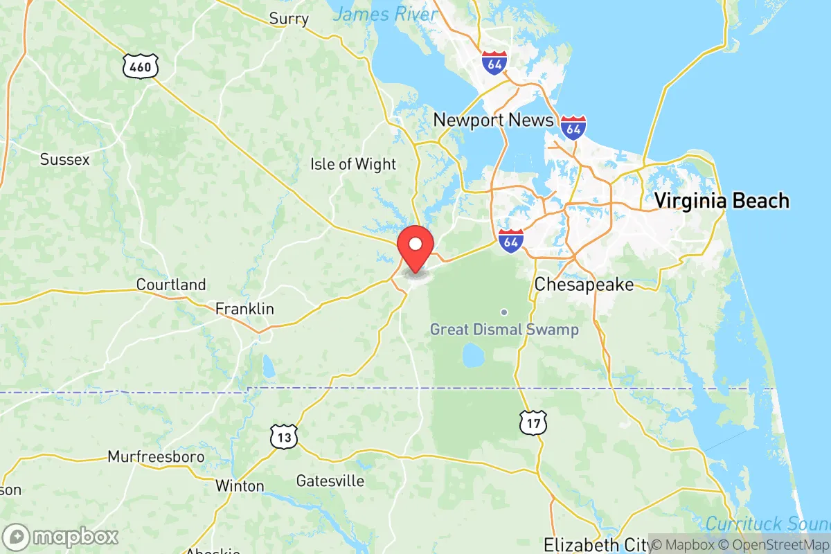
Demographics of Suffolk City County
Affluence Level in Suffolk City County
A middle-class area roughly in line with national averages across income, home values, education, and employment.
People of Suffolk City County
The people of Suffolk City County, Virginia today number 96,638, forming a community defined by its deep African American heritage, steady suburban growth, and a distinctly Southern character that blends rural tradition with expanding suburban development. With a population that is 46.5% White and 41.5% Black, Suffolk stands as one of the most racially balanced cities in Hampton Roads, yet it remains notably less diverse than neighboring Norfolk or Virginia Beach in terms of immigrant communities, with only 1.7% foreign-born residents. The city's identity is shaped by its history as a peanut-farming and railroad hub, its role as a crossroads between the Tidewater region and the interior, and its recent transformation into a bedroom community for the military and industrial workforce of the broader Hampton Roads area.
Settlement & growth (pre-1960)
The land that became Suffolk City County was originally inhabited by the Nansemond tribe, an Algonquian-speaking people who lived along the Nansemond River and its tributaries. English colonists from Jamestown began encroaching on Nansemond territory as early as the 1620s, and by 1634 the area was organized as Nansemond County, one of the original eight shires of Virginia. The Nansemond people were largely displaced or absorbed through a combination of warfare, disease, and forced treaties, though a remnant community persists today in the form of the Nansemond Indian Nation, which maintains a presence in the region.
The colonial period saw the establishment of tobacco plantations worked by enslaved Africans, who by the mid-1700s constituted a majority of the labor force in the area. The town of Suffolk was officially established in 1742 as a port on the Nansemond River, serving as a shipping point for tobacco and later for peanuts. The plantation economy created a demographic structure that persisted for centuries: a White planter class, a large enslaved Black population, and a small number of free Black families and poor White farmers. By 1790, Nansemond County's population was roughly 40% enslaved, a proportion that grew in the antebellum period as cotton and peanut cultivation expanded.
After the Civil War and emancipation, Suffolk's Black population remained concentrated in rural areas and in specific neighborhoods within the city, such as East Suffolk and the Holland area, where freedmen established farms, churches, and schools. The post-Reconstruction era saw the rise of Jim Crow segregation, but Suffolk's Black community built a remarkably self-sufficient network of institutions, including the East Suffolk High School and numerous Black-owned businesses along Main Street. The peanut industry, dominated by the Planters Peanuts company (founded in Suffolk in 1906), provided steady employment for both Black and White workers, creating a stable working class that anchored the city through the early 20th century.
The early 1900s brought a wave of White migration from rural areas of Virginia and North Carolina, drawn by the railroad and peanut-processing jobs. Suffolk became known as the "Peanut Capital of the World," and its population grew steadily, reaching about 10,000 by 1930. The Great Depression hit the peanut economy hard, but World War II brought new growth as the Norfolk Naval Shipyard and other military installations in Hampton Roads drew workers from across the South. Many of these workers settled in Suffolk, particularly in the Whaleyville and Driver communities, where affordable land and proximity to the shipyard made the city an attractive alternative to higher-cost Norfolk.
Modern era (post-1965)
The 1965 Hart-Cellar Act had a relatively muted effect on Suffolk compared to larger American cities. The foreign-born population remains low at 1.7%, and the city did not experience the large-scale immigration from Asia or Latin America that transformed nearby Virginia Beach or the Washington, D.C. suburbs. Instead, Suffolk's modern demographic story is one of domestic migration and suburbanization. The consolidation of Nansemond County and the city of Suffolk into a single independent city in 1974 created the current political boundaries and set the stage for rapid growth.
The most significant demographic shift since the 1970s has been the influx of White families from Norfolk, Portsmouth, and Chesapeake, seeking larger lots, newer housing, and lower crime rates. This suburban wave concentrated in the northern and western parts of the city, particularly around the Harbour View area near the Monitor-Merrimac Memorial Bridge-Tunnel, which provides direct access to Newport News and Hampton. Harbour View has become Suffolk's most affluent and fastest-growing neighborhood, with master-planned subdivisions, shopping centers, and the city's highest concentration of college-educated residents (32.4% citywide hold a bachelor's degree or higher).
The Black population, historically concentrated in downtown Suffolk and the East Suffolk corridor, has become more suburbanized as well, with many middle-class Black families moving to newer developments in the Chuckatuck and Wilroy areas. The Hispanic population, though small at 4.9%, has grown noticeably since 2000, driven by construction and service-industry jobs. This community is most visible in the North Main Street corridor, where Mexican and Central American restaurants and tiendas have opened. The East/Southeast Asian population (1.5%) and Indian-subcontinent population (0.4%) remain small but have grown modestly, largely through professional and military-affiliated families stationed at nearby Joint Base Langley-Eustis and Naval Station Norfolk.
The city's racial geography remains somewhat divided, with the northern Harbour View area predominantly White and the older southern and eastern neighborhoods predominantly Black. However, the newer subdivisions built since 2010 have been more integrated, reflecting a broader trend of middle-class families of all races seeking similar housing and school options. The College Drive corridor, anchored by Paul D. Camp Community College, has become a mixed-income, mixed-race area that exemplifies Suffolk's evolving character.
The future
Suffolk's population is projected to continue growing, potentially reaching 110,000-120,000 by 2040, driven by continued suburban expansion from Norfolk and Virginia Beach. The city is becoming slightly more diverse, with the Hispanic and Asian populations expected to grow as service and healthcare sectors expand, but the foreign-born share will likely remain below 5% for the foreseeable future. The Black population share is holding steady at around 41%, while the White share is slowly declining as younger, more diverse families move into new developments.
The most significant demographic trend is the aging of the White population in established neighborhoods like Driver and Whaleyville, where long-time residents are being replaced by younger Black and Hispanic families. Meanwhile, the Harbour View area continues to attract young White professionals and military families, creating a demographic counterbalance. The city's cultural identity is evolving from its peanut-farming and railroad roots toward a more generic suburban character, though efforts to preserve historic downtown Suffolk and the Nansemond River waterfront are maintaining some local distinctiveness.
For someone moving in now, Suffolk offers a stable, family-oriented environment with good schools, relatively affordable housing, and easy access to Hampton Roads' job markets. The city is becoming more diverse but remains predominantly Black and White, with limited immigrant influence. The political character leans conservative, particularly in the northern suburbs, while the older Black neighborhoods vote reliably Democratic. The next decade will likely see continued growth, gradual diversification, and an ongoing tension between preserving Suffolk's historic identity and accommodating the suburban expansion that is reshaping the city.

* Values derived from national, state, county, city and local statistics and may differ in a specific area. Last updated: 2026-07-12T08:27:54.000Z
Narrative content on this page is AI-generated and may contain mistakes. Verify any details that matter before acting on them.
ReloMaps may earn a commission from affiliate links at no extra cost to you.

