 Popular
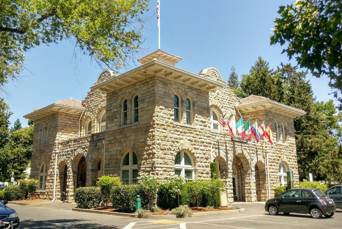
Photo: Wikipedia
Strategic Assessment of Sonoma, CA
Multiple tactical vulnerabilities. Population density, target proximity, or disaster risk are likely compounding. A retreat property and exit planning is required.
What does the Strategic Assessment tell us?
Our Strategic Assessment grades tactical survivability of an area. Major population centers, military targets, fallout zones, natural disasters, and border exposure all drive risk — lower exposure means a more defensible position in a crisis.
This is heavily inspired by Joel Skousen's Strategic Relocation book. Highly recommended you checkout the book ($)What does this tell us?
Our Strategic Assessment grades tactical survivability of an area. Major population centers, military targets, fallout zones, natural disasters, and border exposure all drive risk — lower exposure means a more defensible position in a crisis.
This is heavily inspired by Joel Skousen's Strategic Relocation book. Highly recommended you checkout the book ($)Strategic Pillars

Key Distances
Regional Safe Places
Below is our recommended "safe zones" in California and the surrounding area based on our strategic heuristics. For most people, it's unrealistic to live in a “safe zone” full-time due to work, family or other personal reasons. They tend to be more rural. However, many of these areas are perfect for second homes and retreat properties that double as a vacation home or even a short-term rental.




Important Note: For informational purposes only. This does not mean nothing bad ever happens in the green zones. Please use common sense. This is based on public data and modeled with AI. We tried to take a conservative approach but mistakes happen. We update this regularly as new information becomes available.
Solar Generator Recommendations
Backup power matters more here than in safer locations. We've picked three solar generators across budgets and capacity tiers — start with the budget unit if you only need a few essentials, or step up if you want to run a fridge and HVAC for days at a time.

Jackery Portable Power Station Explorer 300
Budget OptionPower on the Go: Weighing only 11 lbs, it's convenient to set up and store with book-sized foldable solar panels

BLUETTI Portable Power Station AC180
Designed for both indoor and outdoor scenarios, AC180 is highly capable as it has a robost capacity and continuous output power.

EF ECOFLOW DELTA Pro Ultra Power Station
Upgraded PickEcoFlow DELTA Pro Ultra is a whole-home energy system designed to grow with your family. Integrated with the Smart Home Panel 2, it scales to meet your evolving energy needs — keeping your home powered, intelligent, and secure through every stage of life.
We earn a commission, at no additional cost to you.
Strategic Assessment Analysis
Sonoma, California, offers a nuanced strategic picture for the relocation-minded reader focused on resilience and self-sufficiency. While its location in the North Bay provides significant natural advantages in terms of water resources and defensible terrain, it sits within a region that carries distinct exposure risks—from wildfire to proximity to high-value, potentially contested infrastructure in the San Francisco Bay Area. For a conservative-leaning individual or family assessing long-term preparedness, Sonoma represents a trade-off: a relatively insulated, resource-rich pocket that is nonetheless within the shadow of a major metropolitan complex.
Geographic position and natural advantages for long-term stability
Sonoma’s geographic position is one of its strongest cards for resilience. Nestled in the Sonoma Valley, the town sits roughly 45 miles north of San Francisco, placing it far enough from the urban core to avoid the immediate fallout of a major disruption—whether economic collapse, civil unrest, or a natural disaster—yet close enough to access critical supplies and medical infrastructure if needed. The valley is flanked by the Mayacamas Mountains to the west and the Sonoma Mountains to the east, creating a natural bowl that offers some degree of topographic defensibility. This terrain makes the area less accessible to large-scale, disorganized movement, which can be an advantage in a crisis scenario.
The region’s Mediterranean climate—with mild, wet winters and dry summers—supports year-round agriculture, a key factor for food security. The Sonoma Valley is part of the larger North Bay agricultural zone, which includes some of California’s most productive farmland. The presence of the Sonoma Creek watershed and proximity to the Russian River (about 15 miles northwest) provide reliable surface water sources, though drought cycles are a recurring concern. For a relocator, the ability to tap into local water rights or well systems is a tangible advantage over more arid parts of the state. The area’s elevation, ranging from roughly 100 to 1,500 feet, also reduces flood risk compared to low-lying Bay Area communities like San Rafael or Novato.
Exposure to natural and man-made risks, including proximity to fallout-relevant landmarks
The most immediate and recurring risk in Sonoma is wildfire. The 2017 Nuns Fire and the 2020 Glass Fire both burned significant portions of the surrounding hillsides, destroying homes and forcing evacuations. The area’s wildland-urban interface (WUI) is extensive, meaning many properties border dense chaparral and oak woodland. For a relocator, this demands a hard look at defensible space, building materials, and evacuation routes. The valley’s single primary artery—State Route 12—can become a choke point during a fast-moving fire, a vulnerability that should factor into any property decision.
Beyond wildfire, Sonoma’s proximity to the San Francisco Bay Area introduces man-made risks. The region is within 50 miles of the Diablo Canyon Power Plant (though that facility is decommissioning) and within 100 miles of the Lawrence Livermore National Laboratory, a nuclear research facility. In a major geopolitical conflict, these sites could be considered high-value targets. Additionally, the Bay Area’s dense population—over 7 million people—means that a collapse in supply chains or civil order in the urban core could send a wave of displaced persons northward along Highway 101 and Interstate 80. Sonoma’s relative isolation is a double-edged sword: it offers buffer, but also limited egress if the valley becomes a funnel for outbound traffic.
Earthquake risk is moderate but real. The Rodgers Creek Fault runs through the Sonoma Valley, and a major rupture (estimated at a 33% probability of a 6.7+ magnitude quake in the next 30 years by the USGS) could disrupt power, water, and road access for weeks. The town’s older building stock—some structures date to the 1800s—may not meet modern seismic codes, a factor to investigate when evaluating a property.
Practical resilience for a relocator: food, water, energy, and defensibility
For the self-sufficiency-minded relocator, Sonoma offers a mixed but workable baseline. Food security is the area’s strongest suit. The Sonoma Valley is home to dozens of small farms, orchards, and vineyards, plus a robust farmers’ market scene. The nearby Petaluma and Sebastopol areas are hubs for organic and regenerative agriculture. A household with even a quarter-acre lot can establish a substantial vegetable garden, and the climate supports citrus, stone fruit, and olives. Local food co-ops and bulk suppliers (e.g., Sonoma Market, Community Market) provide backup, though reliance on the grocery supply chain is a vulnerability during disruptions.
Water is a more complex picture. Sonoma gets its municipal water from the Sonoma County Water Agency, which draws from the Russian River and Lake Sonoma. During drought years—like 2021–2022—mandatory conservation measures were enacted. For a relocator, securing a property with a private well (typical depths of 200–400 feet in the valley) is a significant resilience upgrade. Rainwater catchment is legal in California and practical here, given the 30–35 inches of annual rainfall. However, storage capacity and filtration are necessary investments.
Energy infrastructure is moderately resilient. PG&E’s grid is prone to Public Safety Power Shutoffs (PSPS) during high-wind fire conditions, which can last days. Solar adoption is high in Sonoma County, and many homes have battery backup (e.g., Tesla Powerwall). Off-grid solar is feasible but requires significant upfront cost. Natural gas is available in town but not in rural areas; propane tanks are common. For defensibility, the valley’s layout offers natural chokepoints—the main roads into Sonoma (SR 12, SR 121, and Arnold Drive) can be monitored or blocked if necessary. However, the town itself is not a fortress; it’s a small city of about 11,000 people, with a walkable downtown but limited perimeter security. A rural property on the valley’s edge, with good sightlines and a single access road, would be far more defensible than an in-town lot.
The overall strategic picture for a conservative relocator
Sonoma, California, is not a bug-out location for the hardcore prepper, nor is it a high-risk urban trap. It sits in a middle zone: a resource-rich, agriculturally productive valley with solid water access and a moderate climate, but one that carries real wildfire and seismic risks and sits within the gravitational pull of the Bay Area’s vulnerabilities. For a family or individual willing to invest in fire-hardening, water independence, and solar backup, Sonoma offers a viable long-term base. The trade-off is that you are not fully off the grid—you are in a community with a strong local economy, good schools, and a conservative-leaning rural culture (Sonoma County voted 60% Democratic in 2024, but the city itself and surrounding unincorporated areas lean more libertarian and agricultural). If your strategic calculus prioritizes food production and water security over absolute isolation, Sonoma deserves a serious look. If your primary concern is avoiding any proximity to major population centers or critical infrastructure, you would be better served by a more remote location in the Sierra foothills or the Pacific Northwest.

* Values derived from national, state, county, city and local statistics and may differ in a specific area. Last updated: 2026-09-22T20:14:07.000Z
Narrative content on this page is AI-generated and may contain mistakes. Verify any details that matter before acting on them.
ReloMaps may earn a commission from affiliate links at no extra cost to you.

