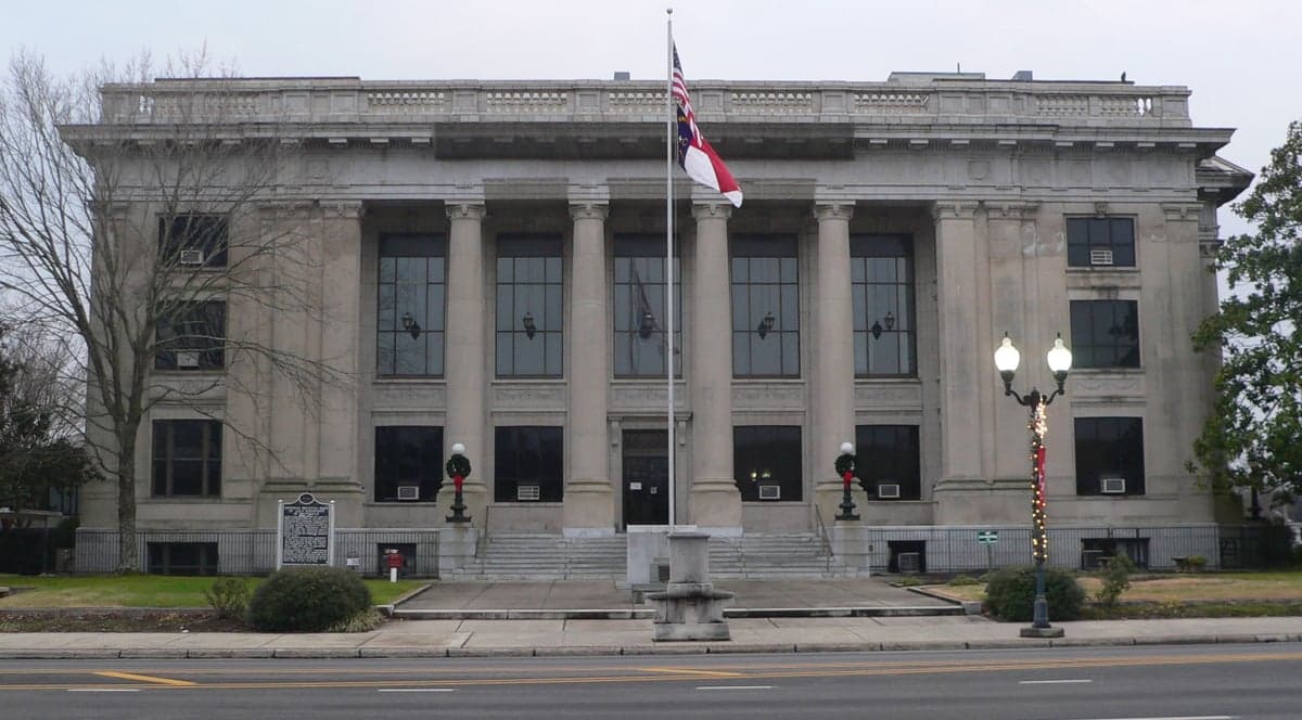
Photo: Wikipedia
Strategic Assessment of Johnston County
Meaningful friction. Expect exposure to either population pressure, blast zones, or natural disaster risk. Consider buying a retreat property.
What does the Strategic Assessment tell us?
Our Strategic Assessment grades tactical survivability of an area. Major population centers, military targets, fallout zones, natural disasters, and border exposure all drive risk — lower exposure means a more defensible position in a crisis.
This is heavily inspired by Joel Skousen's Strategic Relocation book. Highly recommended you checkout the book ($)What does this tell us?
Our Strategic Assessment grades tactical survivability of an area. Major population centers, military targets, fallout zones, natural disasters, and border exposure all drive risk — lower exposure means a more defensible position in a crisis.
This is heavily inspired by Joel Skousen's Strategic Relocation book. Highly recommended you checkout the book ($)Strategic Pillars

Key Distances
Strategic Assessment Analysis
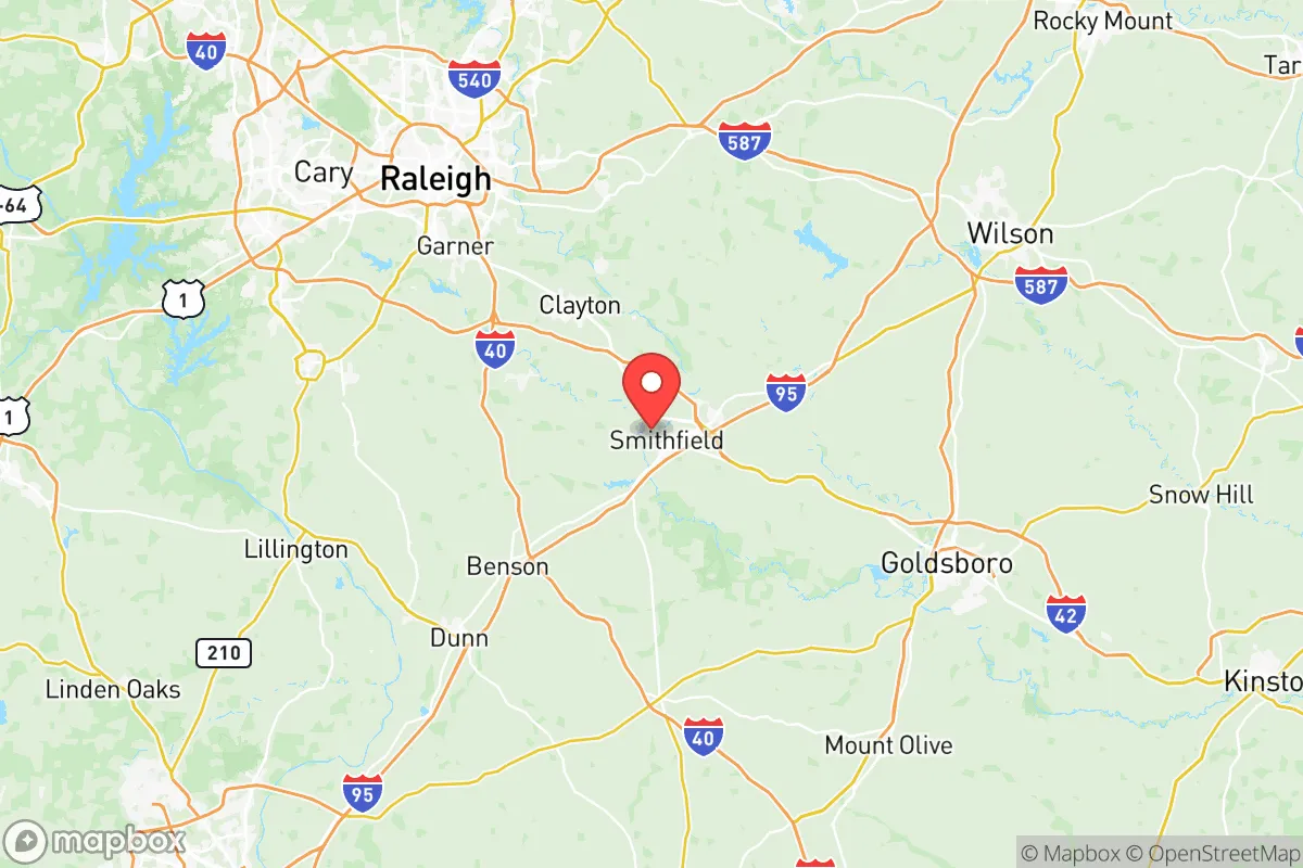
Johnston County, North Carolina, offers a compelling strategic position for relocators prioritizing resilience and self-sufficiency, balancing proximity to the Research Triangle’s economic engine with a distinctly rural character. The county’s location—roughly 30 miles southeast of Raleigh and 45 miles west of the Atlantic coast—places it outside the immediate blast or fallout zones of major metropolitan targets while still providing access to regional infrastructure. With a population of just over 230,000 spread across 796 square miles, Johnston County provides the space and resources for a prepared lifestyle without the isolation of more remote areas.
Geographic position and natural advantages for disaster readiness
Johnston County sits in the Piedmont region of North Carolina, a transition zone between the coastal plain and the Appalachian foothills. This geography offers several resilience benefits. The area is elevated enough—typically 100 to 300 feet above sea level—to avoid the worst storm surge from hurricanes, a significant advantage over coastal counties like Carteret or New Hanover. The Neuse River runs through the county, but the terrain is rolling rather than flood-prone, with most development on higher ground. The county’s natural resources include abundant hardwood forests, which provide cover, fuel, and building materials, and a moderate climate that supports year-round gardening. Average annual rainfall is about 48 inches, ensuring reliable water sources for wells and cisterns. The county’s position also places it outside the primary hurricane landfall zone; storms typically weaken significantly by the time they reach Johnston County, though heavy rain and wind remain risks. For a relocator, the key advantage is the ability to tap into the Research Triangle’s medical and supply networks—Raleigh-Durham International Airport is 40 minutes away—while living in a low-density environment where self-reliance is practical.
Risks, exposures, and proximity to fallout-relevant landmarks
No location is risk-free, and Johnston County has specific exposures that a strategic relocator must weigh. The most significant man-made risk is proximity to Fort Liberty (formerly Fort Bragg), the U.S. Army’s largest installation, located about 50 miles southwest in Fayetteville. Fort Liberty is a high-value military target in a major conflict, and while Johnston County is outside the likely blast radius, fallout patterns from a strike on the base could affect the western parts of the county, particularly towns like Benson and Four Oaks. Similarly, the county is within 100 miles of Norfolk Naval Station in Virginia, the world’s largest naval base, and the Port of Morehead City, a strategic shipping hub. Prevailing winds from the southwest during much of the year mean fallout from a strike on Fort Liberty would likely drift northeast, away from Johnston County’s population centers. However, a nuclear event at the Harris Nuclear Plant in neighboring Wake County—about 20 miles northwest of Smithfield—presents a more immediate risk. The plant’s emergency planning zone extends into Johnston County, and a release could contaminate the Neuse River watershed. Natural risks include occasional tornadoes—the county averages 12 tornado warnings per year—and the potential for inland flooding from hurricanes, as seen during Hurricane Florence in 2018, which caused significant damage in Clayton and Selma. The county’s rural character also means longer emergency response times in remote areas; volunteer fire departments cover much of the territory, and the nearest Level I trauma center is in Raleigh.
Practical resilience for a relocator: food, water, energy, and defensibility
For a relocator focused on self-sufficiency, Johnston County offers strong fundamentals. Agriculture is the county’s largest industry, with over 1,200 farms producing tobacco, soybeans, corn, sweet potatoes, and livestock. This means local food sources are abundant, and farmers’ markets operate year-round in Smithfield, the county seat, and Clayton. The county’s agricultural extension service provides resources for home gardening, livestock raising, and food preservation. Water availability is excellent: the county sits atop the Upper Cape Fear aquifer, which provides clean groundwater at depths of 100 to 300 feet. Many rural properties already have wells, and drilling a new well costs $3,000 to $6,000. Surface water from the Neuse River and its tributaries is also accessible, though treatment is necessary. Energy resilience is mixed. Duke Energy provides grid electricity, but outages during storms are common—the county experienced an average of 1.2 outages per customer in 2023, above the national average. However, the rural landscape makes solar panel installation straightforward, and many properties have space for backup generators or battery systems. Natural gas is available in towns but not in rural areas; propane tanks are common. Defensibility is a key advantage. The county’s low population density—about 290 people per square mile—and network of secondary roads make it easy to secure a property. Many homes are set back from main roads, with tree lines providing natural screening. The county’s gun culture is strong, with multiple shooting ranges and a high rate of firearm ownership, which aligns with a prepared mindset. Local law enforcement is responsive but stretched thin in rural areas; the Johnston County Sheriff’s Office has about 150 deputies for the entire county, so self-defense capability is a practical consideration.
The overall strategic picture for Johnston County is one of balanced opportunity. It offers a rare combination: proximity to the economic and medical resources of the Research Triangle, a robust agricultural base, and a rural layout that supports self-reliance. The risks—proximity to Fort Liberty, the Harris Nuclear Plant, and hurricane flooding—are real but manageable with proper planning. For a relocator who values preparedness, the county’s strengths outweigh its weaknesses, particularly for those who choose properties in the eastern half of the county, away from the major military and industrial targets. The key is to act deliberately: secure a property with well water, install solar with battery backup, and build relationships with local farmers and the agricultural community. Johnston County is not a bunker—it’s a working landscape where resilience is built into the daily rhythm of life. For the right person, it’s a solid strategic bet.

* Values derived from national, state, county, city and local statistics and may differ in a specific area. Last updated: 2026-07-12T15:56:22.000Z
Narrative content on this page is AI-generated and may contain mistakes. Verify any details that matter before acting on them.
ReloMaps may earn a commission from affiliate links at no extra cost to you.

