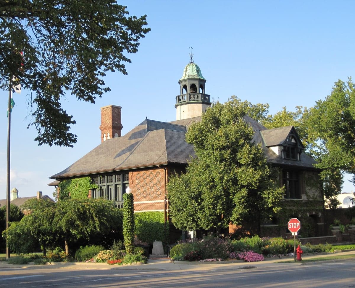
Photo: Wikipedia
Strategic Assessment of Lake Forest, IL
Multiple tactical vulnerabilities. Population density, target proximity, or disaster risk are likely compounding. A retreat property and exit planning is required.
What does the Strategic Assessment tell us?
Our Strategic Assessment grades tactical survivability of an area. Major population centers, military targets, fallout zones, natural disasters, and border exposure all drive risk — lower exposure means a more defensible position in a crisis.
This is heavily inspired by Joel Skousen's Strategic Relocation book. Highly recommended you checkout the book ($)What does this tell us?
Our Strategic Assessment grades tactical survivability of an area. Major population centers, military targets, fallout zones, natural disasters, and border exposure all drive risk — lower exposure means a more defensible position in a crisis.
This is heavily inspired by Joel Skousen's Strategic Relocation book. Highly recommended you checkout the book ($)Strategic Pillars

Key Distances
Regional Safe Places
Below is our recommended "safe zones" in Illinois and the surrounding area based on our strategic heuristics. For most people, it's unrealistic to live in a “safe zone” full-time due to work, family or other personal reasons. They tend to be more rural. However, many of these areas are perfect for second homes and retreat properties that double as a vacation home or even a short-term rental.
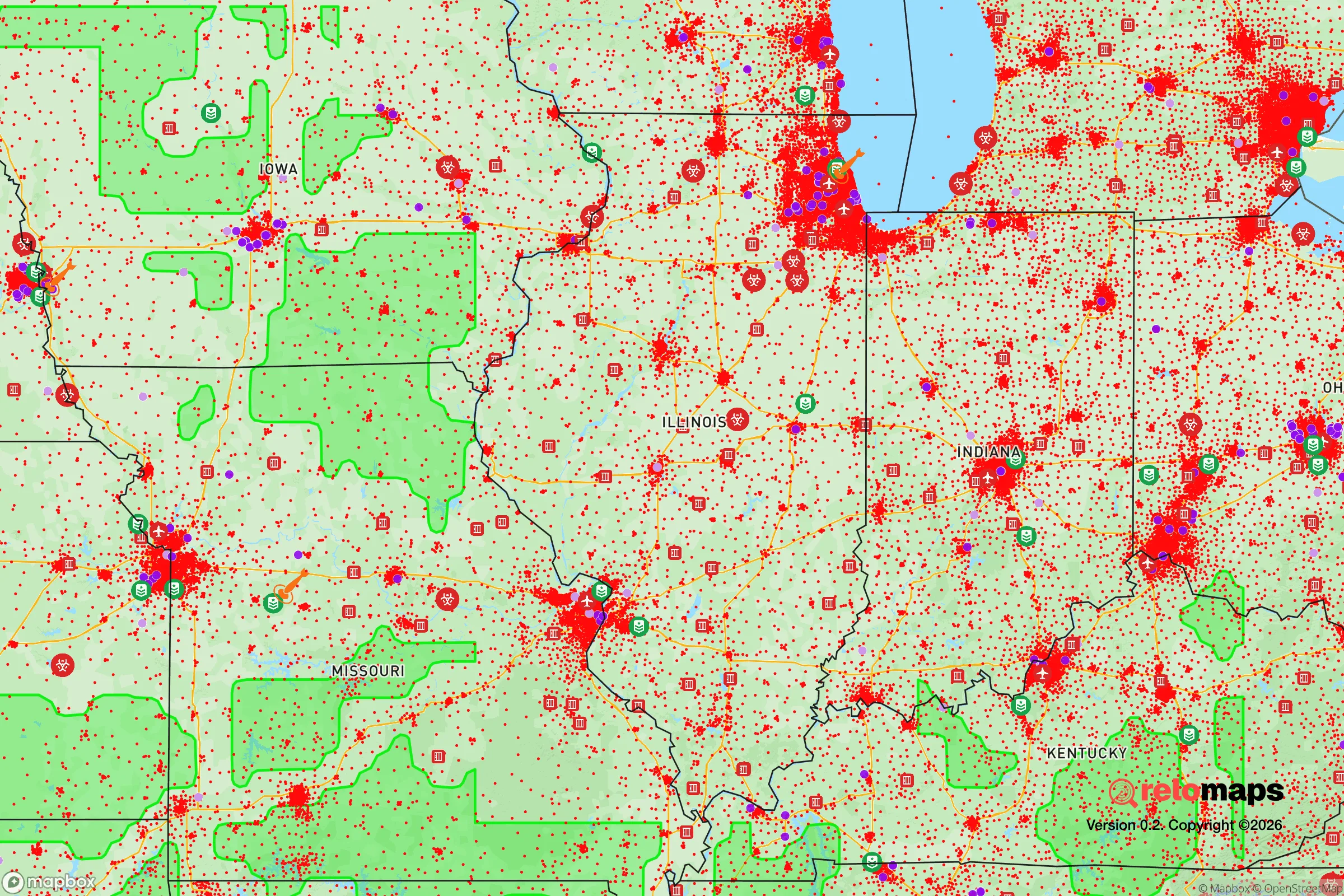
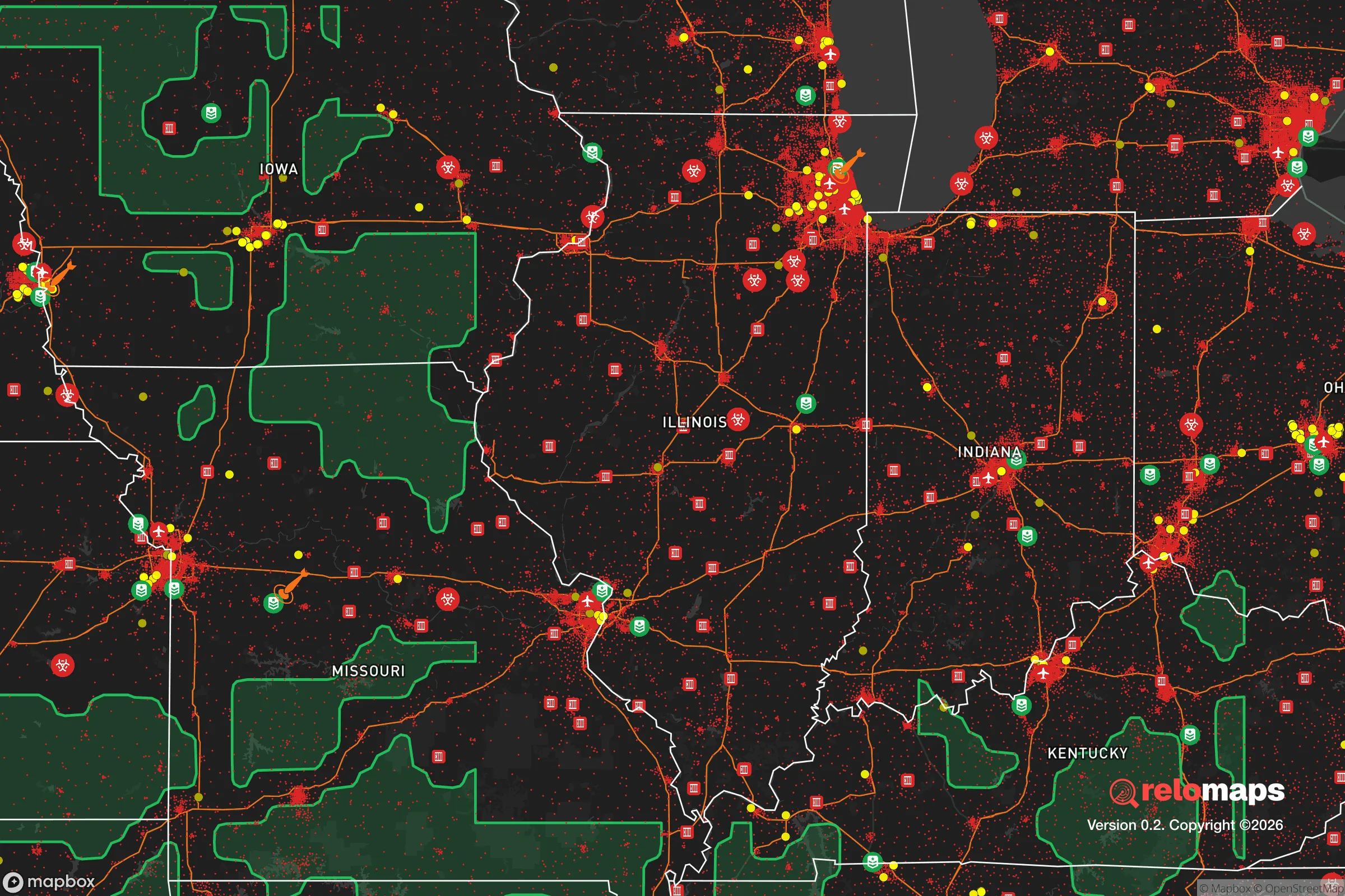


Important Note: For informational purposes only. This does not mean nothing bad ever happens in the green zones. Please use common sense. This is based on public data and modeled with AI. We tried to take a conservative approach but mistakes happen. We update this regularly as new information becomes available.
Solar Generator Recommendations
Backup power matters more here than in safer locations. We've picked three solar generators across budgets and capacity tiers — start with the budget unit if you only need a few essentials, or step up if you want to run a fridge and HVAC for days at a time.

Jackery Portable Power Station Explorer 300
Budget OptionPower on the Go: Weighing only 11 lbs, it's convenient to set up and store with book-sized foldable solar panels

BLUETTI Portable Power Station AC180
Designed for both indoor and outdoor scenarios, AC180 is highly capable as it has a robost capacity and continuous output power.

EF ECOFLOW DELTA Pro Ultra Power Station
Upgraded PickEcoFlow DELTA Pro Ultra is a whole-home energy system designed to grow with your family. Integrated with the Smart Home Panel 2, it scales to meet your evolving energy needs — keeping your home powered, intelligent, and secure through every stage of life.
We earn a commission, at no additional cost to you.
Strategic Assessment Analysis
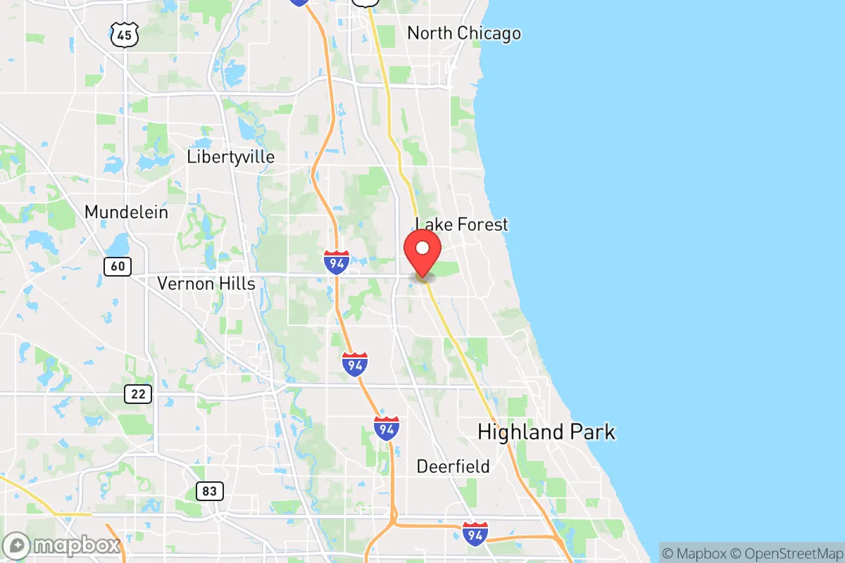
Lake Forest, Illinois, offers a distinctive blend of strategic depth and vulnerability that makes it a nuanced choice for the disaster-conscious relocator. Its position along the Lake Michigan shoreline, roughly 30 miles north of Chicago, provides a natural buffer from the densest urban chaos while still placing you within reach of critical infrastructure. The city’s historic wealth, established tree canopy, and low-density residential layout contribute to a baseline resilience that many suburban communities lack, but its proximity to major metropolitan targets and reliance on regional supply chains demand careful consideration. For a single individual or family weighing self-sufficiency and long-term preparedness, Lake Forest presents a high-floor, moderate-ceiling scenario—strong in everyday stability, but requiring deliberate planning for major disruptions.
Geographic position and natural advantages for long-term stability
Lake Forest’s geography is its primary strategic asset. The city sits on a series of bluffs overlooking Lake Michigan, which provides an immense, reliable freshwater source—a critical advantage in any prolonged emergency where municipal water treatment could fail. The lake’s thermal mass moderates extreme temperatures, reducing heating demand in winter and cooling needs in summer, which lowers energy dependency during grid outages. The surrounding landscape is dominated by the Lake County Forest Preserves, a network of over 30,000 acres of protected woodlands, wetlands, and prairies that offer natural barriers to urban sprawl and potential escape routes. The terrain is gently rolling, with no significant floodplains within the city limits proper, though low-lying areas near the Skokie River and Middle Fork of the North Branch of the Chicago River can see localized flooding during heavy rain events. The area’s deep, fertile soils support robust gardening and small-scale agriculture, a boon for anyone serious about food self-sufficiency. The prevailing westerly winds typically carry airborne contaminants away from the lakefront, a modest but real advantage in a fallout or industrial accident scenario. Overall, Lake Forest’s natural setting provides a solid foundation for resilience, but it is not immune to the broader regional risks that come with being part of the Chicago metropolitan area.
Risks, exposures, and proximity to fallout-relevant landmarks
The most significant vulnerability for Lake Forest is its proximity to Chicago, a Tier 1 target for any major geopolitical conflict or terrorist attack. The city lies roughly 30 miles from downtown Chicago, which houses critical financial infrastructure, O’Hare International Airport (a major logistics and military transport hub), and the Argonne National Laboratory in nearby Lemont. In a nuclear exchange scenario, Lake Forest is within the moderate fallout zone for a ground burst on Chicago, with prevailing winds likely carrying radioactive debris northeast toward Lake Michigan. The city is also within 10 miles of the Zion Nuclear Power Station, a decommissioned plant that still stores spent fuel on-site—a potential secondary hazard. Beyond nuclear risks, Lake Forest faces moderate natural threats. Tornadoes are a real but infrequent danger; Lake County averages one tornado every 5-10 years, typically EF0-EF2 strength. Severe winter storms can knock out power for days, as seen in the 2011 blizzard and the 2021 polar vortex, which stressed the regional grid. The city’s tree canopy, while beautiful, is a liability in ice storms and high winds, with falling limbs frequently damaging power lines. Crime is low—Lake Forest consistently ranks among the safest cities in Illinois—but the community’s wealth makes it a potential target for organized looting or civil unrest during a prolonged crisis. The key takeaway: Lake Forest’s risks are primarily man-made and regional, not local. A relocator must plan for the consequences of a Chicago-area disruption, not for threats originating within the city itself.
Practical resilience for a relocator: food, water, energy, and defensibility
For the self-sufficient-minded individual or family, Lake Forest offers a mixed bag. Water is the strongest asset: Lake Michigan provides an essentially unlimited supply, but accessing it requires a pump, filtration system, and legal permission (the city controls lake access points). Most residents rely on municipal water from the Lake Michigan system, which is vulnerable to contamination or pressure loss during a grid failure. A backup well is not feasible in most of Lake Forest due to shallow bedrock and strict groundwater regulations. Food resilience is moderate: the city has several high-end grocery stores (Mariano’s, Whole Foods) and a farmers’ market, but these are dependent on just-in-time supply chains. Local gardening is viable—many homes have large lots suitable for vegetable plots—but the short growing season (roughly May to October) limits year-round production. Community gardens exist but are small. Energy is a weak point: Lake Forest is served by Commonwealth Edison (ComEd), which has a mixed reliability record. Underground power lines in newer subdivisions help, but many older neighborhoods have overhead lines that fail in storms. Solar panels are permitted but face HOA restrictions in some areas; battery backup is essential. Natural gas is widely available for heating and cooking, but a prolonged grid outage would disable gas pumps and distribution. Defensibility is high for a suburban setting: the city’s layout—winding roads, limited through-traffic, large lots with mature trees—creates natural chokepoints and concealment. The police department is well-funded and responsive, but in a total collapse scenario, the community’s insular nature and low population density (roughly 1,200 people per square mile) make it easier to secure a neighborhood than a denser suburb. The biggest practical challenge is transportation: Lake Forest is car-dependent, and a fuel shortage would severely limit mobility. The Metra train line to Chicago is a vulnerability, as it could bring evacuees or looters from the city. For a relocator, the prescription is clear: invest in a lake-access water filtration system, a solar-plus-battery setup, a deep pantry, and a community network of like-minded neighbors. Lake Forest’s physical assets are strong, but its institutional dependencies require active mitigation.
The overall strategic picture for Lake Forest is one of calculated trade-offs. It offers a rare combination of natural freshwater abundance, low crime, and physical defensibility that few suburbs can match. However, its proximity to Chicago and reliance on regional infrastructure mean that a major disaster—whether natural, economic, or geopolitical—will test the limits of local resilience. For a family willing to invest in backup systems and build local connections, Lake Forest provides a solid base for long-term stability. For someone seeking complete independence from urban risks, a more remote location in the Upper Peninsula or rural Wisconsin would be a better fit. But for the relocator who wants to stay within striking distance of professional opportunities while maintaining a credible preparedness posture, Lake Forest is a strong, if not perfect, choice. The key is to treat it as a base camp, not a bunker—and to plan accordingly.

* Values derived from national, state, county, city and local statistics and may differ in a specific area. Last updated: 2026-10-29T16:04:16.000Z
Narrative content on this page is AI-generated and may contain mistakes. Verify any details that matter before acting on them.
ReloMaps may earn a commission from affiliate links at no extra cost to you.

