
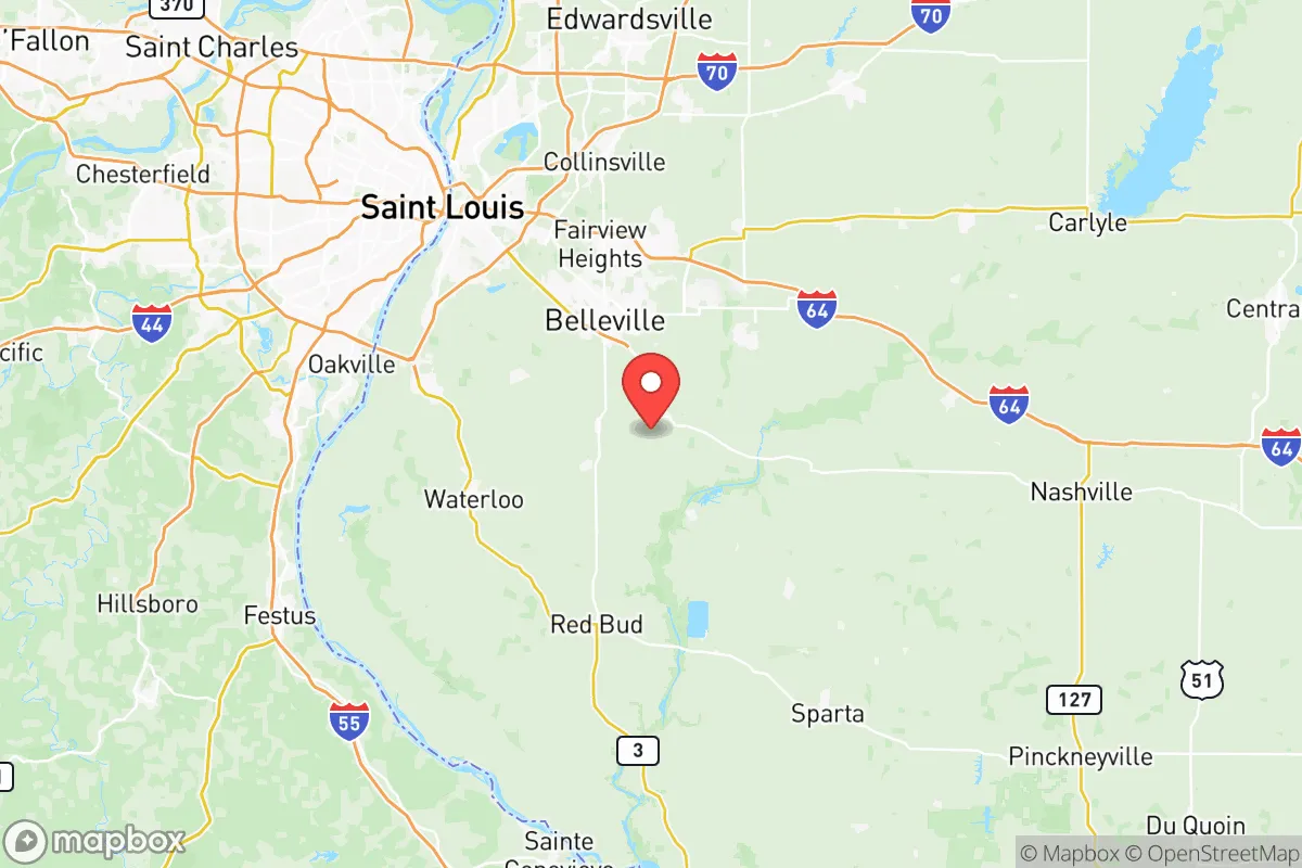
Strategic Assessment of St Clair County
Meaningful friction. Expect exposure to either population pressure, blast zones, or natural disaster risk. Consider buying a retreat property.
What does the Strategic Assessment tell us?
Our Strategic Assessment grades tactical survivability of an area. Major population centers, military targets, fallout zones, natural disasters, and border exposure all drive risk — lower exposure means a more defensible position in a crisis.
This is heavily inspired by Joel Skousen's Strategic Relocation book. Highly recommended you checkout the book ($)What does this tell us?
Our Strategic Assessment grades tactical survivability of an area. Major population centers, military targets, fallout zones, natural disasters, and border exposure all drive risk — lower exposure means a more defensible position in a crisis.
This is heavily inspired by Joel Skousen's Strategic Relocation book. Highly recommended you checkout the book ($)Strategic Pillars

Key Distances
Strategic Assessment Analysis
St Clair County, Illinois, offers a mixed strategic picture for relocation-minded readers prioritizing disaster readiness and self-sufficiency. Its position across the Mississippi River from St. Louis provides access to regional infrastructure while maintaining a degree of separation from the urban core's densest populations and most exposed targets. The county's blend of agricultural land, river access, and suburban-to-rural communities like Belleville, O'Fallon, and Mascoutah creates a foundation for resilience, but proximity to major transportation corridors, industrial sites, and a major metropolitan area introduces real risks that require careful assessment.
Geographic position and natural advantages for self-sufficiency
St Clair County sits on the eastern bank of the Mississippi River, with the Kaskaskia River forming part of its southern boundary. This dual-river geography provides reliable surface water access, a critical asset for long-term water independence if wells or municipal systems are compromised. The county's topography is predominantly rolling hills and fertile bottomlands, supporting a mix of row crops and pasture that gives relocators a realistic base for small-scale food production. The area lies outside the direct blast and thermal zones of downtown St. Louis, roughly 15 miles east of the Gateway Arch, which reduces immediate fallout exposure from a strike on the city core. The presence of Scott Air Force Base near Mascoutah and Belleville is a double-edged asset: it brings military infrastructure, emergency response capability, and a stable employment base, but also elevates the county's profile as a potential secondary target or staging area during a national emergency. The surrounding region includes the American Bottom floodplain, which poses periodic flood risks along the Mississippi, but higher ground east of the river offers defensible positions with good visibility and drainage.
Risks, exposures, and proximity to fallout-relevant landmarks
The county's most significant vulnerability is its adjacency to the St. Louis metropolitan area, a major population center with multiple potential targets. Lambert-St. Louis International Airport, the region's rail hubs, and the Mississippi River barge traffic infrastructure are all within 20-30 miles of central St Clair County. The refinery and chemical corridor along the Mississippi south of St. Louis, including the Wood River Refinery in nearby Roxana, Illinois, represents a substantial industrial risk for hazardous material releases or secondary targeting. Interstate 64 and Interstate 70/55 run through the county, making it a natural evacuation and logistics corridor that could become congested or contested during a crisis. Scott Air Force Base, while a resilience asset, is also a high-value military installation that could draw attention in a conflict scenario. Relocators should also note that the county's population density is uneven: Belleville and O'Fallon are growing suburbs with over 40,000 residents each, while smaller towns like New Athens and Marissa offer lower density but reduced access to supplies and healthcare. The New Madrid Seismic Zone, located roughly 150 miles south, poses a long-term earthquake risk that could disrupt river crossings and infrastructure along the Mississippi.
Practical resilience for a relocator: food, water, energy, and defensibility
St Clair County's agricultural base is a genuine advantage for food security. The county has thousands of acres in corn, soybeans, and wheat production, and smaller-scale livestock operations are common in the eastern and southern townships. Farmers markets and local food networks operate in Belleville and O'Fallon, but relocators should plan to establish direct relationships with growers or secure land for personal production. Groundwater availability is generally good in the region, with the Mahomet Aquifer system underlying parts of the county, though well depths and yields vary by location. Municipal water treatment plants draw from the Mississippi, which could be compromised by upstream contamination or infrastructure failure. Energy resilience is mixed: the county is served by Ameren Illinois, with a grid that has experienced weather-related outages, particularly from ice storms and severe thunderstorms. Natural gas is widely available in suburban areas, but rural properties may rely on propane or heating oil. Solar potential is moderate, with roughly 4.5 peak sun hours per day, making off-grid solar a viable supplement but not a sole solution. Defensibility is strongest in the eastern and southern portions of the county, where lower population density, rolling terrain, and distance from major highways provide natural buffers. The area's network of county roads and state routes offers multiple egress options, but the Mississippi River bridges at St. Louis are chokepoints that could become impassable during an evacuation.
Overall, St Clair County presents a workable but not ideal strategic picture for a relocator focused on disaster readiness. Its strengths lie in water access, agricultural potential, and a location that is close enough to St. Louis for resource access but far enough to avoid the worst of a direct strike's immediate effects. The presence of Scott Air Force Base adds both capability and risk, and the county's position along major transportation corridors means it would likely see significant movement of people and goods during a crisis. For a single individual or family willing to invest in well water, solar backup, and food production capacity, the eastern and southern rural areas offer a realistic base for medium-term self-sufficiency. The key trade-off is between the convenience of suburban infrastructure and the reduced exposure of deeper rural settlement — a choice that depends on how much risk the relocator is willing to accept from the county's proximity to St. Louis and its associated industrial and military targets.

* Values derived from national, state, county, city and local statistics and may differ in a specific area. Last updated: 2026-07-19T21:21:53.000Z
Narrative content on this page is AI-generated and may contain mistakes. Verify any details that matter before acting on them.
ReloMaps may earn a commission from affiliate links at no extra cost to you.

