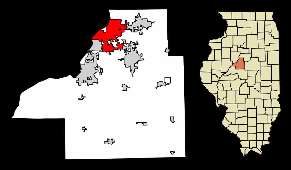
Photo: Wikipedia
Strategic Assessment of East Peoria, IL
Meaningful friction. Expect exposure to either population pressure, blast zones, or natural disaster risk. Consider buying a retreat property.
What does the Strategic Assessment tell us?
Our Strategic Assessment grades tactical survivability of an area. Major population centers, military targets, fallout zones, natural disasters, and border exposure all drive risk — lower exposure means a more defensible position in a crisis.
This is heavily inspired by Joel Skousen's Strategic Relocation book. Highly recommended you checkout the book ($)What does this tell us?
Our Strategic Assessment grades tactical survivability of an area. Major population centers, military targets, fallout zones, natural disasters, and border exposure all drive risk — lower exposure means a more defensible position in a crisis.
This is heavily inspired by Joel Skousen's Strategic Relocation book. Highly recommended you checkout the book ($)Strategic Pillars

Key Distances
Regional Safe Places
Below is our recommended "safe zones" in Illinois and the surrounding area based on our strategic heuristics. For most people, it's unrealistic to live in a “safe zone” full-time due to work, family or other personal reasons. They tend to be more rural. However, many of these areas are perfect for second homes and retreat properties that double as a vacation home or even a short-term rental.
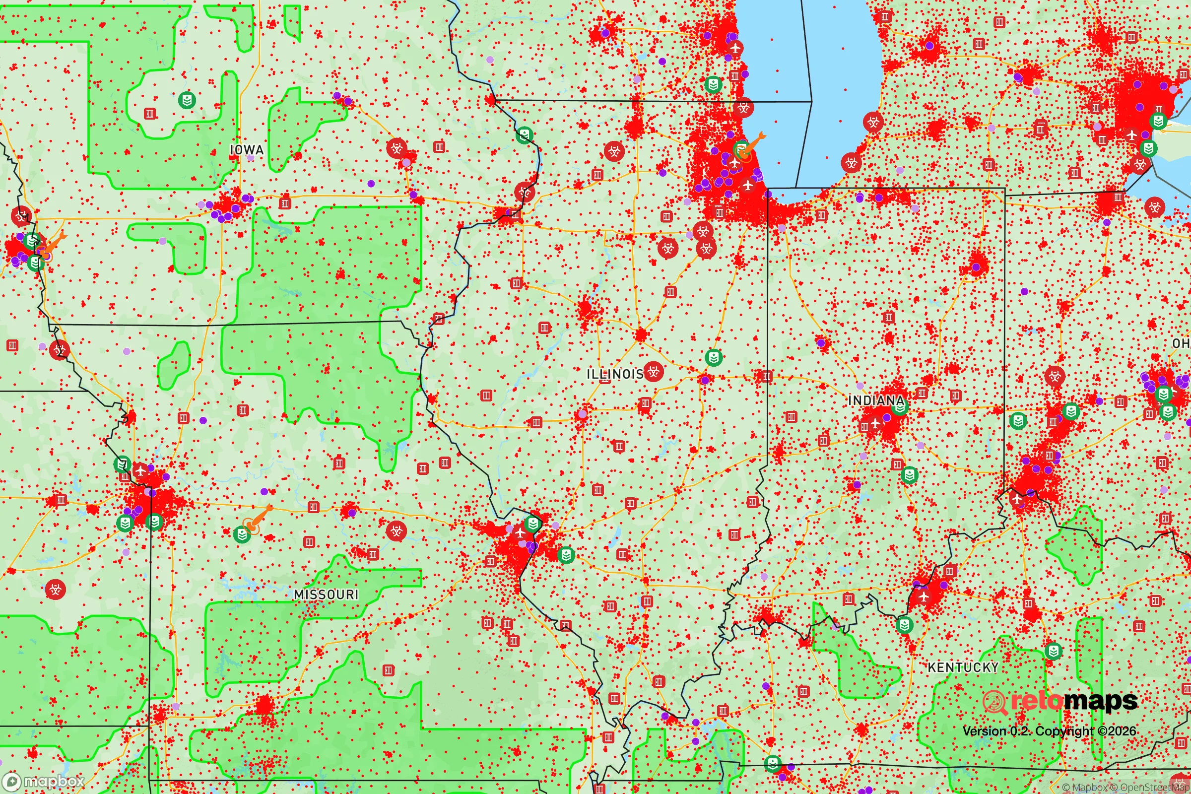
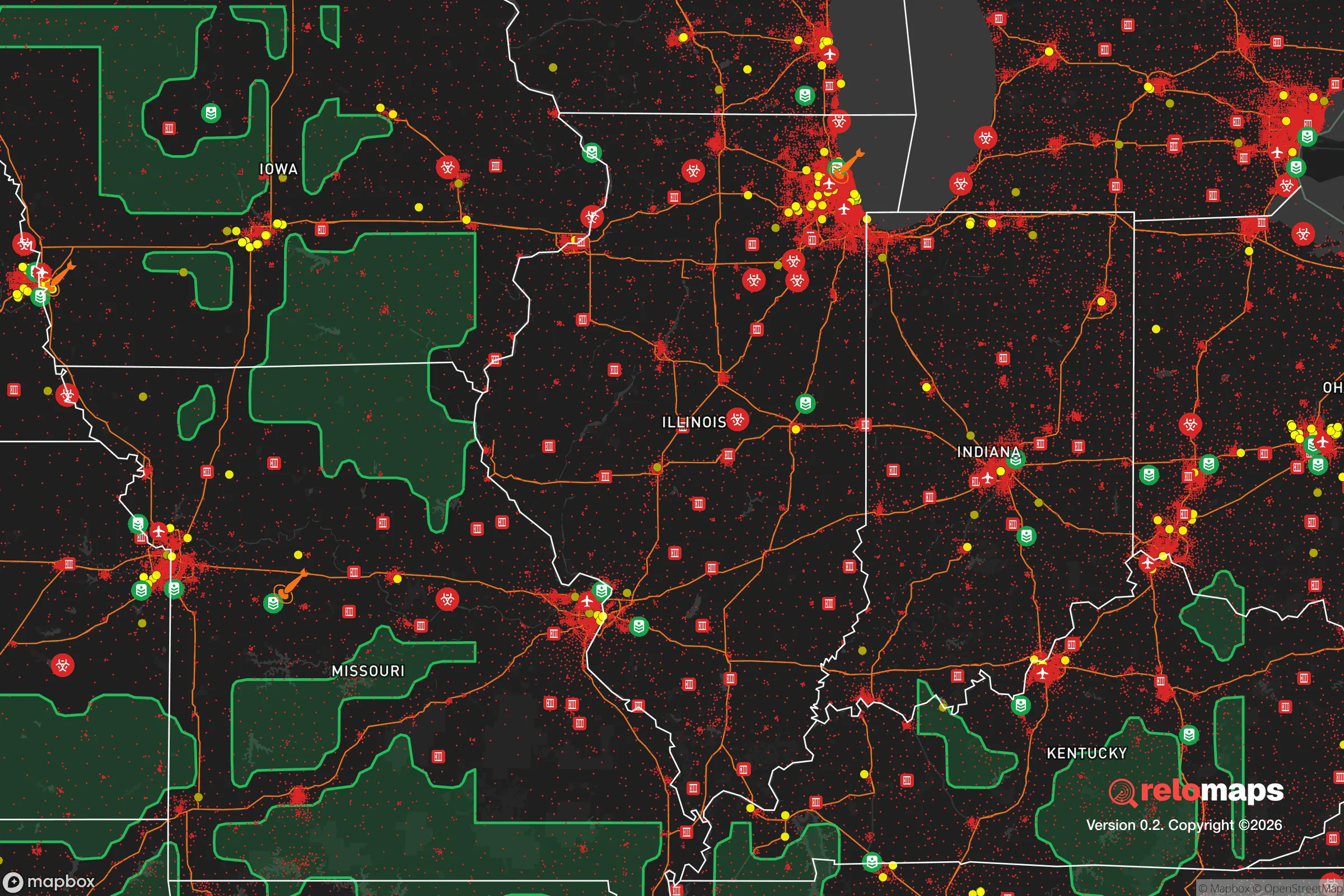


Important Note: For informational purposes only. This does not mean nothing bad ever happens in the green zones. Please use common sense. This is based on public data and modeled with AI. We tried to take a conservative approach but mistakes happen. We update this regularly as new information becomes available.
Solar Generator Recommendations
Backup power matters more here than in safer locations. We've picked three solar generators across budgets and capacity tiers — start with the budget unit if you only need a few essentials, or step up if you want to run a fridge and HVAC for days at a time.

Jackery Portable Power Station Explorer 300
Budget OptionPower on the Go: Weighing only 11 lbs, it's convenient to set up and store with book-sized foldable solar panels

BLUETTI Portable Power Station AC180
Designed for both indoor and outdoor scenarios, AC180 is highly capable as it has a robost capacity and continuous output power.

EF ECOFLOW DELTA Pro Ultra Power Station
Upgraded PickEcoFlow DELTA Pro Ultra is a whole-home energy system designed to grow with your family. Integrated with the Smart Home Panel 2, it scales to meet your evolving energy needs — keeping your home powered, intelligent, and secure through every stage of life.
We earn a commission, at no additional cost to you.
Strategic Assessment Analysis
East Peoria, Illinois, offers a surprisingly strong strategic position for relocation-minded individuals and families who prioritize resilience and self-sufficiency, largely due to its location on the Illinois River and its buffer from major metropolitan chaos. The city sits in a natural corridor that provides both agricultural access and industrial infrastructure, but its true advantage lies in being close enough to Peoria for supply runs while remaining distinct enough to avoid the worst of urban collapse scenarios. For a conservative-leaning reader thinking seriously about disaster readiness, East Peoria presents a mixed but workable picture: solid geographic defenses, moderate exposure to man-made risks, and a practical foundation for long-term sustainability.
Geographic position and natural advantages for long-term stability
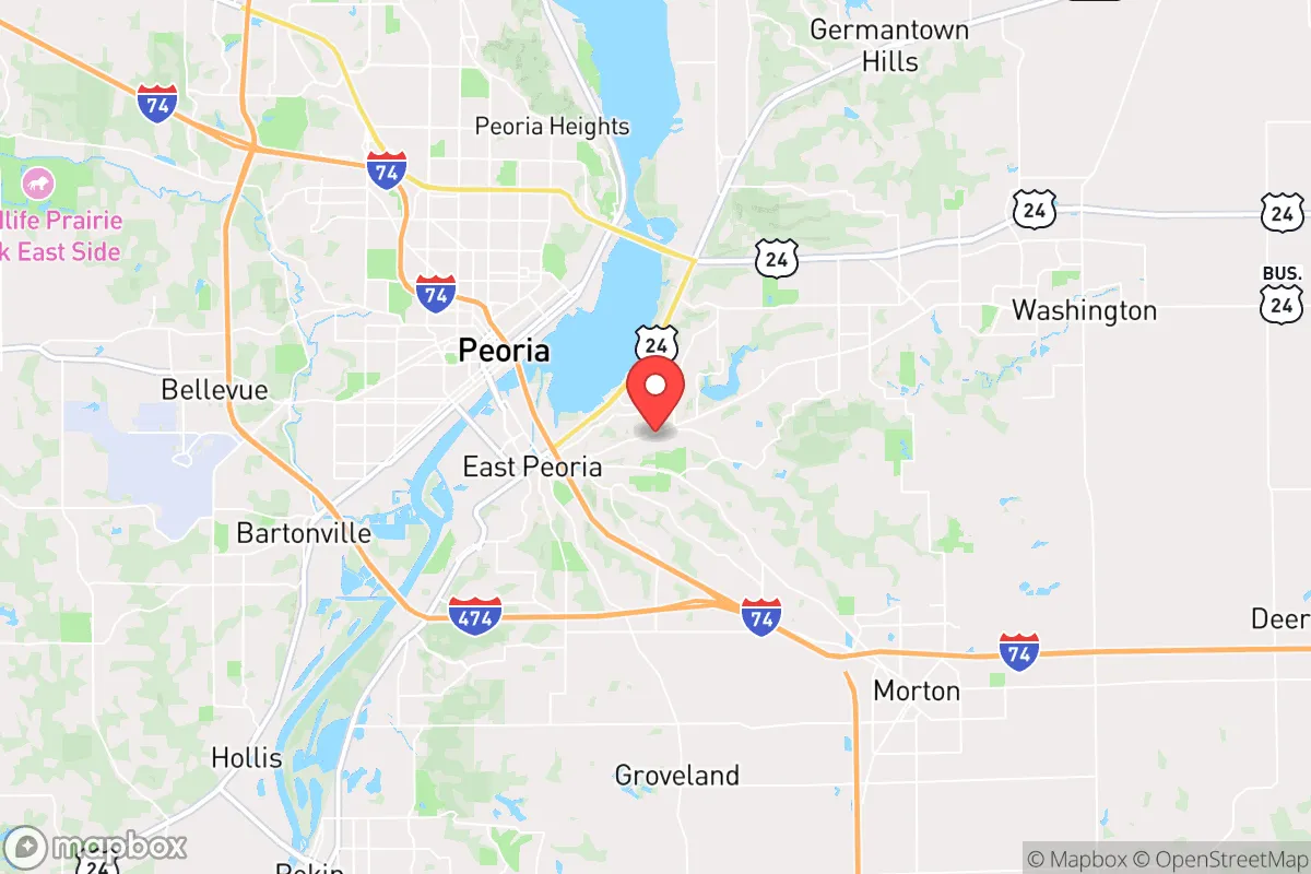
East Peoria is anchored by the Illinois River to its west and the bluffs of the Illinois River Valley to its east, creating a natural funnel that concentrates population and infrastructure along a narrow strip. This topography offers genuine defensive value: the river acts as a barrier to direct approach from the west, while the bluffs provide elevated ground for observation and retreat if needed. The surrounding region is part of the Illinois River Bottomlands, a floodplain that also supports rich soil for agriculture — a critical asset for anyone planning food self-sufficiency. The city's position within the Peoria metropolitan area means it has access to regional healthcare, supply chains, and transportation networks (Interstate 74 runs directly through town), but it is not so dense that evacuation routes would immediately clog. The nearby Wildlife Prairie Park and numerous county forest preserves offer undeveloped land for hunting, foraging, and off-grid living, though these are public lands with limited private control. For a relocator, the key geographic takeaway is that East Peoria sits in a defensible river valley with agricultural hinterlands, but it is not remote — you are still within 30 minutes of Peoria's urban core and its associated vulnerabilities.
Risks, exposures, and proximity to fallout-relevant landmarks
The most significant risk for East Peoria is its proximity to Peoria itself, a city of roughly 110,000 people that hosts major industrial and logistical infrastructure. Peoria is home to Caterpillar Inc.'s global headquarters and multiple manufacturing plants, as well as the Peoria International Airport and a major rail yard — all of which are potential targets for economic disruption, cyberattacks, or physical sabotage in a crisis scenario. The Illinois River is also a barge corridor for grain, chemicals, and fuel, meaning a river-based incident (spill, bridge collapse, or deliberate blockage) could sever supply lines and complicate evacuation. Flooding is the most predictable natural hazard: the river has historically overtopped its banks, and parts of East Peoria, particularly near the riverfront and along the Fondulac Creek drainage, are in FEMA-designated flood zones. Tornado risk is moderate but real — central Illinois sits in the traditional "Tornado Alley" fringe, and the flat terrain offers little natural shelter from severe weather. On the positive side, East Peoria is far from nuclear power plants (the closest, Clinton Power Station, is about 70 miles east), major military bases, and large-scale chemical storage facilities. The area's primary man-made risk is its economic dependence on Caterpillar and related heavy industry, which could collapse or relocate in a prolonged downturn, but that is a slow-burn threat rather than a sudden disaster.
Practical resilience for a relocator: food, water, energy, and defensibility
For someone serious about self-sufficiency, East Peoria's practical resilience is a mixed bag that requires deliberate preparation. Food: the surrounding region is some of the most productive farmland in the United States, with corn, soybeans, and livestock operations within a 20-minute drive. Local farmers' markets (the East Peoria Farmers Market runs seasonally) and direct-from-farm purchasing are viable options, and the city's zoning allows for backyard gardens and small livestock in most residential areas. However, the soil in the river bottom can be heavy clay, so raised beds or amended soil may be necessary. Water: the Illinois River is a reliable surface water source, but it carries agricultural runoff and industrial contaminants, so any long-term plan requires filtration (reverse osmosis or distillation) or a private well. The municipal water supply comes from the river and is treated, but in a grid-down scenario, you would need your own pumping and purification system. Energy: the grid is reasonably stable, but central Illinois experiences occasional ice storms and derecho events that can knock out power for days. Solar is viable — the region gets about 200 sunny days per year — but tree cover in the bluffs can limit rooftop exposure. Natural gas is widely available, and propane tanks are common in rural areas. Defensibility: East Peoria's layout is suburban and spread out, with single-family homes on lots that offer some setback from the street. The river and bluffs provide natural chokepoints, but the city is not walled or gated. A relocator should prioritize a home on the eastern bluffs (higher ground, better visibility) rather than in the floodplain, and should consider a property with a basement for tornado shelter and storage. The local police and fire departments are professional but small — the East Peoria Police Department has about 40 sworn officers — so in a widespread emergency, you would largely be on your own for the first 72 hours.
Overall, East Peoria presents a realistic strategic picture for the conservative-leaning relocator who values preparedness but does not want to go fully off-grid. It offers genuine geographic advantages — river barrier, elevated bluffs, agricultural access — and avoids the worst fallout risks of major cities, military targets, or nuclear plants. The trade-offs are clear: you are close enough to Peoria to benefit from its infrastructure but also exposed to its vulnerabilities, and you must actively prepare for flooding, grid failure, and the possibility of industrial disruption. For a family or individual willing to invest in a well, solar panels, and a basement pantry, East Peoria is a solid base of operations. For someone seeking true isolation and zero risk, the Illinois River Valley is not that — but it is a defensible, resource-rich location that rewards preparation and common sense.

* Values derived from national, state, county, city and local statistics and may differ in a specific area. Last updated: 2026-10-11T13:01:13.000Z
Narrative content on this page is AI-generated and may contain mistakes. Verify any details that matter before acting on them.
ReloMaps may earn a commission from affiliate links at no extra cost to you.

