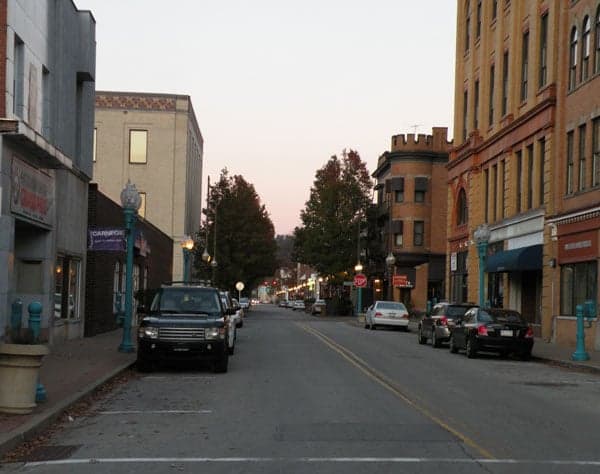
Photo: Wikipedia
Strategic Assessment of Carnegie, PA
Multiple tactical vulnerabilities. Population density, target proximity, or disaster risk are likely compounding. A retreat property and exit planning is required.
What does the Strategic Assessment tell us?
Our Strategic Assessment grades tactical survivability of an area. Major population centers, military targets, fallout zones, natural disasters, and border exposure all drive risk — lower exposure means a more defensible position in a crisis.
This is heavily inspired by Joel Skousen's Strategic Relocation book. Highly recommended you checkout the book ($)What does this tell us?
Our Strategic Assessment grades tactical survivability of an area. Major population centers, military targets, fallout zones, natural disasters, and border exposure all drive risk — lower exposure means a more defensible position in a crisis.
This is heavily inspired by Joel Skousen's Strategic Relocation book. Highly recommended you checkout the book ($)Strategic Pillars

Key Distances
Regional Safe Places
Below is our recommended "safe zones" in Pennsylvania and the surrounding area based on our strategic heuristics. For most people, it's unrealistic to live in a “safe zone” full-time due to work, family or other personal reasons. They tend to be more rural. However, many of these areas are perfect for second homes and retreat properties that double as a vacation home or even a short-term rental.
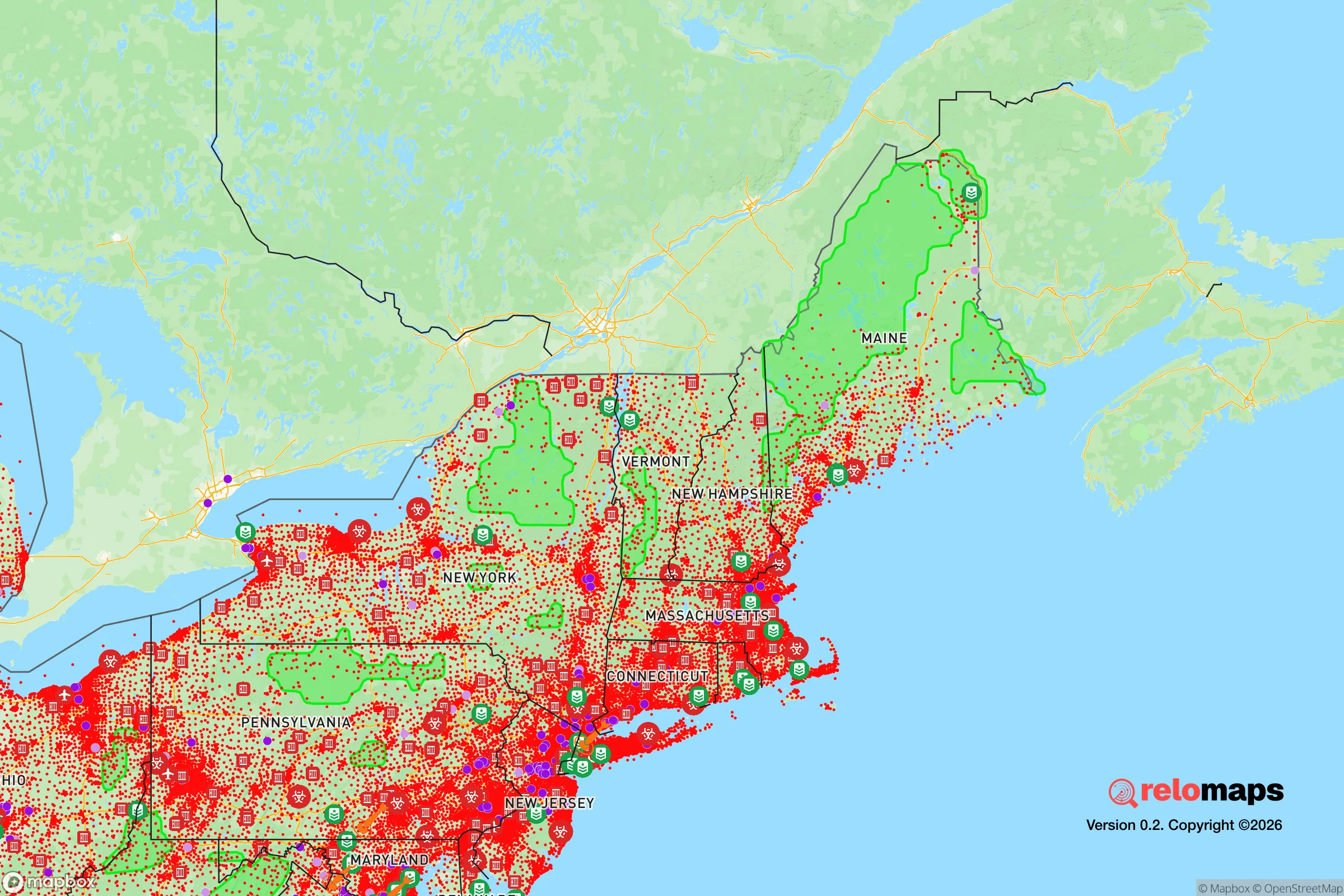
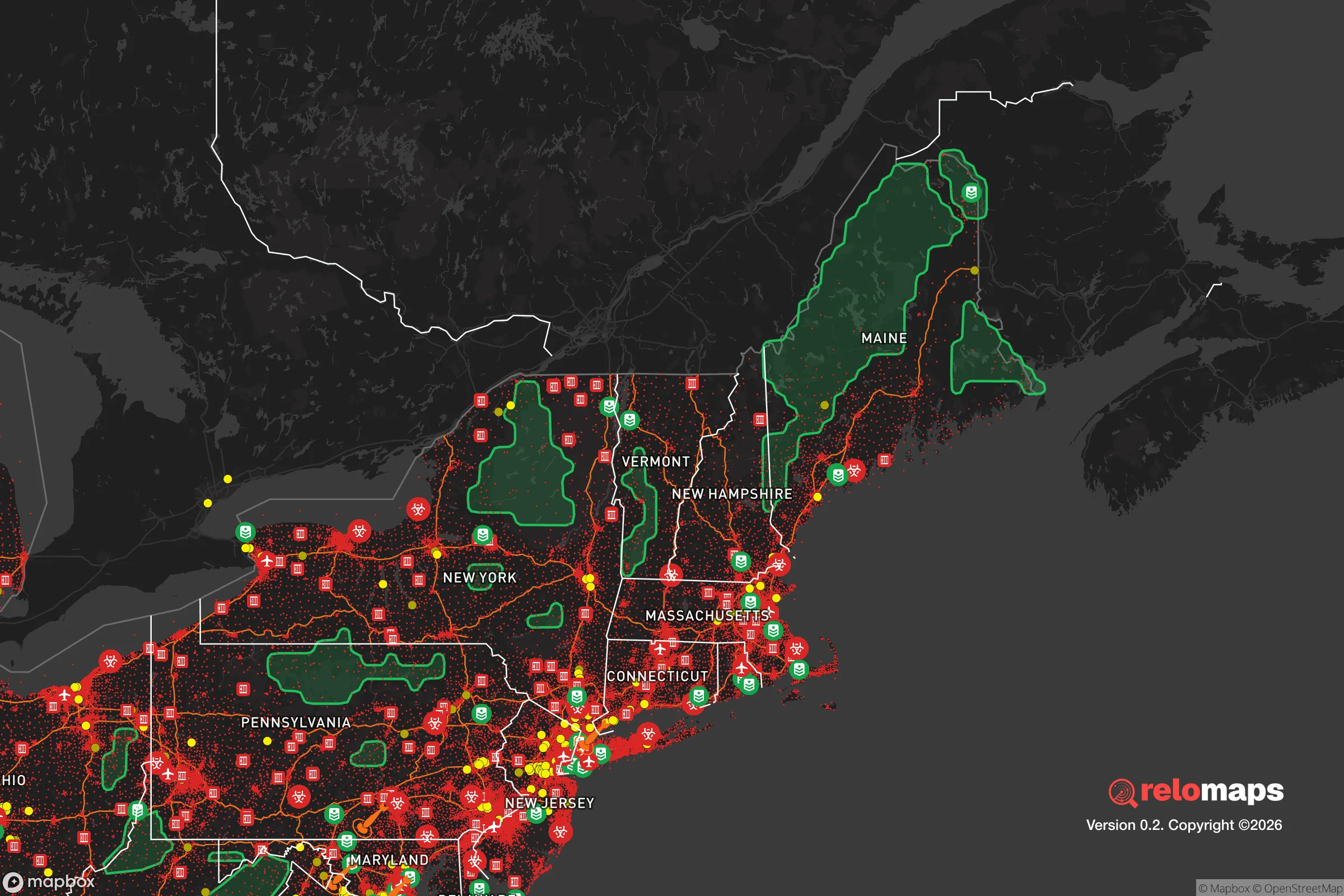


Important Note: For informational purposes only. This does not mean nothing bad ever happens in the green zones. Please use common sense. This is based on public data and modeled with AI. We tried to take a conservative approach but mistakes happen. We update this regularly as new information becomes available.
Solar Generator Recommendations
Backup power matters more here than in safer locations. We've picked three solar generators across budgets and capacity tiers — start with the budget unit if you only need a few essentials, or step up if you want to run a fridge and HVAC for days at a time.

Jackery Portable Power Station Explorer 300
Budget OptionPower on the Go: Weighing only 11 lbs, it's convenient to set up and store with book-sized foldable solar panels

BLUETTI Portable Power Station AC180
Designed for both indoor and outdoor scenarios, AC180 is highly capable as it has a robost capacity and continuous output power.

EF ECOFLOW DELTA Pro Ultra Power Station
Upgraded PickEcoFlow DELTA Pro Ultra is a whole-home energy system designed to grow with your family. Integrated with the Smart Home Panel 2, it scales to meet your evolving energy needs — keeping your home powered, intelligent, and secure through every stage of life.
We earn a commission, at no additional cost to you.
Strategic Assessment Analysis
Carnegie, Pennsylvania, presents a mixed strategic picture for the relocation-minded reader focused on resilience and preparedness. Its position in the Pittsburgh metropolitan area offers certain logistical advantages, but its proximity to a major urban center and associated infrastructure introduces significant vulnerabilities that a serious self-sufficiency planner must weigh. For the individual or family prioritizing disaster readiness, Carnegie is less a standalone haven and more a potential staging ground—one that requires a clear-eyed assessment of its geographic trade-offs and a proactive approach to mitigating its inherent risks.
Geographic position and natural advantages for a preparedness-minded relocator
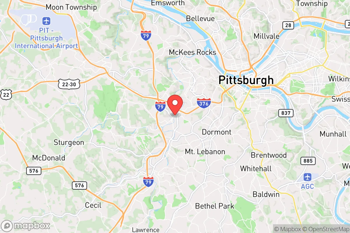
Carnegie sits in the Allegheny Plateau region, approximately five miles southwest of downtown Pittsburgh, in a valley carved by Chartiers Creek. The area's topography provides some natural screening: the rolling hills and wooded ridges common to western Pennsylvania offer limited visual and physical buffering from the densest urban corridors. The local climate is temperate, with four distinct seasons, and the region is not prone to the most catastrophic natural disasters—hurricanes, wildfires, and earthquakes are not significant threats here. The primary natural risks are flash flooding from heavy rain events (Chartiers Creek has a history of exceeding its banks) and occasional winter storms that can disrupt power and transportation for days. For a relocator, the land itself is moderately defensible in a grid-down scenario: the hills create natural chokepoints on the few main roads (primarily PA-50 and the Parkway West), and the surrounding woodlands offer cover and resources for those who know how to use them. However, the valley floor where most of Carnegie's housing stock sits is the least advantageous position—low-lying, exposed, and dependent on a handful of bridges and underpasses to move in or out. A prepared household would want to secure a property on higher ground, ideally on the northern or southern ridge lines, to gain both a vantage point and a buffer from floodwaters.
Risks, exposures, and proximity to fallout-relevant landmarks in the Pittsburgh region
The most serious risk for a Carnegie-based relocator is not natural but man-made: its proximity to Pittsburgh and the region's critical infrastructure. Carnegie lies within the immediate blast and fallout shadow of several high-value targets. The Parkway West (I-376) runs directly through the borough, connecting downtown Pittsburgh to Pittsburgh International Airport and the region's major industrial complexes. The airport itself, roughly 10 miles west, is a likely target in a conflict scenario. Even more concerning for the fallout-aware reader: Carnegie is approximately 12 miles from the Beaver Valley Nuclear Power Station in Shippingport, PA. While the plant is a pressurized water reactor with containment structures, any major incident—whether from accident, sabotage, or attack—would place Carnegie in a dangerous downwind zone depending on prevailing weather patterns. The prevailing winds in western Pennsylvania are from the west-southwest, meaning a release from Beaver Valley would carry directly over Carnegie and into the heart of the metro area. Additionally, the borough is within 20 miles of multiple chemical and industrial facilities along the Ohio River corridor, including the Shell petrochemical plant in Potter Township. For the serious preparedness planner, these are not abstract concerns: they define the area's risk profile. Carnegie's position as a bedroom community for Pittsburgh means it is neither remote enough to avoid fallout nor fortified enough to withstand a prolonged disruption of supply chains. The population density of Allegheny County (roughly 1,200 people per square mile) means that any large-scale evacuation would face immediate gridlock on the limited road network.
Practical resilience for a relocator: food, water, energy, and defensibility
For a household committed to self-sufficiency, Carnegie offers a mixed bag of practical assets and liabilities. On the positive side, the region has abundant fresh water: Chartiers Creek is a perennial stream, and groundwater is accessible via wells in the surrounding hills—though most borough properties are on municipal water from the Pittsburgh Water and Sewer Authority, a single-point-of-failure system. A relocator should prioritize a property with a private well or the ability to install one, plus a hand pump or solar-powered backup. The growing season in western Pennsylvania runs roughly April through October, long enough for a serious garden, and the soil in the valley is decent for vegetables. However, the typical suburban lot in Carnegie is small (0.1–0.25 acres), limiting the scale of food production. For larger-scale gardening or livestock, a relocator would need to look at the more rural townships just outside the borough, such as Collier or Robinson. Energy resilience is a weak point: the grid here is aging and prone to outages during storms, and natural gas is the primary heating fuel for most homes. A relocator should plan for a backup generator (preferably dual-fuel) and a wood-burning stove or fireplace insert, as firewood is plentiful in the surrounding forests. Solar is viable but limited by the tree cover and the region's cloudy climate (Pittsburgh averages only 160 sunny days per year). Defensibility is the hardest variable. Carnegie is a compact, walkable borough with a traditional street grid—easy to navigate for someone familiar with it, but also easy to infiltrate. The best defensive posture is not in the borough itself but on its periphery: a homestead on one of the ridge roads (e.g., Baldwin Road or Greentree Road) offers better sightlines, fewer approach routes, and more space for supplies. The local police force is small (roughly a dozen officers), and in a prolonged emergency, law enforcement presence would be thin. The community itself is tight-knit in parts, but a relocator should not assume automatic mutual aid—building relationships with neighbors before a crisis is essential.
The overall strategic picture for Carnegie is one of calculated trade-offs. It is not a retreat location in the classic sense—it is too close to a major city, too dependent on fragile infrastructure, and too exposed to industrial and nuclear risks. But for a relocator who must remain within commuting distance of Pittsburgh for work or family, it is a viable base of operations if approached with discipline. The key is to treat Carnegie as a forward operating location rather than a final redoubt: secure a property on high ground, develop independent water and power systems, stockpile supplies for at least 90 days, and build a network of like-minded neighbors. The area's natural beauty and moderate climate are genuine assets, but they are offset by the shadow of Pittsburgh's vulnerabilities. For the serious preparedness-minded individual or family, Carnegie demands a higher level of readiness than a more remote location would—but it also offers the resources and community that a truly isolated homestead cannot provide. The decision comes down to whether you are willing to trade absolute security for convenience and opportunity. If you are, and you prepare accordingly, Carnegie can work. If you are not, look farther west or north, past the fallout zone and into the deeper Allegheny forests.

* Values derived from national, state, county, city and local statistics and may differ in a specific area. Last updated: 2026-10-21T15:18:14.000Z
Narrative content on this page is AI-generated and may contain mistakes. Verify any details that matter before acting on them.
ReloMaps may earn a commission from affiliate links at no extra cost to you.

