Photo: Wikipedia
Strategic Assessment of Sonoma County
Meaningful friction. Expect exposure to either population pressure, blast zones, or natural disaster risk. Consider buying a retreat property.
What does the Strategic Assessment tell us?
Our Strategic Assessment grades tactical survivability of an area. Major population centers, military targets, fallout zones, natural disasters, and border exposure all drive risk — lower exposure means a more defensible position in a crisis.
This is heavily inspired by Joel Skousen's Strategic Relocation book. Highly recommended you checkout the book ($)What does this tell us?
Our Strategic Assessment grades tactical survivability of an area. Major population centers, military targets, fallout zones, natural disasters, and border exposure all drive risk — lower exposure means a more defensible position in a crisis.
This is heavily inspired by Joel Skousen's Strategic Relocation book. Highly recommended you checkout the book ($)Strategic Pillars

Key Distances
Strategic Assessment Analysis
Sonoma County offers a compelling mix of strategic advantages and genuine vulnerabilities for the relocation-minded reader focused on resilience and self-sufficiency. Its position north of the San Francisco Bay Area provides a buffer from the densest population centers and most immediate fallout-relevant targets, while still granting access to the economic and logistical resources of Northern California. The county’s agricultural base, varied geography, and relatively low population density outside the main towns make it a serious candidate for those prioritizing long-term preparedness, but the risks are real and must be weighed carefully against the benefits.
Geographic position and natural advantages for resilience
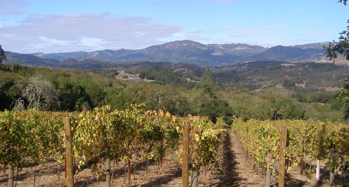
Sonoma County’s geography is its strongest asset for a strategic relocation. The county stretches from the Pacific coastline eastward into the Mayacamas Mountains, creating a layered terrain that offers natural defensibility and resource diversity. The coastal range provides a physical barrier against the most immediate fallout from a major event in the San Francisco Bay Area, while the inland valleys—home to towns like Santa Rosa, Petaluma, and Healdsburg—are sheltered and fertile. The Russian River, which flows through the county from Mendocino to the Pacific, is a reliable freshwater source, and the region’s Mediterranean climate supports year-round agriculture. The county’s position roughly 50 miles north of San Francisco means it is far enough to avoid the worst of a blast or fallout plume from the city or the nearby Travis Air Force Base in Solano County, yet close enough to access emergency supplies or medical care if needed. The Pacific coastline, while exposed to tsunamis, offers a potential retreat route and access to marine resources. For a relocator, the key advantage is the ability to live in a semi-rural or rural setting—areas like Sebastopol or Guerneville—while still being within a two-hour drive of major infrastructure.
Risks, exposures, and proximity to fallout-relevant landmarks
Sonoma County is not without significant exposure to man-made and natural threats. The most immediate concern is its proximity to Travis Air Force Base, a major military logistics hub located about 30 miles southeast of Santa Rosa. In a conflict scenario, Travis would be a high-priority target, and fallout patterns could easily drift into southern Sonoma County depending on wind direction. The county also sits within 50 miles of the San Francisco Bay Area’s refinery corridor, including the Phillips 66 Rodeo refinery and the Chevron Richmond refinery, both of which are potential targets for sabotage or attack. The Port of Oakland, a major container shipping hub, is roughly 60 miles south, and its disruption would ripple through supply chains. On the natural disaster front, the county is seismically active—the San Andreas Fault runs along the coast, and the Rodgers Creek Fault cuts through Santa Rosa. A major earthquake could sever roads, pipelines, and power lines, isolating communities for days or weeks. Wildfire risk is severe and growing; the 2017 Tubbs Fire and 2020 Glass Fire destroyed thousands of homes and demonstrated that even well-prepared areas can be overwhelmed. Flooding along the Russian River is a recurring issue, particularly in low-lying areas like Guerneville and Forestville. For the strategic relocator, these risks mean that property selection—elevation, defensible space, and distance from fault lines—is critical.
Practical resilience for a relocator: food, water, energy, and defensibility
Sonoma County’s agricultural base is a major draw for self-sufficiency. The county is a top producer of wine grapes, but also grows apples, pears, and a wide variety of vegetables, and supports livestock and dairy operations. Farmers’ markets are abundant, and many small farms offer CSA shares. For a relocator, the ability to source local food reduces dependence on long supply chains. Water is generally reliable, with the Russian River and several reservoirs—including Lake Sonoma and Lake Mendocino—providing ample supply, though drought years can strain allocations. Well water is common in rural areas, but drilling depths and yields vary. Energy resilience is mixed: PG&E’s grid is prone to public safety power shutoffs during high-fire-risk weather, which can last days. Solar adoption is high, and many homes have battery backup, but natural gas is the primary heating fuel in most areas. Defensibility varies by terrain. The coastal mountains and narrow valleys offer natural chokepoints, but the same topography can make evacuation difficult during a wildfire. Rural properties with good road access, multiple exits, and defensible space are preferable. The county’s population of roughly 500,000 is spread across many small towns, meaning that a single event is unlikely to overwhelm the entire area. For a relocator, the key is to choose a location that balances access to resources with isolation from the most vulnerable infrastructure.
Overall, Sonoma County presents a nuanced strategic picture. It offers genuine advantages in food production, water availability, and geographic buffering from the Bay Area’s most critical targets. The risks—wildfire, earthquake, and proximity to Travis Air Force Base and refinery corridors—are real and require careful site selection and preparation. For a relocator who is willing to invest in fire-hardening, backup power, and water storage, and who chooses a property in a less exposed area like the western hills or the northern Russian River valley, Sonoma County can be a strong base for long-term resilience. It is not a bug-out location; it is a place to build a life that is both connected to the broader region and capable of weathering disruption. The county’s mix of natural resources, community infrastructure, and strategic position makes it a serious option for those who understand that no place is perfect, but some are better than others.

* Values derived from national, state, county, city and local statistics and may differ in a specific area. Last updated: 2026-07-24T05:22:58.000Z
Narrative content on this page is AI-generated and may contain mistakes. Verify any details that matter before acting on them.
ReloMaps may earn a commission from affiliate links at no extra cost to you.

