
Photo by Balazs Busznyak on Unsplash
Strategic Assessment of York, ME
Meaningful friction. Expect exposure to either population pressure, blast zones, or natural disaster risk. Consider buying a retreat property.
What does the Strategic Assessment tell us?
Our Strategic Assessment grades tactical survivability of an area. Major population centers, military targets, fallout zones, natural disasters, and border exposure all drive risk — lower exposure means a more defensible position in a crisis.
This is heavily inspired by Joel Skousen's Strategic Relocation book. Highly recommended you checkout the book ($)What does this tell us?
Our Strategic Assessment grades tactical survivability of an area. Major population centers, military targets, fallout zones, natural disasters, and border exposure all drive risk — lower exposure means a more defensible position in a crisis.
This is heavily inspired by Joel Skousen's Strategic Relocation book. Highly recommended you checkout the book ($)Strategic Pillars

Key Distances
Regional Safe Places
Below is our recommended "safe zones" in Maine and the surrounding area based on our strategic heuristics. For most people, it's unrealistic to live in a “safe zone” full-time due to work, family or other personal reasons. They tend to be more rural. However, many of these areas are perfect for second homes and retreat properties that double as a vacation home or even a short-term rental.




Important Note: For informational purposes only. This does not mean nothing bad ever happens in the green zones. Please use common sense. This is based on public data and modeled with AI. We tried to take a conservative approach but mistakes happen. We update this regularly as new information becomes available.
Solar Generator Recommendations
Backup power matters more here than in safer locations. We've picked three solar generators across budgets and capacity tiers — start with the budget unit if you only need a few essentials, or step up if you want to run a fridge and HVAC for days at a time.

Jackery Portable Power Station Explorer 300
Budget OptionPower on the Go: Weighing only 11 lbs, it's convenient to set up and store with book-sized foldable solar panels

BLUETTI Portable Power Station AC180
Designed for both indoor and outdoor scenarios, AC180 is highly capable as it has a robost capacity and continuous output power.

EF ECOFLOW DELTA Pro Ultra Power Station
Upgraded PickEcoFlow DELTA Pro Ultra is a whole-home energy system designed to grow with your family. Integrated with the Smart Home Panel 2, it scales to meet your evolving energy needs — keeping your home powered, intelligent, and secure through every stage of life.
We earn a commission, at no additional cost to you.
Strategic Assessment Analysis
York, Maine, presents a mixed strategic picture for the relocation-minded reader prioritizing disaster readiness and self-sufficiency. Its coastal location offers distinct natural advantages in terms of water access and temperate climate, but its proximity to the Boston-to-Portland corridor and specific infrastructure vulnerabilities introduce significant risk factors that a serious prepper must weigh. The town’s resilience is not a simple yes or no; it is a function of how well a relocator can leverage its strengths while actively mitigating its exposures.
Geographic position and natural advantages for long-term security
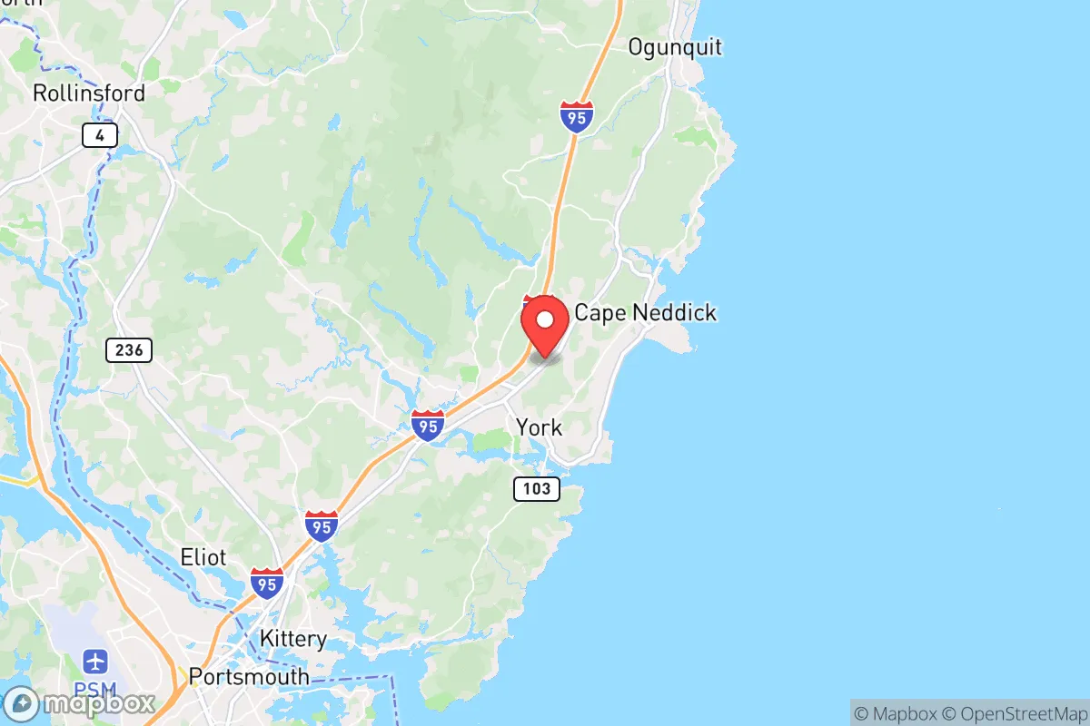
York sits at the southernmost tip of Maine, roughly 45 miles southwest of Portland and 65 miles northeast of Boston. This positioning places it within the extended commuter shed of two major metropolitan areas, which is a double-edged sword. On the positive side, the area benefits from the abundant freshwater resources of the York River and the Atlantic coastline, offering multiple options for water procurement beyond municipal systems. The local climate, while featuring harsh winters, supports a growing season of roughly 150 days, long enough for cold-hardy crops like potatoes, kale, and root vegetables. The surrounding landscape is a mix of forested hills, salt marshes, and rocky coastline, providing natural cover and defensible terrain compared to open plains or dense suburbs. The town’s population of roughly 13,000 swells in summer, but the year-round community is small enough that social cohesion and local knowledge networks are viable. The absence of major industrial targets or military installations within a 20-mile radius reduces the likelihood of direct kinetic or fallout exposure in a conflict scenario, though this is relative to the risks discussed below.
Risks, exposures, and proximity to fallout-relevant landmarks
The most significant strategic liability for York is its proximity to the Boston metropolitan area and the Portsmouth Naval Shipyard, located just 10 miles south in Kittery, Maine. The shipyard is a high-value target for any state-level adversary, and a detonation there would place York well within the moderate-to-heavy fallout zone depending on wind patterns. Additionally, the Seabrook Nuclear Power Station sits roughly 15 miles south in New Hampshire. While the plant is a civilian facility, its vulnerability to accident or attack is a known concern; a catastrophic failure could render large portions of southern York County uninhabitable for extended periods. Beyond man-made risks, the area faces increasing exposure to coastal storm surge and sea-level rise. The York River estuary and low-lying areas like York Beach and Cape Neddick are vulnerable to flooding from nor’easters and hurricanes. The 2023 and 2024 storm seasons saw repeated road closures on Route 1A and damage to shoreline infrastructure. For a relocator, this means any property within a mile of the coast requires serious elevation and drainage planning. The region also sits in a moderate seismic zone; while major earthquakes are rare, the 2012 magnitude 4.0 event near Hollis Center was felt strongly in York, reminding residents that no area is geologically inert.
Practical resilience for a relocator: food, water, energy, and defensibility
For the self-sufficient relocator, York offers a mixed bag of practical assets and liabilities. Water is the strongest asset: the York River is tidal but fresh upstream, and numerous ponds and wetlands provide surface water. Deep wells are common in rural parts of town, with yields typically ranging from 5 to 15 gallons per minute. A hand pump or solar-powered well system is a realistic upgrade. Food security is moderate. The growing season is short but productive, and local agriculture is present but not dominant. The York Farmers’ Market operates seasonally, and nearby communities like Eliot and South Berwick have working farms. However, the town itself is not a food-producing hub; a relocator would need to establish their own garden and consider greenhouse or cold-frame extensions. Energy resilience is a weak point. Central Maine Power’s grid is prone to outages from winter storms and tree falls. Solar potential is decent but not exceptional—York averages about 200 sunny days per year, with winter cloud cover reducing output significantly. Battery backup or a propane generator is nearly essential for anyone serious about year-round self-sufficiency. Wood heating is common and practical, with ample local firewood supply, but requires storage and labor. Defensibility is situational. The town’s layout—a mix of dense coastal settlement and sparse inland lots—means that a rural property on a dead-end road with good sightlines is far more defensible than a beachfront cottage. The local police department is small (roughly 20 officers), and response times in the outer reaches of town can exceed 15 minutes. For a relocator, the key is to choose a property with multiple egress routes (avoiding reliance on Route 1 or I-95 alone) and a buffer of at least 50 feet of cleared perimeter.
Overall, York, Maine, is a location that rewards careful selection and preparation. Its natural water resources, manageable population, and distance from the highest-risk urban cores give it a baseline resilience that many coastal towns lack. However, the proximity to the Portsmouth Naval Shipyard and Seabrook Station introduces a non-trivial risk of fallout or infrastructure collapse that cannot be ignored. A relocator who secures a well-watered, inland property with wood heat, solar backup, and a defensible layout can build a genuinely resilient homestead here. Those who buy near the coast or on the grid without redundancy will find themselves exposed to the same vulnerabilities that plague any suburban-adjacent town. York is not a bug-out paradise, but it is a viable long-term base for the prepared and the prudent.

* Values derived from national, state, county, city and local statistics and may differ in a specific area. Last updated: 2026-10-11T02:47:28.000Z
Narrative content on this page is AI-generated and may contain mistakes. Verify any details that matter before acting on them.
ReloMaps may earn a commission from affiliate links at no extra cost to you.

