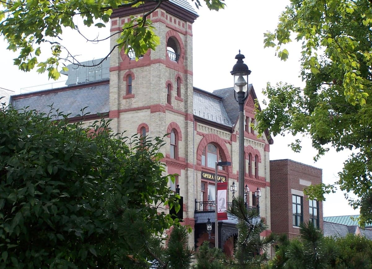
Photo: Wikipedia
Strategic Assessment of Woodstock, IL
Meaningful friction. Expect exposure to either population pressure, blast zones, or natural disaster risk. Consider buying a retreat property.
What does the Strategic Assessment tell us?
Our Strategic Assessment grades tactical survivability of an area. Major population centers, military targets, fallout zones, natural disasters, and border exposure all drive risk — lower exposure means a more defensible position in a crisis.
This is heavily inspired by Joel Skousen's Strategic Relocation book. Highly recommended you checkout the book ($)What does this tell us?
Our Strategic Assessment grades tactical survivability of an area. Major population centers, military targets, fallout zones, natural disasters, and border exposure all drive risk — lower exposure means a more defensible position in a crisis.
This is heavily inspired by Joel Skousen's Strategic Relocation book. Highly recommended you checkout the book ($)Strategic Pillars

Key Distances
Regional Safe Places
Below is our recommended "safe zones" in Illinois and the surrounding area based on our strategic heuristics. For most people, it's unrealistic to live in a “safe zone” full-time due to work, family or other personal reasons. They tend to be more rural. However, many of these areas are perfect for second homes and retreat properties that double as a vacation home or even a short-term rental.
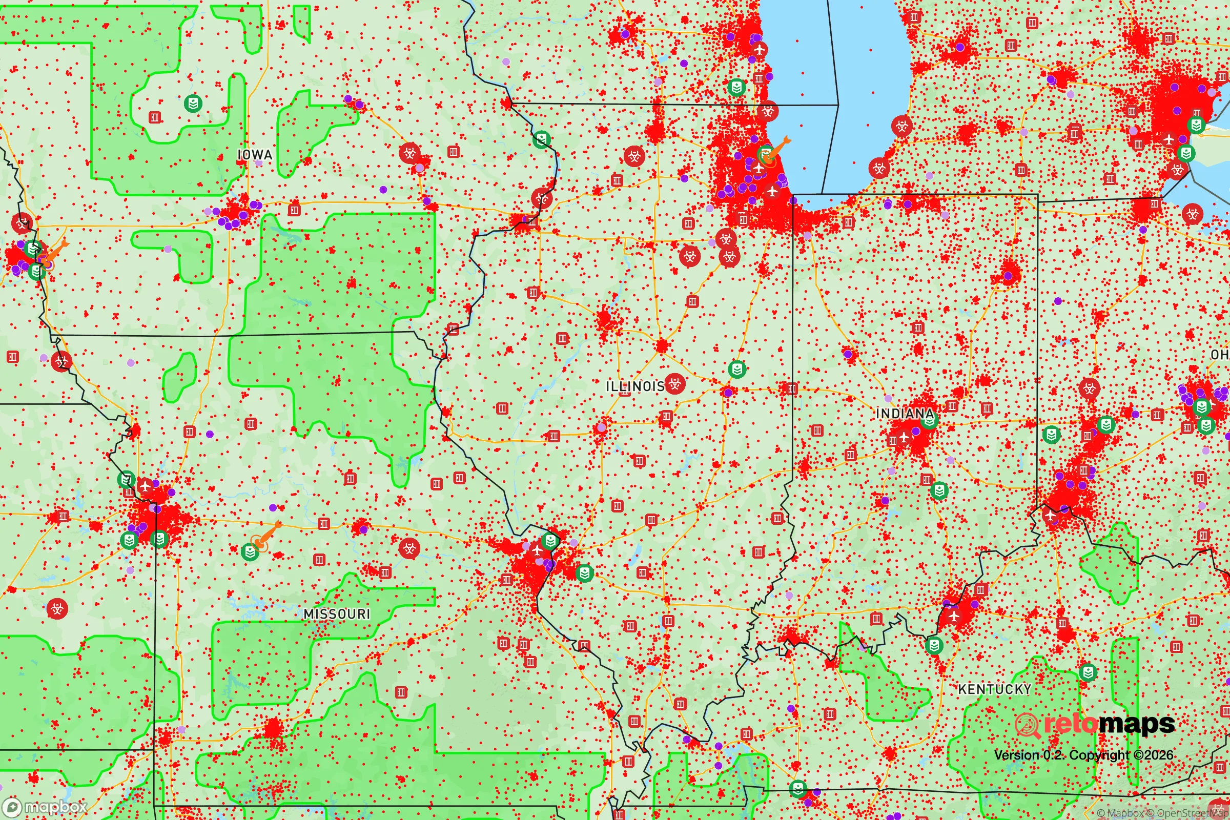
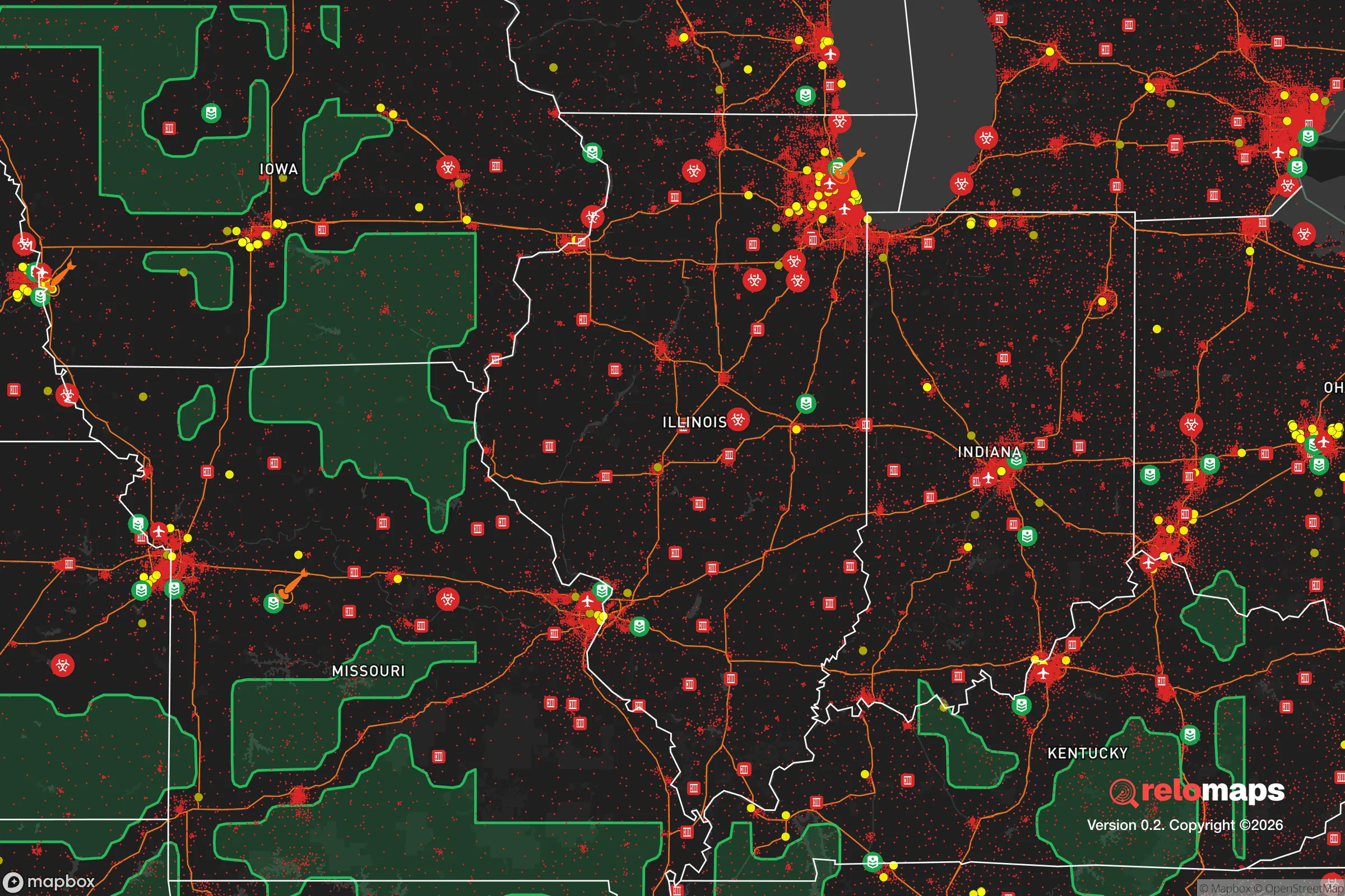


Important Note: For informational purposes only. This does not mean nothing bad ever happens in the green zones. Please use common sense. This is based on public data and modeled with AI. We tried to take a conservative approach but mistakes happen. We update this regularly as new information becomes available.
Solar Generator Recommendations
Backup power matters more here than in safer locations. We've picked three solar generators across budgets and capacity tiers — start with the budget unit if you only need a few essentials, or step up if you want to run a fridge and HVAC for days at a time.

Jackery Portable Power Station Explorer 300
Budget OptionPower on the Go: Weighing only 11 lbs, it's convenient to set up and store with book-sized foldable solar panels

BLUETTI Portable Power Station AC180
Designed for both indoor and outdoor scenarios, AC180 is highly capable as it has a robost capacity and continuous output power.

EF ECOFLOW DELTA Pro Ultra Power Station
Upgraded PickEcoFlow DELTA Pro Ultra is a whole-home energy system designed to grow with your family. Integrated with the Smart Home Panel 2, it scales to meet your evolving energy needs — keeping your home powered, intelligent, and secure through every stage of life.
We earn a commission, at no additional cost to you.
Strategic Assessment Analysis
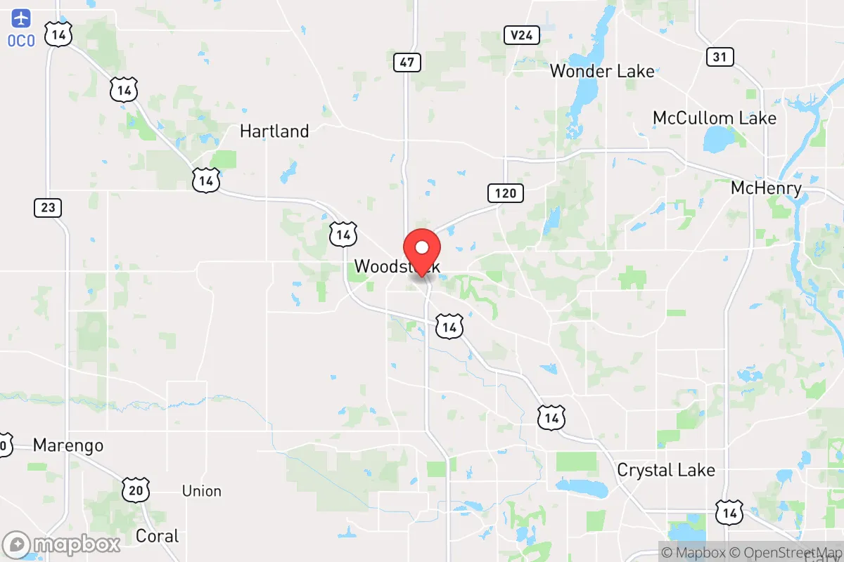
Woodstock, Illinois, offers a surprisingly strong strategic position for those prioritizing resilience and self-sufficiency, balancing proximity to the economic engine of Chicago with a buffer of rural farmland and small-town infrastructure. Its location in McHenry County, roughly 50 miles northwest of the Loop, places it beyond the immediate blast and fallout zones of a major metropolitan target, while still providing access to critical supply chains and medical networks. For a relocator thinking seriously about disaster readiness, Woodstock represents a calculated trade-off: you gain the advantages of a dispersed, agricultural community without being completely isolated from the resources a major city provides in a non-crisis scenario.
Geographic position and natural advantages for long-term stability
Woodstock sits on the edge of the Driftless Area, a region of rolling hills and glacial moraines that escaped the flattening of the last ice age. This topography provides natural drainage and a diversity of microclimates that support small-scale agriculture, a key asset for food security. The area is not prone to the major natural disasters that plague other parts of the country: tornado risk is moderate but not extreme (McHenry County averages one or two touchdowns per decade), earthquake risk is negligible, and wildfire risk is very low due to the region's humid continental climate and extensive farmland. The primary natural hazard is severe winter weather, including lake-effect snow from nearby Lake Michigan, but this is a predictable, manageable event that local infrastructure is well-adapted to handle. The Kishwaukee River and several smaller creeks run through the area, providing surface water sources that are less likely to be contaminated by industrial runoff than those closer to Chicago. The underlying geology includes shallow aquifers that supply many private wells, offering a decentralized water option for those who can secure property with a well permit.
Risks, exposures, and proximity to fallout-relevant landmarks
The most significant risk for Woodstock is its proximity to Chicago, a Tier 1 target for any nuclear or large-scale conventional attack. While the 50-mile distance provides a substantial buffer against the immediate blast and thermal effects of a ground burst, fallout patterns are highly dependent on wind direction. A prevailing westerly wind would carry fallout away from Woodstock, but a southerly or southwesterly wind could deposit significant radioactive material across McHenry County within hours. The area is also within 30 miles of the Exelon Byron Nuclear Generating Station (about 40 miles west), a potential target or accident source, and within 60 miles of the Braidwood Generating Station to the south. Both are large, operating nuclear plants that could become fallout sources in a crisis. Additionally, Woodstock lies near the intersection of several major transportation corridors: Interstate 90 (the Jane Addams Memorial Tollway) runs just south of town, and Union Pacific's Northwest Line rail corridor passes through the city. These are chokepoints that could become contested or congested during an evacuation or supply disruption. The presence of the McHenry County Government Center and the county jail in Woodstock makes it a minor administrative target, but not a primary military objective.
Practical resilience for a relocator: food, water, energy, and defensibility
Woodstock's practical resilience is its strongest selling point. The surrounding farmland is some of the most productive in the Midwest, with a mix of row crops (corn, soybeans) and smaller livestock operations. Local food production is robust: the Woodstock Farmers Market operates seasonally, and several community-supported agriculture (CSA) programs serve the area. For long-term self-sufficiency, the county's agricultural zoning allows for small-scale farming, and the soil quality is excellent for home gardens. Water access is a mixed picture: the city's municipal water comes from deep wells in the Ironton-Galesville aquifer, which is generally reliable but could be vulnerable to contamination from surface runoff or a prolonged power outage. Private wells are common in the unincorporated areas and offer a decentralized, gravity-fed option if properly maintained. Energy infrastructure is typical for the region: ComEd provides grid power with moderate reliability (outages are common during severe storms but usually restored within 24 hours). Natural gas is available in town, but propane and heating oil are the norm in rural areas. For off-grid energy, solar potential is moderate (about 4.5 peak sun hours per day), and small wind turbines are feasible on larger parcels. Defensibility is a key consideration: Woodstock is a compact, walkable town with a historic square, but its open farmland and grid-like street pattern offer limited natural cover. The surrounding rural areas, with their winding roads, wooded lots, and dispersed homesteads, provide much better defensibility for a relocator seeking a retreat. The local law enforcement presence is adequate but not overwhelming; the McHenry County Sheriff's Office has a substation in Woodstock, and response times in rural areas can be 20-30 minutes.
The overall strategic picture for Woodstock is one of a capable, middle-ground option for the disaster-conscious relocator. It avoids the extreme risks of a major city while retaining enough infrastructure and community to avoid the isolation of a deep rural retreat. The primary vulnerability is its position downwind of Chicago and near nuclear facilities, but this is a risk shared by most of northern Illinois. For a family or individual willing to invest in a well, a backup power system, and a modest food storage plan, Woodstock offers a realistic balance of access and security. It is not a hardened bunker location, but it is a place where a prepared person can live comfortably in normal times and ride out most disruptions with reasonable confidence. The key is to treat it as a base of operations, not a fortress, and to have a clear plan for evacuation or sheltering based on the specific threat.

* Values derived from national, state, county, city and local statistics and may differ in a specific area. Last updated: 2026-09-03T21:01:44.000Z
Narrative content on this page is AI-generated and may contain mistakes. Verify any details that matter before acting on them.
ReloMaps may earn a commission from affiliate links at no extra cost to you.

