
Photo: Wikipedia
Strategic Assessment of Dane County
Multiple tactical vulnerabilities. Population density, target proximity, or disaster risk are likely compounding. A retreat property and exit planning is required.
What does the Strategic Assessment tell us?
Our Strategic Assessment grades tactical survivability of an area. Major population centers, military targets, fallout zones, natural disasters, and border exposure all drive risk — lower exposure means a more defensible position in a crisis.
This is heavily inspired by Joel Skousen's Strategic Relocation book. Highly recommended you checkout the book ($)What does this tell us?
Our Strategic Assessment grades tactical survivability of an area. Major population centers, military targets, fallout zones, natural disasters, and border exposure all drive risk — lower exposure means a more defensible position in a crisis.
This is heavily inspired by Joel Skousen's Strategic Relocation book. Highly recommended you checkout the book ($)Strategic Pillars

Key Distances
Strategic Assessment Analysis
Dane County, Wisconsin, offers a compelling mix of Midwestern stability and strategic depth for relocators prioritizing resilience and self-sufficiency. Anchored by Madison, the state capital, the county benefits from a diversified economy, robust infrastructure, and a location that sits outside the highest-risk corridors for natural disasters and major industrial targets. While no place is immune to risk, Dane County’s combination of freshwater access, fertile farmland, and relative geographic isolation from coastal and major fallout zones makes it a serious contender for those evaluating long-term preparedness.
Geographic position and natural advantages for long-term stability
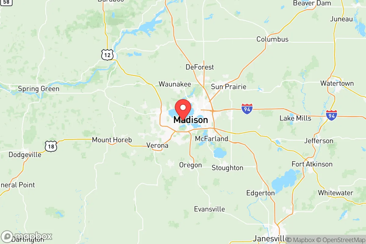
Dane County’s location in south-central Wisconsin places it in a sweet spot for resilience. It is roughly 80 miles west of Milwaukee and 120 miles northwest of Chicago, far enough from those major metropolitan areas to avoid their immediate fallout and congestion risks, yet close enough for supply chain access. The county is part of the Driftless Area, a region that escaped the flattening effects of the last glacial period, resulting in rolling hills, valleys, and a more defensible terrain than the flat plains to the south. The Yahara River chain of lakes—including Lake Mendota, Lake Monona, Lake Waubesa, and Lake Kegonsa—provides a natural freshwater reservoir that is rare in the continental interior. These lakes are fed by groundwater and surface runoff, offering a decentralized water source that is less vulnerable to single-point failure than a river-dependent system. The county’s average annual rainfall of about 35 inches supports rain-fed agriculture without the drought risks of the West, and the growing season, while shorter than the South, is reliable for staple crops like corn, soybeans, and hay.
Risk exposures and proximity to fallout-relevant landmarks
Dane County’s risk profile is moderate compared to coastal or industrial-heavy regions, but it is not without exposure. The most significant man-made risk comes from its proximity to Madison’s downtown core, which houses the Wisconsin State Capitol, the University of Wisconsin–Madison, and several federal and state government offices. These are potential targets for civil unrest or targeted attacks, though not high-yield nuclear targets. The county is also within 100 miles of Rockford, Illinois, which has a major airport and industrial base, and roughly 150 miles from the Chicago metropolitan area, a Tier-1 target for any large-scale conflict. Fallout from a Chicago strike could reach Dane County depending on wind patterns, but the distance and prevailing westerlies reduce the probability of lethal deposition. Natural risks are low: the county is not in a hurricane zone, has minimal seismic activity, and experiences only occasional tornadoes (typically EF-0 to EF-2). Flooding along the Yahara River and around the lakes is the most common hazard, but it is localized and manageable with proper siting. The Dane County Regional Airport and the Interstate 39/90/94 corridor are chokepoints that could become congested during an evacuation, so relocators should plan for ground routes that avoid these arteries.
Practical resilience for a relocator: food, water, energy, and defensibility
For someone serious about self-sufficiency, Dane County offers strong fundamentals. Food: The county is part of Wisconsin’s agricultural heartland, with over 4,000 farms producing dairy, beef, poultry, vegetables, and grains. The Dane County Farmers’ Market in Madison is one of the largest producer-only markets in the country, but more importantly, the surrounding towns—Mount Horeb, Verona, Stoughton, and Sun Prairie—have active local food networks, CSAs, and u-pick operations. Soil quality is excellent, and the growing season (roughly May through September) is sufficient for home gardens and small-scale farming. Water: The four major lakes and numerous smaller ponds and streams provide abundant surface water, but groundwater is also accessible via wells in most rural areas. The county’s water table is generally high, and private wells are common outside city limits. Energy: Dane County is served by the Alliant Energy and Madison Gas and Electric grids, which include a mix of coal, natural gas, and renewables. Solar potential is moderate (about 4.5 peak sun hours per day), but net metering policies are favorable, and off-grid solar is feasible with battery storage. Wood heating is viable given the county’s forest cover (about 15% of land area), and propane is widely available for backup. Defensibility: The Driftless Area’s hills and valleys provide natural cover and chokepoints. Rural properties with long driveways, tree lines, and elevation changes are easier to secure than flat, open farmland. The county’s population density is low outside the Madison metro (about 200 people per square mile countywide, but under 50 in many townships), which reduces competition for resources in a crisis. However, the county’s strong liberal political leanings mean that local governance may prioritize collective response over individual preparedness, so relocators should plan to be self-reliant rather than dependent on county services.
The overall strategic picture for Dane County is one of balanced resilience. It avoids the extreme risks of coastal hurricane zones, seismic fault lines, and major nuclear targets, while offering abundant freshwater, fertile soil, and a temperate climate that supports year-round habitation. The main trade-offs are the cold winters (which require robust heating and food storage plans) and the proximity to Madison’s government and university infrastructure, which could become a liability during civil unrest or targeted attacks. For a relocator who values stability, resource availability, and a lower-risk profile than the Sun Belt or the Northeast, Dane County is a strong candidate—provided they site their property away from major highways and the urban core, and invest in winter-ready systems for water, power, and food storage. It is not a bug-out location, but a solid long-term base for those willing to put in the work.

* Values derived from national, state, county, city and local statistics and may differ in a specific area. Last updated: 2026-07-04T08:06:21.000Z
Narrative content on this page is AI-generated and may contain mistakes. Verify any details that matter before acting on them.
ReloMaps may earn a commission from affiliate links at no extra cost to you.

