
Photo: Wikipedia
Strategic Assessment of Bayfield County
Strong survivability profile. Good buffer from population centers, with manageable environmental and tactical risks.
What does the Strategic Assessment tell us?
Our Strategic Assessment grades tactical survivability of an area. Major population centers, military targets, fallout zones, natural disasters, and border exposure all drive risk — lower exposure means a more defensible position in a crisis.
This is heavily inspired by Joel Skousen's Strategic Relocation book. Highly recommended you checkout the book ($)What does this tell us?
Our Strategic Assessment grades tactical survivability of an area. Major population centers, military targets, fallout zones, natural disasters, and border exposure all drive risk — lower exposure means a more defensible position in a crisis.
This is heavily inspired by Joel Skousen's Strategic Relocation book. Highly recommended you checkout the book ($)Strategic Pillars

Key Distances
Strategic Assessment Analysis
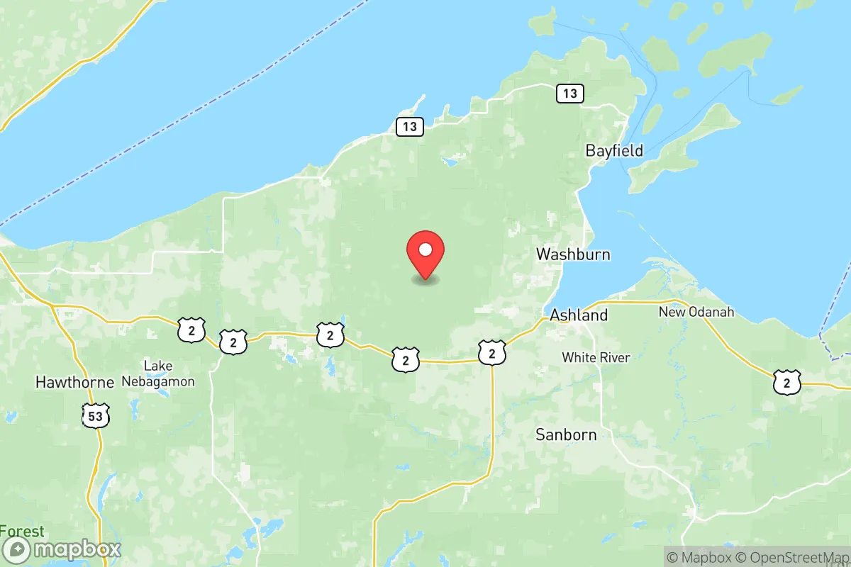
Bayfield County, Wisconsin, offers a compelling strategic profile for relocation-minded readers prioritizing resilience and self-sufficiency, largely due to its remote, sparsely populated geography and location on the south shore of Lake Superior. The county seat, Washburn, and the largest town, Bayfield, sit roughly 80 miles east of Duluth, Minnesota, placing them well outside the immediate fallout zones of major metropolitan targets while still providing access to regional supply chains and medical infrastructure. This positioning, combined with a population density of just 12 people per square mile, creates a natural buffer against both cascading infrastructure failures and population surges that often follow regional disruptions.
Geographic position and natural advantages for long-term stability
Bayfield County’s primary strategic asset is its position along the Apostle Islands National Lakeshore and the Chequamegon-Nicolet National Forest, which together provide a vast, low-density buffer zone. The county is bounded by Lake Superior to the north, offering an essentially limitless freshwater resource, and by dense mixed-hardwood forests to the south and east. This geography naturally limits approach vectors for any large-scale movement of people or goods, making the area inherently more defensible than open terrain. The county’s interior is characterized by rolling hills, numerous small lakes, and wetlands, which further fragment travel corridors and slow any potential influx. For a relocator, the key advantage is that the nearest major population center—Duluth, with roughly 87,000 residents—is separated by 80 miles of mostly rural Douglas County, and the nearest interstate highway (I-35) terminates in Duluth, meaning no high-speed arterial routes penetrate Bayfield County itself. The only state highways, WI-13 and WI-63, are two-lane roads that can be easily monitored or controlled if necessary. This isolation is a double-edged sword: it provides security but also means that resupply from the outside would be slow in a crisis.
Risks, exposures, and proximity to fallout-relevant landmarks
Bayfield County’s exposure to man-made and natural risks is relatively low compared to most of the continental United States, but it is not zero. The most significant man-made risk comes from the Duluth-Superior port complex, which handles coal, iron ore, and petroleum products. A major industrial accident or a targeted disruption at the port could send a plume of hazardous material across the lake, though prevailing westerly winds typically push such events away from Bayfield County. The nearest military installation of strategic importance is the Duluth Air National Guard Base, home to the 148th Fighter Wing. While not a primary nuclear target, it could be a secondary target in a conflict, and its location 80 miles west means Bayfield County would be upwind of any fallout from a strike on that base. The county itself contains no refineries, nuclear power plants, or major industrial facilities that would make it a primary target. The Xcel Energy hydroelectric dam on the Bois Brule River in neighboring Douglas County is a potential infrastructure failure point, but its failure would primarily affect downstream areas, not Bayfield County. Natural risks are dominated by severe lake-effect snow—the county averages 100-150 inches annually—which can paralyze transportation for days and collapse roofs if not properly managed. Wildfire risk is moderate, as the forest is primarily northern hardwoods (maple, birch, aspen) rather than the highly flammable pine forests of the western U.S. The region sits on the Canadian Shield, making earthquakes extremely rare.
Practical resilience for a relocator: food, water, energy, and defensibility
For a relocator serious about self-sufficiency, Bayfield County offers strong fundamentals but requires significant preparation. Water is abundant and high-quality: Lake Superior provides an essentially inexhaustible supply, and the county’s numerous inland lakes and streams offer backup sources. Groundwater is generally clean and shallow, with most wells producing at 10-30 feet. Food production is viable but challenging: the growing season is short (roughly 100-120 frost-free days), and the soil is thin, acidic, and rocky. However, the county has a strong tradition of small-scale agriculture, with the Bayfield Regional Food Producers Cooperative supporting local growers. Cold-hardy crops like potatoes, root vegetables, and apples do well, and the Lake Superior microclimate along the lakeshore extends the season by 2-3 weeks compared to inland areas. For protein, Lake Superior offers whitefish, lake trout, and herring, while inland lakes provide walleye, northern pike, and panfish. Deer hunting is excellent, with the county consistently ranking among Wisconsin’s top for buck harvest. Energy resilience is a weak point: the county is served by Xcel Energy and Bayfield Electric Cooperative, but the grid is rural and prone to outages during winter storms. Solar potential is limited by heavy cloud cover from November through March, though summer days are long. Wood heating is the most practical off-grid option, with abundant firewood available on public lands (with a permit). Defensibility is high: the county’s low population density, limited road network, and dense forest cover make it easy to monitor approaches and difficult for any large group to move through undetected. The Red Cliff Band of Lake Superior Chippewa reservation occupies a significant portion of the northern lakeshore, and its sovereign status adds a layer of jurisdictional complexity that could be either an asset or a liability depending on relationships.
Overall, Bayfield County presents a strong strategic picture for a relocator who values isolation, abundant natural water, and low target risk over economic opportunity and modern convenience. The trade-offs are real: harsh winters, limited medical access (the nearest hospital with a trauma center is in Duluth), and a thin local economy that offers few jobs outside of tourism, government, and logging. For a family or individual with the resources to build a self-sufficient homestead—solar panels, a wood stove, a well, and a greenhouse—the county provides one of the best natural buffers in the Upper Midwest. The proximity to Duluth’s supplies and services, while a risk vector, also means that pre-positioning supplies is feasible via regular trips. The key strategic recommendation is to secure a property with lake access or a reliable well, invest in a high-clearance vehicle with snow tires, and build a network with the local farming and fishing community before a crisis hits. Bayfield County is not a bug-out location; it is a place to build a life that is already resilient by design.

* Values derived from national, state, county, city and local statistics and may differ in a specific area. Last updated: 2026-10-23T18:03:06.000Z
Narrative content on this page is AI-generated and may contain mistakes. Verify any details that matter before acting on them.
ReloMaps may earn a commission from affiliate links at no extra cost to you.

