
Photo: Wikipedia
Strategic Assessment of Wilmette, IL
Multiple tactical vulnerabilities. Population density, target proximity, or disaster risk are likely compounding. A retreat property and exit planning is required.
What does the Strategic Assessment tell us?
Our Strategic Assessment grades tactical survivability of an area. Major population centers, military targets, fallout zones, natural disasters, and border exposure all drive risk — lower exposure means a more defensible position in a crisis.
This is heavily inspired by Joel Skousen's Strategic Relocation book. Highly recommended you checkout the book ($)What does this tell us?
Our Strategic Assessment grades tactical survivability of an area. Major population centers, military targets, fallout zones, natural disasters, and border exposure all drive risk — lower exposure means a more defensible position in a crisis.
This is heavily inspired by Joel Skousen's Strategic Relocation book. Highly recommended you checkout the book ($)Strategic Pillars

Key Distances
Regional Safe Places
Below is our recommended "safe zones" in Illinois and the surrounding area based on our strategic heuristics. For most people, it's unrealistic to live in a “safe zone” full-time due to work, family or other personal reasons. They tend to be more rural. However, many of these areas are perfect for second homes and retreat properties that double as a vacation home or even a short-term rental.
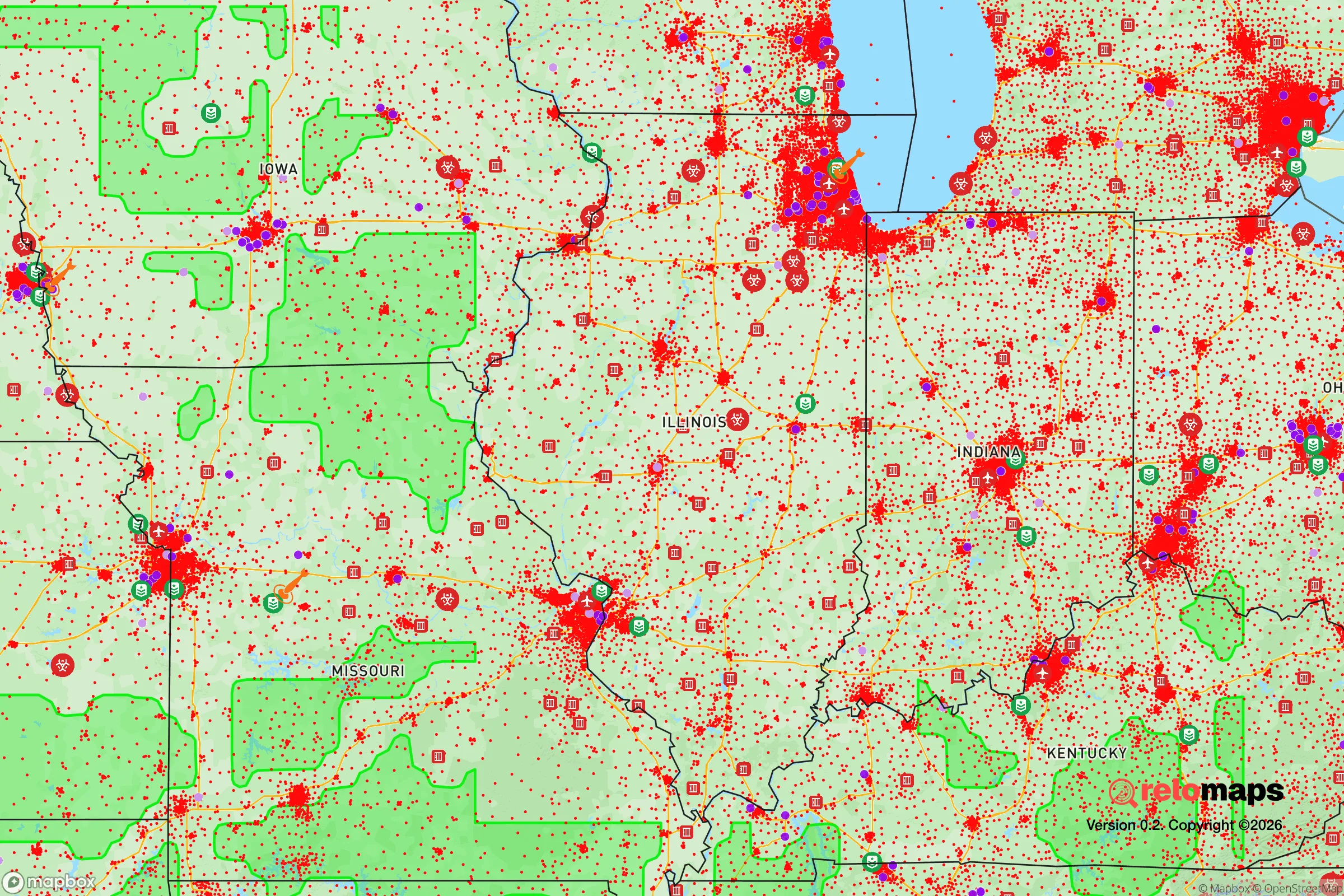
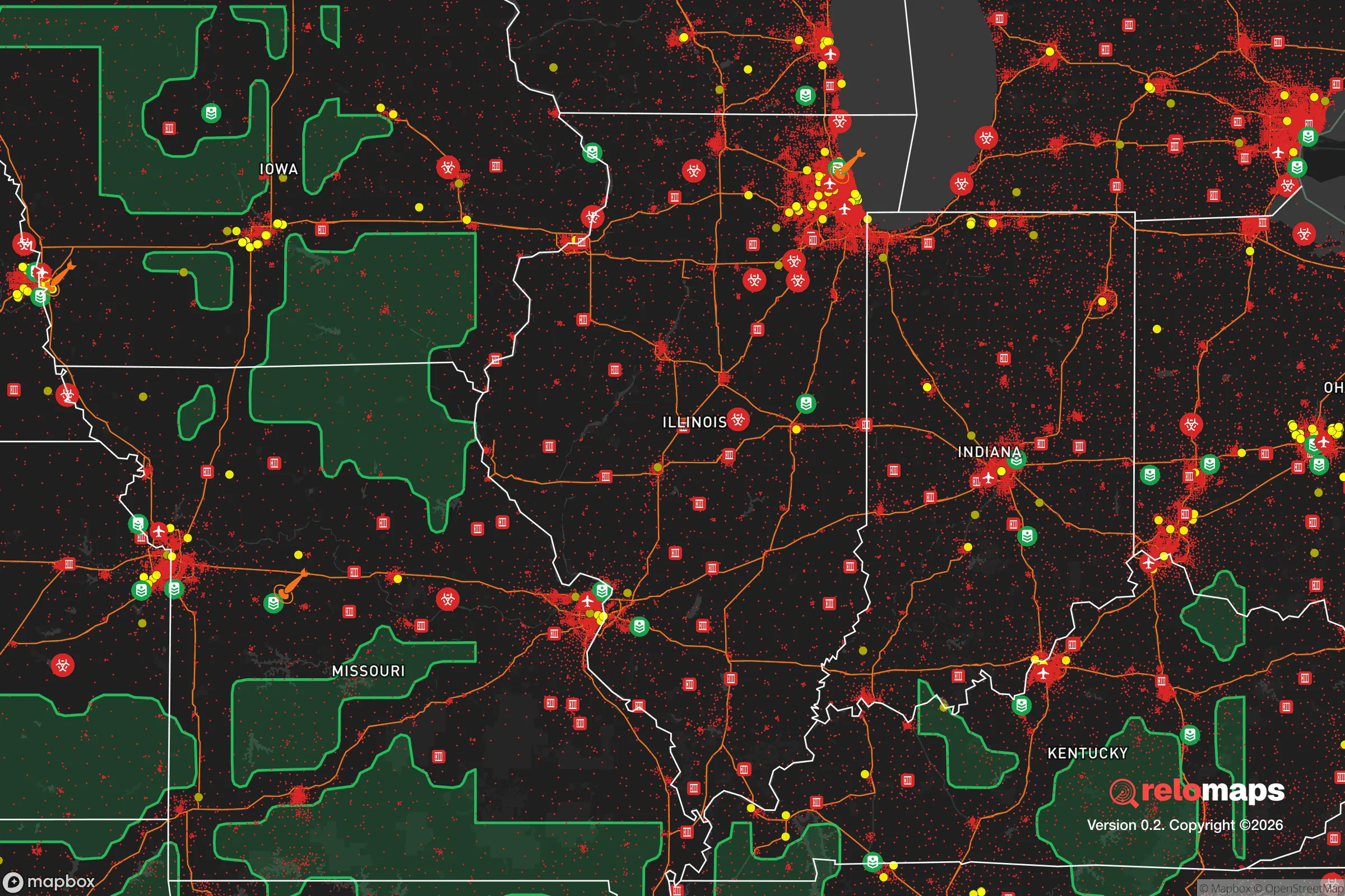


Important Note: For informational purposes only. This does not mean nothing bad ever happens in the green zones. Please use common sense. This is based on public data and modeled with AI. We tried to take a conservative approach but mistakes happen. We update this regularly as new information becomes available.
Solar Generator Recommendations
Backup power matters more here than in safer locations. We've picked three solar generators across budgets and capacity tiers — start with the budget unit if you only need a few essentials, or step up if you want to run a fridge and HVAC for days at a time.

Jackery Portable Power Station Explorer 300
Budget OptionPower on the Go: Weighing only 11 lbs, it's convenient to set up and store with book-sized foldable solar panels

BLUETTI Portable Power Station AC180
Designed for both indoor and outdoor scenarios, AC180 is highly capable as it has a robost capacity and continuous output power.

EF ECOFLOW DELTA Pro Ultra Power Station
Upgraded PickEcoFlow DELTA Pro Ultra is a whole-home energy system designed to grow with your family. Integrated with the Smart Home Panel 2, it scales to meet your evolving energy needs — keeping your home powered, intelligent, and secure through every stage of life.
We earn a commission, at no additional cost to you.
Strategic Assessment Analysis
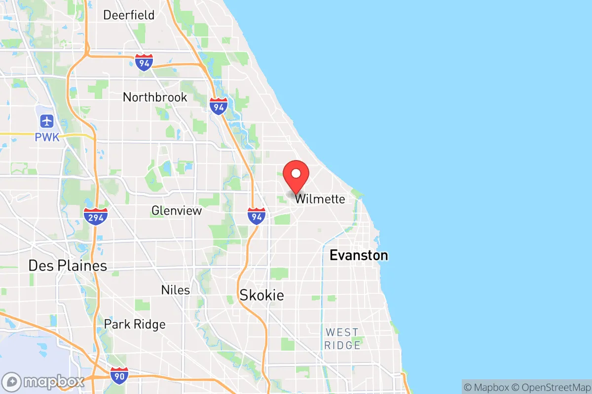
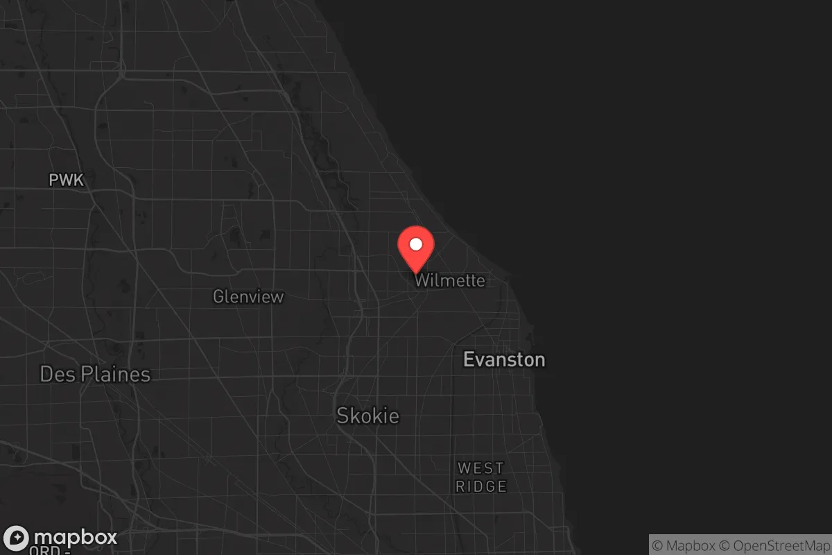
Wilmette, Illinois, occupies a strategic position that is both a blessing and a liability for a relocator focused on disaster readiness and self-sufficiency. Its location on the western shore of Lake Michigan, roughly 14 miles north of downtown Chicago, offers immediate access to a massive freshwater resource and a relatively stable climate zone, but its proximity to a major metropolitan target and critical infrastructure corridors introduces significant man-made risk factors. For the conservative-leaning individual or family weighing long-term resilience, Wilmette presents a trade-off: exceptional day-to-day livability and natural water security against a high-consequence exposure to fallout from a Chicago-centric crisis, whether natural, economic, or geopolitical.
Geographic position and natural advantages for long-term stability
Wilmette’s primary natural asset is its direct frontage on Lake Michigan, which provides an essentially inexhaustible supply of fresh water. The village draws its municipal water from the lake, and for a relocator, this eliminates the primary vulnerability of well-dependent or reservoir-dependent communities during a drought or grid failure. The local topography is flat and well-drained, sitting on a glacial plain that is not prone to landslides, sinkholes, or seismic activity. The climate is continental, with cold winters and warm summers, but it avoids the extremes of tornado alley to the west or hurricane zones to the south. Severe thunderstorms and occasional derechos are the main natural weather threats, but the area is not in a high-risk flood zone, with most properties outside the 100-year floodplain. The surrounding North Shore region—including communities like Winnetka, Kenilworth, and Glencoe—shares this geography, creating a contiguous zone of relatively stable, low-density residential development that could serve as a defensible perimeter in a prolonged disruption. The presence of the Skokie Lagoons and the Chicago Botanic Garden just west of Wilmette adds green space and potential foraging or gardening land, though these are not wilderness areas.
Risks, exposures, and proximity to fallout-relevant landmarks
The most significant risk for Wilmette is its proximity to Chicago, a Tier 1 metropolitan target in any national security scenario. The village lies directly along the Lake Michigan shoreline, which is also the corridor for critical rail and highway infrastructure connecting Chicago to Milwaukee and the Upper Midwest. The Edens Expressway (I-94) and the Metra Union Pacific North Line run through or adjacent to Wilmette, making it a likely evacuation route and potential chokepoint during a crisis. The village is roughly 10 miles from the O'Hare International Airport airspace and 12 miles from the Glenview Naval Air Station (now largely redeveloped, but still a former military installation). More concerning is the proximity to the Zion Nuclear Power Station, located about 35 miles north, which is currently in decommissioning but still contains spent fuel on site. A radiological incident at Zion, or a strike on the Braidwood or Dresden nuclear plants further southwest, could place Wilmette in a downwind plume depending on weather patterns. Additionally, the village is within the blast and fallout radius of a ground-level nuclear detonation in downtown Chicago, though the prevailing westerly winds would carry fallout east over Lake Michigan, not directly over the North Shore. For a relocator, the density of the surrounding suburbs means that any large-scale evacuation would face gridlock on the few north-south arteries—Sheridan Road, Green Bay Road, and I-94—making a timely exit difficult. The presence of multiple hospitals, including Evanston Hospital and NorthShore Glenbrook Hospital, is a double-edged sword: useful for medical care but also potential convergence points for crowds during a crisis.
Practical resilience for a relocator: food, water, energy, and defensibility
Wilmette’s practical resilience is mixed. On the positive side, the village has a robust municipal water system with backup generators at its pumping stations, and most homes are connected to natural gas, which provides heating and cooking capability independent of the electrical grid. The local electrical infrastructure is maintained by ComEd, which has a mixed record on outage restoration during severe storms, but the area is not prone to the extended blackouts seen in rural or coastal zones. For a relocator looking to harden a property, Wilmette’s housing stock—largely single-family homes built between 1920 and 1960—offers basements that can serve as storm shelters or root cellars, and many lots are large enough for a substantial vegetable garden. The village has a strong farmers' market and is within a short drive of multiple grocery stores, but local food production is limited; the area is not agricultural, and a supply chain disruption would quickly empty store shelves. The nearest significant farmland is in Lake County to the west and north, but that is a 30- to 45-minute drive under normal conditions. For energy independence, solar panel installation is feasible but restricted by homeowners' association covenants in some neighborhoods, and the village’s tree canopy can reduce solar efficiency. Defensibility is a challenge: Wilmette is a dense, interconnected suburb with multiple entry points and no natural barriers. A determined group could secure a single block or cul-de-sac, but the village as a whole is not defensible against a large-scale civil unrest scenario. The local police department is well-funded and professional, but it would be overwhelmed in a regional crisis. The community’s social cohesion is a resilience factor—neighborhood associations and local churches are active—but the population is largely white-collar and dependent on the regional economy, which could be a vulnerability in a prolonged downturn.
The overall strategic picture for Wilmette is that of a high-comfort, moderate-resilience location that is best suited for a relocator who values immediate quality of life and is willing to accept a degree of man-made risk in exchange for natural water security and a stable climate. It is not a bug-out location or a self-sufficient homestead; it is a well-positioned suburb that could ride out a short-term crisis but would struggle in a long-term grid-down or societal collapse scenario. For the conservative-leaning family that wants to be near Chicago’s cultural and economic opportunities while maintaining a reasonable level of preparedness, Wilmette offers a solid foundation—provided they invest in backup power, water storage, and a community network. The key takeaway is that Wilmette’s resilience is tied to the stability of the broader region; if Chicago holds, Wilmette thrives. If Chicago falls, Wilmette is too close for comfort and too far from the hinterlands to be a true redoubt.

* Values derived from national, state, county, city and local statistics and may differ in a specific area. Last updated: 2026-10-08T15:03:45.000Z
Narrative content on this page is AI-generated and may contain mistakes. Verify any details that matter before acting on them.
ReloMaps may earn a commission from affiliate links at no extra cost to you.

