Photo: Wikipedia
Strategic Assessment of Pocahontas County
Workable tactical position. Some exposure to population density or targets, but generally defensible in a crisis.
What does the Strategic Assessment tell us?
Our Strategic Assessment grades tactical survivability of an area. Major population centers, military targets, fallout zones, natural disasters, and border exposure all drive risk — lower exposure means a more defensible position in a crisis.
This is heavily inspired by Joel Skousen's Strategic Relocation book. Highly recommended you checkout the book ($)What does this tell us?
Our Strategic Assessment grades tactical survivability of an area. Major population centers, military targets, fallout zones, natural disasters, and border exposure all drive risk — lower exposure means a more defensible position in a crisis.
This is heavily inspired by Joel Skousen's Strategic Relocation book. Highly recommended you checkout the book ($)Strategic Pillars

Key Distances
Strategic Assessment Analysis
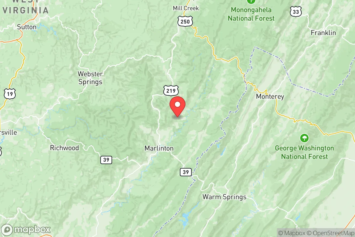
Pocahontas County, West Virginia, offers a strategic relocation option for those prioritizing resilience and self-sufficiency, combining deep rural isolation with surprising logistical advantages. Situated in the Allegheny Mountains along the Virginia border, the county is anchored by the small communities of Marlinton, the county seat, and Snowshoe, a ski resort town that provides a year-round economic anchor. Its position places it roughly 150 miles from the Washington, D.C. metro area and about 200 miles from the Pittsburgh metro, far enough to avoid the immediate fallout zones of major population centers but close enough to access supply chains and medical facilities when necessary. This balance of remoteness and reachability is a core part of the area's appeal for a conservative-leaning audience thinking seriously about disaster readiness.
Geographic position and natural advantages for long-term security
Pocahontas County sits in the heart of the Monongahela National Forest, which covers over 60% of the county's land area. This vast, federally protected forest creates a natural buffer zone that limits development and provides a massive resource base for timber, wildlife, and water. The county's topography is defined by high ridges and deep valleys, with elevations ranging from roughly 2,000 feet in the valleys to over 4,800 feet at the summit of Spruce Knob, the highest point in West Virginia. This rugged terrain offers inherent defensibility—access is limited to a handful of two-lane roads, including US Route 219 and State Route 28, which can be easily monitored and, if necessary, controlled. The Greenbrier River, which runs the length of the county, provides a reliable surface water source, while the numerous springs and creeks in the national forest offer backup options. For a relocator, the combination of high elevation, forest cover, and limited road access creates a natural fortress that is difficult to approach undetected and offers significant advantages in terms of water availability and fuel (wood) for heating and cooking.
Risks, exposures, and proximity to fallout-relevant landmarks
While Pocahontas County is far from the primary targets of a major conflict, it is not entirely free of risk. The nearest significant military installation is the Green Bank Observatory in neighboring Pocahontas County, Virginia (about 30 miles south), which is a radio astronomy facility, not a military base. The closest major military base is Fort Bragg (now Fort Liberty) in North Carolina, roughly 300 miles south, and the Norfolk Naval Shipyard in Virginia is about 250 miles east. These distances are substantial enough that a direct conventional strike on these targets would not produce immediate fallout in Pocahontas County, but prevailing westerly winds could carry particulate matter from a nuclear event on the East Coast. More immediate risks are natural: the county lies in a moderate seismic zone, and while major earthquakes are rare, the region is prone to ice storms, heavy snowfall, and occasional flooding along the Greenbrier River. The 2016 flood that devastated parts of West Virginia largely spared Pocahontas County, but low-lying areas near Marlinton have experienced localized flooding. The county's isolation also means that emergency response times are long—the nearest hospital with a trauma center is in Lewisburg, about 45 minutes south, or Elkins, about an hour north. For a relocator, the primary man-made risk is not direct targeting but the potential for secondary effects—refugee movement from the I-81 corridor (about 40 miles east) or the I-64 corridor (about 30 miles south) in a crisis, which could strain local resources.
Practical resilience for a relocator: food, water, energy, and defensibility
Pocahontas County offers strong practical resilience for those willing to invest in self-sufficiency. Water is abundant: the Greenbrier River and its tributaries provide year-round flow, and the county's high rainfall (averaging 45-50 inches annually) means that rainwater catchment is highly effective. Groundwater is generally accessible via wells, though drilling depths can vary significantly due to the karst topography. Food production is viable: the growing season is short (roughly 120-140 frost-free days) due to elevation, but cool-weather crops like potatoes, greens, and root vegetables thrive. The county has a strong tradition of small-scale livestock farming—cattle, sheep, and goats are common—and the national forest offers hunting for deer, turkey, and small game. Energy independence is achievable: the county's forested terrain makes wood the primary heating fuel for many residents, and solar potential is good despite frequent cloud cover, as the high elevation reduces atmospheric interference. Off-grid solar systems are common in the more remote hollows. Defensibility is inherent: the road network is sparse and easily monitored. The main routes—US 219 and SR 28—can be blocked at chokepoints like the Hillsboro Gap or the Greenbrier River crossings near Marlinton. The county's population density is roughly 11 people per square mile, meaning that a relocator with a well-chosen property can have significant physical separation from neighbors. However, the trade-off is that community ties are essential for long-term resilience—the county's volunteer fire departments, local churches, and hunting clubs are the social fabric that holds the area together. A relocator who arrives without building these relationships will find the isolation more of a liability than an asset.
The overall strategic picture for Pocahontas County is one of high potential with clear trade-offs. It offers some of the best natural advantages in the eastern United States for a resilience-minded relocator: abundant water, defensible terrain, low population density, and proximity to national forest resources. The risks are manageable—primarily natural hazards and the potential for secondary effects from East Coast disruptions—rather than direct targeting. The county's economy is weak, with a median household income around $35,000 and limited job opportunities outside of tourism, healthcare, and remote work. For a family or individual with the capital to buy land (prices are low, with many parcels under $2,000 per acre) and the skills to build a self-sufficient homestead, Pocahontas County represents a strong bet. For those expecting to rely on local infrastructure or emergency services, the isolation will be a liability. The key takeaway: this is a place for the prepared, not the unprepared. If you bring your own plan for food, water, energy, and community integration, the county's natural advantages will serve you well. If you expect to show up and find a ready-made support system, you will struggle. For the conservative-leaning reader who values independence, self-reliance, and a buffer from the chaos of urban centers, Pocahontas County is worth a serious look.

* Values derived from national, state, county, city and local statistics and may differ in a specific area. Last updated: 2026-11-11T23:11:40.000Z
Narrative content on this page is AI-generated and may contain mistakes. Verify any details that matter before acting on them.
ReloMaps may earn a commission from affiliate links at no extra cost to you.

