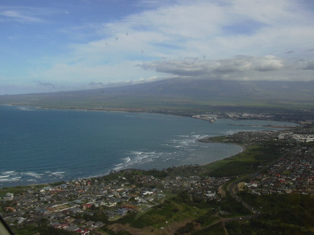
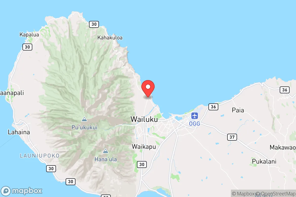
Photo: Wikipedia
Strategic Assessment of Waihee, HI
Strong survivability profile. Good buffer from population centers, with manageable environmental and tactical risks.
What does the Strategic Assessment tell us?
Our Strategic Assessment grades tactical survivability of an area. Major population centers, military targets, fallout zones, natural disasters, and border exposure all drive risk — lower exposure means a more defensible position in a crisis.
This is heavily inspired by Joel Skousen's Strategic Relocation book. Highly recommended you checkout the book ($)What does this tell us?
Our Strategic Assessment grades tactical survivability of an area. Major population centers, military targets, fallout zones, natural disasters, and border exposure all drive risk — lower exposure means a more defensible position in a crisis.
This is heavily inspired by Joel Skousen's Strategic Relocation book. Highly recommended you checkout the book ($)Strategic Pillars

Key Distances
Regional Safe Places
Below is our recommended "safe zones" in Hawaii and the surrounding area based on our strategic heuristics. For most people, it's unrealistic to live in a “safe zone” full-time due to work, family or other personal reasons. They tend to be more rural. However, many of these areas are perfect for second homes and retreat properties that double as a vacation home or even a short-term rental.

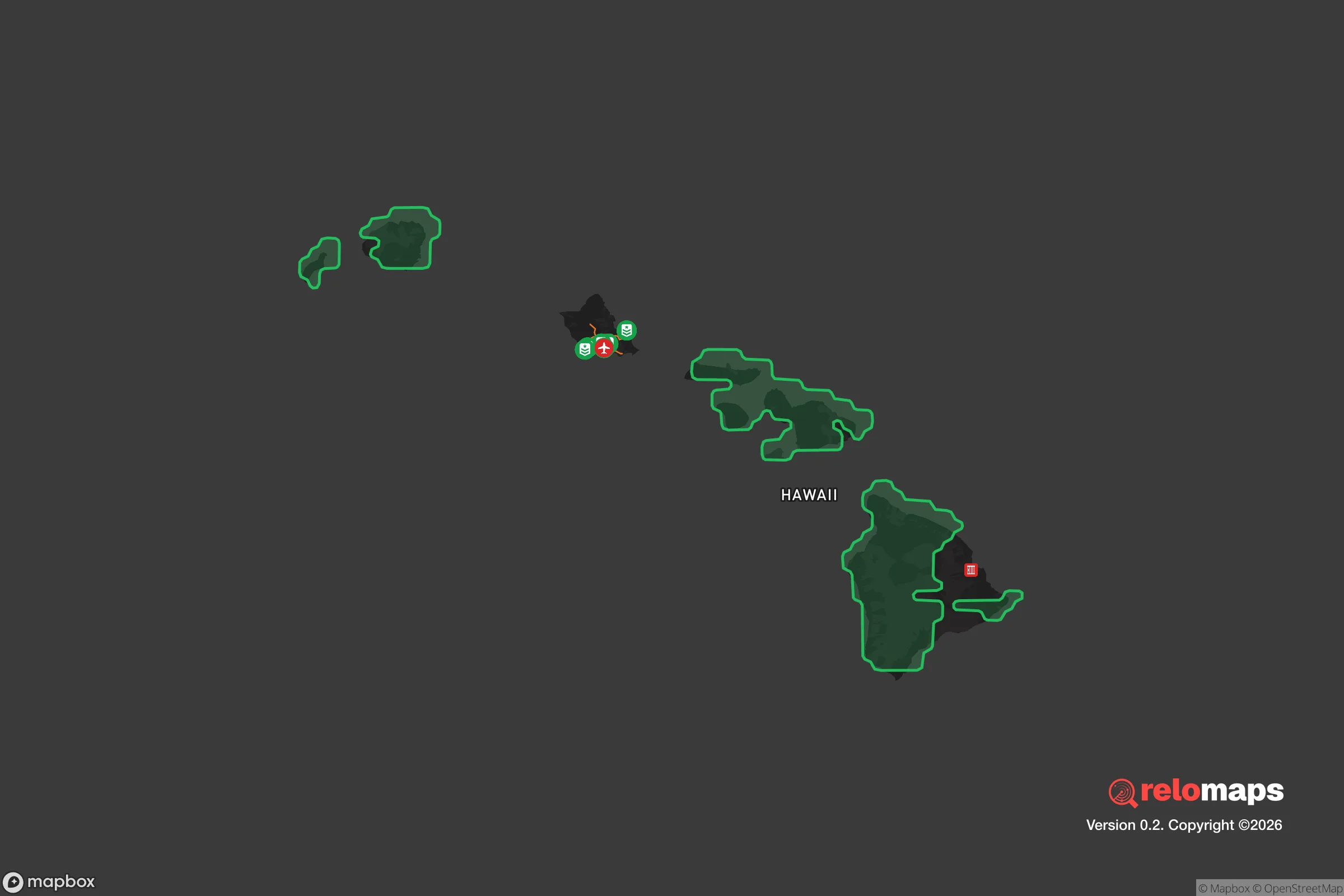


Important Note: For informational purposes only. This does not mean nothing bad ever happens in the green zones. Please use common sense. This is based on public data and modeled with AI. We tried to take a conservative approach but mistakes happen. We update this regularly as new information becomes available.
Solar Generator Recommendations
Backup power matters more here than in safer locations. We've picked three solar generators across budgets and capacity tiers — start with the budget unit if you only need a few essentials, or step up if you want to run a fridge and HVAC for days at a time.

Jackery Portable Power Station Explorer 300
Budget OptionPower on the Go: Weighing only 11 lbs, it's convenient to set up and store with book-sized foldable solar panels

BLUETTI Portable Power Station AC180
Designed for both indoor and outdoor scenarios, AC180 is highly capable as it has a robost capacity and continuous output power.

EF ECOFLOW DELTA Pro Ultra Power Station
Upgraded PickEcoFlow DELTA Pro Ultra is a whole-home energy system designed to grow with your family. Integrated with the Smart Home Panel 2, it scales to meet your evolving energy needs — keeping your home powered, intelligent, and secure through every stage of life.
We earn a commission, at no additional cost to you.
Strategic Assessment Analysis
Waihee, situated on the northern coast of Maui, offers a strategic resilience profile that is notably distinct from the more densely populated and tourism-dependent areas of the island. Its location provides a meaningful buffer from the immediate fallout of a major urban or infrastructure collapse, while still retaining access to critical resources and logistical lifelines. For a relocator prioritizing disaster readiness and self-sufficiency, Waihee presents a compelling balance of isolation and accessibility, though it is not without its own specific vulnerabilities that require careful consideration.
Geographic position and natural advantages for long-term stability
Waihee's primary strategic advantage is its position on the windward (northeast) coast of Maui, which places it in a fundamentally different microclimate and risk profile than the leeward resort areas like Kihei, Wailea, and Lahaina. The area is shielded from the direct brunt of the prevailing trade winds by the West Maui Mountains, but it still receives ample rainfall, which is a critical asset for water security. The Waihee River, one of the few perennial streams on the island, runs through the area, providing a reliable surface water source that is less susceptible to drought than the rainwater catchment systems common in drier parts of the island. This natural water supply is a foundational element of long-term resilience, as it reduces dependence on the county's centralized water system, which could be compromised during a major seismic event or prolonged grid failure. The surrounding terrain, characterized by steep, forested slopes and a relatively narrow coastal plain, naturally limits the scale of potential development, keeping population density low and reducing the risks associated with mass evacuation or civil unrest. The area's proximity to Kahului, the island's primary commercial and transportation hub, is a double-edged sword: it provides access to the airport and seaport for resupply and evacuation, but it also places Waihee within the potential blast radius or fallout zone of a targeted strike on those critical infrastructure nodes. However, the prevailing northeast trade winds would carry any airborne contamination from a Kahului event away from Waihee, toward the open ocean, a significant meteorological advantage.
Risks, exposures, and proximity to fallout-relevant landmarks
The most significant risk for Waihee is its exposure to natural disasters, particularly hurricanes and tsunamis. The 2023 Lahaina fire demonstrated that even windward areas are not immune to wildfire, especially during drought conditions when the abundant vegetation becomes fuel. The narrow coastal strip is vulnerable to tsunami inundation from a distant-source earthquake, such as a major event in the Aleutian Trench, with the Waihee River valley providing a potential path for water to surge inland. The area is also subject to periodic flooding from heavy rainfall, which can wash out the single main road, Highway 30, cutting off access to Kahului and the rest of the island. This road dependency is a critical vulnerability: a landslide or bridge failure at the Waihee Bridge would effectively isolate the community. From a man-made risk perspective, Waihee's proximity to Kahului Airport (OGG) and Kahului Harbor is the primary concern. These are high-value targets in any conflict scenario, and a conventional or even a limited nuclear strike on either would produce significant fallout. While the trade winds would carry the initial plume away from Waihee, secondary fallout patterns could shift with changing weather, and the area would be within the zone of significant radioactive contamination from a ground burst. The presence of the Kahului Power Plant, a fossil-fuel facility, also represents a potential hazard, though it is not a nuclear reactor. The overall risk profile is moderate: the natural hazards are real and require active preparation, while the man-made risks are tied to the area's necessary connection to the island's economic and logistical core.
Practical resilience for a relocator: food, water, energy, and defensibility
Waihee's practical resilience is a mixed picture, with strong fundamentals in water and food production but significant challenges in energy and defensibility. The reliable rainfall and fertile volcanic soil make the area highly suitable for subsistence agriculture. Many existing properties have established fruit trees (mango, avocado, citrus) and space for vegetable gardens, and the nearby upcountry areas of Kula and Makawao provide additional sources of locally grown produce and livestock. The ocean offers a protein source, though fishing requires a boat or shore access and is subject to seasonal conditions. Water security is the area's strongest asset: a property with a well or a legal diversion from the Waihee River, combined with a rainwater catchment system, can provide a truly independent water supply. Energy is the weakest link. The grid on Maui is fragile and expensive, and a prolonged outage is a near-certainty after a major hurricane or seismic event. Solar panels with battery storage are essential for any serious preparedness plan, but the area's frequent cloud cover reduces their efficiency compared to sunnier parts of the island. A backup generator, with a stored supply of fuel, is a practical necessity. Defensibility is a nuanced topic. The single road access makes Waihee easy to block or control, which is a double-edged sword: it can protect the community from outside threats, but it also makes it a potential trap if evacuation is necessary. The terrain is not easily defensible in a military sense, as the forested slopes provide cover for approach. The community is small and relatively tight-knit, which can be a social asset for mutual aid and information sharing, but it also means that a single disruptive event or person could have an outsized impact. The overall practical resilience is good for a single individual or family that is willing to invest in off-grid infrastructure and actively participate in the local community, but it is not a location where one can simply show up and be self-sufficient without significant preparation.
The overall strategic picture for Waihee is one of a high-potential but high-responsibility location. It offers genuine advantages in water and food security that are rare in Hawaii, and its position on the windward side provides a natural buffer from the worst of the island's tourism-driven chaos and the immediate effects of a strike on Kahului. However, the single road access, the real risk of natural disasters, and the proximity to high-value targets mean that resilience is not a given; it must be actively built and maintained. For a relocator who is serious about disaster readiness and willing to invest in off-grid infrastructure, build local relationships, and accept the trade-offs of a quieter, more remote lifestyle, Waihee is a strong candidate. For someone looking for a turnkey solution or a location with no significant risks, it is not the right choice. The area rewards preparation and punishes complacency, which is precisely the kind of environment a strategic thinker should be looking for.

* Values derived from national, state, county, city and local statistics and may differ in a specific area. Last updated: 2026-07-12T14:07:24.000Z
Narrative content on this page is AI-generated and may contain mistakes. Verify any details that matter before acting on them.
ReloMaps may earn a commission from affiliate links at no extra cost to you.

