
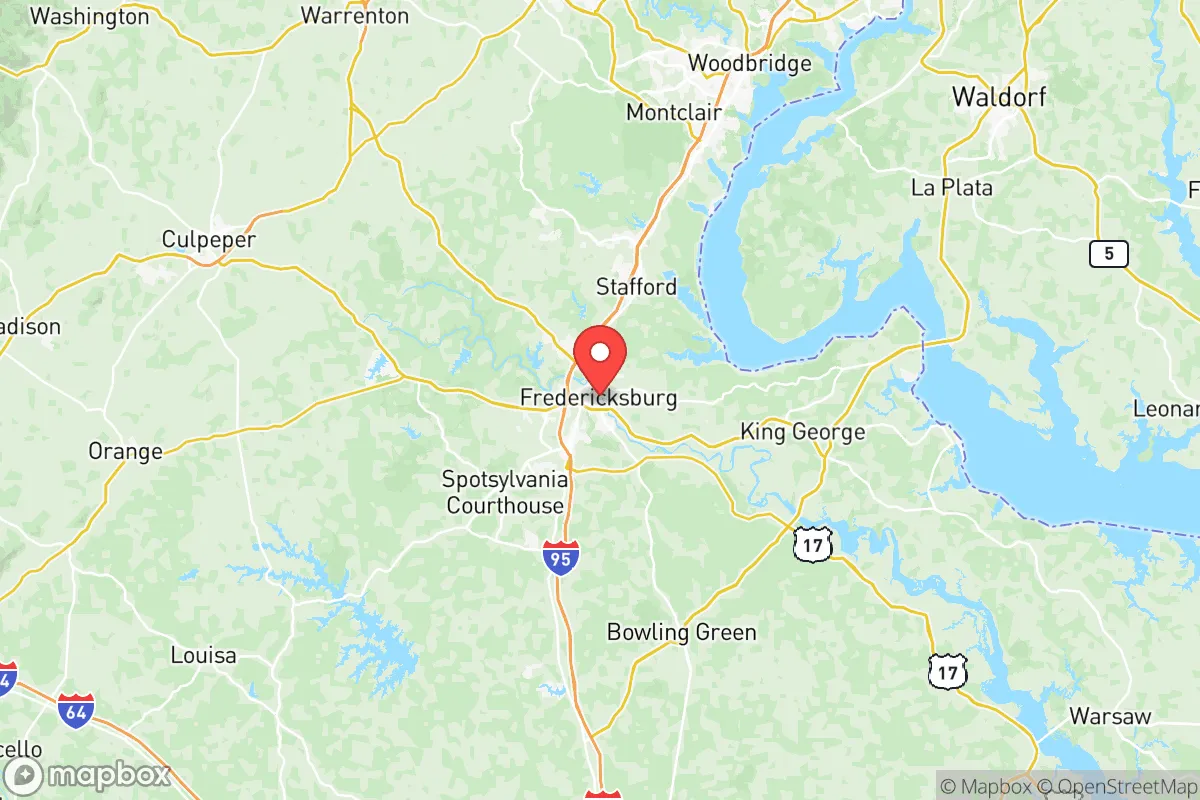
Strategic Assessment of Fredericksburg City County
Meaningful friction. Expect exposure to either population pressure, blast zones, or natural disaster risk. Consider buying a retreat property.
What does the Strategic Assessment tell us?
Our Strategic Assessment grades tactical survivability of an area. Major population centers, military targets, fallout zones, natural disasters, and border exposure all drive risk — lower exposure means a more defensible position in a crisis.
This is heavily inspired by Joel Skousen's Strategic Relocation book. Highly recommended you checkout the book ($)What does this tell us?
Our Strategic Assessment grades tactical survivability of an area. Major population centers, military targets, fallout zones, natural disasters, and border exposure all drive risk — lower exposure means a more defensible position in a crisis.
This is heavily inspired by Joel Skousen's Strategic Relocation book. Highly recommended you checkout the book ($)Strategic Pillars

Key Distances
Strategic Assessment Analysis
Fredericksburg City County, Virginia, occupies a strategic position roughly halfway between Washington, D.C., and Richmond, offering a blend of historical depth and modern infrastructure that appeals to relocation-minded individuals and families. Its location along the I-95 corridor provides rapid access to major urban centers, but the city itself maintains a distinct, slower-paced character with a population of around 28,000, making it a potential buffer zone for those seeking proximity to opportunity without being immersed in dense metropolitan risk. For a reader prioritizing disaster readiness and self-sufficiency, Fredericksburg presents a mixed picture: its geographic advantages are real, but its proximity to high-value targets and natural hazard exposures demand careful consideration.
Geographic position and natural advantages for self-sufficiency
Fredericksburg sits at the fall line of the Rappahannock River, where the Piedmont region meets the Coastal Plain, giving it a topographical diversity that is rare for a city this close to the Atlantic seaboard. The Rappahannock itself is a significant water resource, flowing roughly 184 miles from the Blue Ridge Mountains to the Chesapeake Bay, and it provides a reliable freshwater source for the city and surrounding areas. The terrain rises gently to the west, with elevations reaching 200–300 feet in the city proper and higher in the nearby Spotsylvania and Stafford counties, offering some natural defensibility against storm surges and sea-level rise that threaten lower-lying coastal communities like Norfolk or Virginia Beach. The city is also within a two-hour drive of the Shenandoah National Park and the George Washington National Forest, which serve as potential retreat zones with abundant timber, game, and water. However, the immediate area is heavily suburbanized, with residential developments and commercial strips dominating the landscape, meaning that true wilderness self-sufficiency would require a deliberate move to the western counties. The climate is temperate, with four distinct seasons, and the region averages about 43 inches of rainfall annually, which supports local agriculture but also contributes to flood risks along the Rappahannock and its tributaries.
Risks, exposures, and proximity to fallout-relevant landmarks
Fredericksburg’s greatest strategic vulnerability is its location along the I-95 corridor, a critical transportation artery that connects the nation’s capital to the rest of the Eastern Seaboard. The city lies just 50 miles south of Washington, D.C., and 60 miles north of Richmond, placing it within the fallout zone of any major event targeting the federal government or military installations in the region. Quantico Marine Corps Base is only 20 miles north, and Fort Belvoir and the Pentagon are within 40 miles, making Fredericksburg a potential secondary target or evacuation corridor chokepoint. The city itself hosts the University of Mary Washington and the Fredericksburg Regional Airport, but neither is a high-value military or industrial target. However, the nearby Dominion Energy North Anna Nuclear Generating Station in Louisa County, about 40 miles west, presents a dual risk: it is a potential target for sabotage or accident, and its spent fuel pools could release radioactive material in a worst-case scenario. The Rappahannock River also flows past the city, and any upstream contamination from the nuclear plant or industrial sites in the Shenandoah Valley could compromise the water supply. Natural hazards include periodic flooding from hurricanes and nor’easters, with the city experiencing major floods in 1942, 1972 (Hurricane Agnes), and 2011 (Hurricane Irene). The region is also in a moderate seismic zone, with the 2011 Mineral, Virginia earthquake (magnitude 5.8) causing minor damage to historic buildings in Fredericksburg. Wildfire risk is low due to the urbanized landscape, but the surrounding forests in Spotsylvania and Stafford counties can burn during drought years.
Practical resilience for a relocator: food, water, energy, and defensibility
For a relocator focused on practical resilience, Fredericksburg offers a mixed bag of resources and challenges. The city’s water supply comes from the Rappahannock River, treated at the Fredericksburg Water Treatment Plant, which has a capacity of 12 million gallons per day. Backup wells exist but are limited, so a long-term power outage or contamination event would strain the system. Residents should plan for at least two weeks of stored water per person, as municipal supply is vulnerable to both natural disasters and upstream industrial accidents. The local food scene is robust, with the Fredericksburg Farmers Market operating year-round and numerous community gardens, but the city is not a major agricultural producer. Most food is trucked in via I-95, meaning supply chain disruptions could empty grocery shelves quickly. The Central Rappahannock Regional Library system offers seed libraries and gardening workshops, but true food self-sufficiency would require acreage outside the city limits. Energy infrastructure is dominated by Dominion Energy, with the North Anna nuclear plant providing about 60% of the region’s electricity. A grid-down scenario would leave residents reliant on natural gas or solar, but the area’s tree cover and moderate solar insolation (about 4.5 peak sun hours per day) make rooftop solar a viable option. Defensibility is a concern: Fredericksburg’s historic downtown is walkable and compact, but the suburban sprawl of Spotsylvania and Stafford counties creates a fragmented landscape that is hard to secure. The city’s police force is well-funded, with about 1.8 officers per 1,000 residents, but during a major crisis, the influx of evacuees from D.C. and Richmond could overwhelm local law enforcement. The Fredericksburg National Cemetery and the Battlefield Park offer open space but also serve as potential gathering points for displaced populations. For those seeking defensibility, the western parts of the city near the Rappahannock River’s fall line offer higher ground and natural chokepoints, but the overall urban density makes a prolonged stand unlikely without a coordinated community plan.
The overall strategic picture for Fredericksburg is one of calculated trade-offs. Its location between two major capitals provides economic opportunity and access to world-class medical facilities like Mary Washington Hospital, but it also places residents in the shadow of high-value targets that could attract attention in a national emergency. The Rappahannock River and the nearby national forests offer genuine natural advantages for water and retreat, but the city’s reliance on I-95 and the North Anna nuclear plant introduces vulnerabilities that require proactive mitigation. For a family or individual willing to invest in water storage, solar backup, and a community network, Fredericksburg can serve as a resilient base that balances urban convenience with a manageable risk profile. However, those seeking true isolation and self-sufficiency would be better served by moving further west into the Shenandoah Valley or the Blue Ridge foothills, where population density drops and natural resources are more abundant. Fredericksburg is not a bug-out location, but it is a defensible, resource-rich city for those who plan ahead and stay informed.

* Values derived from national, state, county, city and local statistics and may differ in a specific area. Last updated: 2026-06-28T12:31:20.000Z
Narrative content on this page is AI-generated and may contain mistakes. Verify any details that matter before acting on them.
ReloMaps may earn a commission from affiliate links at no extra cost to you.

