
Photo: Wikipedia
Strategic Assessment of Nacogdoches County
Workable tactical position. Some exposure to population density or targets, but generally defensible in a crisis.
What does the Strategic Assessment tell us?
Our Strategic Assessment grades tactical survivability of an area. Major population centers, military targets, fallout zones, natural disasters, and border exposure all drive risk — lower exposure means a more defensible position in a crisis.
This is heavily inspired by Joel Skousen's Strategic Relocation book. Highly recommended you checkout the book ($)What does this tell us?
Our Strategic Assessment grades tactical survivability of an area. Major population centers, military targets, fallout zones, natural disasters, and border exposure all drive risk — lower exposure means a more defensible position in a crisis.
This is heavily inspired by Joel Skousen's Strategic Relocation book. Highly recommended you checkout the book ($)Strategic Pillars

Key Distances
Strategic Assessment Analysis
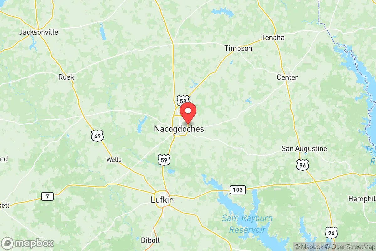
Nacogdoches County offers a blend of geographic isolation and strategic access that appeals to relocators prioritizing resilience. Located in the Piney Woods region of East Texas, the county sits roughly 150 miles northeast of Houston and 180 miles southeast of Dallas-Fort Worth—close enough for supply runs but far enough to avoid the immediate fallout of a major metropolitan crisis. With a population around 65,000 and the county seat of Nacogdoches at 33,000, the area provides a low-density environment where self-sufficiency is practical and community ties remain strong.
Geographic Position and Natural Advantages: The Piney Woods Buffer Zone
Nacogdoches County’s terrain is dominated by dense pine forests, rolling hills, and numerous creeks and rivers, offering both natural resources and defensive cover. The county sits in the heart of the Angelina River basin, with Lake Nacogdoches providing a year-round surface water source for the city of Nacogdoches and surrounding areas. To the east lies the Sabine National Forest, a massive tract of public land that serves as a buffer against encroaching development and a potential food-and-fuel reservoir in a crisis. The region’s abundant rainfall (roughly 47 inches per year) supports local agriculture and recharges groundwater aquifers, making long-term water security far more viable than in arid parts of Texas. For someone looking to relocate to a place with defensible natural features, the combination of forested breaks and the nearby Sam Rayburn Reservoir (30 miles south) supplies a layered water-and-cover advantage.
Risk Assessment: Proximity to Refinery Corridors and Major Transport Routes
While Nacogdoches County avoids the direct threats of coastal storm surge or proximity to high-value military targets like Fort Cavazos (formerly Fort Hood, 200 miles west), it is not without exposure. The county lies downwind and downstream from the Houston Ship Channel refinery corridor—the largest concentration of oil refineries and chemical plants in the United States. In a scaled disaster scenario involving atmospheric or waterborne contamination from that corridor, Nacogdoches could experience fallout within 12–24 hours depending on wind direction. Additionally, Interstate 69/U.S. Highway 59 runs directly through the county, serving as a major north-south logistics route linking the Gulf Coast to the interior. This highway, along with the parallel Union Pacific rail line, means hazardous material transport passes through the county daily, increasing the risk of accidents or deliberate releases near population centers like the city of Nacogdoches and the smaller towns of Cushing and Douglass. The county also sits within the natural hurricane evacuation corridor from the upper Texas coast, meaning significant temporary population surges during storm seasons—though the county itself rarely takes a direct hit.
Practical Resilience for Relocators: Food, Water, Energy, and Defensibility in East Texas
For a household seeking self-sufficiency, Nacogdoches County delivers on several fronts. Water availability is a standout: beyond Lake Nacogdoches, the county sits atop the Sparta and Carrizo-Wilcox aquifers, allowing private wells to produce clean water at moderate depths (100–400 feet). Permits for new wells are generally straightforward, and the county has no widespread groundwater contamination issues. In terms of food, the area supports small-scale farming, livestock, and hunting—white-tailed deer, feral hogs, and turkey are abundant in the national forest and private timberlands, supplemented by local cattle operations. The climate supports three-season gardening, and farmers’ markets in Nacogdoches provide fresh produce even under normal conditions. For energy, the county is served by Oncor and the city of Nacogdoches utility; however, the grid in rural East Texas has endured ice storm and high-wind outages. A backup generator with fuel storage is recommended, as local propane and solar installations are both viable given the ample forest clearings and reliable sun. Defensibility is aided by the highly rural and fragmented road network—especially east of U.S. 59—where limited access points and dense forest make it difficult for uninvited outsiders to cover ground quickly. However, this also means emergency response times can exceed 20–30 minutes in remote areas, so medical and security preparedness falls heavily on the individual. The local sheriff’s office and Nacogdoches Police Department are professional but thinly spread, especially in the county’s 1,000 square miles of wooded terrain.
The overall strategic picture for Nacogdoches County is one of calculated trade-offs. It offers strong natural advantages in water, cover, and food resources, along with distance from the most obvious target zones along the Texas coast and major military bases. At the same time, its location within the influence of the Houston refinery corridor and its position as a transportation nexus introduce real, though manageable, risk. For the relocator willing to invest in well water, off-grid energy, and emergency supplies, the Piney Woods provide a defensible home base that balances isolation with access to the supplies and services of East Texas towns like Lufkin and Tyler. It is a region where preparedness-minded families can build a resilient lifestyle without feeling cut off from the world—but only if they enter with eyes open to both its strengths and exposures.

* Values derived from national, state, county, city and local statistics and may differ in a specific area. Last updated: 2026-06-20T11:54:18.000Z
Narrative content on this page is AI-generated and may contain mistakes. Verify any details that matter before acting on them.
ReloMaps may earn a commission from affiliate links at no extra cost to you.

