
Photo: Wikipedia
Strategic Assessment of Maverick County
Workable tactical position. Some exposure to population density or targets, but generally defensible in a crisis.
What does the Strategic Assessment tell us?
Our Strategic Assessment grades tactical survivability of an area. Major population centers, military targets, fallout zones, natural disasters, and border exposure all drive risk — lower exposure means a more defensible position in a crisis.
This is heavily inspired by Joel Skousen's Strategic Relocation book. Highly recommended you checkout the book ($)What does this tell us?
Our Strategic Assessment grades tactical survivability of an area. Major population centers, military targets, fallout zones, natural disasters, and border exposure all drive risk — lower exposure means a more defensible position in a crisis.
This is heavily inspired by Joel Skousen's Strategic Relocation book. Highly recommended you checkout the book ($)Strategic Pillars

Key Distances
Strategic Assessment Analysis
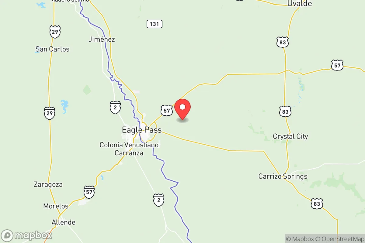
Maverick County, anchored by the border city of Eagle Pass, offers a unique strategic position for those prioritizing resilience and self-sufficiency, blending geographic isolation with critical cross-border infrastructure. Its location along the Rio Grande, roughly 140 miles southwest of San Antonio and 50 miles east of Piedras Negras, Mexico, places it far from major metropolitan targets while still providing access to essential trade routes and resources. For a relocator assessing disaster readiness, the county’s low population density—around 58,000 residents spread across 1,292 square miles—reduces competition for resources in a crisis, while its arid climate and border economy present both opportunities and distinct challenges.
Geographic position and natural advantages for self-sufficiency
Maverick County’s primary strategic asset is its distance from high-value targets like Houston’s refinery corridor, Fort Hood, or the Dallas-Fort Worth metroplex, which are likely to be primary fallout zones in a major conflict or infrastructure collapse. The county sits in the South Texas Plains, a region characterized by flat to rolling terrain, sparse brush, and the Rio Grande as a natural southern boundary. This geography provides natural defensibility: the river creates a physical barrier to the south, while the vast, open rangeland to the north offers limited cover for potential threats but excellent visibility for those monitoring approaches. The area’s semi-arid climate, with average annual rainfall of just 20 inches, reduces risks of flooding compared to coastal Texas, though flash floods along the Rio Grande and its tributaries—like the Nueces River to the east—remain a seasonal concern. For a relocator, the county’s position near the intersection of U.S. Highway 57 and U.S. Highway 277 offers a strategic corridor for movement, connecting to Del Rio (45 miles northwest) and Laredo (70 miles southeast), both of which have their own border crossings and logistical hubs.
Risks, exposures, and proximity to fallout-relevant landmarks
While Maverick County avoids the direct blast zones of major cities, it is not without exposure to man-made and natural risks that could disrupt a self-sufficient lifestyle. The most significant concern is the county’s border location: Eagle Pass is a major port of entry for commercial and personal traffic, with the Eagle Pass Port of Entry handling over 1.5 million vehicles annually. In a crisis, this crossing could become a chokepoint for migration or smuggling, potentially straining local law enforcement and resources. Additionally, the county lies within 100 miles of the Eagle Ford Shale, a massive oil and gas formation that includes drilling operations and pipelines near Carrizo Springs and Crystal City. A major industrial accident or targeted attack on these facilities could release toxic fumes or disrupt energy supplies. Natural risks include drought—the region is prone to extended dry spells—and occasional severe storms, though tornadoes are less common than in North Texas. The county’s proximity to the Amistad Reservoir (30 miles northwest) is a double-edged sword: it provides a reliable water source but also serves as a potential target for sabotage or contamination, given its role in irrigation and hydroelectric power for the region.
Practical resilience for a relocator: food, water, energy, and defensibility
For a relocator serious about self-sufficiency, Maverick County offers a mixed picture. Water availability is the most critical factor: the Rio Grande and the Amistad Reservoir are the primary sources, but both are subject to treaty agreements with Mexico and periodic drought restrictions. Wells are common in rural areas, with groundwater from the Carrizo-Wilcox Aquifer accessible at depths of 200–500 feet, though water quality varies and requires testing for salinity and minerals. Food production is feasible but limited by the arid climate; small-scale gardening with drought-resistant crops like beans, squash, and peppers is possible, but large-scale agriculture depends on irrigation from the river. Local ranching—primarily cattle and goats—is well-established, and the county’s hunting opportunities for white-tailed deer and feral hogs provide a protein source. Energy resilience is a bright spot: the region has abundant solar potential, with over 260 sunny days per year, and wind energy is viable in the open plains. Off-grid solar setups are practical, though backup battery storage is essential due to grid instability during summer heatwaves. Defensibility is moderate: the county’s low population density and vast open spaces make it difficult for large groups to approach unnoticed, but the border location means law enforcement (U.S. Border Patrol and Maverick County Sheriff’s Office) is heavily present, which could be a stabilizing factor or a source of friction depending on the scenario. The Eagle Pass Municipal Airport and nearby U.S. Highway 57 provide evacuation routes, but these could become congested in a crisis.
The overall strategic picture for Maverick County is one of calculated trade-offs. Its isolation from major fallout zones and access to cross-border resources make it a viable option for those seeking distance from urban collapse, but the border dynamics, water constraints, and industrial exposure require careful planning. For a family or individual willing to invest in rainwater catchment, solar power, and a well, the county offers a defensible, low-profile base with room to grow food and maintain independence. However, the reliance on the Rio Grande and the potential for border-related instability mean that a relocator must have contingency plans—including alternative water sources and secure storage—to weather both natural and man-made disruptions. In short, Maverick County is not a bug-out location for the unprepared, but for the disciplined strategist, it provides a solid foundation for long-term resilience in a volatile world.

* Values derived from national, state, county, city and local statistics and may differ in a specific area. Last updated: 2026-11-20T20:00:47.000Z
Narrative content on this page is AI-generated and may contain mistakes. Verify any details that matter before acting on them.
ReloMaps may earn a commission from affiliate links at no extra cost to you.

