
Photo: Wikipedia
Strategic Assessment of Fort Bend County
Multiple tactical vulnerabilities. Population density, target proximity, or disaster risk are likely compounding. A retreat property and exit planning is required.
What does the Strategic Assessment tell us?
Our Strategic Assessment grades tactical survivability of an area. Major population centers, military targets, fallout zones, natural disasters, and border exposure all drive risk — lower exposure means a more defensible position in a crisis.
This is heavily inspired by Joel Skousen's Strategic Relocation book. Highly recommended you checkout the book ($)What does this tell us?
Our Strategic Assessment grades tactical survivability of an area. Major population centers, military targets, fallout zones, natural disasters, and border exposure all drive risk — lower exposure means a more defensible position in a crisis.
This is heavily inspired by Joel Skousen's Strategic Relocation book. Highly recommended you checkout the book ($)Strategic Pillars

Key Distances
Strategic Assessment Analysis
Fort Bend County offers a layered strategic picture for those prioritizing disaster readiness and self-sufficiency, anchored by its position southwest of Houston along the Brazos River. The county’s key advantage is its location at the intersection of relative geographic insulation from coastal surge and access to critical regional infrastructure, but that same proximity to Houston’s industrial and energy complex introduces distinct man-made risks. For a relocator weighing long-term resilience, Fort Bend presents a trade-off: strong practical advantages in food, water, and energy security are shadowed by exposure to fallout-relevant landmarks along the Houston Ship Channel and refinery corridor.
Geographic position and natural advantages for strategic relocation
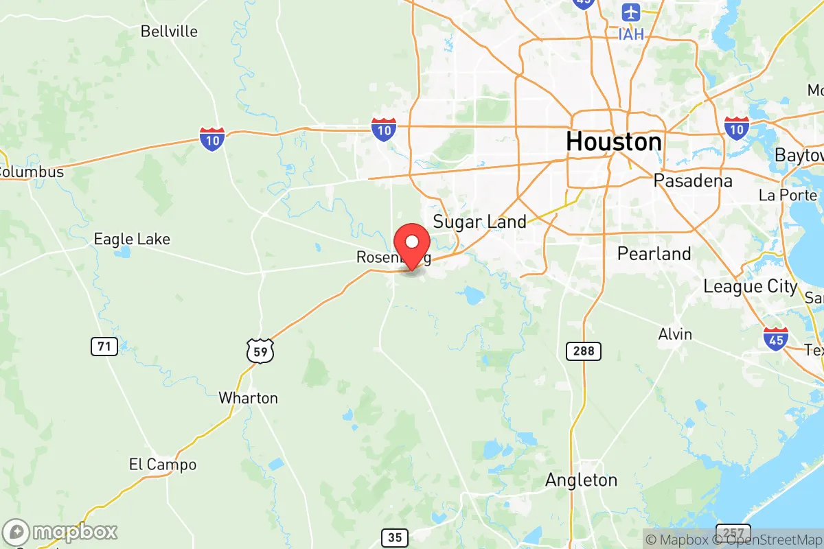
Fort Bend County sits roughly 30–50 miles inland from the Gulf Coast, a distance that spares it from the worst of hurricane storm surge while still placing it within the broader Houston metropolitan orbit. The county’s topography is predominantly flat prairie and coastal plain, with elevations ranging from about 50 to 100 feet above sea level, offering some natural drainage but little in the way of defensible high ground. Key towns such as Richmond, the county seat, and Rosenberg lie along the Brazos River, which provides a reliable freshwater source but also introduces flood risk during heavy rainfall events—the 2016 Tax Day Flood and 2017 Hurricane Harvey both inundated parts of the county. The presence of the Brazos and San Bernard rivers, along with numerous creeks and reservoirs, means water is abundant, a clear plus for self-sufficiency planning. The county’s position also places it within a two-hour drive of Austin and San Antonio, offering multiple evacuation corridors via I-10, US-59, and US-90, though these routes can clog during emergencies. The George Bush Intercontinental Airport and William P. Hobby Airport are about 45–60 minutes to the east, providing airlift capacity for evacuation or supply chains.
Risk exposure: proximity to Houston’s refinery corridor and industrial landmarks
Fort Bend’s most significant resilience liability is its proximity to the Houston Ship Channel and the massive petrochemical complex stretching from Baytown through Texas City and into Harris County. The county’s eastern edge, near Missouri City and Stafford, sits within 20–30 miles of major refineries, chemical plants, and liquified natural gas facilities. A directed asset assessment would note that the Phillips 66 Sweeny Refinery and Formosa Plastics complex in nearby Point Comfort are roughly 40 miles to the south, while the Houston Ship Channel’s concentration of benzene, ammonia, and hydrogen fluoride storage lies about 30 miles northeast. In the event of a major industrial accident, natural disaster, or fallout event, Fort Bend County lies predominantly downwind of prevailing southeasterly winds, meaning airborne contaminants from these facilities could be carried directly over the county. Additionally, the county contains its own energy infrastructure: the Sunoco Logistics pipeline hub near Rosenberg and multiple natural gas compressor stations. While not a primary target, the county’s own Fort Bend County Regional Airport and its proximity to the NASA Johnson Space Center in Clear Lake (about 35 miles east) add secondary strategic value. The county’s flood risk, while natural, also compounds man-made dangers—a Harvey-level event could release industrial pollutants from upstream facilities.
Practical resilience for relocators: food, water, energy, and defensibility
Fort Bend County offers strong fundamentals for those seeking practical self-sufficiency. Water is the county’s clearest asset: the Brazos River Authority operates multiple reservoirs, including Lake Georgetown to the north, but the county also draws from the Gulf Coast Aquifer, a deep groundwater source that provides backup if surface supplies are compromised. For food resilience, the county retains significant agricultural land—particularly south of US-90 near Needville and Pleak—with working farms, ranches, and the Houston Livestock Show and Rodeo supply chain passing through. The Texas A&M AgriLife Extension in Fort Bend County provides resources for small-scale farming, and local farmers’ markets in Richmond, Rosenberb, and Sugar Land are well-established. Energy resilience is mixed: the county sits on the ERCOT grid, which experienced massive failures during Winter Storm Uri in 2021, but natural gas distribution is robust, and many newer homes include solar-ready infrastructure. The county’s defensibility is limited—it is mostly open, flat terrain with few choke points. However, the rural areas west of Kendleton and near Fulshear offer larger lot sizes (5–20 acres) and greater spatial buffer from population centers. The Fort Bend County Sheriff’s Office and local constable precincts provide law enforcement, but response times in outlying areas can exceed 20 minutes. Internet and communications infrastructure is solid in urbanizing areas but weakens in the far western stretches, a factor for remote emergency coordination.
The overall strategic picture for Fort Bend County is one of qualified viability for the disaster-conscious relocator. Its inland position and water abundance provide genuine resilience advantages over coastal or drought-prone regions, and the mix of agricultural land and suburban infrastructure allows for a balanced self-sufficiency setup. However, the county’s proximity to Houston’s refinery corridor and the ERCOT grid’s fragility introduce concentrated risks that require active mitigation—stockpiling water filtration, maintaining backup power, and planning evacuation routes that avoid industrial zones. For a family or individual who can secure a property in the western or southern reaches—away from the major pipeline and chemical storage nodes—Fort Bend County offers a tenable long-term base with access to medical, educational, and logistical resources. The key is recognizing that local resilience must be supplemented by regional awareness: this is not an isolated refuge, but a buffer zone within a high-stakes energy and industrial landscape.

* Values derived from national, state, county, city and local statistics and may differ in a specific area. Last updated: 2026-07-02T01:14:49.000Z
Narrative content on this page is AI-generated and may contain mistakes. Verify any details that matter before acting on them.
ReloMaps may earn a commission from affiliate links at no extra cost to you.

