
Photo: Wikipedia
Strategic Assessment of Sterling Heights, MI
Multiple tactical vulnerabilities. Population density, target proximity, or disaster risk are likely compounding. A retreat property and exit planning is required.
What does the Strategic Assessment tell us?
Our Strategic Assessment grades tactical survivability of an area. Major population centers, military targets, fallout zones, natural disasters, and border exposure all drive risk — lower exposure means a more defensible position in a crisis.
This is heavily inspired by Joel Skousen's Strategic Relocation book. Highly recommended you checkout the book ($)What does this tell us?
Our Strategic Assessment grades tactical survivability of an area. Major population centers, military targets, fallout zones, natural disasters, and border exposure all drive risk — lower exposure means a more defensible position in a crisis.
This is heavily inspired by Joel Skousen's Strategic Relocation book. Highly recommended you checkout the book ($)Strategic Pillars

Key Distances
Regional Safe Places
Below is our recommended "safe zones" in Michigan and the surrounding area based on our strategic heuristics. For most people, it's unrealistic to live in a “safe zone” full-time due to work, family or other personal reasons. They tend to be more rural. However, many of these areas are perfect for second homes and retreat properties that double as a vacation home or even a short-term rental.


Important Note: For informational purposes only. This does not mean nothing bad ever happens in the green zones. Please use common sense. This is based on public data and modeled with AI. We tried to take a conservative approach but mistakes happen. We update this regularly as new information becomes available.
Solar Generator Recommendations
Backup power matters more here than in safer locations. We've picked three solar generators across budgets and capacity tiers — start with the budget unit if you only need a few essentials, or step up if you want to run a fridge and HVAC for days at a time.

Jackery Portable Power Station Explorer 300
Budget OptionPower on the Go: Weighing only 11 lbs, it's convenient to set up and store with book-sized foldable solar panels

BLUETTI Portable Power Station AC180
Designed for both indoor and outdoor scenarios, AC180 is highly capable as it has a robost capacity and continuous output power.

EF ECOFLOW DELTA Pro Ultra Power Station
Upgraded PickEcoFlow DELTA Pro Ultra is a whole-home energy system designed to grow with your family. Integrated with the Smart Home Panel 2, it scales to meet your evolving energy needs — keeping your home powered, intelligent, and secure through every stage of life.
We earn a commission, at no additional cost to you.
Strategic Assessment Analysis
Sterling Heights, Michigan, offers a surprisingly strong resilience profile for a suburban city of its size, combining the logistical advantages of proximity to Detroit with the practical benefits of a stable, inland Great Lakes location. Its position in Macomb County places it outside the immediate blast radius of any single high-value target while still providing access to the region's industrial base, transportation networks, and freshwater resources. For a relocator weighing disaster readiness and self-sufficiency, Sterling Heights represents a middle-ground option: not as remote as rural Michigan, but far more defensible and resource-secure than a dense urban core.
Geographic position and natural advantages for long-term stability
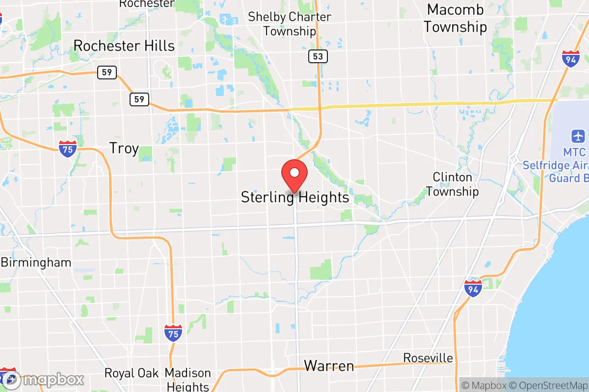
Sterling Heights sits roughly 20 miles north of downtown Detroit, placing it well outside the urban core's immediate risk zone for most man-made or natural disasters. The city lies on the relatively flat, well-drained terrain of the southeastern Michigan till plains, which means it faces virtually no risk of earthquakes, tsunamis, landslides, or wildfires. Its inland location, approximately 15 miles from Lake St. Clair and 30 miles from Lake Erie, provides access to the Great Lakes watershed without the direct storm-surge or lake-effect snow extremes that hammer lakeshore communities. The region's climate is continental, with cold winters and warm summers, but it rarely experiences the catastrophic weather events — hurricanes, tornado outbreaks, or prolonged drought — that plague other parts of the country. The area's natural advantages are modest but real: abundant freshwater, fertile soil for small-scale gardening, and a temperate climate that supports year-round habitation without extreme energy demands.
Risks, exposures, and proximity to fallout-relevant landmarks
The primary risk for Sterling Heights is its location within the Detroit metropolitan area, a region with significant industrial, military, and infrastructure targets. The city lies approximately 15 miles from Selfridge Air National Guard Base in Harrison Township, a major military installation that could be a target in a conflict scenario. It is also within 25 miles of the Detroit-Windsor border crossing, the busiest international crossing in North America, and within 30 miles of the Fermi 2 nuclear power plant in Monroe County. These are not trivial distances — fallout patterns depend heavily on wind direction and yield — but they are far enough to provide meaningful standoff. More immediate risks include the potential for civil unrest or supply-chain disruptions that could affect a metro area of 4.3 million people. Sterling Heights itself is a suburban bedroom community with a population of about 134,000, meaning it lacks the hardened infrastructure or redundant systems of a major city. However, its low population density relative to Detroit proper, its grid-like street layout, and its distance from the urban core all reduce the likelihood of being caught in the worst of a localized event. The city's industrial base — dominated by automotive manufacturing and defense contracting — could also make it a secondary target in a prolonged conflict, though this is speculative.
Practical resilience for a relocator: food, water, energy, and defensibility
Sterling Heights offers a mixed but workable picture for practical self-sufficiency. The city is served by the Great Lakes Water Authority, which draws from Lake Huron via the Detroit River, providing a virtually unlimited freshwater supply under normal conditions. However, the system is centralized and vulnerable to contamination or disruption; a relocator would be wise to invest in a private well or rainwater catchment system, though well-drilling in this suburban environment is often restricted. The electrical grid is part of the DTE Energy system, which has a mixed reliability record — winter storms and summer heat waves have caused multi-day outages in recent years. Solar panels are a viable option, as the region receives about 200 sunny days per year, though winter cloud cover reduces output significantly. Natural gas is widely available for heating and cooking, which is a resilience advantage over all-electric homes. For food security, the city has several community gardens and farmers' markets, but the growing season is short (roughly May to October), and the soil in many suburban lots is compacted or contaminated from decades of development. A serious gardener would need raised beds, imported soil, and a greenhouse to achieve meaningful food production. Defensibility is the weakest point: Sterling Heights is a sprawling, car-dependent suburb with multiple entry points, no natural barriers, and a police force of about 160 officers for 134,000 residents. In a breakdown scenario, the city would be difficult to secure. However, its strong sense of community — reflected in active neighborhood associations and a relatively low crime rate — provides a social resilience that is often more important than physical fortifications.
The overall strategic picture for Sterling Heights is one of cautious optimism for the prepared relocator. It is not a survivalist's paradise — it lacks the remoteness, defensibility, and self-sufficiency of a rural homestead — but it offers a realistic balance of access to resources, distance from the highest-risk targets, and a stable community fabric. The city's greatest strength is its location within the Great Lakes region, which provides abundant freshwater, a moderate climate, and a diversified economy that would likely recover faster than many other areas after a major disruption. Its greatest weakness is its dependence on regional infrastructure and its proximity to Detroit's vulnerabilities. For a family or individual willing to invest in backup power, water storage, and food production, Sterling Heights represents a defensible, livable base of operations in an uncertain future. It is a place where resilience is achievable through preparation rather than geography alone.

* Values derived from national, state, county, city and local statistics and may differ in a specific area. Last updated: 2026-07-10T15:29:39.000Z
Narrative content on this page is AI-generated and may contain mistakes. Verify any details that matter before acting on them.
ReloMaps may earn a commission from affiliate links at no extra cost to you.

