Photo: Wikipedia
Strategic Assessment of Springfield, OR
Workable tactical position. Some exposure to population density or targets, but generally defensible in a crisis.
What does the Strategic Assessment tell us?
Our Strategic Assessment grades tactical survivability of an area. Major population centers, military targets, fallout zones, natural disasters, and border exposure all drive risk — lower exposure means a more defensible position in a crisis.
This is heavily inspired by Joel Skousen's Strategic Relocation book. Highly recommended you checkout the book ($)What does this tell us?
Our Strategic Assessment grades tactical survivability of an area. Major population centers, military targets, fallout zones, natural disasters, and border exposure all drive risk — lower exposure means a more defensible position in a crisis.
This is heavily inspired by Joel Skousen's Strategic Relocation book. Highly recommended you checkout the book ($)Strategic Pillars

Key Distances
Regional Safe Places
Below is our recommended "safe zones" in Oregon and the surrounding area based on our strategic heuristics. For most people, it's unrealistic to live in a “safe zone” full-time due to work, family or other personal reasons. They tend to be more rural. However, many of these areas are perfect for second homes and retreat properties that double as a vacation home or even a short-term rental.


Important Note: For informational purposes only. This does not mean nothing bad ever happens in the green zones. Please use common sense. This is based on public data and modeled with AI. We tried to take a conservative approach but mistakes happen. We update this regularly as new information becomes available.
Solar Generator Recommendations
Backup power matters more here than in safer locations. We've picked three solar generators across budgets and capacity tiers — start with the budget unit if you only need a few essentials, or step up if you want to run a fridge and HVAC for days at a time.

Jackery Portable Power Station Explorer 300
Budget OptionPower on the Go: Weighing only 11 lbs, it's convenient to set up and store with book-sized foldable solar panels

BLUETTI Portable Power Station AC180
Designed for both indoor and outdoor scenarios, AC180 is highly capable as it has a robost capacity and continuous output power.

EF ECOFLOW DELTA Pro Ultra Power Station
Upgraded PickEcoFlow DELTA Pro Ultra is a whole-home energy system designed to grow with your family. Integrated with the Smart Home Panel 2, it scales to meet your evolving energy needs — keeping your home powered, intelligent, and secure through every stage of life.
We earn a commission, at no additional cost to you.
Strategic Assessment Analysis
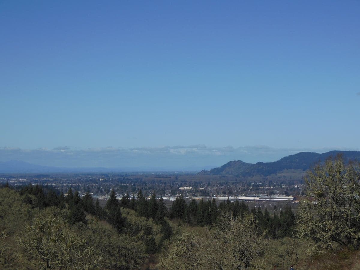
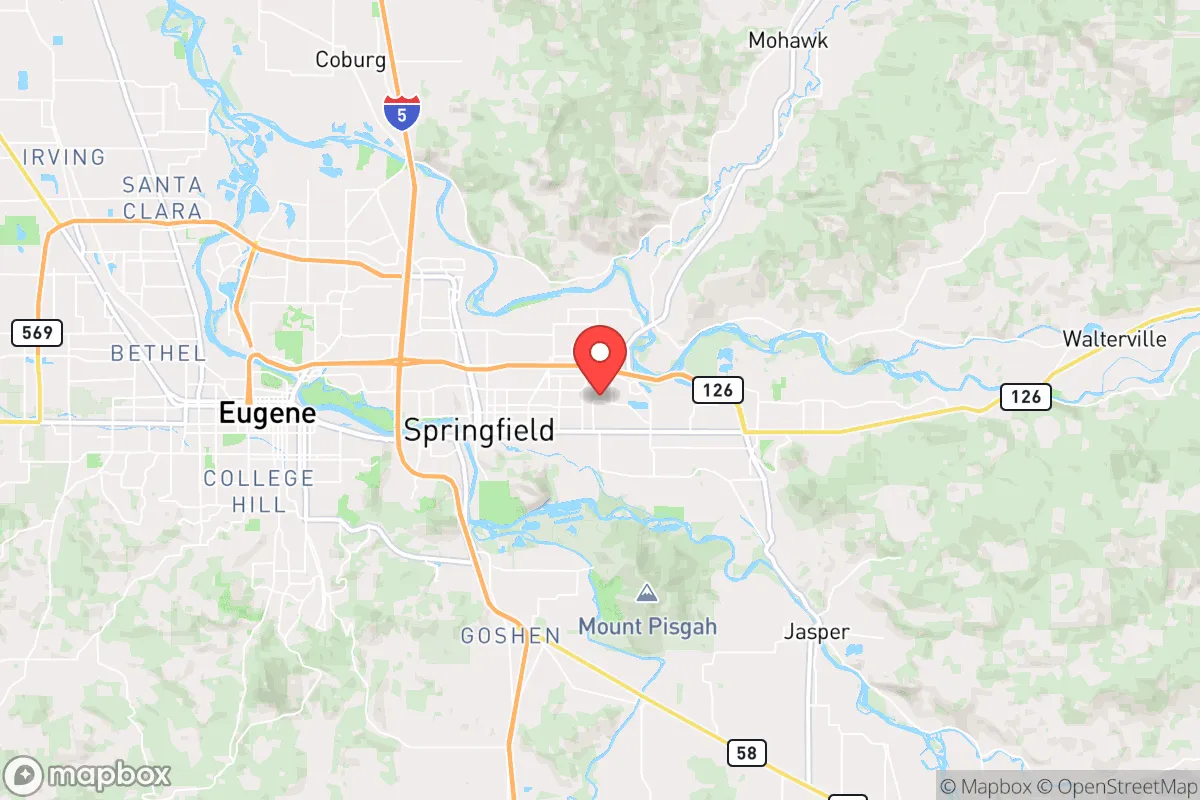
Springfield, Oregon, occupies a strategic position in the Willamette Valley that offers a blend of natural resource abundance and moderate geographic isolation from the highest-risk urban targets, making it a credible option for relocation-minded individuals and families prioritizing disaster readiness and self-sufficiency. Located just east of Eugene and roughly 110 miles south of Portland, Springfield sits at the confluence of the McKenzie and Willamette Rivers, with the Cascade Range rising to the east. This positioning provides access to rich agricultural land, abundant freshwater, and forest resources, while still being close enough to a mid-sized city (Eugene-Springfield metro population ~380,000) for supply runs and employment. For a reader weighing resilience, the area's key trade-off is clear: you gain significant natural advantages in water, food, and defensible terrain, but you also accept exposure to seismic risk, wildfire danger, and the fallout shadow of a major metropolitan area to the north.
Geographic position and natural advantages for self-sufficiency
Springfield's most compelling resilience asset is its location in the southern Willamette Valley, a region with some of the most productive agricultural soils in the United States. The valley floor is a patchwork of farms, orchards, and pastureland, meaning that a relocator with even modest acreage could realistically pursue food production. The McKenzie River, which runs through the northern edge of Springfield, is a cold, fast-flowing river fed by snowmelt from the Cascade peaks, providing a reliable year-round water source that is less prone to the seasonal drawdowns seen in other western rivers. The city's elevation (roughly 450 feet) places it above the valley's worst flood zones, though low-lying areas near the Willamette River do experience periodic inundation. To the east, the Cascade foothills offer timber, game, and defensible retreat options, while the Coast Range to the west provides a buffer against Pacific storms. For someone looking to establish a semi-rural or suburban homestead, Springfield's climate—mild, wet winters and dry summers—supports year-round gardening with proper irrigation planning. The area's access to public lands (Willamette National Forest, Umpqua National Forest) also means foraging, hunting, and timber harvesting are realistic supplementary activities, though permits and regulations apply.
Risks, exposures, and proximity to fallout-relevant landmarks
The most significant risk factor for Springfield is its location within the Cascadia Subduction Zone, a fault line capable of producing a magnitude 9.0+ earthquake and subsequent tsunami. While Springfield itself is far enough inland (roughly 60 miles from the coast) to avoid direct tsunami inundation, the shaking and liquefaction risks are real. The valley's alluvial soils are prone to liquefaction during prolonged shaking, which could damage underground utilities, roads, and foundations. Additionally, the area's wildfire risk has increased notably in recent decades; the 2020 Holiday Farm Fire burned over 173,000 acres in the McKenzie River corridor east of Springfield, forcing evacuations and degrading air quality for weeks. Properties in the wildland-urban interface (WUI) along the McKenzie River or in the foothills face elevated fire danger. From a man-made risk perspective, Springfield's proximity to Eugene (a regional population and economic hub) is a double-edged sword. Eugene is not a likely primary nuclear target, but its status as a transportation and logistics node (including the Eugene Airport and I-5 corridor) could make it a secondary target or a chokepoint during a crisis. More concerning is the city's location roughly 110 miles south of Portland, which is a plausible target given its population, port infrastructure, and economic significance. In a nuclear exchange, prevailing westerly winds would carry fallout from a Portland strike eastward into the Columbia River Gorge and central Oregon, but Springfield's position south of Portland means it would likely be downwind only under specific meteorological conditions. Prevailing winds in the Willamette Valley are generally from the west or southwest, which would push fallout from a Portland detonation away from Springfield and toward the Cascades. However, a detonation in Eugene itself—less likely but not impossible—would pose a direct fallout hazard. The Hanford Nuclear Site in Washington (roughly 250 miles northeast) is another distant but non-zero concern; a catastrophic release there could contaminate the Columbia River watershed, though Springfield draws its water from the McKenzie and Willamette systems, not the Columbia.
Practical resilience for a relocator: food, water, energy, and defensibility
For a relocator serious about self-sufficiency, Springfield offers strong fundamentals but requires deliberate preparation. Water availability is excellent: the McKenzie River is a high-volume, high-quality source, and many properties in the area have access to groundwater via wells. The city's municipal water system draws from the McKenzie, but a well or rainwater catchment system provides redundancy. Food production is viable on even small parcels; the growing season runs roughly April through October, with cool-season crops (kale, carrots, potatoes) extending into early winter. The nearby agricultural industry means that seeds, tools, and livestock supplies are locally available. For energy, Springfield's grid is served by the Bonneville Power Administration, which provides relatively cheap hydroelectric power, but the grid is vulnerable to seismic disruption. Solar potential is moderate—the valley experiences significant cloud cover from November through February, so a solar-plus-battery system would need to be oversized for winter months. Wood heating is a practical backup, given the surrounding forests. Defensibility is a mixed picture. The Eugene-Springfield metro area is a liberal-leaning urban center with a significant homeless population and property crime rates above the national average (Springfield's property crime rate was roughly 50% higher than the Oregon average in recent years). This means that in a prolonged crisis, the city itself could become a source of instability. However, the surrounding rural areas—especially east toward the Cascades and south toward Cottage Grove—offer more defensible terrain with limited road access, natural chokepoints, and a more self-sufficient population. A relocator would be wise to choose a property outside the urban core, ideally with a well, septic, and access to multiple egress routes (Highway 126 east over the Cascades, Highway 58 south, and I-5 north/south). The area's community preparedness culture is uneven; there are active prepper and homesteading groups in Lane County, but the broader population is not particularly disaster-ready. Building local networks before a crisis is essential.
Overall, Springfield presents a credible but imperfect option for the disaster-conscious relocator. Its natural advantages—abundant water, fertile soil, moderate climate, and access to public lands—are genuine assets that few other mid-sized cities in the Pacific Northwest can match. The risks are real but manageable with proper site selection and preparation: avoid low-lying flood zones, choose a property with defensible space against wildfire, and invest in seismic retrofitting if purchasing an older home. The proximity to Eugene and Portland is a liability in a worst-case scenario, but Springfield's position south of the primary threat axis (Portland) and its distance from the coast reduce the most acute risks. For a family willing to invest in infrastructure—well, solar, wood heat, food storage, and community ties—Springfield offers a solid foundation for long-term resilience. It is not a bug-out location; it is a live-and-prepare location, with the trade-offs that entails.

* Values derived from national, state, county, city and local statistics and may differ in a specific area. Last updated: 2026-07-08T06:21:04.000Z
Narrative content on this page is AI-generated and may contain mistakes. Verify any details that matter before acting on them.
ReloMaps may earn a commission from affiliate links at no extra cost to you.

