
Photo: Wikipedia
Strategic Assessment of Madison County
Workable tactical position. Some exposure to population density or targets, but generally defensible in a crisis.
What does the Strategic Assessment tell us?
Our Strategic Assessment grades tactical survivability of an area. Major population centers, military targets, fallout zones, natural disasters, and border exposure all drive risk — lower exposure means a more defensible position in a crisis.
This is heavily inspired by Joel Skousen's Strategic Relocation book. Highly recommended you checkout the book ($)What does this tell us?
Our Strategic Assessment grades tactical survivability of an area. Major population centers, military targets, fallout zones, natural disasters, and border exposure all drive risk — lower exposure means a more defensible position in a crisis.
This is heavily inspired by Joel Skousen's Strategic Relocation book. Highly recommended you checkout the book ($)Strategic Pillars

Key Distances
Strategic Assessment Analysis
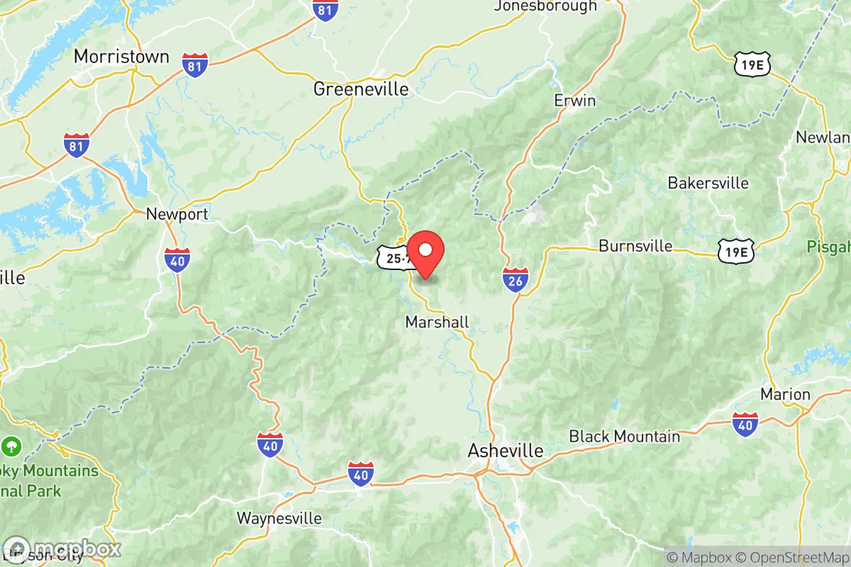
Madison County, North Carolina, offers a resilience profile that is quietly strong, trading the high-risk exposure of major metros for the defensive depth of the southern Appalachian mountains. Its position in the far western corner of the state, anchored by the county seat of Marshall and the town of Hot Springs, provides a strategic buffer that is increasingly rare on the Eastern Seaboard. For a relocator weighing disaster readiness and self-sufficiency, this is not a flashy choice, but it is a fundamentally sound one, with the Blue Ridge Parkway serving as both a scenic asset and a high-elevation logistical spine.
Geographic position and natural defensive advantages
Madison County’s core advantage is its terrain. The county is bisected by the French Broad River, which carves a valley through the Blue Ridge Mountains, but the majority of its 450 square miles is steep, forested, and sparsely populated. This topography is a natural filter: it limits sprawl, slows any large-scale movement through the area, and provides numerous ridgeline positions that are inherently defensible. The county seat of Marshall sits in the river valley, but the surrounding communities—such as Mars Hill, Trust, and Walnut—are tucked into hollows and higher elevations that offer significant separation from any single point of failure.
The proximity to Asheville, roughly 20 miles to the south, is a double-edged sword, but in a resilience context it leans positive. Asheville is a regional medical and supply hub, but Madison County’s mountain barrier means it is not a suburb; it is a distinct, harder-to-reach zone. The county’s access to the Pisgah National Forest and the Appalachian Trail corridor, which runs directly through Hot Springs, provides a massive, undeveloped hinterland for foraging, hunting, and water sourcing that few other counties in the eastern U.S. can match. The Blue Ridge Parkway, which clips the county’s southern edge, offers a high-elevation route that remains passable in many scenarios where valley roads are compromised.
Risk exposure and proximity to fallout-relevant landmarks
In terms of man-made and industrial risk, Madison County is in a favorable position compared to most of the eastern seaboard. There are no major refineries, nuclear power plants, or large-scale chemical facilities within the county. The nearest significant industrial concentration is the Tri-Cities area of Tennessee—Kingsport, Johnson City, and Bristol—roughly 60 to 70 miles to the northwest. That corridor includes chemical manufacturing and a major Eastman Chemical plant, but the intervening mountain massif of the Bald Mountains and the Cherokee National Forest provides a substantial buffer against any airborne or ground-level contamination event.
The more relevant strategic consideration is the broader regional picture. Madison County sits roughly 100 miles from the Oak Ridge National Laboratory complex in Tennessee, a historic nuclear research site, and about 120 miles from the Savannah River Site in South Carolina, a major nuclear facility. In a worst-case scenario involving those sites, the prevailing westerly winds would carry fallout toward the east, but the rugged terrain and distance would significantly dilute any impact. The county is also far from the major ports of Charleston and Norfolk, and it is not on any primary missile trajectory corridor that would make it a target in a conflict. The primary natural risks are winter ice storms, which can knock out power for extended periods, and flash flooding in the narrow river valleys, particularly around Marshall and Hot Springs. These are manageable, predictable events, not existential threats.
Practical resilience for a relocator: food, water, energy, and defensibility
For a family or individual serious about self-sufficiency, Madison County’s practical assets are substantial. Water is the first and most critical factor, and the county is rich in it. The French Broad River is a reliable year-round source, but more importantly, the mountain hollows are laced with dozens of perennial springs and small creeks. Properties with a gravity-fed spring or a drilled well at elevation are common, and the water quality is generally excellent due to the lack of upstream industrial activity. A relocator should prioritize a property with an independent water source over one reliant on a community well system.
Energy resilience is more of a challenge, but it is solvable. The county is served by a mix of cooperative and municipal power providers, and grid reliability is moderate at best, with outages common during winter storms. However, the steep terrain and forest cover make the area well-suited for micro-hydro generation on smaller creeks, and solar potential is decent despite the tree cover, provided panels are sited on south-facing slopes. Wood heat is a practical and culturally embedded option here; most long-time residents have a wood stove as a primary or secondary heat source, and the surrounding national forest provides a sustainable fuel supply for those with a permit.
Food security is a genuine strength. Madison County has a strong agricultural heritage, and the Marshall Farmers Market and the Madison County Cooperative Extension office are active resources. The growing season is short—roughly 150 days—but the valley floors around Marshall and Mars Hill support productive gardens, and the higher elevations are excellent for root crops and cold-hardy greens. For protein, the county has a notable livestock presence, including cattle and poultry operations, and the surrounding national forest offers deer and turkey hunting. The main practical weakness is the lack of a large-scale food distribution center within the county; a relocator should plan for at least a 30-day supply of staples, as supply chain disruptions to Asheville would be felt locally within a few days.
Defensibility is where the county’s geography shines. The narrow, winding roads—particularly NC 209, known as the "Laurel River Road," and the back routes through Trust and Walnut—create natural chokepoints that are easy to monitor and hard to bypass. A property on a dead-end gravel road at mid-elevation offers a level of security that is nearly impossible to find in flatter, more open regions. The community culture also leans toward mutual aid; the county is rural, predominantly conservative, and has a strong tradition of neighbors helping neighbors during weather events. This social fabric is a resilience asset that cannot be purchased, only earned through time and participation.
The overall strategic picture for a relocating family
Madison County is not a prepper’s fantasy of total isolation, nor is it a high-risk zone that demands constant vigilance. It is a middle-ground, high-capability location that rewards preparation and community integration. The county’s weaknesses—moderate grid reliability, a short growing season, and distance from major medical facilities—are known and manageable. Its strengths—abundant water, defensible terrain, low industrial exposure, and a working agricultural base—are structural and unlikely to change. For a conservative-leaning family looking to build a resilient life in the eastern U.S., Madison County offers a rare combination of natural security and practical livability, provided the relocator is willing to trade some convenience for capability. The mountains here do not promise safety; they provide the conditions for it, and that is a far more honest offer.

* Values derived from national, state, county, city and local statistics and may differ in a specific area. Last updated: 2026-10-28T00:08:22.000Z
Narrative content on this page is AI-generated and may contain mistakes. Verify any details that matter before acting on them.
ReloMaps may earn a commission from affiliate links at no extra cost to you.

