
Photo: Wikipedia
Strategic Assessment of Franklin County
Workable tactical position. Some exposure to population density or targets, but generally defensible in a crisis.
What does the Strategic Assessment tell us?
Our Strategic Assessment grades tactical survivability of an area. Major population centers, military targets, fallout zones, natural disasters, and border exposure all drive risk — lower exposure means a more defensible position in a crisis.
This is heavily inspired by Joel Skousen's Strategic Relocation book. Highly recommended you checkout the book ($)What does this tell us?
Our Strategic Assessment grades tactical survivability of an area. Major population centers, military targets, fallout zones, natural disasters, and border exposure all drive risk — lower exposure means a more defensible position in a crisis.
This is heavily inspired by Joel Skousen's Strategic Relocation book. Highly recommended you checkout the book ($)Strategic Pillars

Key Distances
Strategic Assessment Analysis
Franklin County, North Carolina, sits in a strategic sweet spot that balances rural self-sufficiency with access to critical infrastructure, making it a compelling option for relocators prioritizing resilience and preparedness. Located just northeast of the Raleigh-Durham metro area, the county offers a buffer from the immediate fallout risks of a major urban center while still being close enough to leverage its medical, supply, and logistical networks. The county’s geography—rolling Piedmont hills, abundant water, and a temperate climate—provides a natural foundation for long-term sustainability, but a clear-eyed assessment of its risks and advantages is essential for anyone serious about disaster readiness.
Geographic position and natural advantages for long-term sustainability
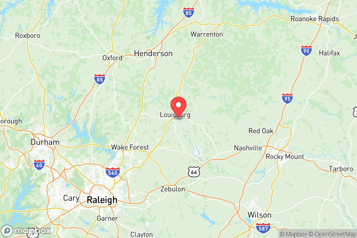
Franklin County’s location in the central Piedmont region of North Carolina gives it a distinct resilience profile. It is roughly 30 miles northeast of Raleigh and 50 miles south of the Virginia border, placing it outside the immediate blast or fallout zones of a major metropolitan target like Raleigh-Durham, but within a reasonable driving distance for supply runs or medical evacuations. The county is bisected by Interstate 85, a major north-south corridor, and U.S. Highway 401, which provides secondary access to the coast and inland areas. This dual-access road network is a practical advantage for evacuation or resupply, though it also means the area is a potential chokepoint during a mass exodus.
The natural landscape is dominated by the Tar River, which flows through the county seat of Louisburg and provides a reliable freshwater source. The river is not dammed or heavily industrialized in this stretch, meaning water quality is generally good, though it is susceptible to agricultural runoff. The county’s rolling hills and mixed hardwood-pine forests offer natural cover and defensible terrain, with numerous small creeks and streams that can support off-grid water collection. Soils in the area are predominantly sandy loam, suitable for small-scale farming, and the growing season runs from April to October—long enough for staple crops like corn, beans, and squash. The climate is humid subtropical, with average annual rainfall of about 45 inches, which reduces the risk of prolonged drought compared to the western part of the state.
Risks, exposures, and proximity to fallout-relevant landmarks
No strategic assessment is complete without acknowledging the risks. Franklin County’s primary man-made exposure comes from its proximity to the Raleigh-Durham metro area, which contains multiple potential targets: Research Triangle Park (a hub for biotech and defense contractors), Raleigh-Durham International Airport, and the Fort Liberty military base (formerly Fort Bragg) about 70 miles southwest. A nuclear or EMP event targeting these sites could produce fallout patterns that, depending on wind direction, might affect eastern and northeastern parts of Franklin County. The county is also within 100 miles of the Harris Nuclear Plant in New Hill, NC, and the Surry Nuclear Power Station near the Virginia border—both are potential targets or accident sites that could necessitate evacuation or sheltering.
Natural risks are more predictable. The county lies in a zone of moderate tornado risk, with an average of 2-3 tornado warnings per year, typically during spring and summer thunderstorms. Hurricanes are a secondary concern; while Franklin County is 150 miles inland, remnants of storms like Hurricane Florence (2018) caused significant flooding along the Tar River in Louisburg and surrounding low-lying areas. The county’s floodplain maps show that areas near the Tar River and its tributaries—particularly around the town of Franklinton—are at risk for 100-year floods. Wildfire risk is low due to the humid climate, but the dense forest cover in the northern part of the county could support a moderate-intensity fire during a dry spell. Earthquake risk is negligible.
On the positive side, Franklin County has no major industrial refineries, chemical plants, or ports within its borders. The closest large-scale industrial site is the Shearon Harris nuclear plant, but it is 40 miles southwest—far enough to avoid direct blast effects, though fallout could be a concern depending on wind. The county’s lack of high-value military or industrial targets makes it a lower-priority location for a first-strike scenario, which is a significant advantage for relocators focused on man-made disaster preparedness.
Practical resilience for a relocator: food, water, energy, and defensibility
For someone serious about self-sufficiency, Franklin County offers a mix of existing infrastructure and off-grid potential. Water is the strongest asset: the Tar River and its tributaries provide surface water, and the county’s groundwater table is relatively high, with most wells producing at 10-20 gallons per minute at depths of 100-200 feet. The Louisburg Water Treatment Plant serves the county seat, but rural residents typically rely on private wells, which are a more resilient option during a grid-down scenario. Rainwater harvesting is viable given the 45 inches of annual precipitation, though a filtration system is necessary due to potential agricultural runoff.
Food production is feasible but requires planning. The county has a strong agricultural tradition—tobacco, soybeans, and sweet potatoes are major crops—and there are active farmers’ markets in Louisburg and Franklinton. For a relocator, the key is securing land with good soil and southern exposure. The average farm size in Franklin County is about 100 acres, but smaller parcels of 5-20 acres are available for homesteading. The local extension office at North Carolina State University offers workshops on soil management, canning, and livestock raising, which is a practical resource for newcomers. Hunting and fishing are also viable: white-tailed deer, wild turkey, and squirrel are common, and the Tar River supports catfish, bass, and bream.
Energy resilience is a mixed picture. The county is served by Duke Energy, which has a relatively reliable grid, but rural areas experience outages during storms—typically 2-4 times per year, lasting from a few hours to a day. Solar potential is moderate: the region gets about 4.5 peak sun hours per day, which is enough for a grid-tied system with battery backup, but not for full off-grid living without a substantial panel array. Wood heating is a practical option, as firewood is abundant and relatively cheap, with many local suppliers offering seasoned hardwood for $200-$300 per cord. Defensibility is aided by the county’s rural character: many properties are set back from main roads, with tree lines and natural terrain providing cover. The Franklin County Sheriff’s Office has a strong presence in the rural areas, with response times averaging 15-20 minutes, but in a widespread emergency, residents would need to rely on themselves and their neighbors.
Community resilience is an underrated factor. The county has a population of about 75,000, with a mix of long-time farming families and newer transplants from the Raleigh area. There are active volunteer fire departments, a county emergency management office that runs annual preparedness drills, and a growing number of homesteading and prepper groups that meet informally. The town of Youngsville, in the southern part of the county, has a particularly active community garden and tool-sharing cooperative. For a relocator, building relationships with these existing networks is as important as stockpiling supplies.
Overall, Franklin County presents a balanced strategic picture for the resilience-minded relocator. Its geographic position offers a buffer from major urban targets while maintaining access to critical resources. The natural advantages—abundant water, arable land, and a moderate climate—are genuine assets for long-term sustainability. The risks are real but manageable: flooding in low-lying areas, moderate tornado activity, and the shadow of nearby nuclear and military infrastructure. The county is not a fortress, but it is a place where a prepared individual or family can build a self-sufficient life with reasonable effort. For someone looking to trade the vulnerability of a dense metro area for a more defensible, resource-rich environment, Franklin County deserves a serious look.

* Values derived from national, state, county, city and local statistics and may differ in a specific area. Last updated: 2026-11-15T23:20:12.000Z
Narrative content on this page is AI-generated and may contain mistakes. Verify any details that matter before acting on them.
ReloMaps may earn a commission from affiliate links at no extra cost to you.

