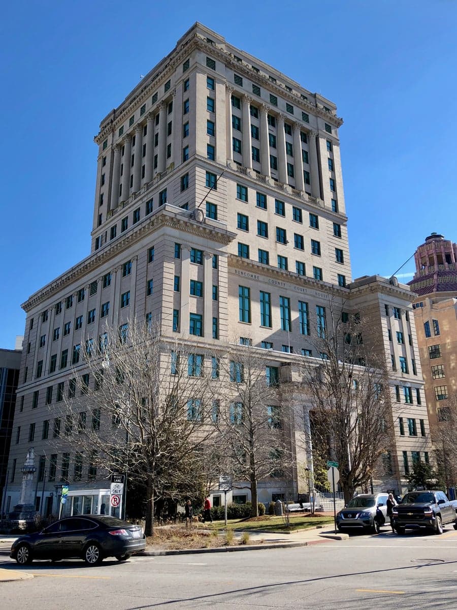
Photo: Wikipedia
Strategic Assessment of Buncombe County
Workable tactical position. Some exposure to population density or targets, but generally defensible in a crisis.
What does the Strategic Assessment tell us?
Our Strategic Assessment grades tactical survivability of an area. Major population centers, military targets, fallout zones, natural disasters, and border exposure all drive risk — lower exposure means a more defensible position in a crisis.
This is heavily inspired by Joel Skousen's Strategic Relocation book. Highly recommended you checkout the book ($)What does this tell us?
Our Strategic Assessment grades tactical survivability of an area. Major population centers, military targets, fallout zones, natural disasters, and border exposure all drive risk — lower exposure means a more defensible position in a crisis.
This is heavily inspired by Joel Skousen's Strategic Relocation book. Highly recommended you checkout the book ($)Strategic Pillars

Key Distances
Strategic Assessment Analysis
Buncombe County, anchored by Asheville in western North Carolina, offers a compelling mix of geographic isolation and practical self-sufficiency that appeals to relocators prioritizing resilience. Its position in the Blue Ridge Mountains provides natural barriers against many coastal and industrial threats, while the county’s size—roughly 660 square miles—allows for dispersed settlement away from the urban core of Asheville. For a conservative-leaning audience weighing disaster readiness, Buncombe County presents a defensible, resource-rich environment, though it is not without strategic vulnerabilities that require careful consideration.
Geographic position and natural advantages for disaster readiness
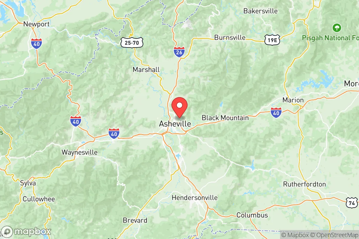
Buncombe County sits in a mountain basin surrounded by the Pisgah National Forest and the Blue Ridge Parkway, placing it over 250 miles from the Atlantic coast and well inland from hurricane storm surges. The elevation ranges from roughly 2,000 feet in the valley floors to over 6,000 feet on surrounding peaks, which reduces the risk of flooding for most properties outside of narrow creek bottoms. The county’s terrain creates natural chokepoints—Interstate 26 and Interstate 40 are the primary corridors—which can be both a defensive asset and a logistical limitation. For a relocator, towns like Black Mountain, Weaverville, and the rural areas around Leicester offer lower population density and better access to forest resources than central Asheville. The mountains also provide a natural buffer against electromagnetic pulse (EMP) effects, as the rugged topography can shield electronics from line-of-sight exposure, though this is not a guaranteed defense.
Risks, exposures, and proximity to fallout-relevant landmarks
While Buncombe County is far from major coastal targets, it is not immune to man-made risks. The county lies roughly 60 miles from the Oak Ridge National Laboratory in Tennessee, a historic nuclear research site that could be a secondary target in a conflict scenario. Additionally, the Asheville Regional Airport and the nearby Asheville Mall are potential non-military targets for disruption, though neither is a high-value strategic asset. The county’s primary natural risk is flash flooding from heavy rainfall, as seen during Hurricane Helene in 2024, which caused significant damage in the Swannanoa River valley and parts of Black Mountain. Wildfire risk is moderate, with the highest danger in dry seasons along the urban-wildland interface near the Pisgah National Forest. For a relocator, the most prudent approach is to avoid properties in floodplains and to maintain defensible space around structures in wooded areas. The county’s distance from major military bases—Fort Liberty (formerly Fort Bragg) is about 200 miles east—reduces the likelihood of direct fallout, but the prevailing westerly winds could carry particulate from a strike on Oak Ridge.
Practical resilience for a relocator: food, water, energy, and defensibility
Buncombe County’s practical resilience is strong for a semi-urban area, but it requires intentional planning. The county has abundant surface water from the French Broad River and its tributaries, but municipal water systems in Asheville and surrounding towns are vulnerable to power outages and contamination events. A relocator should plan for a private well or a rainwater catchment system, especially in rural areas where well depths of 200-400 feet are common. The region’s growing season runs from April to October, with fertile valley soils supporting gardens and small-scale farming; the Asheville City Market and local farms in Fairview and Alexander provide fresh produce, but supply chains can be disrupted by road closures. Energy resilience is a mixed picture: Duke Energy provides grid power, but the mountainous terrain makes line repairs slow after storms. Solar panel viability is good, with the county averaging 200 sunny days per year, though tree cover in wooded lots can reduce efficiency. Defensibility is high in the outlying areas—properties on dead-end roads or with single-access driveways offer natural security—but the county’s population of roughly 270,000 means that a full-scale collapse scenario would strain local resources. The Buncombe County Sheriff’s Office and local volunteer fire departments are well-regarded, but response times in remote areas can exceed 20 minutes.
Overall, Buncombe County offers a balanced strategic picture for the resilience-minded relocator. Its mountain geography provides natural buffers against coastal and industrial threats, while the presence of Oak Ridge 60 miles west introduces a non-trivial fallout risk that should be factored into any preparedness plan. The county’s practical advantages—abundant water, arable land, and defensible terrain—are offset by the need for self-sufficient infrastructure and the reality of a growing population that could strain resources in a crisis. For a single individual or family willing to invest in off-grid capabilities and choose a rural location outside the Asheville basin, Buncombe County ranks as a strong, though not flawless, choice for long-term resilience.

* Values derived from national, state, county, city and local statistics and may differ in a specific area. Last updated: 2026-06-17T17:12:44.000Z
Narrative content on this page is AI-generated and may contain mistakes. Verify any details that matter before acting on them.
ReloMaps may earn a commission from affiliate links at no extra cost to you.

