Photo: Wikipedia
Strategic Assessment of Taos County
Strong survivability profile. Good buffer from population centers, with manageable environmental and tactical risks.
What does the Strategic Assessment tell us?
Our Strategic Assessment grades tactical survivability of an area. Major population centers, military targets, fallout zones, natural disasters, and border exposure all drive risk — lower exposure means a more defensible position in a crisis.
This is heavily inspired by Joel Skousen's Strategic Relocation book. Highly recommended you checkout the book ($)What does this tell us?
Our Strategic Assessment grades tactical survivability of an area. Major population centers, military targets, fallout zones, natural disasters, and border exposure all drive risk — lower exposure means a more defensible position in a crisis.
This is heavily inspired by Joel Skousen's Strategic Relocation book. Highly recommended you checkout the book ($)Strategic Pillars

Key Distances
Strategic Assessment Analysis
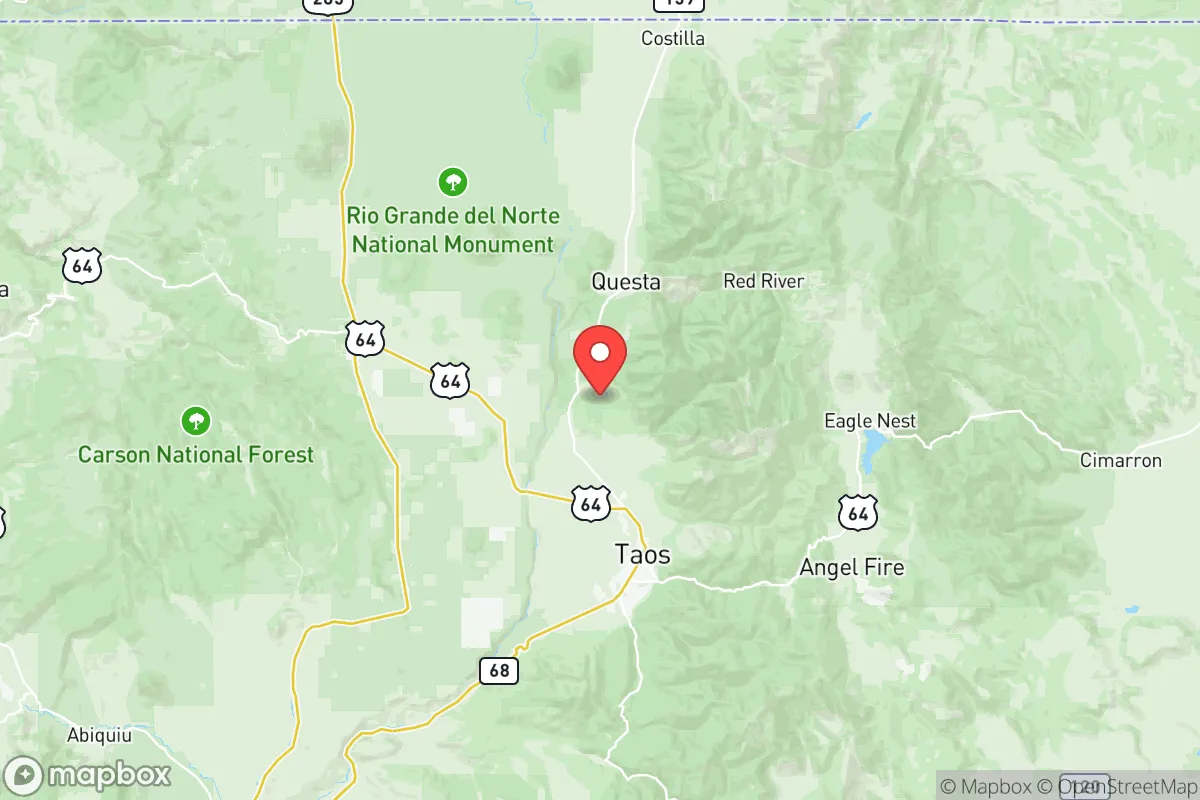
Taos County, New Mexico, offers a compelling mix of geographic isolation and strategic depth for those prioritizing resilience and self-sufficiency. Its location in the high desert of northern New Mexico, roughly 70 miles north of Santa Fe and 130 miles from Albuquerque, places it well outside the immediate blast and fallout zones of major metropolitan targets, while still providing access to regional supply chains and medical facilities. The county’s rugged terrain, sparse population density (about 33,000 residents across 2,200 square miles), and elevation above 7,000 feet create a natural buffer against many of the risks that plague more densely populated or strategically critical areas of the country.
Geographic position and natural advantages for long-term security
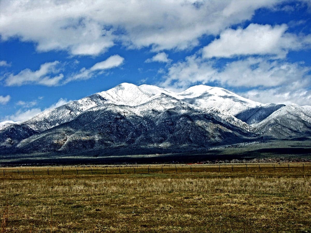
Taos County sits in the Sangre de Cristo Mountains, a region defined by deep canyons, high plateaus, and the Rio Grande Gorge. This topography provides inherent defensibility: the county is not a natural thoroughfare for large-scale movement, and its primary access routes—US 64, NM 68, and NM 522—are easily monitored and, if necessary, controlled. The county’s distance from major interstate corridors (I-25 is about 40 miles east) further reduces the risk of refugee flow or supply chain disruption during a crisis. The area is also far removed from any major military installations, nuclear facilities, or petrochemical infrastructure. The nearest significant military base is Kirtland Air Force Base in Albuquerque, over 130 miles south, and the closest nuclear-related site is Los Alamos National Laboratory, roughly 80 miles southwest. While Los Alamos is a potential target, prevailing winds and the mountainous terrain between the two locations significantly reduce fallout risk for Taos County. The county’s high elevation also means cooler summers and lower wildfire risk compared to lower-elevation parts of the Southwest, though it is not immune to drought.
Risks, exposures, and proximity to fallout-relevant landmarks
While Taos County is far from the highest-risk targets, it is not entirely without exposure. The primary man-made risk comes from its proximity to Los Alamos National Laboratory (LANL), a high-value target for any adversary. However, the 80-mile distance, combined with the Jemez Mountains and Rio Grande Valley acting as natural buffers, means that only a very large ground burst or a direct hit would pose a significant fallout threat to Taos County. Prevailing winds from the southwest would carry fallout from a LANL strike toward the northeast, away from Taos. The county is also roughly 200 miles from the Permian Basin oil fields in southeastern New Mexico and west Texas, a major energy infrastructure target, but again, distance and terrain mitigate the risk. Natural risks include periodic drought, which can stress water supplies, and a moderate seismic risk due to the Rio Grande Rift. The county has experienced minor earthquakes, but none above magnitude 5.0 in recorded history. Wildfire is a more immediate concern, particularly in dry years, but the county’s fire departments and mutual aid agreements with neighboring counties provide a reasonable response capability.
Practical resilience for a relocator: food, water, energy, and defensibility
For someone serious about self-sufficiency, Taos County offers several practical advantages. Water is the most critical resource: the county sits atop the Taos Plateau, which has significant groundwater reserves, and the Rio Grande and its tributaries provide surface water. However, water rights are complex and heavily regulated in New Mexico, so any relocator must secure a legal water source—either a well with a valid permit or a property with senior water rights. Food production is feasible but challenging: the short growing season (about 120 days) and high elevation limit crops to cold-hardy varieties like potatoes, root vegetables, and some grains, but the area has a strong tradition of small-scale agriculture and community-supported agriculture (CSA) programs. The county also has a robust local food network, including the Taos Farmers Market and several local ranches producing grass-fed beef and lamb. Energy resilience is strong: the county has high solar insolation (over 300 sunny days per year), making off-grid solar power highly viable. Many existing homes already have solar arrays, and the local utility, Kit Carson Electric Cooperative, has invested heavily in community solar and battery storage. Defensibility is excellent: the terrain provides natural chokepoints, and the county’s low population density means that a small, well-prepared community can effectively control its perimeter. The local sheriff’s office and volunteer fire departments are well-regarded, but in a prolonged crisis, residents would need to rely primarily on themselves and their neighbors.
Overall, Taos County presents a strong strategic picture for the resilience-minded relocator. Its combination of geographic isolation, defensible terrain, abundant solar energy, and access to water and local food networks makes it one of the more viable options in the Southwest for long-term self-sufficiency. The primary trade-offs are the short growing season, the need to secure water rights, and the moderate risk from Los Alamos as a distant target. For those willing to invest in infrastructure and adapt to a high-desert lifestyle, Taos County offers a balanced mix of security and livability that is hard to find elsewhere in the region. The nearby towns of Taos, Ranchos de Taos, and Arroyo Seco provide essential services and a sense of community without the vulnerabilities of a major urban center.

* Values derived from national, state, county, city and local statistics and may differ in a specific area. Last updated: 2026-07-01T22:06:06.000Z
Narrative content on this page is AI-generated and may contain mistakes. Verify any details that matter before acting on them.
ReloMaps may earn a commission from affiliate links at no extra cost to you.

