
Photo by Joris Beugels on Unsplash
Strategic Assessment of McCarthy, AK
Deep buffer from population centers and strategic targets. Low natural disaster risk and minimal exposure to border or coastal threats.
What does the Strategic Assessment tell us?
Our Strategic Assessment grades tactical survivability of an area. Major population centers, military targets, fallout zones, natural disasters, and border exposure all drive risk — lower exposure means a more defensible position in a crisis.
This is heavily inspired by Joel Skousen's Strategic Relocation book. Highly recommended you checkout the book ($)What does this tell us?
Our Strategic Assessment grades tactical survivability of an area. Major population centers, military targets, fallout zones, natural disasters, and border exposure all drive risk — lower exposure means a more defensible position in a crisis.
This is heavily inspired by Joel Skousen's Strategic Relocation book. Highly recommended you checkout the book ($)Strategic Pillars

Key Distances
Regional Safe Places
Below is our recommended "safe zones" in Alaska and the surrounding area based on our strategic heuristics. For most people, it's unrealistic to live in a “safe zone” full-time due to work, family or other personal reasons. They tend to be more rural. However, many of these areas are perfect for second homes and retreat properties that double as a vacation home or even a short-term rental.
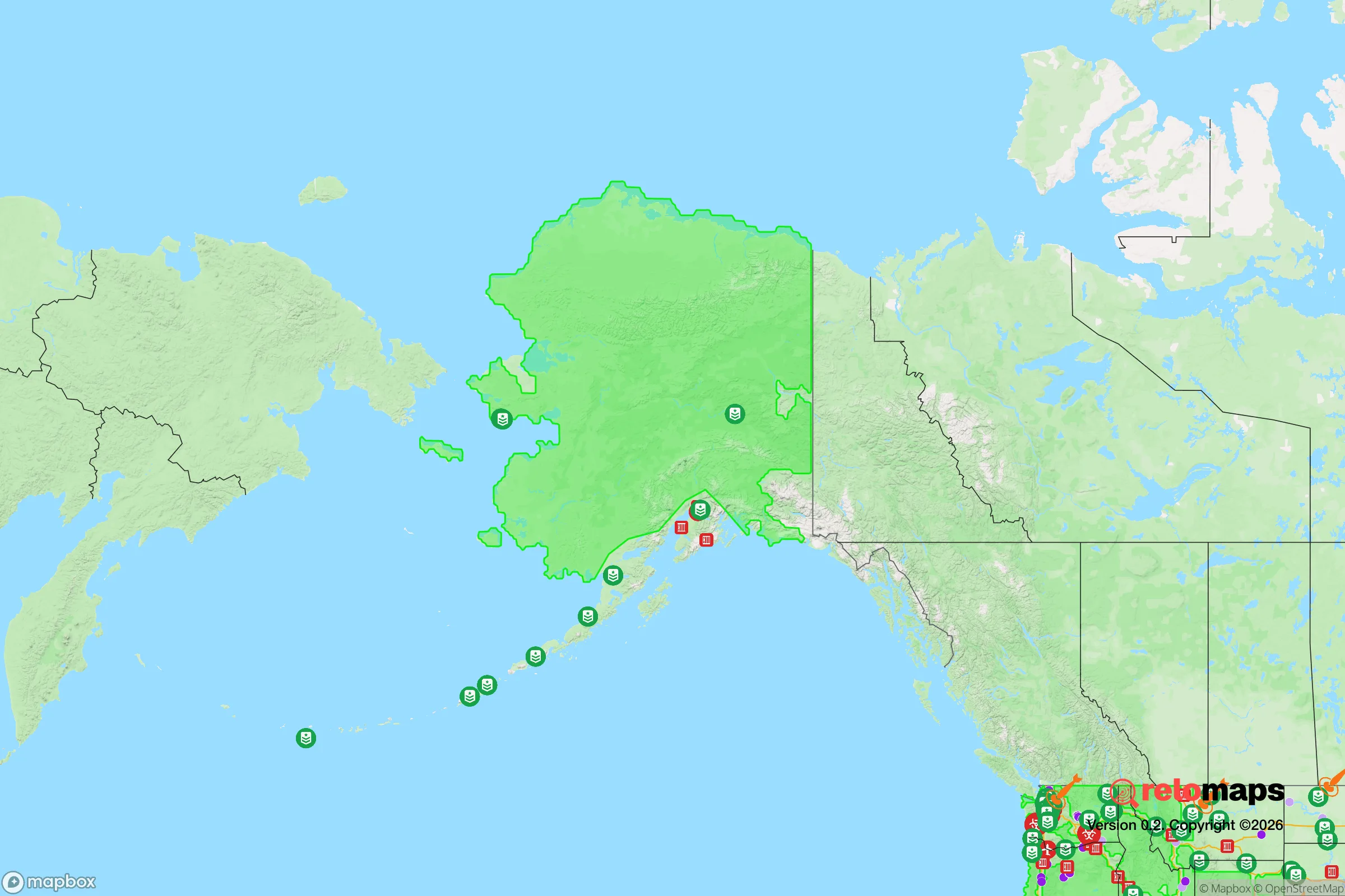
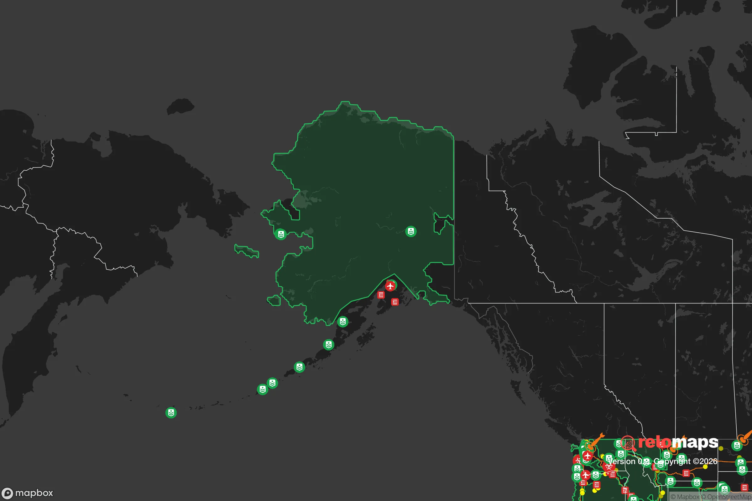


Important Note: For informational purposes only. This does not mean nothing bad ever happens in the green zones. Please use common sense. This is based on public data and modeled with AI. We tried to take a conservative approach but mistakes happen. We update this regularly as new information becomes available.
Solar Generator Recommendations
Backup power matters more here than in safer locations. We've picked three solar generators across budgets and capacity tiers — start with the budget unit if you only need a few essentials, or step up if you want to run a fridge and HVAC for days at a time.

Jackery Portable Power Station Explorer 300
Budget OptionPower on the Go: Weighing only 11 lbs, it's convenient to set up and store with book-sized foldable solar panels

BLUETTI Portable Power Station AC180
Designed for both indoor and outdoor scenarios, AC180 is highly capable as it has a robost capacity and continuous output power.

EF ECOFLOW DELTA Pro Ultra Power Station
Upgraded PickEcoFlow DELTA Pro Ultra is a whole-home energy system designed to grow with your family. Integrated with the Smart Home Panel 2, it scales to meet your evolving energy needs — keeping your home powered, intelligent, and secure through every stage of life.
We earn a commission, at no additional cost to you.
Strategic Assessment Analysis
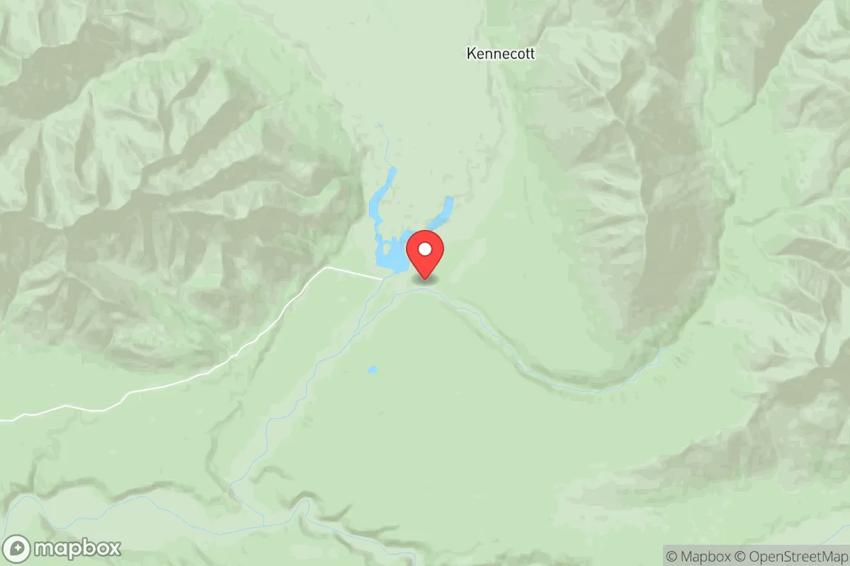
McCarthy, Alaska, offers a strategic relocation option for those prioritizing resilience and self-sufficiency, but it demands a clear-eyed understanding of its trade-offs. Located at the end of the McCarthy Road in Wrangell-St. Elias National Park, this remote community of roughly 30 year-round residents sits over 200 miles east of Anchorage and 60 miles from the nearest significant town, Glennallen. Its isolation is both its greatest asset and its most significant liability, providing natural buffering from many man-made risks while creating practical challenges for daily life and long-term preparedness.
Geographic position and natural advantages for self-sufficiency
McCarthy’s location in the heart of Wrangell-St. Elias National Park—the largest national park in the United States at 13.2 million acres—places it in one of the most geographically isolated inhabited areas in North America. The community is accessible only by a 60-mile gravel road from the Richardson Highway, which itself is a two-lane road through sparsely populated terrain. This remoteness provides a natural buffer against many of the risks that concern disaster-preparedness-minded relocators. The nearest population center of any size, Anchorage, is a 5-6 hour drive under good conditions, meaning McCarthy is far removed from the social and economic disruptions that can affect urban areas. The surrounding landscape is dominated by the Wrangell and St. Elias mountain ranges, with the Kennicott River flowing through the valley. This terrain offers natural defensibility—the community is effectively a dead-end, with only one road in and out, and the river crossing (via a footbridge in summer, ice bridge in winter) adds a layer of access control. The area’s climate is subarctic, with long, cold winters and short, mild summers. Average January lows hover around -10°F, while July highs reach the mid-60s°F. This climate supports natural food preservation (freezing) but limits growing seasons to roughly 90 days. The region’s water resources are abundant, with the Kennicott River providing year-round fresh water, though treatment is necessary for safe consumption. The surrounding forests offer timber for construction and fuel, and the park’s wildlife—moose, caribou, bear, and small game—provides a potential food source for those with hunting skills. The area’s elevation (roughly 1,600 feet) and latitude (61°N) mean long daylight hours in summer (up to 19 hours) and extreme darkness in winter (as little as 5 hours), which affects solar power viability and seasonal activity patterns.
Risks, exposures, and proximity to fallout-relevant landmarks
McCarthy’s primary risk profile is dominated by natural hazards rather than man-made threats, which is a significant advantage for those concerned about fallout or societal collapse. The community is over 200 miles from Anchorage, 150 miles from Fairbanks, and 300 miles from the nearest major military installation (Fort Wainwright near Fairbanks). This distance places McCarthy well outside the likely blast or fallout zones of any strategic targets in Alaska. The nearest potential target of concern is the Trans-Alaska Pipeline, which runs roughly 100 miles to the west, near Glennallen. While a pipeline disruption could affect fuel supplies statewide, the direct fallout risk to McCarthy from such an event is minimal due to prevailing wind patterns (typically from the north and west) and the distance. The primary natural risks in McCarthy are seismic and wildfire. The area sits in a seismically active region, with the Denali Fault running through the park. The 2002 Denali earthquake (magnitude 7.9) was centered about 100 miles northwest of McCarthy and caused significant ground shaking but no structural damage in the community itself. Wildfire risk is moderate, with the surrounding boreal forest and tundra capable of carrying fire during dry summer months. The community’s isolation means that emergency services are extremely limited—there is no hospital in McCarthy (the nearest is in Glennallen, 60 miles away), and the local volunteer fire department has basic equipment. Winter brings additional risks: extreme cold, heavy snowfall (averaging 60-80 inches annually), and the potential for road closures that can isolate the community for days or weeks. The Kennicott River crossing is particularly vulnerable; the summer footbridge can be washed out by high water, and the winter ice bridge requires careful monitoring for safety. For a relocator concerned about societal disruption, McCarthy’s primary exposure is not to direct threats but to supply chain dependency—nearly all food, fuel, and manufactured goods must be brought in over the McCarthy Road, which is unpaved and subject to washouts and snow drifts.
Practical resilience for a relocator: food, water, energy, and defensibility
For a relocator serious about self-sufficiency, McCarthy presents a mixed picture. Water is abundant and accessible year-round from the Kennicott River, but it requires treatment (boiling, filtration, or UV) to be safe from glacial silt and microbial contaminants. Most residents rely on hauled water or shallow wells, with gravity-fed systems possible in some locations. Food production is challenging but feasible. The growing season is short (roughly June through August), but hardy crops like potatoes, carrots, kale, and root vegetables can be grown in raised beds or greenhouses. The surrounding wilderness offers hunting and fishing opportunities—salmon runs in the nearby Copper River system (accessible via the McCarthy Road) provide a reliable seasonal protein source, and moose and caribou hunting is permitted with proper licenses. For long-term storage, the cold climate allows for natural freezing for much of the year, but a reliable root cellar or freezer with backup power is essential. Energy is the most significant practical challenge. McCarthy is not connected to the statewide power grid; electricity comes from a local microgrid powered by diesel generators, supplemented by some solar installations. The cost of electricity is high (roughly $0.50-$0.75 per kWh, compared to the national average of $0.12), and fuel must be trucked in over the McCarthy Road. For off-grid living, solar power is viable only during the summer months; winter requires wind, hydro, or generator backup. The Kennicott River offers potential for micro-hydro, but installation is technically demanding and requires permits from the National Park Service. Heating is primarily from wood or diesel, with the surrounding forest providing ample fuel for those willing to cut and split their own. Defensibility is a strong point. The community’s dead-end road access, river crossing, and small population make it naturally secure. The nearest law enforcement is the Alaska State Troopers in Glennallen, response time is measured in hours, so residents must be self-reliant for security. The community is tight-knit, with a culture of mutual aid, but newcomers should expect to earn trust through demonstrated competence and contribution. The National Park Service presence provides some oversight but does not offer emergency services. For a relocator, the key practical considerations are: (1) securing a reliable year-round water source and treatment system, (2) establishing a food production and storage plan that accounts for the short growing season, (3) designing an energy system that works through the dark winter months, and (4) building relationships with existing residents for mutual support and information sharing.
Overall, McCarthy offers a compelling strategic option for those willing to accept significant trade-offs. Its extreme isolation provides natural buffering from most man-made risks, including fallout and societal disruption, while its abundant water and wilderness resources support a subsistence lifestyle. However, the practical challenges of energy, food production, and access cannot be overstated. This is not a location for someone seeking a comfortable retirement or a low-effort homestead—it demands physical hardiness, mechanical skills, and a tolerance for long periods of darkness and cold. For the right person—someone with wilderness experience, a strong sense of self-reliance, and the financial resources to establish a well-equipped off-grid setup—McCarthy represents one of the most resilient locations in North America. For anyone else, the risks of isolation and supply chain dependency may outweigh the advantages. The community’s small size and remote location mean that newcomers should plan for a multi-year transition, building relationships and infrastructure before committing fully. In the calculus of strategic relocation, McCarthy scores high on natural defensibility and low on immediate threats, but requires a correspondingly high investment in personal capability and preparation.

* Values derived from national, state, county, city and local statistics and may differ in a specific area. Last updated: 2026-09-07T01:31:31.000Z
Narrative content on this page is AI-generated and may contain mistakes. Verify any details that matter before acting on them.
ReloMaps may earn a commission from affiliate links at no extra cost to you.

