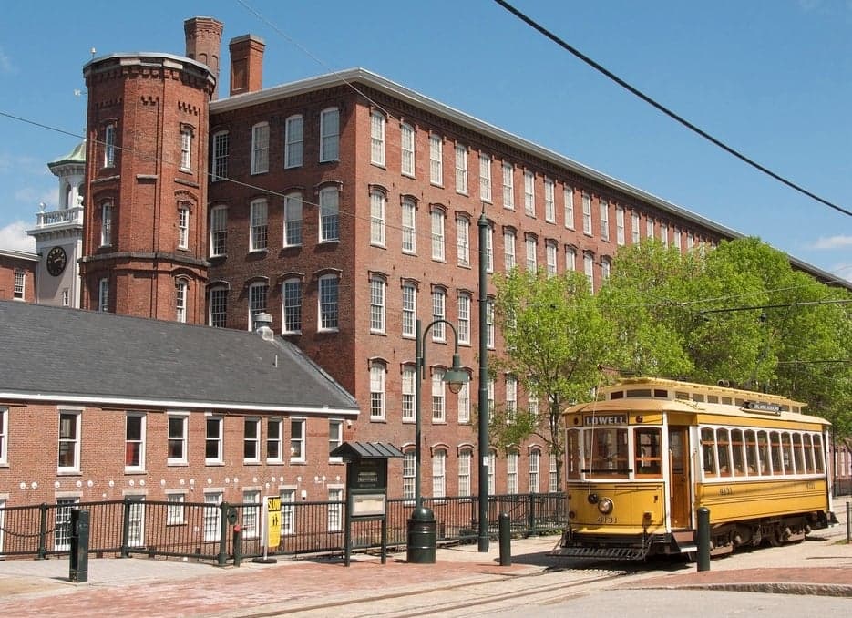
Photo: Wikipedia
Strategic Assessment of Middlesex County
Multiple tactical vulnerabilities. Population density, target proximity, or disaster risk are likely compounding. A retreat property and exit planning is required.
What does the Strategic Assessment tell us?
Our Strategic Assessment grades tactical survivability of an area. Major population centers, military targets, fallout zones, natural disasters, and border exposure all drive risk — lower exposure means a more defensible position in a crisis.
This is heavily inspired by Joel Skousen's Strategic Relocation book. Highly recommended you checkout the book ($)What does this tell us?
Our Strategic Assessment grades tactical survivability of an area. Major population centers, military targets, fallout zones, natural disasters, and border exposure all drive risk — lower exposure means a more defensible position in a crisis.
This is heavily inspired by Joel Skousen's Strategic Relocation book. Highly recommended you checkout the book ($)Strategic Pillars

Key Distances
Strategic Assessment Analysis
Middlesex County, Massachusetts, offers a unique strategic profile for relocation-minded individuals and families who prioritize resilience, blending the resource density of a major metropolitan region with the practical advantages of New England’s decentralized infrastructure. Its position as the most populous county in Massachusetts—home to over 1.6 million residents—means it is not a remote retreat, but rather a hub of logistical capability, medical infrastructure, and economic activity that can be leveraged in a crisis. The county’s resilience stems from its deep integration with Boston’s supply chains, its access to the Atlantic via the Port of Boston, and a robust network of state and local emergency management systems, all while maintaining a suburban and rural character in its western and northern towns that offers a degree of geographic buffer.
Geographic position and natural advantages for long-term stability
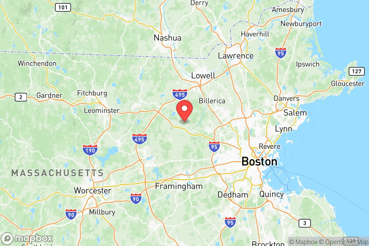
Middlesex County’s geography provides a layered set of advantages for those thinking about disaster readiness. The county stretches from the Atlantic coast in the east—touching Boston Harbor and the mouth of the Mystic River—westward to the rolling hills and forests of the Nashoba Valley. This east-west gradient means relocators can choose a location that balances proximity to urban resources with the security of inland terrain. The Merrimack River and the Concord River systems provide reliable freshwater sources, while the county’s numerous lakes and reservoirs, including the Wachusett Reservoir (which supplies drinking water to much of the region), offer a decentralized water supply less vulnerable to a single point of failure. The terrain is generally low-lying but punctuated by drumlins and eskers—glacial features that provide natural elevation and defensible positions in towns like Acton and Concord. The county’s location roughly 30 miles inland from the coast means it is less exposed to direct hurricane storm surge than coastal communities, though it still faces the risk of inland flooding from nor’easters. For a relocator, the key takeaway is that Middlesex County offers a mix of accessible water, moderate elevation, and proximity to the logistical backbone of the Boston metro area, all within a region that has historically been spared the worst of natural disasters like wildfires, tornadoes, and earthquakes.
Risks, exposures, and proximity to fallout-relevant landmarks
While Middlesex County is not a high-risk zone for catastrophic natural disasters, it carries significant exposure to man-made and infrastructure-related risks that a resilience-minded relocator must weigh. The county is bisected by major transportation corridors—Interstate 95 (Route 128) and Interstate 495—which are critical for regional logistics but also represent chokepoints that could be disrupted by accidents, cyberattacks, or civil unrest. The county’s proximity to Boston’s Logan International Airport and the Port of Boston (both within 15 miles of eastern Middlesex towns like Cambridge and Somerville) means that any major incident at those facilities—whether a terrorist attack, industrial accident, or supply chain disruption—would have immediate ripple effects across the county. Additionally, the county is home to several high-value targets: the Hanscom Air Force Base in Bedford, a major U.S. Air Force installation with a focus on command, control, and communications; the MIT Lincoln Laboratory in Lexington, a federally funded research center; and the Billerica facility of the Raytheon Technologies defense contractor. These sites, while economically vital, also make the county a potential target for adversaries in a conflict scenario. For a relocator, the eastern half of the county—particularly the urbanized core around Cambridge, Arlington, and Medford—carries the highest risk profile due to density and proximity to these assets. The western and northern towns, such as Littleton, Westford, and Groton, offer a lower exposure profile while still being within a 30-minute drive of the county’s medical and logistical resources.
Practical resilience for a relocator: food, water, energy, and defensibility
For a family or individual serious about self-sufficiency, Middlesex County presents a mixed picture. On the positive side, the county benefits from a robust agricultural heritage—towns like Carlisle, Concord, and Sudbury have active farming communities, farmers’ markets, and community-supported agriculture (CSA) programs that provide local food sources. The Middlesex County Farm Bureau and local conservation trusts have preserved thousands of acres of farmland, offering a buffer against complete reliance on industrial food supply chains. Water access is generally strong: the Massachusetts Water Resources Authority (MWRA) supplies treated water from the Quabbin and Wachusett Reservoirs to most of the county, but individual wells are common in the more rural western towns, providing a decentralized alternative. Energy resilience is a weaker point—the county is heavily dependent on the regional grid operated by Eversource and National Grid, and while solar adoption is growing, battery storage and backup generators are not yet widespread. The county’s defensibility is moderate: the suburban and rural towns offer natural chokepoints (narrow roads, river crossings, and wooded areas) that could be used for perimeter security, but the overall population density and interconnected road network make it difficult to isolate a single area. For a relocator, the most practical approach is to target a town with a well, a south-facing roof for solar, and proximity to a local farm or food co-op—places like Harvard, Bolton, or Stow fit this profile. The county’s strong network of volunteer fire departments, community emergency response teams (CERTs), and local emergency management agencies also provides a social resilience layer that is often overlooked in national-level assessments.
Overall, Middlesex County offers a strategic balance for the resilience-minded relocator: it is not a remote bunker, but a well-resourced region with the infrastructure, water, and community networks to weather a wide range of disruptions. The key is to choose a location within the county that minimizes exposure to the highest-risk zones—avoiding the dense urban core and the immediate vicinity of defense installations—while maximizing access to the county’s natural and logistical advantages. For a family that values preparedness without complete isolation, the western and northern towns of Middlesex County represent a solid, defensible choice in a region that has historically been stable, well-governed, and resilient in the face of both natural and man-made challenges.

* Values derived from national, state, county, city and local statistics and may differ in a specific area. Last updated: 2026-07-03T03:30:06.000Z
Narrative content on this page is AI-generated and may contain mistakes. Verify any details that matter before acting on them.
ReloMaps may earn a commission from affiliate links at no extra cost to you.

