Photo: Wikipedia
Strategic Assessment of Baltimore City County
Multiple tactical vulnerabilities. Population density, target proximity, or disaster risk are likely compounding. A retreat property and exit planning is required.
What does the Strategic Assessment tell us?
Our Strategic Assessment grades tactical survivability of an area. Major population centers, military targets, fallout zones, natural disasters, and border exposure all drive risk — lower exposure means a more defensible position in a crisis.
This is heavily inspired by Joel Skousen's Strategic Relocation book. Highly recommended you checkout the book ($)What does this tell us?
Our Strategic Assessment grades tactical survivability of an area. Major population centers, military targets, fallout zones, natural disasters, and border exposure all drive risk — lower exposure means a more defensible position in a crisis.
This is heavily inspired by Joel Skousen's Strategic Relocation book. Highly recommended you checkout the book ($)Strategic Pillars

Key Distances
Strategic Assessment Analysis
Baltimore City County, Maryland, presents a complex strategic picture for the relocation-minded reader focused on resilience and self-sufficiency. While its location on the Chesapeake Bay offers significant maritime advantages, its dense urban core, aging infrastructure, and proximity to major federal and industrial targets create substantial vulnerabilities that outweigh its benefits for most disaster-preparedness scenarios. The county’s historical role as a major port and industrial hub means it is both a potential asset for supply chain access and a high-priority target in any large-scale disruption, making it a location that demands careful, sober assessment rather than casual consideration.
Geographic position and natural advantages for self-sufficiency
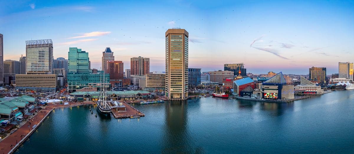
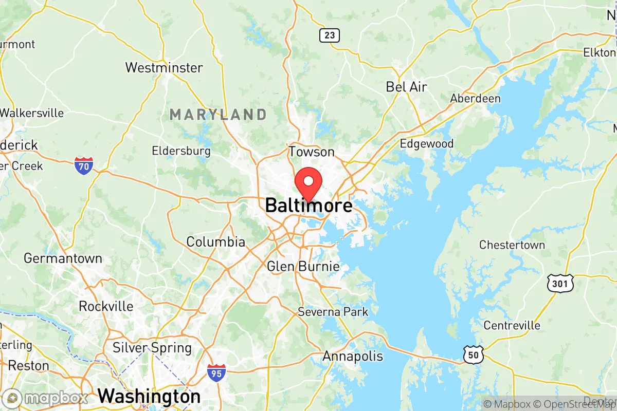
Baltimore City County sits at the tidal head of the Patapsco River, a deep-water estuary of the Chesapeake Bay. This position provides direct access to the Atlantic Ocean via the Chesapeake and Delaware Canal, a strategic maritime chokepoint. The area’s natural advantages are primarily water-based: the bay offers abundant seafood resources (blue crab, rockfish, oysters) and a potential freshwater source via the Patapsco and its tributaries, though much of the shoreline is heavily industrialized. The terrain is generally flat to gently rolling, with the Piedmont Plateau beginning just west of the city, offering slightly higher ground and better drainage. The county’s location places it within a day’s drive of major agricultural regions in Pennsylvania’s Lancaster County and Maryland’s Eastern Shore, which could serve as fallback food sources. However, the city itself is built on a series of low-lying peninsulas and islands, much of it reclaimed marshland, making it vulnerable to storm surge and sea-level rise. The nearby Fort McHenry National Monument and the Port of Baltimore are critical infrastructure points, but their strategic value also makes them likely targets in any conflict or major disruption. The presence of Joint Base Andrews and the U.S. Naval Academy in Annapolis, both within 30 miles, further concentrates military and governmental assets in the region.
Risks, exposures, and proximity to fallout-relevant landmarks
Baltimore City County’s risk profile is dominated by its proximity to high-value targets and its own dense urban fabric. The county is home to the Port of Baltimore, one of the busiest in the nation for roll-on/roll-off cargo and automobiles, and the Domino Sugar Refinery in the Inner Harbor, a major food-processing facility that could become a contamination source. The city also hosts the Johns Hopkins University Applied Physics Laboratory in nearby Laurel (Howard County), a major defense contractor, and the Social Security Administration headquarters in Woodlawn (Baltimore County). These facilities, combined with the proximity to Washington, D.C. (40 miles south), make the entire region a high-priority zone for any adversary. Natural risks include hurricanes and nor’easters, which can push storm surge up the Chesapeake Bay, flooding low-lying neighborhoods like Fells Point, Canton, and Locust Point. The city’s aging stormwater and sewage systems are prone to overflow during heavy rains, creating public health hazards. The Chesapeake Bay Bridge (US 50/301) and the Fort McHenry Tunnel (I-95) are critical evacuation chokepoints that would likely be compromised in a crisis. The presence of the Baltimore Gas and Electric (BGE) Spring Gardens facility and the Brandon Shores Generating Station (coal-fired) in nearby Anne Arundel County adds industrial risk. For a relocator, the sheer density of the city (over 585,000 people in 92 square miles) means that any major event would trigger rapid, chaotic population movement, with limited egress routes.
Practical resilience for a relocator: food, water, energy, and defensibility
For a relocator prioritizing self-sufficiency, Baltimore City County presents significant practical challenges. Food security is a mixed bag: the city has a growing network of urban farms and community gardens (e.g., Baltimore Urban Gardening with Students and Real Food Farm), but these are small-scale and not reliable for sustained survival. The Lexington Market and Broadway Market offer fresh food, but they depend on supply chains that would fail in a crisis. The Maryland Food Bank is a centralized resource but would be overwhelmed. Water security is a major concern: the city draws its drinking water from the Liberty Reservoir and Loch Raven Reservoir, both in Baltimore County, but the treatment plants (e.g., Montebello Filtration Plant) are vulnerable to power loss and contamination. The Patapsco River is heavily polluted and not a viable drinking source without advanced filtration. Energy resilience is poor: the grid is aging and prone to outages during storms, and the city’s reliance on natural gas and coal-fired plants (like the Brandon Shores and Herbert A. Wagner plants) means fuel supply disruptions would be crippling. Solar potential is moderate, but rooftop space is limited in dense neighborhoods. Defensibility is the weakest point: the city’s dense rowhouse blocks, narrow streets, and numerous alleys make it difficult to secure a perimeter. The Inner Harbor and Fells Point areas are tourist-heavy and would be chaotic in a crisis. The Jones Falls Expressway (I-83) and I-95 corridors are natural chokepoints for both ingress and egress. The Patterson Park and Druid Hill Park areas offer some open space but are not defensible. For a relocator, the best option within the county would be a well-fortified single-family home in a less dense neighborhood like Hampden or Medfield, but even these are within walking distance of major targets. The Baltimore County suburbs (e.g., Towson, Catonsville) offer slightly better defensibility but still suffer from proximity to the city’s risks.
Overall, Baltimore City County is a high-risk, low-resilience location for a relocator focused on disaster readiness and self-sufficiency. Its strategic maritime position and access to the Chesapeake Bay are genuine assets, but they are far outweighed by the concentration of high-value targets, dense population, aging infrastructure, and limited defensibility. For a conservative-leaning individual or family seeking a secure, self-sufficient base, the county’s vulnerabilities—particularly its proximity to Washington, D.C., and its own industrial and military landmarks—make it a poor choice. The Port of Baltimore and Fort McHenry are not assets for a relocator; they are liabilities. The practical challenges of securing food, water, and energy in a crisis, combined with the difficulty of defending a home in a dense urban environment, suggest that relocators would be better served by looking to rural areas in western Maryland or Pennsylvania. Baltimore City County is a place to pass through, not to hunker down in.

* Values derived from national, state, county, city and local statistics and may differ in a specific area. Last updated: 2026-06-28T02:21:05.000Z
Narrative content on this page is AI-generated and may contain mistakes. Verify any details that matter before acting on them.
ReloMaps may earn a commission from affiliate links at no extra cost to you.

