
Photo: Ron Dauphin via Unsplash
Strategic Assessment of St Landry County
Workable tactical position. Some exposure to population density or targets, but generally defensible in a crisis.
What does the Strategic Assessment tell us?
Our Strategic Assessment grades tactical survivability of an area. Major population centers, military targets, fallout zones, natural disasters, and border exposure all drive risk — lower exposure means a more defensible position in a crisis.
This is heavily inspired by Joel Skousen's Strategic Relocation book. Highly recommended you checkout the book ($)What does this tell us?
Our Strategic Assessment grades tactical survivability of an area. Major population centers, military targets, fallout zones, natural disasters, and border exposure all drive risk — lower exposure means a more defensible position in a crisis.
This is heavily inspired by Joel Skousen's Strategic Relocation book. Highly recommended you checkout the book ($)Strategic Pillars

Key Distances
Strategic Assessment Analysis
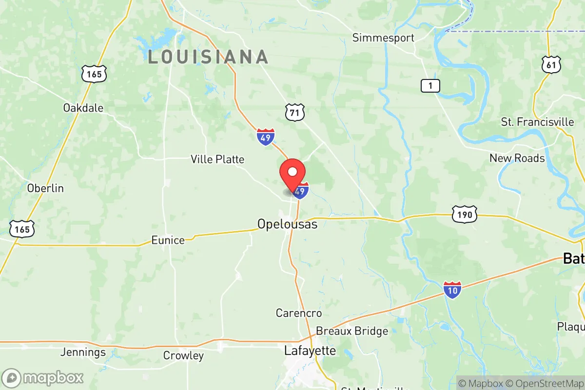
St Landry Parish offers a notable balance of seclusion and access for those prioritizing resilience and self-sufficiency, sitting about 90 miles northwest of Baton Rouge and 60 miles north of Lafayette, away from the immediate blast zones and fallout plumes of Louisiana's major industrial and population centers. Its location along the I-49 corridor provides a practical evacuation route inland, while the surrounding agricultural and forested landscape supports a lower population density than the state's coastal and river parishes. For a relocator focused on disaster readiness, St Landry Parish presents a strategic base with genuine opportunities for self-reliance, though it is not without specific exposures that warrant a sober assessment.
Geographic position and natural advantages for long-term security
St Landry Parish sits on the southwestern edge of the Mississippi River Alluvial Plain, transitioning into the piney woods and hills of central Louisiana, which gives it a topographical advantage over the flood-prone bayou country to the south. The parish is drained by the Atchafalaya River basin to the east and the Red River system to the north, but the majority of its populated areas—including the parish seat of Opelousas and the towns of Eunice, Ville Platte, and Sunset—sit on higher, better-drained ground. This reduces the risk of catastrophic flooding from hurricanes and storm surge, a critical factor for long-term habitability compared to coastal parishes. The area’s location roughly 80 miles north of the Gulf Coast also places it outside the typical 50-mile radius of major hurricane landfall impacts, meaning residents are less likely to face the full force of wind and storm surge. The parish’s interior position further distances it from the petrochemical and refinery complexes concentrated along the Mississippi River between Baton Rouge and New Orleans—a major fallout and secondary hazard zone—and from the ports and LNG terminals near Lake Charles. For a relocator, this translates to a lower likelihood of needing to evacuate due to natural disaster or being downwind of a major industrial accident.
Risks, exposures, and proximity to fallout-relevant landmarks
While St Landry Parish avoids the worst of Louisiana’s coastal and industrial exposures, it is not immune to hazards. The primary man-made risk comes from its position roughly 50-60 miles southeast of Fort Johnson (formerly Fort Polk), a major Army installation that houses live-fire training ranges, ammunition storage depots, and chemical weapons storage facilities. In a conflict or major accident scenario, an east-southeast wind could carry fallout or hazardous materials directly into the northern half of the parish. The town of Ville Platte is particularly exposed, lying almost directly in the prevailing wind path from the base. Another significant risk is the proximity to the Louisiana Highway 190 and I-49 corridors, which are major transportation arteries for hazardous materials—including crude oil, anhydrous ammonia, and chlorine—moving between the Gulf Coast refineries and inland storage facilities. A derailment or truck accident on these routes could release toxic clouds over a wide area; in 2023, a train derailment near Eunice released chlorine gas, forcing a brief shelter-in-place. Natural risks include periodic flash flooding from heavy rainfall, as seen with the 2024 floods that affected parts of Opelousas, and the potential for tornadoes, which are common in the region during spring and fall. The parish does not have any nuclear power plants within 75 miles, and the nearest major nuclear facility is the River Bend Station near Baton Rouge, roughly 80 miles east. For a resilience-minded relocator, these risks are manageable but require a solid awareness of local wind patterns and emergency alerts.
Practical resilience for a relocator: food, water, energy, and defensibility
St Landry Parish’s agricultural base is its strongest asset for self-sufficiency. The parish is a leading producer of rice, soybeans, corn, and crawfish, with hundreds of active farms scattered across its 1,385 square miles. Eunice is the hub of the regional rice industry, hosting mills and grain elevators that could provide local food sources even in a supply-chain disruption. The Atchafalaya Basin to the east is a massive freshwater swamp that offers a year-round source of fish, crawfish, and deer for those with hunting and fishing skills. Groundwater is plentiful and high-quality, with the Chicot and Evangeline aquifers providing abundant water for wells; many rural homes already rely on private wells, reducing dependence on municipal systems. Energy resilience is moderate: the area has intermittent electric service from Cleco and SLECA (co-ops), but power outages from thunderstorms and ice storms are common, so solar with battery backup is a practical investment. Propane is widely available from suppliers like the ones in Opelousas and Ville Platte, and wood for heating is abundant in the surrounding pine forests. Defensibility is mixed. The parish’s flat-to-rolling terrain and open farmland offer limited natural cover, but the low population density—roughly 80,000 people across a wide area—means that prepper-style retreats in the rural eastern and northern parts of the parish are far more practical than near any town. The presence of two state prisons (Louisiana State Penitentiary at Angola is about 30 miles north, and St Landry Parish Jail in Opelousas holds about 400 inmates) means there is a higher than average local law enforcement presence, but also a non-zero risk of escapees near correctional transport routes. For a family or individual, the key resilience strategy is to locate at least 10 miles from the I-49 and US 190 corridors, in the less-trafficked areas near the Chicot State Park, which offers dense forest, a secure water source, and limited road access.
Overall, St Landry Parish presents a realistic option for the conservative-leaning relocator who wants to be part of a functioning rural community with genuine self-sufficiency potential, while still being within a couple hours of major medical centers in Baton Rouge or Lafayette. The parish’s agricultural capacity, relatively low flood risk, and distance from the state’s petrochemical belt are genuine advantages for long-term stability. The primary strategic trade-off is the proximity to Fort Johnson and the transportation corridors—these are manageable with proper planning, including a wind-direction monitoring station and a well-stocked safe room. For a reader serious about disaster readiness, St Landry Parish offers a solid foundation that requires active preparation but does not demand the extreme isolation or limited resources of a full off-grid mountain retreat. It is a credible, grounded choice for those who want a rural buffer without abandoning all access to modern infrastructure.

* Values derived from national, state, county, city and local statistics and may differ in a specific area. Last updated: 2026-06-24T18:05:00.000Z
Narrative content on this page is AI-generated and may contain mistakes. Verify any details that matter before acting on them.
ReloMaps may earn a commission from affiliate links at no extra cost to you.

