
Photo: Wikipedia
Strategic Assessment of Kittery, ME
Meaningful friction. Expect exposure to either population pressure, blast zones, or natural disaster risk. Consider buying a retreat property.
What does the Strategic Assessment tell us?
Our Strategic Assessment grades tactical survivability of an area. Major population centers, military targets, fallout zones, natural disasters, and border exposure all drive risk — lower exposure means a more defensible position in a crisis.
This is heavily inspired by Joel Skousen's Strategic Relocation book. Highly recommended you checkout the book ($)What does this tell us?
Our Strategic Assessment grades tactical survivability of an area. Major population centers, military targets, fallout zones, natural disasters, and border exposure all drive risk — lower exposure means a more defensible position in a crisis.
This is heavily inspired by Joel Skousen's Strategic Relocation book. Highly recommended you checkout the book ($)Strategic Pillars

Key Distances
Regional Safe Places
Below is our recommended "safe zones" in Maine and the surrounding area based on our strategic heuristics. For most people, it's unrealistic to live in a “safe zone” full-time due to work, family or other personal reasons. They tend to be more rural. However, many of these areas are perfect for second homes and retreat properties that double as a vacation home or even a short-term rental.




Important Note: For informational purposes only. This does not mean nothing bad ever happens in the green zones. Please use common sense. This is based on public data and modeled with AI. We tried to take a conservative approach but mistakes happen. We update this regularly as new information becomes available.
Solar Generator Recommendations
Backup power matters more here than in safer locations. We've picked three solar generators across budgets and capacity tiers — start with the budget unit if you only need a few essentials, or step up if you want to run a fridge and HVAC for days at a time.

Jackery Portable Power Station Explorer 300
Budget OptionPower on the Go: Weighing only 11 lbs, it's convenient to set up and store with book-sized foldable solar panels

BLUETTI Portable Power Station AC180
Designed for both indoor and outdoor scenarios, AC180 is highly capable as it has a robost capacity and continuous output power.

EF ECOFLOW DELTA Pro Ultra Power Station
Upgraded PickEcoFlow DELTA Pro Ultra is a whole-home energy system designed to grow with your family. Integrated with the Smart Home Panel 2, it scales to meet your evolving energy needs — keeping your home powered, intelligent, and secure through every stage of life.
We earn a commission, at no additional cost to you.
Strategic Assessment Analysis
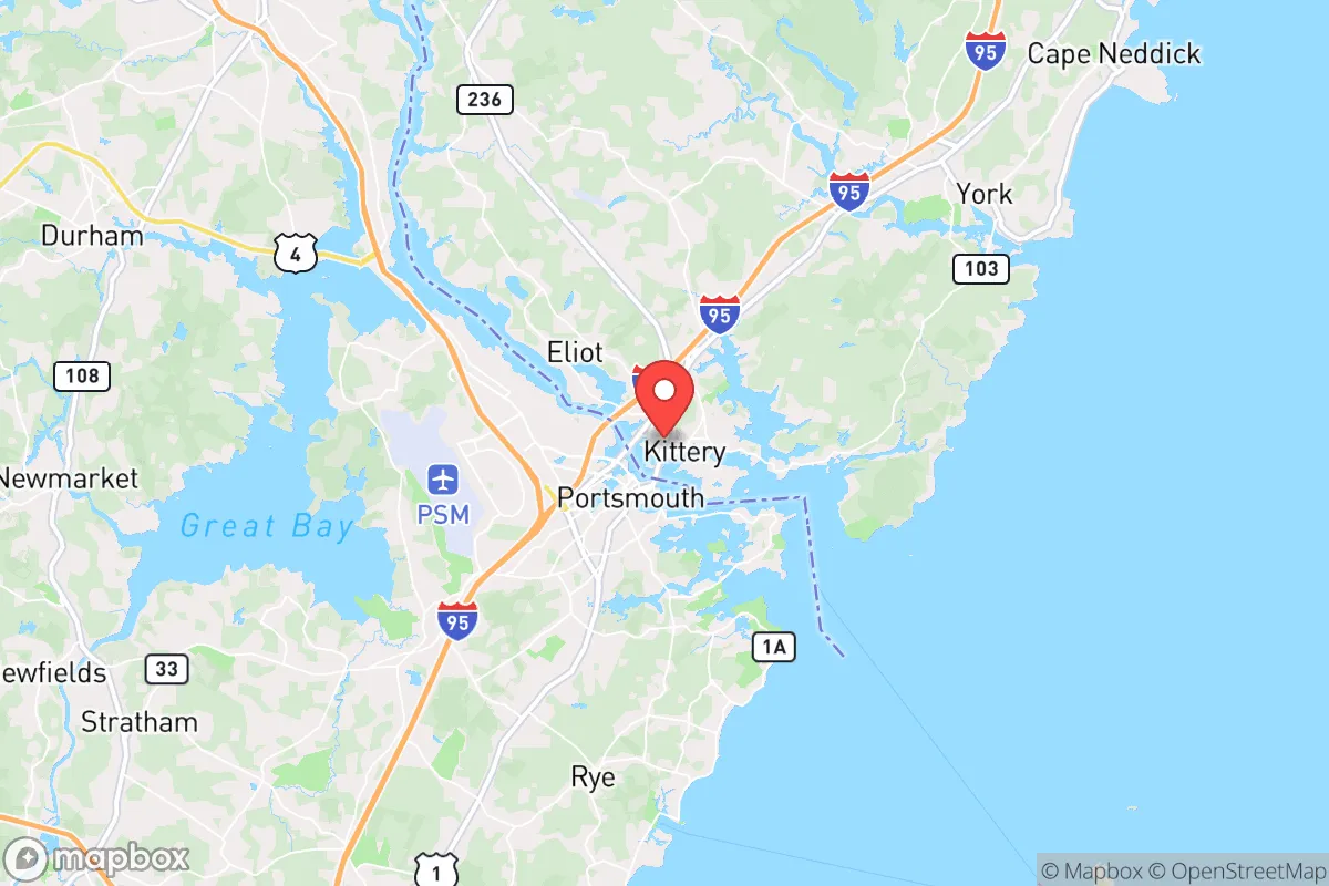
Kittery, Maine, occupies a unique strategic position at the southernmost tip of the state, where the Piscataqua River meets the Atlantic Ocean. Its resilience profile is a study in contrasts: the town benefits from deep natural resources and a location that is both defensible and resource-rich, yet it sits immediately adjacent to one of the most concentrated military-industrial zones on the East Coast. For a relocator thinking seriously about disaster readiness and self-sufficiency, Kittery offers genuine advantages in food and water security, but its proximity to Portsmouth Naval Shipyard and the broader Seacoast region introduces man-made risks that cannot be ignored. The key is understanding that Kittery’s resilience is highly conditional—strong for natural hazards, but compromised by its position relative to high-value strategic targets.
Geographic position and natural advantages for self-sufficiency
Kittery’s geography provides a strong foundation for a self-sufficient lifestyle. The town is situated on a peninsula bounded by the Atlantic Ocean to the east and the Piscataqua River to the south and west, giving it direct access to one of the richest marine ecosystems in New England. The Gulf of Maine’s cold, nutrient-dense waters support abundant populations of lobster, cod, haddock, clams, and mussels, meaning a skilled individual could supplement food supplies indefinitely from the sea. The Piscataqua River itself is a deep, fast-moving tidal estuary that flushes twice daily, providing reliable access to shellfish beds and finfish. Inland, Kittery’s soils are a mix of sandy loam and glacial till, suitable for small-scale vegetable gardening, though the short growing season (roughly 140 frost-free days) limits staple crops like corn and beans. The town’s forested areas—primarily mixed hardwoods and pines—offer firewood, small game (deer, turkey, squirrel), and construction materials. Freshwater is abundant: Kittery sits atop the Saco River aquifer system, and numerous ponds and streams (such as Spruce Creek and the Kittery Town Forest wetlands) provide surface water, though treatment would be necessary for long-term consumption. The terrain is gently rolling, with no significant elevation changes, which limits defensibility but makes the area easily traversable on foot or by bicycle. The climate is temperate maritime, with winters averaging 20-30°F and summers 60-80°F, reducing the energy burden for heating and cooling compared to inland Maine or the Midwest.
Risks, exposures, and proximity to fallout-relevant landmarks
The most significant vulnerability in Kittery is its proximity to Portsmouth Naval Shipyard, located on Seavey Island just across the Piscataqua River in Kittery itself. This is a nuclear-capable naval installation that refuels and overhauls Los Angeles-class submarines, meaning it is a high-priority target in any major conflict. The shipyard is roughly 2 miles from Kittery’s town center, placing the entire community within a likely blast zone or fallout footprint for a precision strike. Additionally, the nearby Portsmouth International Airport at Pease (10 miles west) hosts an Air National Guard base and a commercial airport, adding another layer of target risk. The Seacoast region as a whole—Portsmouth, Dover, and the New Hampshire side—is a dense population corridor with over 250,000 people within a 20-mile radius, which would create severe competition for resources in a crisis. Natural hazards are less acute but still present: storm surge from nor’easters and hurricanes is a real threat, with FEMA flood zones covering much of the coastal and riverfront areas (including Kittery Point and parts of Route 1). The town has experienced flooding from storms like the 2023 nor’easter that caused coastal erosion and road closures. Sea-level rise projections for 2050 suggest an additional 1-2 feet of water, which would inundate low-lying areas near the river. Earthquakes are rare and minor. The primary man-made risk beyond military targets is the I-95 corridor, which runs through Kittery and is a major evacuation route for the entire Seacoast; in a crisis, this road would become impassable due to congestion, making egress difficult. The town’s reliance on a single bridge (the I-95 Piscataqua River Bridge) for road access to the south is a critical chokepoint.
Practical resilience for a relocator: food, water, energy, and defensibility
For a relocator serious about self-sufficiency, Kittery offers a mixed bag. Food security is above average due to marine resources: a person with a boat or even a kayak could harvest shellfish and fish year-round, and the town has several community gardens and farmers’ markets (like the Kittery Community Market) that could be leveraged in normal times. However, the short growing season limits year-round vegetable production without a greenhouse. Local agriculture is modest—there are a few small farms (e.g., Kittery Land Trust’s community farm plots) but no large-scale producers. Water security is strong: the town’s public water supply comes from the Saco River via the Kennebunk, Kennebunkport, and Wells Water District, but private wells are common in rural areas (about 30% of homes), and the aquifer is reliable. Boiling or filtering surface water from Spruce Creek or the town forest ponds is feasible. Energy resilience is moderate: Kittery is connected to the ISO-New England grid, which is vulnerable to storm outages (the 2021 nor’easter left 10,000+ without power in York County). Solar potential is decent—the area gets about 200 sunny days per year—but tree cover limits rooftop solar efficiency. Wood heating is practical, with ample firewood from local forests, and the town has no restrictions on wood stoves. Defensibility is poor: the terrain is flat and open, with no natural chokepoints except the bridges. The town’s population of about 5,000 is spread across 7.5 square miles, making it hard to secure a perimeter. The presence of the naval shipyard means any crisis would draw military and federal attention, which could be either a protection or a liability. The local police force is small (about 15 officers), and the nearest hospital is Portsmouth Regional Hospital (5 miles), which would be overwhelmed in a major event. The community is tight-knit, with active volunteer fire and EMS services, which is a plus for mutual aid.
Overall, Kittery presents a strategic picture of high resource availability but high target risk. For a relocator who values immediate access to food from the sea and fresh water, and who is willing to accept the elevated man-made risks from the naval shipyard and nearby population centers, it could work as a base for a self-sufficient lifestyle—provided one has a plan for evacuation or sheltering in place during a crisis. The town’s natural advantages are real, but they are offset by its position on a vulnerable peninsula adjacent to a primary military target. A more resilient alternative might be inland Maine (e.g., Washington County or the western mountains), where target risk is lower and defensibility is higher, but Kittery offers a rare combination of marine resources and infrastructure that could sustain a small, prepared group. The bottom line: Kittery is not a bug-out location, but it could be a viable long-term home for someone who understands the risks and invests in redundancy—especially in water storage, alternative energy, and a solid evacuation route north.

* Values derived from national, state, county, city and local statistics and may differ in a specific area. Last updated: 2026-10-11T02:58:03.000Z
Narrative content on this page is AI-generated and may contain mistakes. Verify any details that matter before acting on them.
ReloMaps may earn a commission from affiliate links at no extra cost to you.

