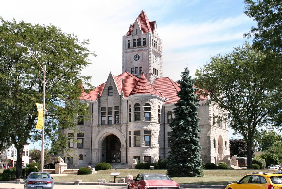
Photo: Wikipedia
Strategic Assessment of Fulton County
Workable tactical position. Some exposure to population density or targets, but generally defensible in a crisis.
What does the Strategic Assessment tell us?
Our Strategic Assessment grades tactical survivability of an area. Major population centers, military targets, fallout zones, natural disasters, and border exposure all drive risk — lower exposure means a more defensible position in a crisis.
This is heavily inspired by Joel Skousen's Strategic Relocation book. Highly recommended you checkout the book ($)What does this tell us?
Our Strategic Assessment grades tactical survivability of an area. Major population centers, military targets, fallout zones, natural disasters, and border exposure all drive risk — lower exposure means a more defensible position in a crisis.
This is heavily inspired by Joel Skousen's Strategic Relocation book. Highly recommended you checkout the book ($)Strategic Pillars

Key Distances
Strategic Assessment Analysis
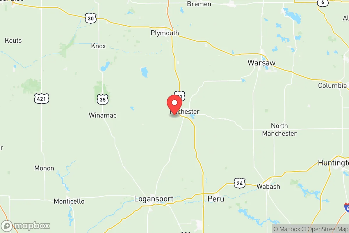
Fulton County, Indiana, offers a strategic blend of geographic isolation and practical self-sufficiency that appeals to relocation-minded individuals and families prioritizing resilience. Situated roughly 90 miles south of the Chicago metro area and 40 miles west of South Bend, the county sits in a sweet spot—close enough to access urban resources but far enough to avoid the fallout risks and congestion of major population centers. The county seat, Rochester, anchors a region of about 20,000 residents, with smaller communities like Akron, Fulton, and Kewanna providing additional rural nodes. For a reader weighing disaster readiness and long-term stability, Fulton County’s position in the flat, agricultural heart of north-central Indiana offers distinct advantages in food security, water access, and low population density, while its distance from high-value targets like the Gary refinery corridor or the Chicago rail nexus reduces man-made risk exposure.
Geographic position and natural advantages for self-sufficiency
Fulton County’s geography is defined by the Tippecanoe River, which meanders through the county and feeds into the broader Wabash River watershed. This river system provides a reliable surface water source for irrigation, livestock, and emergency use—a critical asset in a grid-down scenario. The county sits atop the Mississinewa and Tippecanoe River aquifers, offering groundwater access that many Midwestern counties lack. The terrain is predominantly flat to gently rolling, with fertile, well-drained soils that support corn, soybeans, and wheat—meaning local food production is not just possible but historically proven. The county’s position in USDA Plant Hardiness Zone 5b allows for a 150-170 day growing season, suitable for staple crops and cold-hardy vegetables. For a relocator, this means the land itself can sustain a household with modest effort, unlike arid or mountainous regions where water and arable land are scarce. The nearest major military installation is Grissom Air Reserve Base (about 25 miles east in Miami County), but it’s a reserve base with limited strategic value, not a primary target like Fort Hood or a nuclear command center. The county’s distance from the Gary/Whiting refinery complex (roughly 70 miles northwest) and the Chicago rail and shipping hubs (90+ miles) places it outside the primary fallout zones of a major industrial or military strike, though prevailing winds from the west could carry particulate matter in a worst-case scenario.
Risks, exposures, and proximity to fallout-relevant landmarks
Fulton County’s risk profile is moderate, with natural hazards outweighing man-made threats. The county lies in Tornado Alley’s eastern fringe, with an average of 2-3 tornado warnings per year—typically EF0-EF2 events, though the 2016 outbreak produced an EF2 that damaged structures near Rochester. Flooding along the Tippecanoe River is the most consistent natural risk; the river has exceeded flood stage 12 times since 2000, with the 2008 and 2019 floods causing significant agricultural damage and some residential flooding in low-lying areas of Rochester and Fulton. Winter storms are a recurring hazard, with lake-effect snow from Lake Michigan occasionally dumping 8-12 inches in a single event, though the county averages only 30 inches annually—less than areas closer to the lake. Man-made risks are lower than in coastal or industrial regions. The closest nuclear facility is the Donald C. Cook Nuclear Plant in Bridgman, Michigan, about 60 miles northwest—within the 50-mile ingestion exposure zone but outside the 10-mile plume exposure zone. A catastrophic release there could affect Fulton County depending on wind direction, but the plant’s safety record is solid. The nearest major chemical facility is the NIPSCO coal plant in Wheatfield (Jasper County), about 30 miles west, but it’s a power plant, not a refinery. The county has no major rail yards, pipelines, or storage terminals that would make it a secondary target. For a relocator, the primary risk is weather-related, not man-made, which is manageable with proper shelter and drainage planning.
Practical resilience for a relocator: food, water, energy, and defensibility
Fulton County offers strong practical resilience for a household or small community. Food security is excellent: the county has 1,200+ farms covering 180,000 acres, with local grain elevators in Rochester, Akron, and Kewanna that can supply bulk staples. The Rochester Farmers Market (May-October) and several U-pick operations provide fresh produce, while the county’s Amish and Mennonite communities in the southeastern part near Akron offer direct access to preserved goods, livestock, and handcrafted tools. Water access is above average: the Tippecanoe River and its tributaries (including the Eel River in the south) provide year-round surface water, and the aquifer depth averages 50-100 feet, making hand-pump wells feasible for most properties. The county’s water table is high enough that shallow wells are common—many older homes in rural areas still use them. Energy resilience is moderate: the grid is served by Duke Energy and NIPSCO, with above-average reliability for rural Indiana (average outage duration of 90 minutes per year, versus 120 for the state). Solar potential is decent, with 4.5 peak sun hours per day, and wood heating is practical given the county’s 25% forest cover (mostly oak-hickory in the Tippecanoe River valley). Propane is widely available for backup generation. Defensibility is favorable: the county’s low population density (about 45 people per square mile) and dispersed settlement pattern—most homes sit on 1-10 acre lots with clear sightlines—make it hard to isolate or overwhelm. The county has no major highways (only US 31 and SR 14/25), which limits through-traffic and potential refugee flow from Chicago or South Bend. The local sheriff’s office has 15 sworn deputies, and the Rochester Police Department adds 10 officers—small but sufficient for a rural area with low crime (violent crime rate of 120 per 100,000, about half the national average). The county’s two hospitals (Woodlawn Hospital in Rochester and a critical access facility in Akron) provide basic emergency care, though trauma cases require transport to South Bend or Fort Wayne (45-60 minutes).
The overall strategic picture for Fulton County is one of balanced, low-drama resilience. It lacks the dramatic defensibility of a mountain redoubt or the immediate self-sufficiency of a coastal homestead, but it offers something more practical for most relocators: a place where a family can live affordably (median home price around $180,000), grow food, access clean water, and stay clear of the major fallout zones that threaten the coasts, the Chicago corridor, and the refinery belt. The county’s biggest weakness is its reliance on a single north-south artery (US 31) for evacuation or supply, and its vulnerability to river flooding in the Tippecanoe Valley. But for a reader who wants a real, livable option—not a fantasy bunker—Fulton County is a solid, under-the-radar choice that balances risk, cost, and capability better than most Midwestern counties. It’s not a fortress, but it’s a foundation. And for most people, that’s enough.

* Values derived from national, state, county, city and local statistics and may differ in a specific area. Last updated: 2026-11-08T12:33:52.000Z
Narrative content on this page is AI-generated and may contain mistakes. Verify any details that matter before acting on them.
ReloMaps may earn a commission from affiliate links at no extra cost to you.

