
Photo: Wikipedia
Strategic Assessment of Dekalb County
Workable tactical position. Some exposure to population density or targets, but generally defensible in a crisis.
What does the Strategic Assessment tell us?
Our Strategic Assessment grades tactical survivability of an area. Major population centers, military targets, fallout zones, natural disasters, and border exposure all drive risk — lower exposure means a more defensible position in a crisis.
This is heavily inspired by Joel Skousen's Strategic Relocation book. Highly recommended you checkout the book ($)What does this tell us?
Our Strategic Assessment grades tactical survivability of an area. Major population centers, military targets, fallout zones, natural disasters, and border exposure all drive risk — lower exposure means a more defensible position in a crisis.
This is heavily inspired by Joel Skousen's Strategic Relocation book. Highly recommended you checkout the book ($)Strategic Pillars

Key Distances
Strategic Assessment Analysis
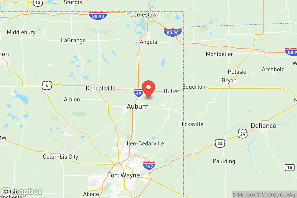
Dekalb County, Indiana, offers a strategic blend of Midwestern stability and practical self-sufficiency that appeals to relocation-minded individuals and families who prioritize resilience. Located in the northeastern corner of the state, the county sits roughly 25 miles north of Fort Wayne and about 35 miles south of the Michigan border, placing it within a day’s drive of major Great Lakes population centers like Chicago, Detroit, and Cleveland, yet far enough removed to avoid the direct fallout risks associated with those metropolitan areas. The county’s economic backbone—anchored by manufacturing, agriculture, and a steady stream of commuters to Fort Wayne’s defense and logistics sectors—provides a buffer against boom-and-bust cycles, while its low population density (roughly 43,000 residents across 363 square miles) and rural character make it a plausible base for those seeking a quieter, more prepared lifestyle. For a conservative-leaning audience weighing disaster readiness and long-term stability, Dekalb County merits a serious look, though its proximity to certain regional vulnerabilities demands careful consideration.
Geographic position and natural advantages for long-term stability
Dekalb County’s geography is defined by flat to gently rolling farmland, part of the larger Maumee River watershed, which drains north toward Lake Erie. The county seat, Auburn, sits at the intersection of Interstate 69 and U.S. Route 6, providing efficient road access to Fort Wayne’s international airport and rail hubs without the congestion of a major metro. The St. Joseph River, which flows through the county’s western edge near the town of Butler, offers a reliable surface water source, while numerous smaller creeks and ponds dot the landscape—a practical advantage for off-grid water planning. The area’s natural hazards are minimal: tornadoes are the primary weather risk, with the county falling within Indiana’s typical severe thunderstorm zone, but the flat terrain reduces the likelihood of flash flooding compared to hilly regions. Winters bring moderate snowfall (averaging 30-35 inches annually), which can disrupt travel but also replenish groundwater. The lack of significant seismic activity, coastal storm surge, or wildfire risk makes Dekalb County a comparatively stable choice for those prioritizing natural disaster resilience.
Risks, exposures, and proximity to fallout-relevant landmarks
While Dekalb County avoids the direct blast and fallout zones of major cities, it is not without strategic exposures. The most notable nearby landmark is the Fort Wayne Defense Logistics Agency (DLA) Distribution Center, located about 20 miles south in Allen County—a key military supply hub that could become a target in a conflict scenario. Additionally, the General Motors Fort Wayne Assembly plant in Roanoke (roughly 25 miles southwest) and the Steel Dynamics Inc. mill in Butler (within the county itself) represent industrial assets that could draw secondary attention. The county’s proximity to Interstate 69, a major north-south corridor connecting Indianapolis to the Canadian border, means that any large-scale evacuation or military movement would likely funnel through the area, potentially creating congestion or security checkpoints. On the positive side, Dekalb County is far from nuclear power plants (the nearest, Fermi 2 in Michigan, is about 80 miles north) and major chemical refineries, reducing the risk of industrial accidents. The county’s rural character also means fewer high-value targets than urban or suburban areas, though the Auburn Cord Duesenberg Automobile Museum and the National Automotive and Truck Museum in Auburn are notable cultural assets that could attract looting in a breakdown scenario. For a relocator, the key takeaway is that Dekalb County is not a zero-risk zone, but its risks are manageable and far less acute than those of a city or a coastal region.
Practical resilience for a relocator: food, water, energy, and defensibility
For a family or individual serious about self-sufficiency, Dekalb County offers strong fundamentals. Food security is a standout: the county is part of Indiana’s agricultural heartland, with thousands of acres of corn, soybeans, and wheat, plus numerous small farms and livestock operations. The DeKalb County Farmers Market in Auburn operates seasonally, and local producers like Byler’s Farm Market near Waterloo provide direct access to fresh produce and meat. For long-term storage, the county’s rural zoning allows for backyard gardens, chicken coops, and even small-scale livestock without the restrictions common in suburban subdivisions. Water availability is generally good: the St. Joseph River and the Cedar Creek watershed offer surface water, while most rural properties rely on private wells with average depths of 50-100 feet—a more resilient setup than municipal systems vulnerable to contamination or pressure loss. Energy independence is feasible: the area receives ample sunlight for solar panels (about 180 sunny days per year), and wood-burning stoves are common in older homes. The county’s electric grid is served by Indiana Michigan Power, which has a mixed generation portfolio including coal, natural gas, and renewables, but rural areas are prone to longer outage durations during storms—a factor that favors off-grid backup systems. Defensibility is a mixed picture: the flat, open terrain offers good visibility but limited natural cover, making a rural homestead with a clear perimeter and a well-stocked armory more practical than a suburban lot. The county’s low crime rate (violent crime is roughly 60% below the national average, per 2023 FBI data) reduces the likelihood of immediate security threats, but the proximity to I-69 means that transient populations could increase during a crisis. For a relocator, the best approach is to choose a property with a good well, south-facing roof for solar, and at least 5-10 acres of buffer from main roads.
Overall, Dekalb County presents a solid strategic option for those seeking a balance between accessibility and resilience. It avoids the high-risk zones of major cities and coastal areas while offering practical advantages in food production, water access, and energy independence. The county’s conservative-leaning culture—evident in its voting patterns (Trump won 68% of the vote in 2020) and strong support for Second Amendment rights—aligns with the values of many relocation-minded readers. The main trade-offs are the manageable risks from nearby industrial and military assets and the need for proactive preparation against severe weather and grid outages. For a family or individual willing to invest in a well, solar panels, and a defensible property, Dekalb County offers a realistic foundation for long-term stability in an uncertain world. It is not a bunker, but it is a viable base for building a resilient life.

* Values derived from national, state, county, city and local statistics and may differ in a specific area. Last updated: 2026-10-22T20:53:12.000Z
Narrative content on this page is AI-generated and may contain mistakes. Verify any details that matter before acting on them.
ReloMaps may earn a commission from affiliate links at no extra cost to you.

