Photo: Wikipedia
Strategic Assessment of Sangamon County
Meaningful friction. Expect exposure to either population pressure, blast zones, or natural disaster risk. Consider buying a retreat property.
What does the Strategic Assessment tell us?
Our Strategic Assessment grades tactical survivability of an area. Major population centers, military targets, fallout zones, natural disasters, and border exposure all drive risk — lower exposure means a more defensible position in a crisis.
This is heavily inspired by Joel Skousen's Strategic Relocation book. Highly recommended you checkout the book ($)What does this tell us?
Our Strategic Assessment grades tactical survivability of an area. Major population centers, military targets, fallout zones, natural disasters, and border exposure all drive risk — lower exposure means a more defensible position in a crisis.
This is heavily inspired by Joel Skousen's Strategic Relocation book. Highly recommended you checkout the book ($)Strategic Pillars

Key Distances
Strategic Assessment Analysis
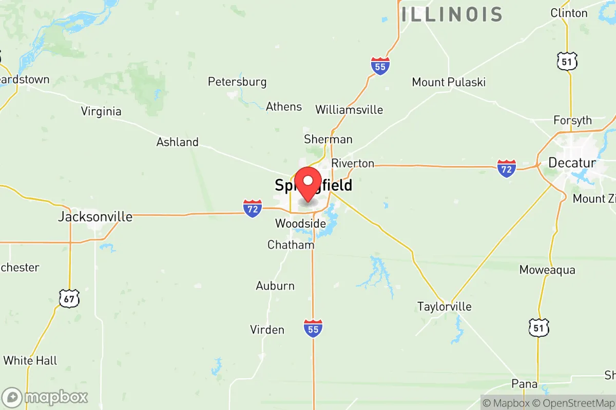
Sangamon County, anchored by the state capital of Springfield, offers a strategic balance of Midwestern stability and practical resilience that appeals to relocation-minded individuals and families who prioritize preparedness without sacrificing access to essential services. The county’s location along Interstate 55 and its position roughly 90 miles northeast of St. Louis places it within a day’s drive of major population centers, yet far enough removed to avoid the immediate fallout risks associated with larger metropolitan areas. With a population of roughly 195,000, the county provides a modest urban core surrounded by agricultural land, creating a defensible buffer that supports self-sufficiency while maintaining connectivity to regional infrastructure.
Geographic position and natural advantages for long-term stability
Sangamon County sits in central Illinois, a region defined by flat to gently rolling terrain that is largely agricultural, with the Sangamon River meandering through the county and providing a natural water source. The county’s position in the Illinois River watershed offers access to groundwater and surface water, which is a significant advantage for long-term water security. The area is not prone to earthquakes, hurricanes, or wildfires, and while tornadoes are a seasonal risk—the county lies within the traditional Tornado Alley footprint—the open landscape allows for ample warning time and straightforward storm shelter construction. The county’s agricultural base means that local food production is a realistic option; the surrounding farmland grows corn, soybeans, and wheat, and there are numerous small-scale farms and farmers markets within a 30-minute drive of Springfield. The presence of the Lincoln Memorial Garden and Nature Center and the Sangamon River Forest Preserve provides green space and wildlife corridors, but the real advantage is the sheer amount of undeveloped land that could support gardening, livestock, or foraging in a prolonged disruption scenario.
Risks, exposures, and proximity to fallout-relevant landmarks
While Sangamon County avoids the highest-risk zones, it is not without exposure. The most significant man-made risk is the Springfield Rail Yard, a major freight hub that handles hazardous materials, including chemicals and petroleum products, which could pose a localized contamination risk in the event of a derailment or accident. The county also hosts the Illinois State Capitol Complex in downtown Springfield, a potential symbolic target for civil unrest or targeted attacks, though the risk is low compared to federal government hubs. The Abraham Lincoln Capital Airport (SPI) is a small commercial and general aviation facility that could become a focal point for emergency logistics but also a potential target. More broadly, the county’s proximity to St. Louis (90 miles southwest) and Chicago (200 miles northeast) means that fallout from a major event in either city—whether a nuclear detonation, industrial accident, or large-scale infrastructure failure—could affect Sangamon County depending on wind patterns and the nature of the event. The Decatur industrial corridor, about 40 miles east, includes refineries and chemical plants that could produce secondary hazards. However, the county’s distance from coastal ports, major military bases (the nearest is Scott Air Force Base, 80 miles southwest), and high-density urban centers means it is not a primary target, and the surrounding rural landscape provides a significant buffer against cascading failures.
Practical resilience for a relocator: food, water, energy, and defensibility
For a family or individual serious about self-sufficiency, Sangamon County offers a workable foundation. Water access is a strong point: the Sangamon River and its tributaries run through the county, and groundwater is generally plentiful and of good quality, though well drilling is recommended for those seeking independence from municipal systems. The county’s agricultural character means that local food production is feasible, with the Illinois State Fairgrounds hosting annual agricultural events and the Springfield Farmers Market operating seasonally. For long-term storage, the county has several grain elevators and food processing facilities that could be leveraged in a crisis. Energy resilience is mixed: the grid is reliable but aging, and the county is served by City Water, Light & Power (CWLP), a municipally owned utility that operates the Dallman Power Plant (coal and natural gas) and the Lakeside Power Plant (natural gas). This local control is an advantage, as CWLP is less vulnerable to regional blackouts than investor-owned utilities. Solar potential is moderate—central Illinois receives about 4.5 peak sun hours per day—and off-grid solar setups are viable with battery storage. Defensibility is a mixed bag: the county’s flat terrain offers few natural chokepoints, but the rural areas provide ample space for perimeter security, and the county’s relatively low population density (roughly 200 people per square mile) reduces competition for resources in a collapse scenario. The Springfield Armory National Historic Site is a historical landmark, not a functional resource, but the region’s hunting culture means firearms and ammunition are common, and there are several gun shops and shooting ranges in the area. For medical resilience, HSHS St. John’s Hospital and Memorial Medical Center in Springfield provide Level I trauma care, but rural areas may face longer response times in a crisis.
The overall strategic picture for Sangamon County is one of moderate resilience with clear trade-offs. It is not a remote bunker location, nor is it a high-risk urban center. The county’s greatest strengths are its agricultural base, local water resources, and municipally controlled power grid, which together provide a foundation for self-sufficiency that is rare in more densely populated regions. The primary weaknesses are the seasonal tornado risk, the presence of a rail yard handling hazardous materials, and the potential for secondary effects from events in St. Louis or Chicago. For a relocator who values access to healthcare, education, and infrastructure while maintaining the ability to retreat to a rural property within the county, Sangamon County offers a pragmatic middle ground. The key is to choose a location outside the immediate Springfield city limits—consider towns like Rochester, Chatham, or Pleasant Plains—where land is affordable, water is accessible, and the buffer from the county’s few industrial and government targets is maximized. With deliberate preparation, including well water, solar backup, and a stocked pantry, Sangamon County can support a resilient lifestyle that balances readiness with everyday livability.

* Values derived from national, state, county, city and local statistics and may differ in a specific area. Last updated: 2026-07-27T10:46:49.000Z
Narrative content on this page is AI-generated and may contain mistakes. Verify any details that matter before acting on them.
ReloMaps may earn a commission from affiliate links at no extra cost to you.

