Photo: Wikipedia
Strategic Assessment of Custer County
Deep buffer from population centers and strategic targets. Low natural disaster risk and minimal exposure to border or coastal threats.
What does the Strategic Assessment tell us?
Our Strategic Assessment grades tactical survivability of an area. Major population centers, military targets, fallout zones, natural disasters, and border exposure all drive risk — lower exposure means a more defensible position in a crisis.
This is heavily inspired by Joel Skousen's Strategic Relocation book. Highly recommended you checkout the book ($)What does this tell us?
Our Strategic Assessment grades tactical survivability of an area. Major population centers, military targets, fallout zones, natural disasters, and border exposure all drive risk — lower exposure means a more defensible position in a crisis.
This is heavily inspired by Joel Skousen's Strategic Relocation book. Highly recommended you checkout the book ($)Strategic Pillars

Key Distances
Strategic Assessment Analysis
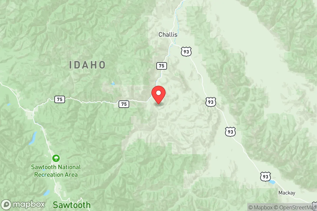
Custer County, Idaho, offers a compelling strategic profile for relocators prioritizing resilience and self-sufficiency, anchored by its remote, high-elevation geography and distance from major population centers. Located in the central part of the state, the county is defined by the Salmon River Mountains and the Lost River Range, with the small communities of Challis (the county seat), Mackay, and Clayton serving as the primary population hubs. This region’s core advantage is its isolation: it sits roughly 150 miles from Boise, 120 miles from Idaho Falls, and over 200 miles from Salt Lake City, placing it well outside the immediate fallout zones and secondary disruption radii of any major metropolitan or industrial target. The area’s rugged terrain and low population density—approximately 4,800 residents spread across 4,938 square miles—create a natural buffer against cascading societal collapse, though this same remoteness demands careful planning for logistics and supply chains.
Geographic position and natural advantages for long-term security
Custer County’s location in the central Idaho mountains provides several structural advantages for a resilience-minded relocator. The county is bisected by the Salmon River, which flows through the Challis Valley, offering a reliable water source that is less contested than in arid regions. The surrounding mountains, including Borah Peak (Idaho’s highest point at 12,662 feet), create natural defensive terrain, with limited road access via U.S. Highway 93 and a handful of secondary routes like State Highway 75. This chokepoint geography makes the area inherently defensible—any approach from the south or east must pass through narrow valleys, and the county’s interior is a maze of canyons and ridges that would be difficult to navigate without local knowledge. The high elevation (Challis sits at 5,300 feet) also means cooler summers and significant winter snowpack, which, while challenging, provides a natural water reservoir for spring runoff. For a relocator, the key takeaway is that Custer County is not a transit corridor; it is a destination, and its geography discourages casual passage, reducing the risk of refugee flows or resource competition from outside.
Risks, exposures, and proximity to fallout-relevant landmarks
While Custer County is far from major targets, it is not immune to risks. The most significant man-made exposure is the Idaho National Laboratory (INL), located about 70 miles southeast near Arco and Idaho Falls. The INL is a 890-square-mile nuclear research facility that includes test reactors, spent fuel storage, and historical waste sites. In a major conflict or terrorist event, the INL could be a secondary target, though its remote location and hardened infrastructure reduce the likelihood of a catastrophic release. Fallout from a strike on the INL would likely drift east or southeast with prevailing winds, sparing Custer County, but a worst-case scenario involving a ground burst could contaminate the upper Salmon River watershed. Additionally, the county lies within the Intermountain Seismic Belt, with the Lost River Fault running through the region—the same fault that produced the 1983 Borah Peak earthquake (magnitude 6.9). This fault is capable of generating a magnitude 7.0+ event, which could disrupt roads, power lines, and water systems for weeks. Wildfire is a more immediate and frequent risk: the 2020 Badger Fire burned over 90,000 acres in the county, and the 2021 Bootleg Fire (Oregon) sent smoke hundreds of miles. For a relocator, these risks are manageable with proper site selection—avoiding valley bottoms near fault lines and building with fire-resistant materials—but they are not negligible.
Practical resilience for a relocator: food, water, energy, and defensibility
For a relocator serious about self-sufficiency, Custer County offers a mixed but workable picture. Water is abundant: the Salmon River and its tributaries (the Pahsimeroi, East Fork, and Big Lost River) provide year-round flow, and groundwater is accessible via wells in the valley floors. However, surface water rights are heavily allocated for agriculture, and new wells may require permits and drilling depths of 200-400 feet. Food production is limited by the short growing season (roughly 60-90 frost-free days) and poor soils in the mountain valleys. The Challis-Mackay area supports some hay and cattle ranching, but staple crops like wheat or corn are not viable without significant inputs. Relocators should plan for greenhouse growing, cold-hardy perennials, and stored food reserves. Energy is a bright spot: the county has abundant solar potential (over 300 sunny days per year), and micro-hydro from the Salmon River or its tributaries is feasible for properties with water rights. Off-grid solar is common, and the county’s rural nature means few restrictions on renewable energy installations. Defensibility is excellent due to the terrain: the valley floors are narrow, and the surrounding ridges offer natural observation points. The small population means that social cohesion is high—most residents know each other—and the county’s culture of self-reliance (ranching, hunting, and trapping) aligns with resilience goals. The main vulnerability is supply chain dependence: Challis has a grocery store, a hardware store, and a clinic, but specialized medical care, building materials, and fuel require a 2-3 hour drive to Idaho Falls or Twin Falls. A relocator should stockpile fuel, medical supplies, and spare parts for vehicles and equipment.
Overall, Custer County presents a strong strategic option for a relocator who values isolation, natural resources, and defensibility over convenience and economic opportunity. The area’s distance from major targets, abundant water, and rugged terrain make it one of the more resilient locations in the lower 48 states, but this comes with trade-offs: a harsh climate, limited agricultural potential, and significant earthquake and wildfire risks. For a family or individual willing to invest in off-grid infrastructure, build a community network, and accept a slower pace of life, Custer County offers a genuine sanctuary. The key is to secure a property with reliable water access, defensible terrain, and a buffer from the main highway—ideally in the Pahsimeroi Valley or the upper East Fork of the Salmon River, where the population is thinnest and the natural barriers are strongest. This is not a location for the unprepared, but for those who plan carefully, it is a place where resilience is not just possible but sustainable.

* Values derived from national, state, county, city and local statistics and may differ in a specific area. Last updated: 2026-07-23T00:38:57.000Z
Narrative content on this page is AI-generated and may contain mistakes. Verify any details that matter before acting on them.
ReloMaps may earn a commission from affiliate links at no extra cost to you.

