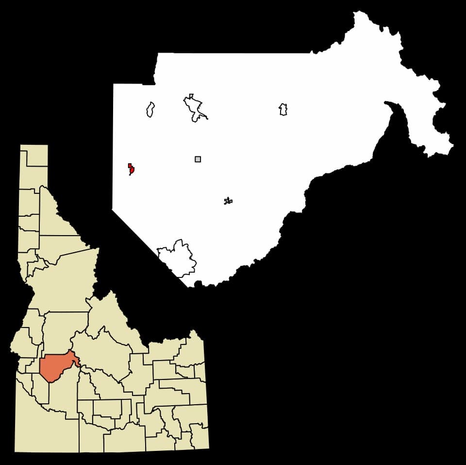
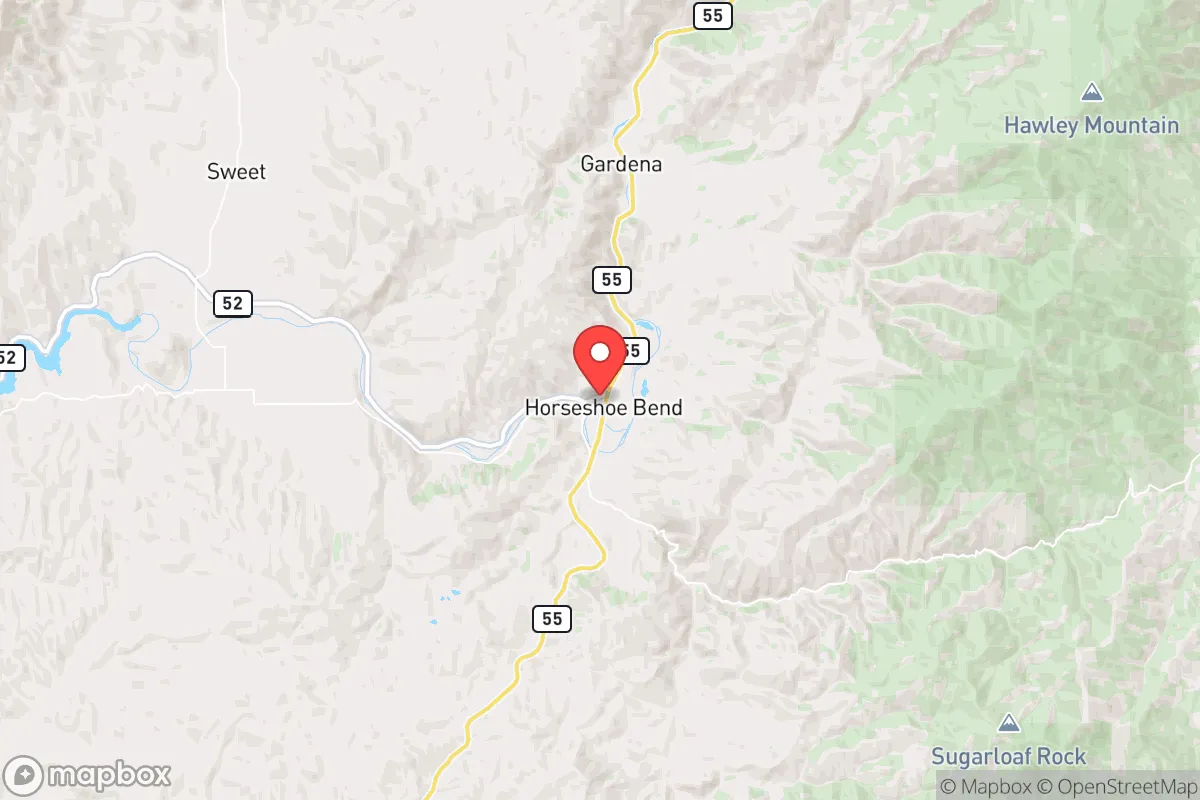
Photo: Wikipedia
Strategic Assessment of Horseshoe Bend, ID
Workable tactical position. Some exposure to population density or targets, but generally defensible in a crisis.
What does the Strategic Assessment tell us?
Our Strategic Assessment grades tactical survivability of an area. Major population centers, military targets, fallout zones, natural disasters, and border exposure all drive risk — lower exposure means a more defensible position in a crisis.
This is heavily inspired by Joel Skousen's Strategic Relocation book. Highly recommended you checkout the book ($)What does this tell us?
Our Strategic Assessment grades tactical survivability of an area. Major population centers, military targets, fallout zones, natural disasters, and border exposure all drive risk — lower exposure means a more defensible position in a crisis.
This is heavily inspired by Joel Skousen's Strategic Relocation book. Highly recommended you checkout the book ($)Strategic Pillars

Key Distances
Regional Safe Places
Below is our recommended "safe zones" in Idaho and the surrounding area based on our strategic heuristics. For most people, it's unrealistic to live in a “safe zone” full-time due to work, family or other personal reasons. They tend to be more rural. However, many of these areas are perfect for second homes and retreat properties that double as a vacation home or even a short-term rental.
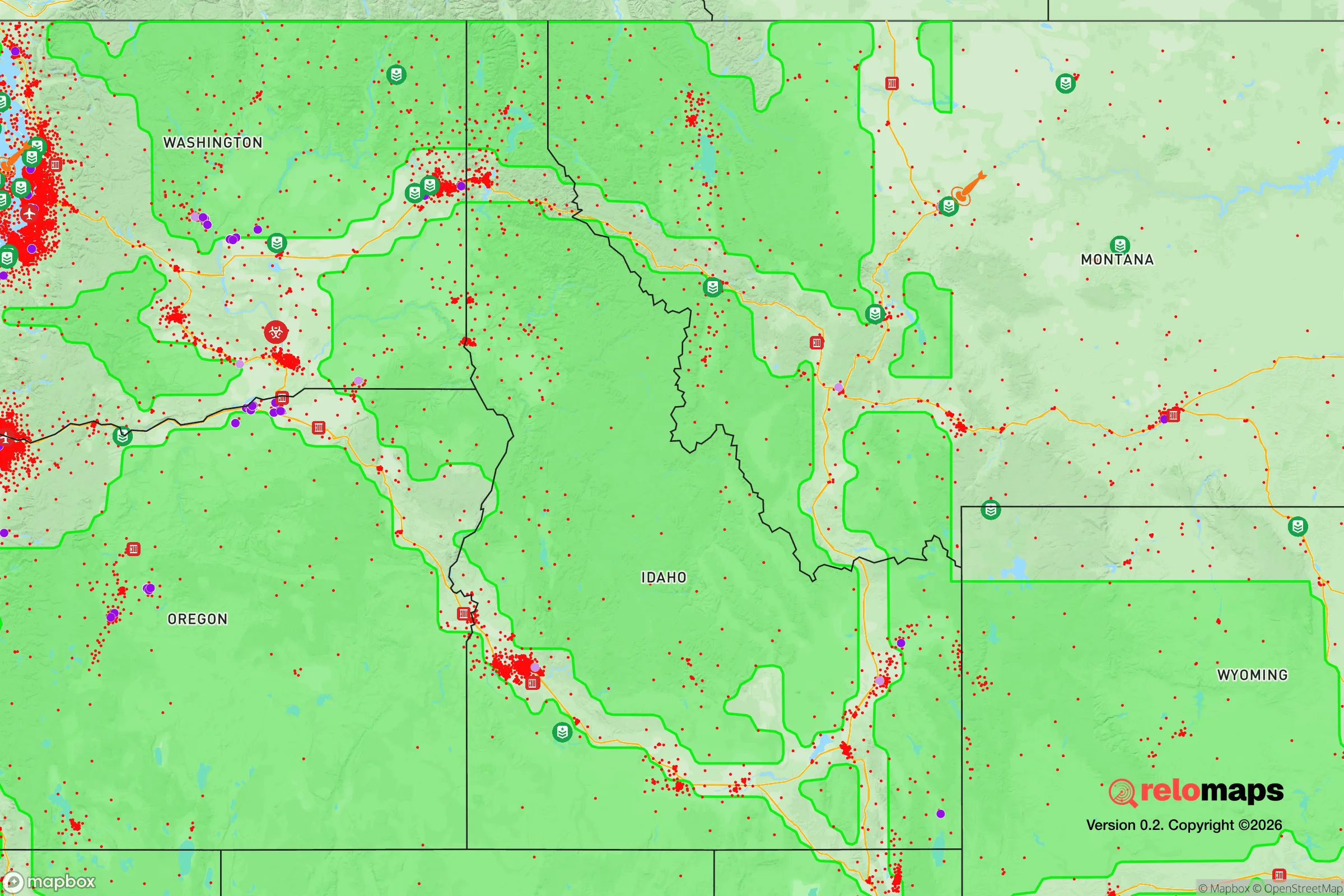
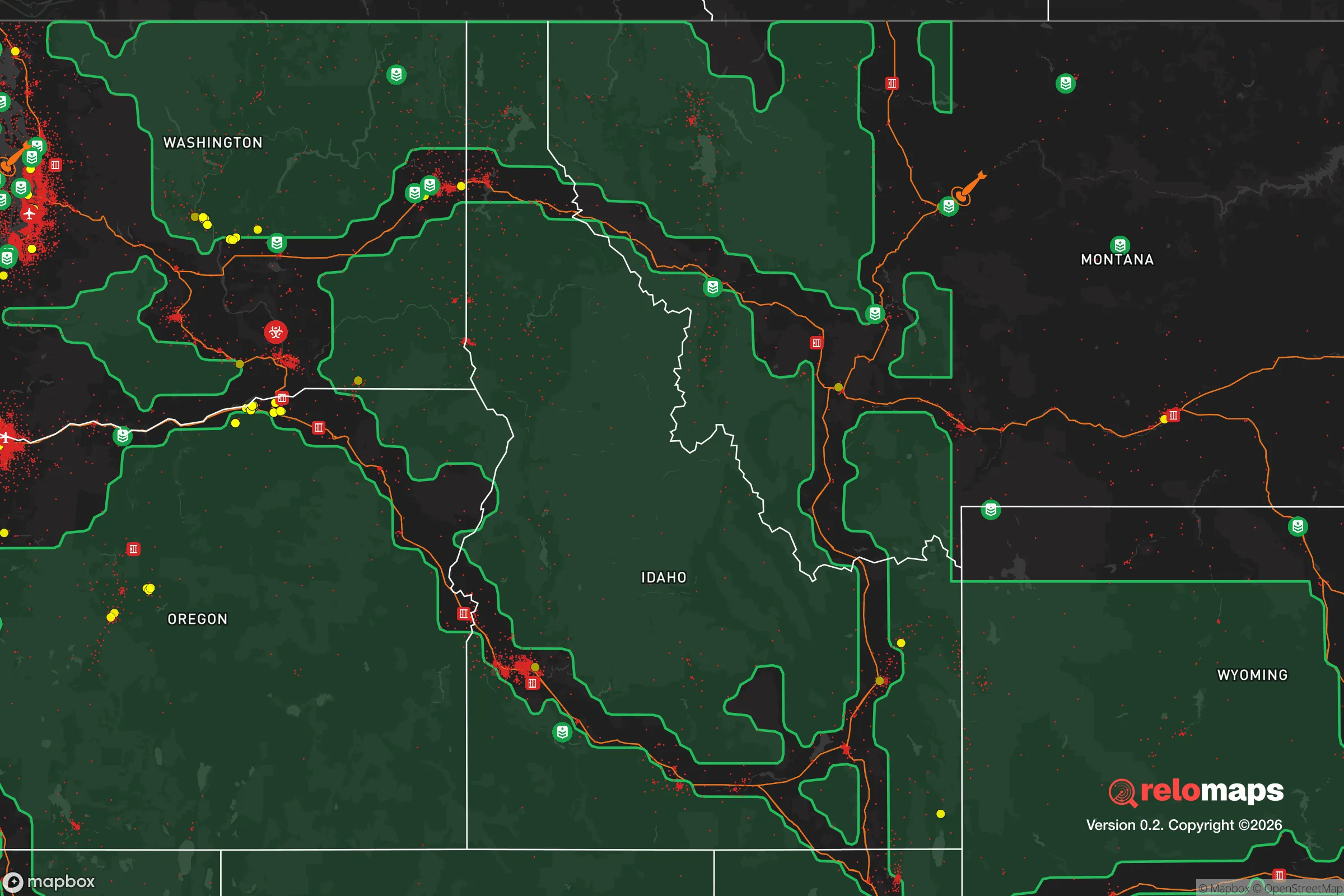


Important Note: For informational purposes only. This does not mean nothing bad ever happens in the green zones. Please use common sense. This is based on public data and modeled with AI. We tried to take a conservative approach but mistakes happen. We update this regularly as new information becomes available.
Solar Generator Recommendations
Backup power matters more here than in safer locations. We've picked three solar generators across budgets and capacity tiers — start with the budget unit if you only need a few essentials, or step up if you want to run a fridge and HVAC for days at a time.

Jackery Portable Power Station Explorer 300
Budget OptionPower on the Go: Weighing only 11 lbs, it's convenient to set up and store with book-sized foldable solar panels

BLUETTI Portable Power Station AC180
Designed for both indoor and outdoor scenarios, AC180 is highly capable as it has a robost capacity and continuous output power.

EF ECOFLOW DELTA Pro Ultra Power Station
Upgraded PickEcoFlow DELTA Pro Ultra is a whole-home energy system designed to grow with your family. Integrated with the Smart Home Panel 2, it scales to meet your evolving energy needs — keeping your home powered, intelligent, and secure through every stage of life.
We earn a commission, at no additional cost to you.
Strategic Assessment Analysis
Horseshoe Bend, Idaho, sits in a narrow pocket of the Boise River canyon roughly 35 miles northeast of Boise, and for a relocator thinking in terms of resilience, that position is a genuine double-edged sword. The town’s core advantage is that it is far enough off the I-84 corridor to avoid the sprawl and congestion of the Treasure Valley, yet close enough to retain access to major medical and supply infrastructure when things are running normally. For a household weighing disaster readiness, Horseshoe Bend offers a mix of defensible terrain, water access, and small-town social cohesion that is increasingly rare within commuting distance of a state capital, but it also carries specific exposure risks that demand clear-eyed planning.
Geographic position and natural advantages for long-term stability
Horseshoe Bend’s geography is defined by the Boise River cutting through the foothills of the Boise National Forest, which creates a natural funnel for travel and a clear line of sight for anyone paying attention to their surroundings. The town sits at roughly 2,600 feet elevation, which puts it above the worst of the valley’s winter inversions but below the heavy snow zones that can isolate mountain communities for weeks at a time. The surrounding terrain is steep, timbered, and sparsely populated, which means a household here has natural buffers on three sides and only one primary road—Highway 55—connecting them to the outside world. That single choke point is both a security asset and a logistical liability, but for a family that plans ahead, it is far more manageable than the sprawling, multi-exit suburban landscape south of Boise.
The immediate area offers meaningful natural resources that support a self-sufficiency strategy. The Boise River provides a year-round water source, and the surrounding national forest land offers hunting, foraging, and firewood collection opportunities that are simply not available to residents of Eagle or Meridian. The climate is semi-arid but irrigable, and the growing season, while short, is sufficient for cold-hardy crops, root vegetables, and hay production. For a relocator serious about food security, the soils in the adjacent Long Valley and the benchlands above the river are workable, and water rights in the area are older and more established than in many other parts of the West, which matters if you are thinking about long-term agricultural viability rather than just a hobby garden.
Risk exposure, natural hazards, and proximity to fallout-relevant landmarks
The most significant natural risk in Horseshoe Bend is wildfire, and it is not a hypothetical concern. The 2016 Pioneer Fire burned over 48,000 acres in the Boise National Forest just north of town, and the 2024 Valley Fire came within a few miles of the community, forcing evacuations and closing Highway 55 for days. The canyon topography that makes the town defensible also channels fire winds, and the surrounding slopes are covered in cheatgrass and ponderosa pine that burn hot and fast. A household relocating here needs a serious defensible space plan—not just clearing brush, but thinking about ember intrusion, roof materials, and a pre-planned evacuation route that does not depend on a single road. Flooding is a secondary concern, particularly in the spring when the Boise River runs high, but the town’s core sits above the worst floodplain, and the bigger issue is road washouts on Highway 55 that can temporarily cut off access to Boise.
In terms of man-made risks and fallout-relevant landmarks, Horseshoe Bend’s position is more nuanced than many relocation guides acknowledge. The town is roughly 40 miles from Mountain Home Air Force Base, which is a strategic asset and therefore a potential target in a major conflict scenario. The base hosts the 366th Fighter Wing and is a key part of the U.S. Air Force’s strike capability in the Pacific theater, which makes it a plausible first-wave target in a peer-level war. The prevailing winds in this region blow from the west and southwest, which means fallout from a strike on Mountain Home would generally track northeast, away from Horseshoe Bend, but that is a statistical tendency, not a guarantee. The Idaho National Laboratory, about 120 miles to the east near Idaho Falls, is another potential target, though the distance and the intervening mountain ranges provide substantial shielding. The closer concern is the Treasure Valley itself—Boise, Meridian, and Nampa are home to over 700,000 people, and in a major disruption scenario, that population would likely move toward the mountains along Highway 55, which runs directly through Horseshoe Bend. The town is not a fallout zone in the traditional sense, but it is a potential chokepoint for mass evacuation, and that carries its own set of risks for a resident household.
Practical resilience for a relocator: food, water, energy, and defensibility
For a household serious about practical resilience, Horseshoe Bend offers a workable baseline, but it requires deliberate investment rather than passive benefit. Water is the strongest asset: the Boise River runs year-round, and many properties in the area have access to well water, though well depths vary significantly and some newer wells in the area have been drilled to 300 feet or more. A household should budget for a backup pumping solution—either a generator, solar, or a hand pump—because the power grid in this canyon is served by overhead lines that are vulnerable to both winter ice and summer fire. The town’s municipal water system is fed by the river and has backup generators, but a self-sufficient household should not rely on that in a prolonged outage.
Food resilience is achievable but not automatic. The growing season runs roughly from mid-May to late September, which is enough for potatoes, squash, beans, and cold-hardy greens, and the surrounding forest provides significant wild game, particularly elk and mule deer, though hunting pressure has increased in recent years. The nearest substantial grocery is in Eagle, about 25 minutes south, which means a household needs to maintain a meaningful pantry buffer—two to four weeks of stored food is a reasonable minimum given the road vulnerability. Energy is the weakest link. The area has good solar exposure, and off-grid solar is viable for most of the year, but the winter months bring short days and frequent cloud cover, so a serious setup needs battery storage and a backup generator. Propane is widely available and is the most common heating fuel in the area, and a 500-gallon tank is a reasonable investment for a household planning for extended disruptions.
Defensibility is where Horseshoe Bend genuinely shines compared to most relocation destinations. The town’s canyon position means there are limited approach routes, and the surrounding terrain offers natural observation points that make it difficult for anyone to approach unnoticed. The community itself is small—roughly 800 residents—and the social fabric is still intact in a way that is rare in the modern West. Neighbors know each other, the local church and volunteer fire department are active, and there is a cultural norm of mutual aid that does not exist in suburban subdivisions. That social capital is arguably the most valuable resilience asset a relocator can buy, and it is not something that can be replicated with gear or supplies.
The overall strategic picture for Horseshoe Bend is positive for a relocator who is willing to plan around its specific constraints. The town offers a rare combination of water access, defensible terrain, and small-community cohesion within a reasonable distance of major infrastructure, but it is not a remote survivalist retreat—it is a working-class river town with real exposure to wildfire, road vulnerability, and the demographic pressure of the Treasure Valley. A household that invests in defensible space, a robust pantry, backup power, and genuine relationships with neighbors will find Horseshoe Bend to be one of the more resilient locations in the Intermountain West. A household that expects the location alone to do the work will find the canyon unforgiving. The town rewards preparation, punishes complacency, and offers a quality of life that is grounded, practical, and increasingly difficult to find anywhere else in the region.

* Values derived from national, state, county, city and local statistics and may differ in a specific area. Last updated: 2026-10-28T16:40:36.000Z
Narrative content on this page is AI-generated and may contain mistakes. Verify any details that matter before acting on them.
ReloMaps may earn a commission from affiliate links at no extra cost to you.

