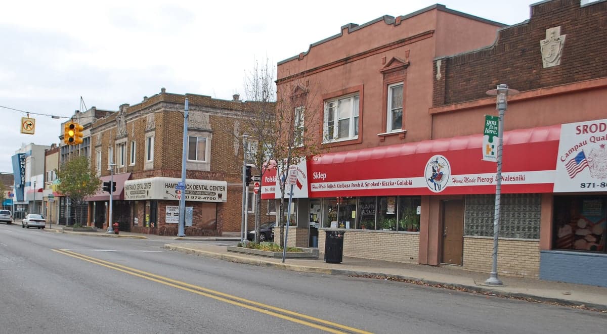
Photo: Wikipedia
Strategic Assessment of Hamtramck, MI
Multiple tactical vulnerabilities. Population density, target proximity, or disaster risk are likely compounding. A retreat property and exit planning is required.
What does the Strategic Assessment tell us?
Our Strategic Assessment grades tactical survivability of an area. Major population centers, military targets, fallout zones, natural disasters, and border exposure all drive risk — lower exposure means a more defensible position in a crisis.
This is heavily inspired by Joel Skousen's Strategic Relocation book. Highly recommended you checkout the book ($)What does this tell us?
Our Strategic Assessment grades tactical survivability of an area. Major population centers, military targets, fallout zones, natural disasters, and border exposure all drive risk — lower exposure means a more defensible position in a crisis.
This is heavily inspired by Joel Skousen's Strategic Relocation book. Highly recommended you checkout the book ($)Strategic Pillars

Key Distances
Regional Safe Places
Below is our recommended "safe zones" in Michigan and the surrounding area based on our strategic heuristics. For most people, it's unrealistic to live in a “safe zone” full-time due to work, family or other personal reasons. They tend to be more rural. However, many of these areas are perfect for second homes and retreat properties that double as a vacation home or even a short-term rental.


Important Note: For informational purposes only. This does not mean nothing bad ever happens in the green zones. Please use common sense. This is based on public data and modeled with AI. We tried to take a conservative approach but mistakes happen. We update this regularly as new information becomes available.
Solar Generator Recommendations
Backup power matters more here than in safer locations. We've picked three solar generators across budgets and capacity tiers — start with the budget unit if you only need a few essentials, or step up if you want to run a fridge and HVAC for days at a time.

Jackery Portable Power Station Explorer 300
Budget OptionPower on the Go: Weighing only 11 lbs, it's convenient to set up and store with book-sized foldable solar panels

BLUETTI Portable Power Station AC180
Designed for both indoor and outdoor scenarios, AC180 is highly capable as it has a robost capacity and continuous output power.

EF ECOFLOW DELTA Pro Ultra Power Station
Upgraded PickEcoFlow DELTA Pro Ultra is a whole-home energy system designed to grow with your family. Integrated with the Smart Home Panel 2, it scales to meet your evolving energy needs — keeping your home powered, intelligent, and secure through every stage of life.
We earn a commission, at no additional cost to you.
Strategic Assessment Analysis
Hamtramck, Michigan, presents a complex strategic picture for the relocation-minded reader focused on resilience and self-sufficiency. While its location within the Detroit metro area offers certain logistical advantages, it simultaneously exposes residents to the full spectrum of urban and industrial risks that a serious preparedness plan must account for. This assessment evaluates Hamtramck’s geographic position, its exposure to natural and man-made hazards, and the practical realities of daily life for someone prioritizing disaster readiness.
Geographic position and natural advantages in the Great Lakes region
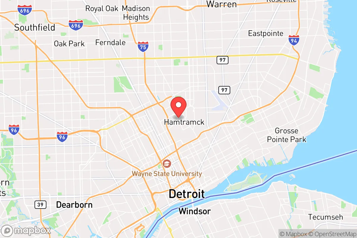
Hamtramck occupies a 2.1-square-mile enclave entirely surrounded by Detroit, placing it at the heart of southeast Michigan’s urban core. Its primary natural advantage is proximity to the Great Lakes freshwater system—specifically the Detroit River, roughly 3 miles south, and Lake St. Clair, about 8 miles east. This access to abundant surface water is a genuine strategic asset in a region where drought is rare and groundwater is generally reliable. The area’s flat terrain and clay-based soils are not prone to landslides or significant flooding beyond localized stormwater issues, and the region’s temperate climate avoids the extremes of hurricane, wildfire, or seismic activity common in other parts of the country. However, these natural advantages are heavily offset by the built environment. Hamtramck’s dense, grid-like street pattern and aging infrastructure mean that a prolonged power outage or water system failure would affect the entire population simultaneously. The city’s elevation—roughly 620 feet above sea level—provides no defensive high ground, and its complete encirclement by Detroit means that any regional disruption (transportation shutdown, civil unrest, or supply chain interruption) immediately becomes a local crisis. For a relocator seeking geographic security, Hamtramck’s position offers freshwater access but little else in terms of natural defensibility or isolation from cascading urban failures.
Risks, exposures, and proximity to fallout-relevant landmarks
The most significant strategic liability for Hamtramck is its proximity to multiple high-value, high-risk targets within a 10-mile radius. The Detroit Metro Airport (DTW) is 18 miles southwest, but closer concerns include the Ambassador Bridge and Detroit-Windsor Tunnel—critical international border crossings that are perennial security concerns. Within 5 miles lie the Marathon Petroleum refinery in southwest Detroit, the Zug Island industrial complex, and multiple heavy manufacturing facilities along the Rouge River. These are not abstract risks: a major industrial accident, terrorist event, or wartime strike on any of these targets would place Hamtramck directly in the hazard zone for chemical release, fire, or secondary explosions. Additionally, the Fermi 2 nuclear power plant in Newport is 35 miles south—outside the immediate danger radius but within the 50-mile emergency planning zone. For the reader concerned with fallout from a radiological event, Hamtramck’s location is suboptimal. The city’s dense population (roughly 28,000 people packed into two square miles) means that any evacuation scenario would face severe bottlenecks: only two major arterial roads—I-75 and I-94—provide egress, and both are prone to congestion during normal rush hours. The city’s aging housing stock, much of it wood-frame construction from the early 20th century, offers limited protection against blast, fire, or airborne contaminants. In a serious disaster scenario, Hamtramck’s residents would be competing with the entire Detroit metro population for limited exit routes and resources.
Practical resilience for a relocator: food, water, energy, and defensibility
For a relocator serious about self-sufficiency, Hamtramck presents significant challenges in every practical category. Food security is the most immediate concern: the city has no working farms, community gardens are limited, and the nearest full-service grocery store is a 10-minute drive into Detroit or Warren. The city’s zoning is almost entirely residential and light industrial, with no space for meaningful food production. A household would need to rely entirely on stored supplies or frequent resupply from suburban stores—a fragile arrangement in any disruption lasting more than a week. Water access is theoretically strong given the Great Lakes proximity, but the city’s water comes from the Detroit Water and Sewerage Department, a regional system vulnerable to cyberattack, infrastructure failure, or contamination. A private well is not an option in this dense urban setting, and rainwater collection is limited by roof space and local codes. Energy resilience is equally constrained: DTE Energy provides electricity via overhead lines that are susceptible to ice storms, wind, and sabotage. Solar panel installation is possible but limited by small lot sizes, shading from neighboring buildings, and homeowner association restrictions in some blocks. Natural gas is widely available but again dependent on a centralized grid. For defensibility, Hamtramck’s urban density cuts both ways: the tight streets and alleyways can be barricaded, and the city’s strong sense of community—rooted in its Polish, Yemeni, Bangladeshi, and African American populations—could foster neighborhood watch and mutual aid. However, the lack of standoff distance from surrounding Detroit neighborhoods means that any civil unrest or crime wave in the larger city will spill over immediately. Hamtramck’s police department is small (roughly 30 officers), and response times in a widespread emergency would be stretched thin. A relocator would need to invest heavily in home security, food storage, water filtration, and off-grid power—and even then, the fundamental vulnerability of being in a dense urban target zone remains.
The overall strategic picture for Hamtramck is one of trade-offs weighted heavily toward risk. Its freshwater access and tight-knit community are genuine assets, but they are dwarfed by the liabilities of being a dense, landlocked enclave surrounded by a major city with multiple high-value industrial and infrastructure targets. For a single individual or family whose primary concern is disaster readiness and self-sufficiency, Hamtramck is a poor choice unless they have deep ties to the area or a specific reason to be in the Detroit metro. The city’s resilience profile is better suited to someone who values urban community and cultural diversity over physical security and logistical independence. If the goal is to be prepared for long-term disruption, a relocator would be better served by a rural or exurban location in Michigan’s Thumb region or the Upper Peninsula, where land, water, and distance from targets are more favorable. Hamtramck can work as a base for someone who is highly mobile and prepared to evacuate quickly, but as a permanent residence for the serious prepper, it falls short on nearly every practical metric.

* Values derived from national, state, county, city and local statistics and may differ in a specific area. Last updated: 2026-10-15T08:44:52.000Z
Narrative content on this page is AI-generated and may contain mistakes. Verify any details that matter before acting on them.
ReloMaps may earn a commission from affiliate links at no extra cost to you.

