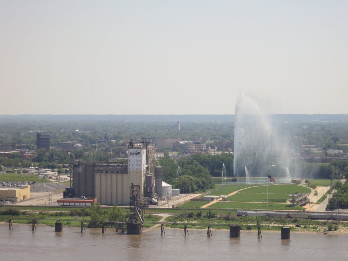
Photo: Wikipedia
Strategic Assessment of East St. Louis, IL
Multiple tactical vulnerabilities. Population density, target proximity, or disaster risk are likely compounding. A retreat property and exit planning is required.
What does the Strategic Assessment tell us?
Our Strategic Assessment grades tactical survivability of an area. Major population centers, military targets, fallout zones, natural disasters, and border exposure all drive risk — lower exposure means a more defensible position in a crisis.
This is heavily inspired by Joel Skousen's Strategic Relocation book. Highly recommended you checkout the book ($)What does this tell us?
Our Strategic Assessment grades tactical survivability of an area. Major population centers, military targets, fallout zones, natural disasters, and border exposure all drive risk — lower exposure means a more defensible position in a crisis.
This is heavily inspired by Joel Skousen's Strategic Relocation book. Highly recommended you checkout the book ($)Strategic Pillars

Key Distances
Regional Safe Places
Below is our recommended "safe zones" in Illinois and the surrounding area based on our strategic heuristics. For most people, it's unrealistic to live in a “safe zone” full-time due to work, family or other personal reasons. They tend to be more rural. However, many of these areas are perfect for second homes and retreat properties that double as a vacation home or even a short-term rental.
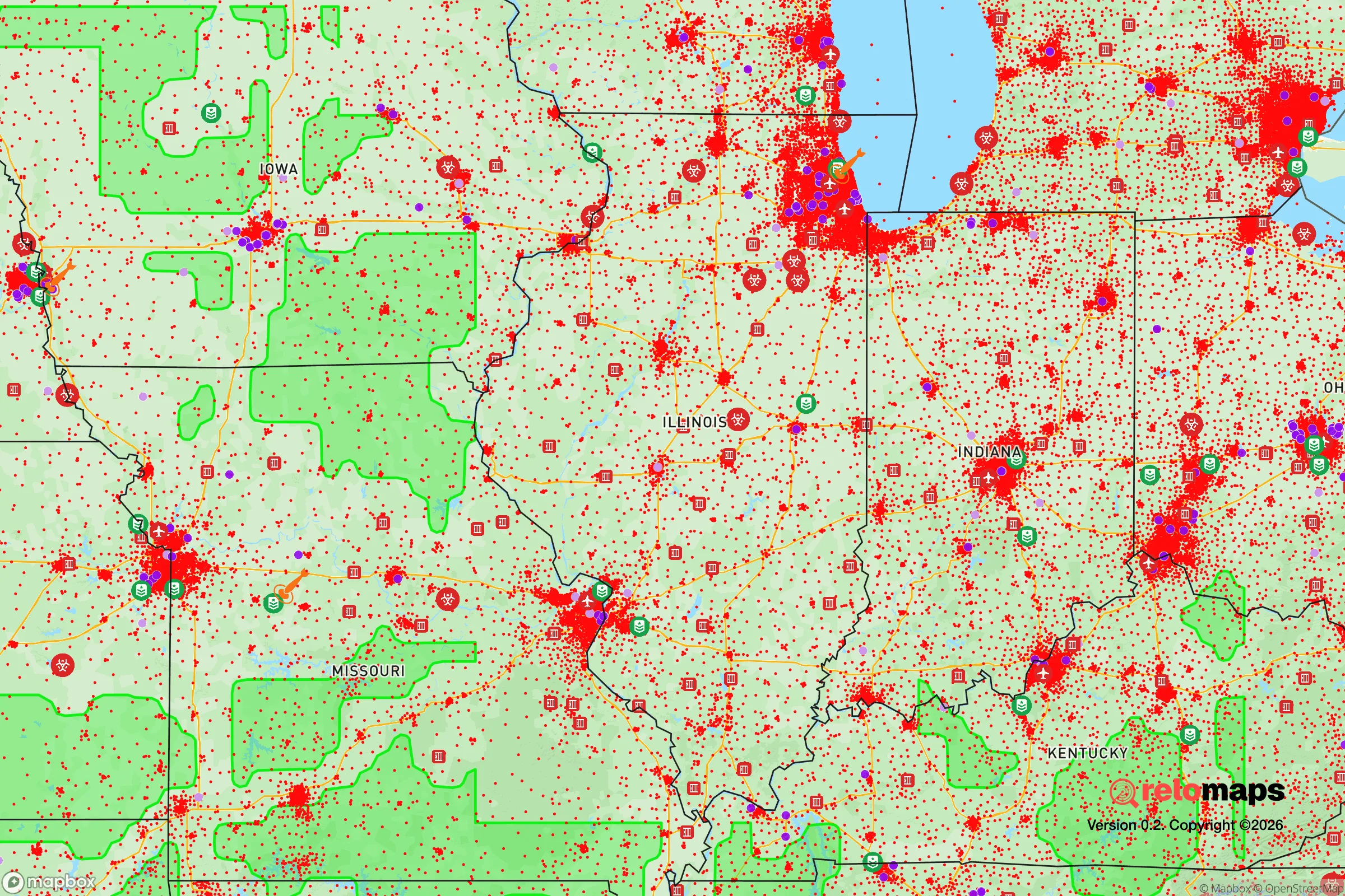
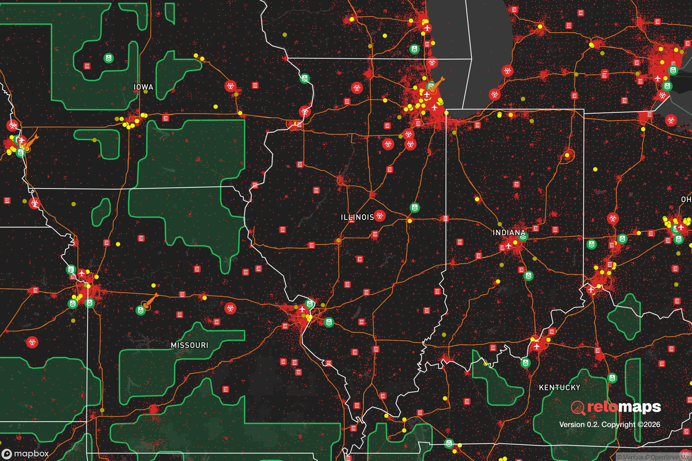


Important Note: For informational purposes only. This does not mean nothing bad ever happens in the green zones. Please use common sense. This is based on public data and modeled with AI. We tried to take a conservative approach but mistakes happen. We update this regularly as new information becomes available.
Solar Generator Recommendations
Backup power matters more here than in safer locations. We've picked three solar generators across budgets and capacity tiers — start with the budget unit if you only need a few essentials, or step up if you want to run a fridge and HVAC for days at a time.

Jackery Portable Power Station Explorer 300
Budget OptionPower on the Go: Weighing only 11 lbs, it's convenient to set up and store with book-sized foldable solar panels

BLUETTI Portable Power Station AC180
Designed for both indoor and outdoor scenarios, AC180 is highly capable as it has a robost capacity and continuous output power.

EF ECOFLOW DELTA Pro Ultra Power Station
Upgraded PickEcoFlow DELTA Pro Ultra is a whole-home energy system designed to grow with your family. Integrated with the Smart Home Panel 2, it scales to meet your evolving energy needs — keeping your home powered, intelligent, and secure through every stage of life.
We earn a commission, at no additional cost to you.
Strategic Assessment Analysis
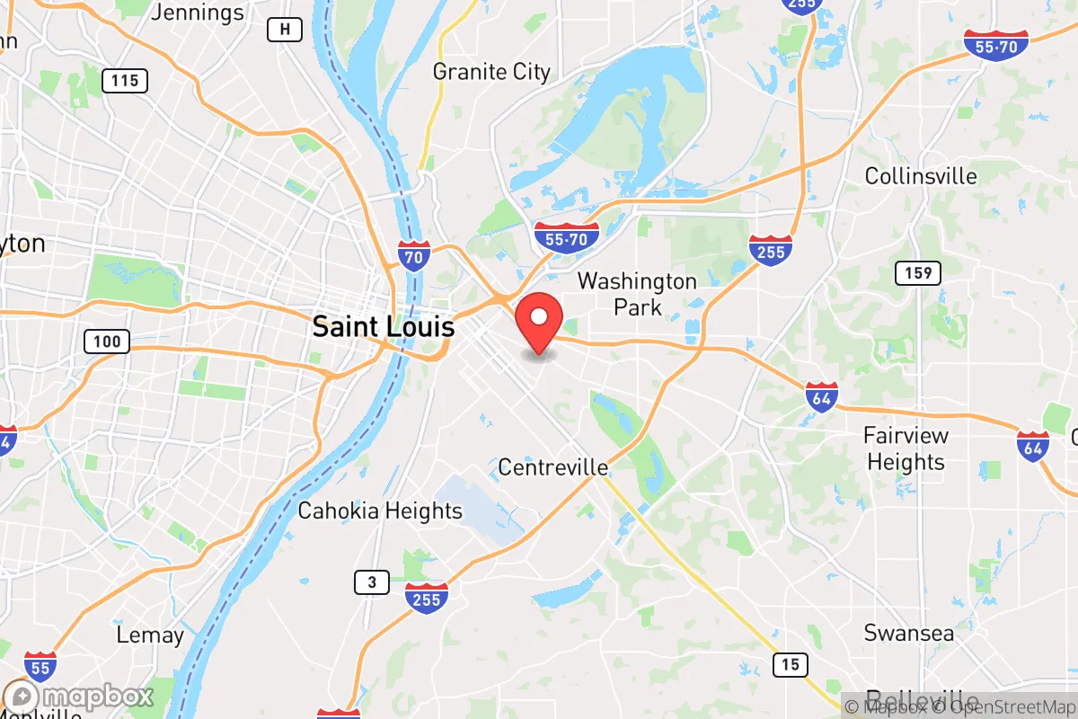
East St. Louis, Illinois, presents a complex strategic picture for the disaster-ready relocator. While its reputation is dominated by economic hardship and urban decay, the area’s underlying geographic position offers genuine resilience advantages that are often overlooked. Located on the Mississippi River floodplain directly across from St. Louis, Missouri, the city sits at a critical transportation nexus—interstates 55, 64, and 70 converge here, and the region is a major rail and barge hub. For someone thinking seriously about self-sufficiency and long-term preparedness, East St. Louis is less a destination and more a potential staging ground: a low-cost, low-density urban footprint with direct access to the nation’s interior logistics spine, but also with significant liabilities that must be weighed carefully.
Geographic position and natural advantages for a strategic relocation
East St. Louis’s most underappreciated asset is its location within the American Bottom, the fertile floodplain of the Mississippi River. This flat, open terrain provides abundant space for gardening, rainwater catchment, and solar panel placement—advantages that are scarce in the hilly, forested Ozarks to the south or the dense suburbs of St. Louis County. The city itself is built on a grid that, while degraded, still offers clear sightlines and multiple egress routes via the Poplar Street Bridge, the Martin Luther King Bridge, and the McKinley Bridge into Missouri. The Mississippi River is a reliable, year-round water source, though it requires filtration and treatment. The region’s climate is temperate continental, with four distinct seasons and an average annual rainfall of about 38 inches, which supports rain barrels and small-scale agriculture without the drought risks of the West. For a relocator, the key natural advantage is the sheer flatness and water proximity—it makes the area defensible in a low-tech sense (clear fields of fire, easy drainage) and viable for off-grid food production, provided the soil is tested for industrial contaminants.
Risks, exposures, and proximity to fallout-relevant landmarks
The strategic downsides are substantial and cannot be glossed over. East St. Louis sits within the immediate blast and fallout zone of the St. Louis metropolitan area, which includes the Lambert–St. Louis International Airport, major rail yards, and the nation’s second-largest inland port by tonnage. In a major conflict or terrorist event targeting transportation hubs, this area would be a primary target. The city is also directly adjacent to the St. Louis Downtown Airport and the Jefferson Barracks National Cemetery, both of which are potential military-adjacent landmarks. On the natural disaster side, the Mississippi River flood risk is real: the 1993 flood inundated large portions of the American Bottom, and the city’s levees are aging. The New Madrid Seismic Zone, roughly 150 miles south, poses a moderate earthquake risk—a major quake could liquefy the alluvial soil and disrupt bridges and levees simultaneously. Additionally, the area has a legacy of industrial pollution, including lead smelting and chemical manufacturing, which means that groundwater and soil contamination are concerns for anyone planning to dig a well or garden. For the preparedness-minded relocator, these risks mean that East St. Louis is a high-risk, high-reward location: the low property costs and strategic transport access come with exposure to both man-made and natural hazards that are above the national average.
Practical resilience for a relocator: food, water, energy, and defensibility
On the practical side, East St. Louis offers a mixed bag. Food resilience is surprisingly viable: the city has numerous vacant lots that can be converted to community gardens or private plots, and the nearby Illinois farmland (St. Clair County is a major corn and soybean producer) provides a local food source if supply chains hold. However, grocery store access is poor—the city is a food desert, with few full-service supermarkets, meaning a relocator must either grow their own food or drive into Missouri for supplies. Water resilience is strong in theory (the Mississippi River is a massive, unfiltered source), but in practice, the city’s water treatment infrastructure is aging and vulnerable to both flooding and power outages. A well is an option in some parts of the city, but the shallow aquifer is likely contaminated by decades of industrial activity. Energy resilience is a bright spot: the flat, open terrain and abundant sunlight make solar panel installation straightforward, and the city’s grid is connected to the Midcontinent Independent System Operator (MISO) network, which is relatively stable. Natural gas is available in most areas, but a relocator should plan for a backup generator or off-grid solar system. Defensibility is the most complex factor. The city’s population has declined from over 80,000 in 1950 to roughly 18,000 today, leaving a hollowed-out urban core with many abandoned buildings. This creates both a security risk (squatters, crime) and an opportunity: a relocator can secure a large property with clear sightlines and multiple exits. The flat terrain means no natural chokepoints, but the grid layout allows for easy barricading of streets. The proximity to the Mississippi River also provides a natural barrier to the west, though the bridges are potential chokepoints in an evacuation scenario. For a single individual or family, the key is to choose a property on the eastern edge of the city, away from the river and closer to the farmland, where population density is lower and egress routes to the east (via I-64 or I-70) are more open.
The overall strategic picture for East St. Louis is one of high potential paired with high risk. For the relocator who is willing to invest in water filtration, soil remediation, and a robust security plan, the city offers a low-cost entry point into a region with excellent transport links, abundant water, and flat land for self-sufficiency. The proximity to St. Louis is a double-edged sword: it provides access to medical facilities, hardware stores, and trade networks, but it also places the area in a high-risk zone for both natural disasters and man-made events. The city’s hollowed-out state means that a prepared individual can acquire property at rock-bottom prices—often under $10,000 for a fixer-upper—and build a resilient homestead without the zoning restrictions common in suburban areas. However, the social fabric is thin, and the local government is chronically underfunded, meaning that emergency services and infrastructure maintenance are unreliable. For the conservative-leaning relocator who values self-reliance and is comfortable with a gritty, hands-on environment, East St. Louis is a viable strategic option—but only if they are prepared to treat it as a base camp, not a finished product. The area rewards the prepared and punishes the naive. If you can handle the risks, the rewards in terms of cost, space, and strategic position are unmatched in the St. Louis region.

* Values derived from national, state, county, city and local statistics and may differ in a specific area. Last updated: 2026-07-23T02:36:10.000Z
Narrative content on this page is AI-generated and may contain mistakes. Verify any details that matter before acting on them.
ReloMaps may earn a commission from affiliate links at no extra cost to you.

