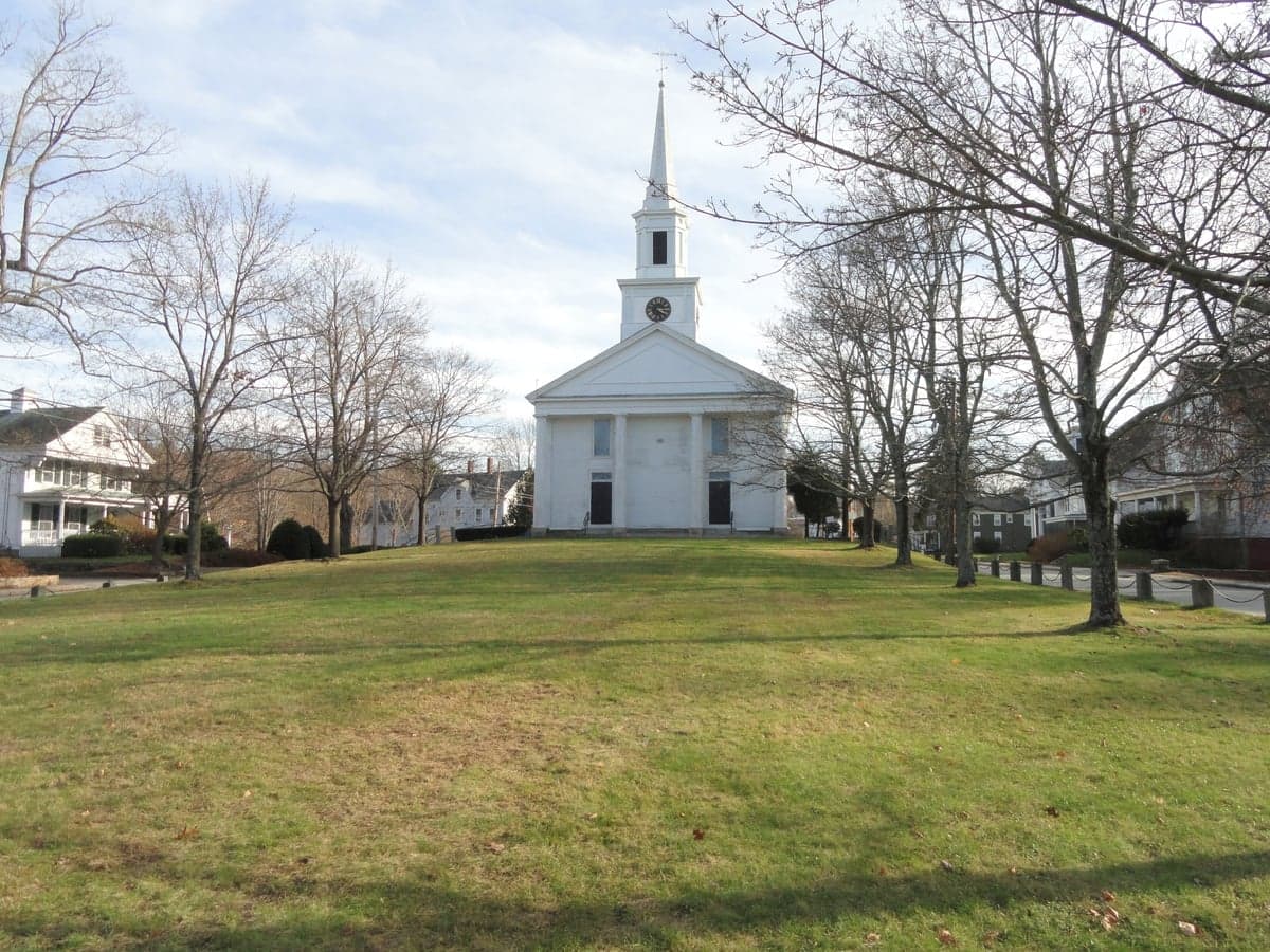
Photo: Wikipedia
Strategic Assessment of Douglas, MA
Multiple tactical vulnerabilities. Population density, target proximity, or disaster risk are likely compounding. A retreat property and exit planning is required.
What does the Strategic Assessment tell us?
Our Strategic Assessment grades tactical survivability of an area. Major population centers, military targets, fallout zones, natural disasters, and border exposure all drive risk — lower exposure means a more defensible position in a crisis.
This is heavily inspired by Joel Skousen's Strategic Relocation book. Highly recommended you checkout the book ($)What does this tell us?
Our Strategic Assessment grades tactical survivability of an area. Major population centers, military targets, fallout zones, natural disasters, and border exposure all drive risk — lower exposure means a more defensible position in a crisis.
This is heavily inspired by Joel Skousen's Strategic Relocation book. Highly recommended you checkout the book ($)Strategic Pillars

Key Distances
Regional Safe Places
Below is our recommended "safe zones" in Massachusetts and the surrounding area based on our strategic heuristics. For most people, it's unrealistic to live in a “safe zone” full-time due to work, family or other personal reasons. They tend to be more rural. However, many of these areas are perfect for second homes and retreat properties that double as a vacation home or even a short-term rental.
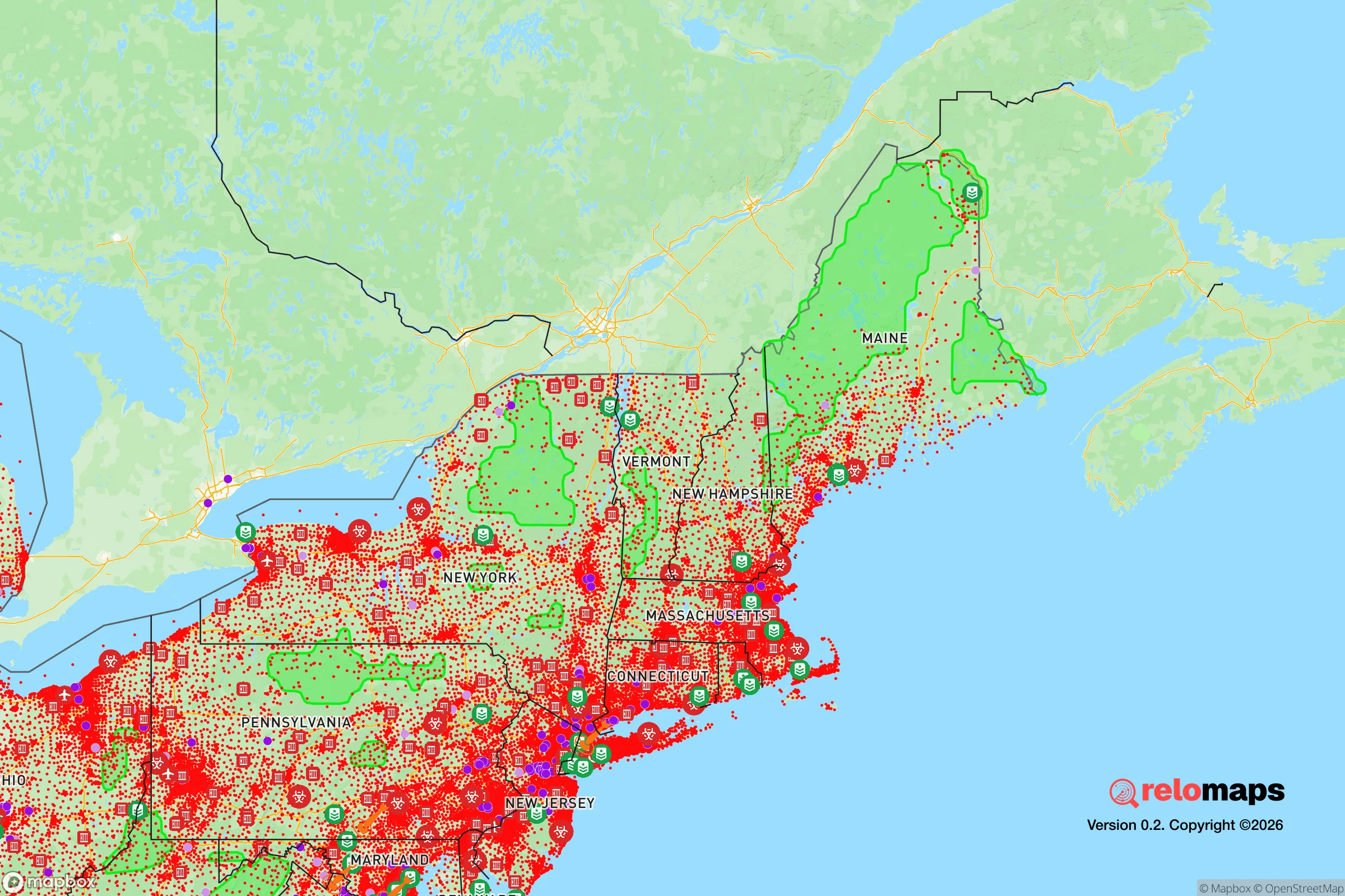
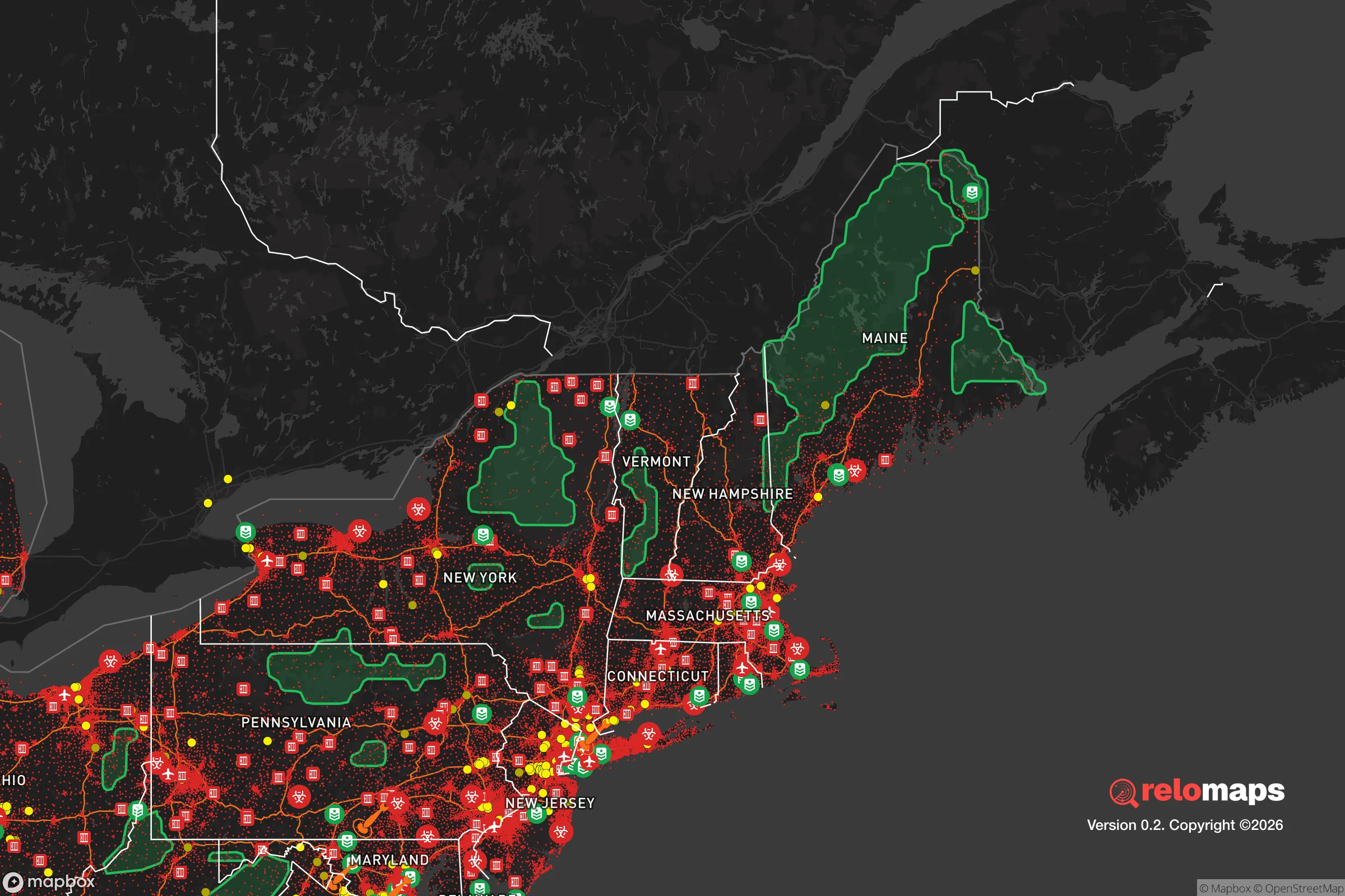


Important Note: For informational purposes only. This does not mean nothing bad ever happens in the green zones. Please use common sense. This is based on public data and modeled with AI. We tried to take a conservative approach but mistakes happen. We update this regularly as new information becomes available.
Solar Generator Recommendations
Backup power matters more here than in safer locations. We've picked three solar generators across budgets and capacity tiers — start with the budget unit if you only need a few essentials, or step up if you want to run a fridge and HVAC for days at a time.

Jackery Portable Power Station Explorer 300
Budget OptionPower on the Go: Weighing only 11 lbs, it's convenient to set up and store with book-sized foldable solar panels

BLUETTI Portable Power Station AC180
Designed for both indoor and outdoor scenarios, AC180 is highly capable as it has a robost capacity and continuous output power.

EF ECOFLOW DELTA Pro Ultra Power Station
Upgraded PickEcoFlow DELTA Pro Ultra is a whole-home energy system designed to grow with your family. Integrated with the Smart Home Panel 2, it scales to meet your evolving energy needs — keeping your home powered, intelligent, and secure through every stage of life.
We earn a commission, at no additional cost to you.
Strategic Assessment Analysis
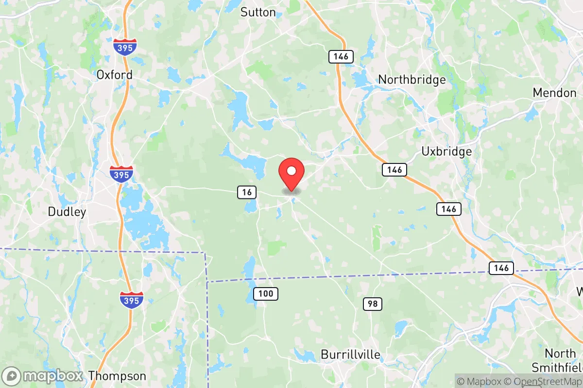
Douglas, Massachusetts, offers a strategic balance of rural seclusion and practical access that appeals to relocation-minded readers prioritizing disaster readiness and self-sufficiency. Located in southern Worcester County, this town of roughly 8,900 residents sits 15 miles southeast of Worcester and 50 miles southwest of Boston, placing it far enough from major metropolitan centers to reduce exposure to urban cascading failures yet close enough for supply runs or medical emergencies. Its position along the Rhode Island border, near the Blackstone River Valley, provides a natural buffer zone that many preppers and resilience-focused families find attractive for long-term stability.
Geographic position and natural advantages for self-sufficiency
Douglas occupies a landscape of rolling hills, mixed hardwood forests, and numerous small water bodies, including the 1,200-acre Douglas State Forest. This terrain offers several inherent advantages for a resilience-minded relocator. The town's elevation averages around 600 feet above sea level, which reduces flood risk compared to low-lying communities along the Blackstone River corridor. The forested areas provide natural cover, sound dampening, and a ready supply of firewood for heating or cooking in grid-down scenarios. The town's low population density — roughly 200 people per square mile — means fewer neighbors competing for resources during a crisis, and the winding, dead-end roads common in the area create natural chokepoints that slow unauthorized access. Douglas also sits outside the primary evacuation zones for any major Massachusetts infrastructure, such as the Pilgrim Nuclear Power Station (decommissioned but still a spent-fuel storage site) or the Seabrook Station reactor in New Hampshire, both of which are over 60 miles away. This distance reduces the risk of being caught in a plume-exposure zone or a mass-evacuation traffic jam.
Risks, exposures, and proximity to fallout-relevant landmarks
While Douglas avoids the highest-risk zones, it is not immune to threats. The town lies within 30 miles of the Worcester Regional Airport, a potential target for limited conventional or EMP attacks, and within 50 miles of Hanscom Air Force Base and Naval Submarine Base New London in Groton, Connecticut. These military installations could become secondary targets or generate refugee flows in a major conflict. More immediately, Douglas is within the 50-mile fallout zone of the Seabrook nuclear plant (about 65 miles east), though prevailing winds typically carry any release out to sea. The town's proximity to Interstate 495 (5 miles west) and Route 146 (3 miles east) means that in a crisis, Douglas could see significant through-traffic from Boston and Providence evacuees, potentially overwhelming local roads and resources. Natural hazards include occasional nor'easters that dump 2-3 feet of snow, ice storms that knock out power for days, and the remote possibility of a moderate earthquake along the Clinton-Newbury fault line. Tornadoes are rare but not unheard of — the 2011 Springfield tornado was 60 miles west, but microbursts have caused localized damage in the region. Flooding is limited to low-lying areas near the Mumford River and a few small ponds; most residential lots on higher ground remain dry.
Practical resilience for a relocator: food, water, energy, and defensibility
For a relocator serious about self-sufficiency, Douglas offers several practical advantages. Water availability is strong: the town sits atop the Mamakating aquifer, and many homes have private wells with depths of 100-300 feet, providing a reliable off-grid water source. Surface water from the Mumford River, West River, and numerous ponds (like Wallum Lake and Lake Singletary) can be treated for drinking with proper filtration. Food production is viable: the growing season runs from late April to early October, with USDA Zone 5b/6a conditions suitable for cold-hardy crops like potatoes, squash, kale, and apples. Soil quality varies but is generally loamy in the valleys and rocky on the hillsides; raised beds or hugelkultur mounds work well. Local farms, such as Douglas Orchards and Sunny Crest Farm, offer produce and livestock, but a relocator should plan to establish their own garden and possibly chickens or goats within the first year. Energy resilience is moderate: the town is served by National Grid, and power outages from storms are common (averaging 2-3 per year, lasting 4-24 hours). Solar panels with battery backup are feasible, though tree cover on many lots may require clearing. Propane delivery is available from local suppliers like Maugel's Fuel, and wood stoves are common in older homes. Defensibility is good: the town's layout — with a compact center and scattered rural homesteads — means a prepared household can secure a perimeter with minimal effort. The Douglas Police Department has 12 full-time officers, but response times to outlying areas can exceed 15 minutes. Neighbors are generally self-reliant and suspicious of outsiders, which cuts both ways: it reduces the risk of looting but also means mutual-aid networks must be built deliberately. The town has no hospital; the nearest emergency room is at Milford Regional Medical Center (12 miles north) or Landmark Medical Center in Woonsocket, RI (10 miles south). For long-term grid-down scenarios, the Douglas State Forest provides a 4,500-acre buffer of public land that can serve as a foraging and hunting area (deer, turkey, small game), though state regulations apply.
The overall strategic picture for Douglas is one of moderate-to-high resilience with manageable trade-offs. Its geographic isolation from major cities reduces exposure to urban collapse, nuclear fallout from coastal targets, and mass refugee flows, while its natural resources — water, timber, and arable land — support long-term self-sufficiency. The primary vulnerabilities are its proximity to I-495 and Route 146, which could funnel evacuees into the area, and its reliance on a single major road (Route 16) for egress. For a relocator willing to invest in well water, solar or propane backup, and a defensible homestead, Douglas offers a solid foundation for disaster readiness without the extreme remoteness that complicates supply runs or medical access. It is not a bug-out location for a total collapse scenario — the population density and infrastructure links are too high for that — but it is a strong choice for a family seeking a balanced, prepared lifestyle in a region with real but manageable risks. The town's character, rooted in 18th-century farming and 19th-century mill history, still rewards those who value quiet competence over convenience.

* Values derived from national, state, county, city and local statistics and may differ in a specific area. Last updated: 2026-10-21T14:14:07.000Z
Narrative content on this page is AI-generated and may contain mistakes. Verify any details that matter before acting on them.
ReloMaps may earn a commission from affiliate links at no extra cost to you.

