
Photo: Wikipedia
Strategic Assessment of Deer Isle, ME
Meaningful friction. Expect exposure to either population pressure, blast zones, or natural disaster risk. Consider buying a retreat property.
What does the Strategic Assessment tell us?
Our Strategic Assessment grades tactical survivability of an area. Major population centers, military targets, fallout zones, natural disasters, and border exposure all drive risk — lower exposure means a more defensible position in a crisis.
This is heavily inspired by Joel Skousen's Strategic Relocation book. Highly recommended you checkout the book ($)What does this tell us?
Our Strategic Assessment grades tactical survivability of an area. Major population centers, military targets, fallout zones, natural disasters, and border exposure all drive risk — lower exposure means a more defensible position in a crisis.
This is heavily inspired by Joel Skousen's Strategic Relocation book. Highly recommended you checkout the book ($)Strategic Pillars

Key Distances
Regional Safe Places
Below is our recommended "safe zones" in Maine and the surrounding area based on our strategic heuristics. For most people, it's unrealistic to live in a “safe zone” full-time due to work, family or other personal reasons. They tend to be more rural. However, many of these areas are perfect for second homes and retreat properties that double as a vacation home or even a short-term rental.




Important Note: For informational purposes only. This does not mean nothing bad ever happens in the green zones. Please use common sense. This is based on public data and modeled with AI. We tried to take a conservative approach but mistakes happen. We update this regularly as new information becomes available.
Solar Generator Recommendations
Backup power matters more here than in safer locations. We've picked three solar generators across budgets and capacity tiers — start with the budget unit if you only need a few essentials, or step up if you want to run a fridge and HVAC for days at a time.

Jackery Portable Power Station Explorer 300
Budget OptionPower on the Go: Weighing only 11 lbs, it's convenient to set up and store with book-sized foldable solar panels

BLUETTI Portable Power Station AC180
Designed for both indoor and outdoor scenarios, AC180 is highly capable as it has a robost capacity and continuous output power.

EF ECOFLOW DELTA Pro Ultra Power Station
Upgraded PickEcoFlow DELTA Pro Ultra is a whole-home energy system designed to grow with your family. Integrated with the Smart Home Panel 2, it scales to meet your evolving energy needs — keeping your home powered, intelligent, and secure through every stage of life.
We earn a commission, at no additional cost to you.
Strategic Assessment Analysis
Deer Isle, Maine, is a working island community roughly 40 miles southwest of Bangor, and for a relocator thinking in terms of resilience, it punches well above its weight. The island’s strategic value isn’t in what it has, but in what it lacks: no bridge to a major interstate, no industrial targets, and no suburban sprawl. What it offers instead is a self-contained geography that has supported year-round fishing, lobstering, and farming communities for generations, which is a far better foundation for preparedness than any suburban cul-de-sac.
Geographic position and natural advantages for long-term stability
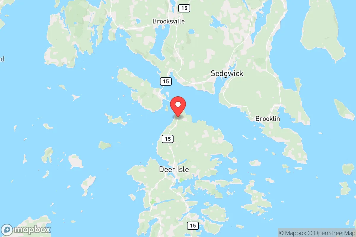
Deer Isle sits in Penobscot Bay, connected to the mainland by the Deer Isle Bridge at Eggemoggin Reach. That single bridge is both a chokepoint and a defensive asset. The island itself is roughly 12 miles long and 8 miles wide, with a year-round population of around 2,000 spread across the towns of Deer Isle and Stonington. The terrain is rocky, forested, and hilly, with dozens of coves and inlets that break up the coastline and make the interior feel far more remote than the crow-flies distance to Bangor suggests.
The natural advantages for a resilience-minded relocator are concrete. The island has abundant fresh water in the form of ponds, streams, and wetlands, including the large Walker Pond and the smaller Greenhead Pond, which historically supported ice harvesting and still serve as reliable freshwater sources. The surrounding waters of Penobscot Bay are among the most productive lobster grounds in the world, and the island’s working waterfront in Stonington is one of the busiest lobster ports in the United States by volume. That means the local food economy is not a boutique farmers market affair; it is a commercial-scale protein production system that operates year-round, weather permitting.
Forest cover is dense and continuous across the island, providing firewood, building material, and natural cover. The island’s elevation is modest—the highest points are only around 150 to 200 feet above sea level—but the rolling hills and tree lines provide natural visual screening from the water and from the mainland. For a family or individual looking to establish a low-profile, defensible property, Deer Isle offers far more natural concealment than most coastal Maine towns, which tend to be exposed along the shoreline.
Risks, exposures, and proximity to fallout-relevant landmarks
The most significant risk factor for Deer Isle is not a direct strike—it is the island’s position relative to regional infrastructure that could become a target in a broader conflict. The island sits roughly 40 miles from Bangor, which hosts the Bangor International Airport, a civilian field that also serves as a refueling and diversion point for military aircraft, including the Air Force’s E-6B Mercury fleet. The airport has been a designated alternate landing site for presidential and military flights for decades, which makes it a plausible target in a worst-case scenario. The nearby Portsmouth Naval Shipyard in Kittery, about 130 miles southwest, is a major nuclear submarine maintenance facility and would be a high-value target in any peer-state conflict.
In terms of fallout exposure, Deer Isle’s position is a double-edged sword. The prevailing winds in coastal Maine are from the west and northwest, which means fallout from a strike on Bangor would generally drift east and northeast, potentially carrying contamination toward the island. However, the distance is significant enough—40 miles—that the heaviest particulate fallout would likely settle well before reaching the island, and the bay’s maritime air tends to disperse and dilute airborne particulates more quickly than inland conditions. The island is also far from the Seabrook Nuclear Power Station in New Hampshire, roughly 150 miles southwest, and from the Maine Yankee site in Wiscasset, which is decommissioned but still holds spent fuel on site, about 45 miles southwest.
Natural risks are more immediate and more predictable. The island is exposed to nor’easters and hurricane remnants, and storm surge can flood low-lying coastal roads and the Stonington waterfront. The 2023-2024 winter storms caused significant erosion and damage to coastal properties in the region, and the island’s causeway and bridge approach are vulnerable to storm damage. Winter ice can be severe, and the island occasionally sees extended power outages of a week or more during ice storms. These are not hypothetical risks; they are recurring events that any long-term resident plans around.
Practical resilience for a relocator: food, water, energy, and defensibility
For a relocator serious about self-sufficiency, Deer Isle’s practical resilience is strong but requires deliberate effort. The island has two small grocery stores—the Deer Isle IGA and the Stonington Market—but both depend on daily truck deliveries across the bridge. In a prolonged disruption, those shelves will empty quickly. The real food security on the island comes from its working waterfront and its small farms. Stonington’s lobster fleet lands millions of pounds annually, and there are active oyster farms and mussel operations in the surrounding waters. Several small farms on the island raise poultry, pigs, and vegetables, and the island has a strong tradition of home canning and preserving, particularly among year-round families.
Water is the island’s strongest resilience asset. Most year-round homes have private wells, and the island’s aquifer is recharged by frequent coastal precipitation. The ponds are accessible for emergency use, and the island’s fire department maintains a network of dry hydrants at several ponds for firefighting, which also serves as a practical water access point for residents. A relocator should verify well depth and yield before purchasing, as some coastal wells have salinity issues, but the interior of the island generally has reliable freshwater.
Energy is the weakest link. The island is at the end of the electrical distribution line, and outages are common in winter. Heating oil is delivered by truck, and propane is similarly dependent on bridge access. Wood heat is the most resilient option, and the island’s forests provide ample supply, but a relocator should expect to invest in a wood stove or boiler and secure a reliable source of seasoned firewood. Solar is viable but should be paired with battery storage, as net metering does not help during a grid outage. The island’s maritime climate means less winter sun than inland Maine, so solar should be treated as a supplement, not a primary source.
Defensibility is where Deer Isle genuinely excels. The single bridge approach is easily monitored, and the island’s many coves and rocky shores make waterborne access difficult except at a few known landings. The interior is a maze of narrow, winding roads with limited sightlines, which is a disadvantage for daily commuting but a significant advantage for maintaining privacy and security. The year-round community is tight-knit, and the local culture is one of mutual aid—neighbors help with storms, breakdowns, and emergencies as a matter of course. That social fabric is arguably the island’s most valuable resilience asset, and it is not something that can be purchased or built quickly.
The overall strategic picture for Deer Isle is favorable for a relocator who values preparedness over convenience. The island offers genuine food security from the sea, reliable freshwater, defensible geography, and a community that already operates on a self-reliant basis. The trade-offs are real: winter isolation, dependence on a single bridge for supplies, and a limited job market outside of fishing, tourism, and remote work. But for someone looking to build a long-term, low-profile, resilient life on the Maine coast, Deer Isle is one of the better-positioned communities in the region—provided you arrive with your own skills, supplies, and a willingness to adapt to island time.

* Values derived from national, state, county, city and local statistics and may differ in a specific area. Last updated: 2026-09-05T23:41:10.000Z
Narrative content on this page is AI-generated and may contain mistakes. Verify any details that matter before acting on them.
ReloMaps may earn a commission from affiliate links at no extra cost to you.

