Photo: Wikipedia
Strategic Assessment of Coalville, UT
Workable tactical position. Some exposure to population density or targets, but generally defensible in a crisis.
What does the Strategic Assessment tell us?
Our Strategic Assessment grades tactical survivability of an area. Major population centers, military targets, fallout zones, natural disasters, and border exposure all drive risk — lower exposure means a more defensible position in a crisis.
This is heavily inspired by Joel Skousen's Strategic Relocation book. Highly recommended you checkout the book ($)What does this tell us?
Our Strategic Assessment grades tactical survivability of an area. Major population centers, military targets, fallout zones, natural disasters, and border exposure all drive risk — lower exposure means a more defensible position in a crisis.
This is heavily inspired by Joel Skousen's Strategic Relocation book. Highly recommended you checkout the book ($)Strategic Pillars

Key Distances
Regional Safe Places
Below is our recommended "safe zones" in Utah and the surrounding area based on our strategic heuristics. For most people, it's unrealistic to live in a “safe zone” full-time due to work, family or other personal reasons. They tend to be more rural. However, many of these areas are perfect for second homes and retreat properties that double as a vacation home or even a short-term rental.


Important Note: For informational purposes only. This does not mean nothing bad ever happens in the green zones. Please use common sense. This is based on public data and modeled with AI. We tried to take a conservative approach but mistakes happen. We update this regularly as new information becomes available.
Solar Generator Recommendations
Backup power matters more here than in safer locations. We've picked three solar generators across budgets and capacity tiers — start with the budget unit if you only need a few essentials, or step up if you want to run a fridge and HVAC for days at a time.

Jackery Portable Power Station Explorer 300
Budget OptionPower on the Go: Weighing only 11 lbs, it's convenient to set up and store with book-sized foldable solar panels

BLUETTI Portable Power Station AC180
Designed for both indoor and outdoor scenarios, AC180 is highly capable as it has a robost capacity and continuous output power.

EF ECOFLOW DELTA Pro Ultra Power Station
Upgraded PickEcoFlow DELTA Pro Ultra is a whole-home energy system designed to grow with your family. Integrated with the Smart Home Panel 2, it scales to meet your evolving energy needs — keeping your home powered, intelligent, and secure through every stage of life.
We earn a commission, at no additional cost to you.
Strategic Assessment Analysis
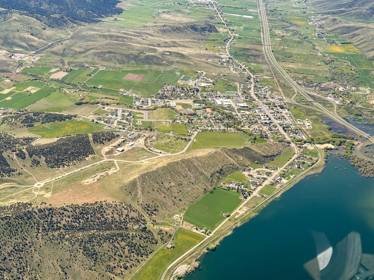
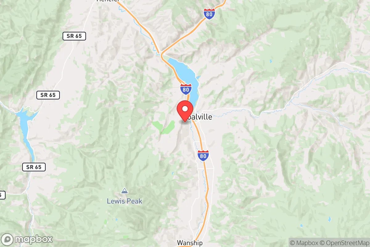
Coalville, Utah, offers a compelling strategic profile for relocators prioritizing resilience and self-sufficiency, combining a high-elevation mountain setting with proximity to critical infrastructure while maintaining a buffer from the most acute risks of the Wasatch Front. As the seat of Summit County, this town of roughly 1,500 residents sits at 5,600 feet in the Chalk Creek Valley, roughly 45 minutes east of Salt Lake City and 30 minutes from Park City. Its position along Interstate 80 and the Union Pacific rail corridor provides logistical connectivity, while the surrounding Uinta-Wasatch-Cache National Forest and the Weber River watershed offer natural resources that support a long-term sustainability strategy. For a conservative-leaning audience thinking seriously about disaster readiness, Coalville represents a middle-ground option—close enough to urban centers for supply runs and medical access, yet far enough to avoid the densest population zones and their associated vulnerabilities.
Geographic position and natural advantages for long-term security
Coalville’s geography provides several structural advantages for resilience. The town is nestled in a valley flanked by the Wasatch Mountains to the west and the Chalk Creek Range to the east, creating natural defensibility through terrain that limits approach corridors. The Weber River runs through the town center, offering a perennial surface water source that is rare in much of the Intermountain West. The surrounding national forest land—over 1.2 million acres in the Uinta-Wasatch-Cache system—provides a buffer against suburban sprawl and offers hunting, foraging, and timber resources. Elevation is a double-edged sword: at 5,600 feet, the area avoids the inversion pollution and summer heat waves that plague the Salt Lake Valley, but it also experiences harsh winters with average snowfall exceeding 100 inches annually. For a relocator, this means a shorter growing season (roughly 90-110 frost-free days) but reliable snowpack that feeds the Weber River well into summer. The town’s position along I-80 is critical—it’s the primary east-west artery through northern Utah, connecting to Evanston, Wyoming (30 minutes east) and the Wasatch Front (45 minutes west). This gives residents evacuation options in multiple directions, unlike many mountain towns that rely on a single road in and out.
Risk exposure: natural hazards and proximity to fallout-relevant landmarks
Coalville’s risk profile is moderate compared to many Western mountain communities, but it is not immune to significant hazards. The primary natural threat is wildfire: the town sits in a high-risk zone surrounded by dense conifer and sagebrush vegetation, with the 2020 Range Fire burning roughly 10 miles to the south. Summit County has experienced increasing wildfire frequency, and Coalville’s valley location means fire can move rapidly upslope from the south and west. Flooding is a secondary concern—the Weber River has exceeded bankfull stage multiple times in the past decade, particularly during spring snowmelt and rain-on-snow events. The town’s floodplain maps show several dozen structures within the 100-year flood zone. Seismic risk is moderate; the Wasatch Fault runs roughly 30 miles west, capable of producing a magnitude 7.0+ earthquake, which could disrupt I-80 and rail lines for days or weeks. For the relocator concerned about man-made risks, the most significant exposure is proximity to Hill Air Force Base (roughly 60 miles northwest), a major logistics and munitions hub that could be a target in a conflict scenario. The town is also within 100 miles of the Tooele Army Depot and the Dugway Proving Ground, both of which store chemical munitions and conduct testing. While Coalville is far enough from Salt Lake City’s urban core (population 1.2 million) to avoid the immediate blast and fallout zones of a ground burst, prevailing westerly winds would carry fallout from a strike on Hill AFB or the Tooele facilities directly toward the Wasatch Back, including Coalville. The town’s distance from the Intermountain Power Project (a coal-fired plant in Delta, 150 miles south) and the nuclear reactor at Idaho National Laboratory (200 miles north) provides some buffer, but the concentration of military and industrial targets along the Wasatch Front makes this a moderate-risk area for fallout exposure in a major conflict.
Practical resilience: food, water, energy, and defensibility for a relocator
For a relocator building a self-sufficient homestead, Coalville offers a mixed but workable foundation. Water is the strongest asset: the Weber River flows year-round at an average of 400 cubic feet per second, and groundwater wells in the valley typically produce 10-50 gallons per minute at depths of 100-300 feet. Summit County allows exempt wells for domestic use on parcels of one acre or more, though new permits require a hydrogeologic study in some areas. The town’s municipal water comes from the Weber River and several springs, with a 1.5-million-gallon storage tank providing roughly 48 hours of supply without power. Food production is limited by climate: the growing season is short, but cold-hardy crops like potatoes, kale, carrots, and some grains can succeed with season extension (hoop houses, cold frames). The surrounding national forest supports elk, mule deer, and wild turkey hunting, though pressure is moderate. Summit County has relatively permissive livestock ordinances—chickens, goats, and up to two cattle are allowed on parcels of two acres or more within the county’s unincorporated areas. Energy resilience is achievable: the area averages 5.5 peak sun hours per day in summer (3.0 in winter), making solar viable with battery storage, though snow cover requires panel tilting or manual clearing. Rocky Mountain Power provides grid electricity, with an average of 1-2 outages per year lasting 2-6 hours, primarily from winter storms. Propane is the dominant heating fuel, with bulk delivery available from several suppliers in the valley. Defensibility is terrain-dependent: the valley floor is open and approachable from I-80, but the surrounding hillsides offer natural chokepoints and observation points. The town’s small population and lack of major industry mean it would not be a primary target for looting or resource competition in a crisis, but its position along a major highway could attract transient traffic. The Summit County Sheriff’s Office (based in Coalville) has 30 sworn deputies covering 1,872 square miles, meaning response times in the outlying areas can exceed 30 minutes. A relocator should plan for self-defense and neighborhood mutual aid rather than relying on rapid law enforcement response.
The overall strategic picture for Coalville is one of moderate resilience with specific trade-offs. Its water abundance, defensible terrain, and buffer from the Wasatch Front’s densest population centers make it a viable base for a prepared relocator willing to invest in winter-ready infrastructure and off-grid energy. The primary liabilities are wildfire risk, a short growing season, and proximity to military targets that could generate fallout under worst-case scenarios. For a conservative-leaning family or individual who values self-sufficiency and is willing to accept a colder, more isolated lifestyle, Coalville offers a realistic middle path—not as remote as the Deep West or as exposed as the urban corridor. The key is to treat it as a strategic asset: secure water, build redundant energy systems, develop a food storage buffer, and establish relationships with neighbors who share a preparedness mindset. In a regional crisis, Coalville’s location along I-80 and the Weber River could become either a lifeline or a liability, depending on the nature of the event and the quality of the relocator’s preparations.

* Values derived from national, state, county, city and local statistics and may differ in a specific area. Last updated: 2026-11-07T07:12:17.000Z
Narrative content on this page is AI-generated and may contain mistakes. Verify any details that matter before acting on them.
ReloMaps may earn a commission from affiliate links at no extra cost to you.

