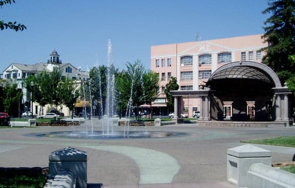
Photo: Wikipedia
Strategic Assessment of Chico, CA
Workable tactical position. Some exposure to population density or targets, but generally defensible in a crisis.
What does the Strategic Assessment tell us?
Our Strategic Assessment grades tactical survivability of an area. Major population centers, military targets, fallout zones, natural disasters, and border exposure all drive risk — lower exposure means a more defensible position in a crisis.
This is heavily inspired by Joel Skousen's Strategic Relocation book. Highly recommended you checkout the book ($)What does this tell us?
Our Strategic Assessment grades tactical survivability of an area. Major population centers, military targets, fallout zones, natural disasters, and border exposure all drive risk — lower exposure means a more defensible position in a crisis.
This is heavily inspired by Joel Skousen's Strategic Relocation book. Highly recommended you checkout the book ($)Strategic Pillars

Key Distances
Regional Safe Places
Below is our recommended "safe zones" in California and the surrounding area based on our strategic heuristics. For most people, it's unrealistic to live in a “safe zone” full-time due to work, family or other personal reasons. They tend to be more rural. However, many of these areas are perfect for second homes and retreat properties that double as a vacation home or even a short-term rental.

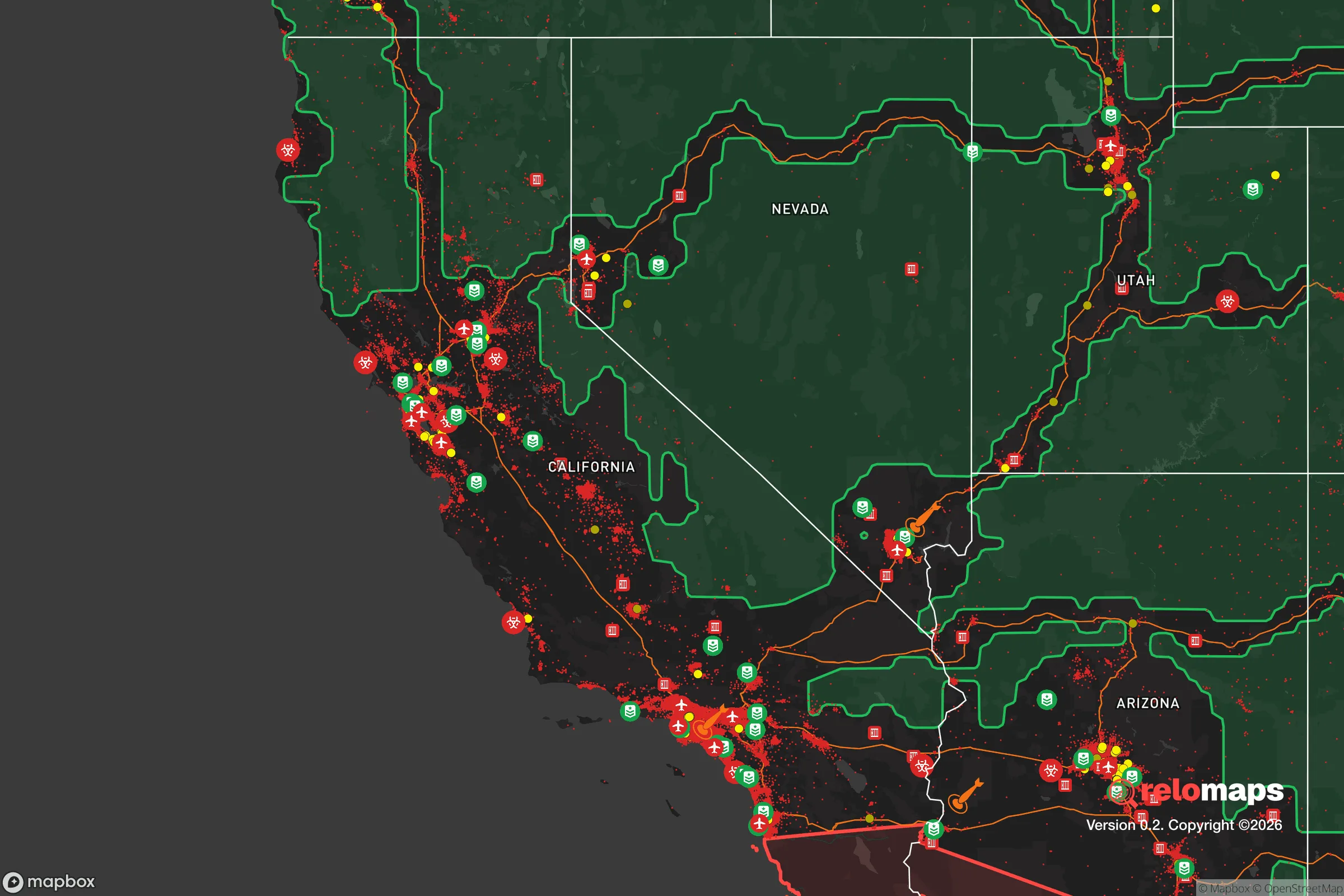


Important Note: For informational purposes only. This does not mean nothing bad ever happens in the green zones. Please use common sense. This is based on public data and modeled with AI. We tried to take a conservative approach but mistakes happen. We update this regularly as new information becomes available.
Solar Generator Recommendations
Backup power matters more here than in safer locations. We've picked three solar generators across budgets and capacity tiers — start with the budget unit if you only need a few essentials, or step up if you want to run a fridge and HVAC for days at a time.

Jackery Portable Power Station Explorer 300
Budget OptionPower on the Go: Weighing only 11 lbs, it's convenient to set up and store with book-sized foldable solar panels

BLUETTI Portable Power Station AC180
Designed for both indoor and outdoor scenarios, AC180 is highly capable as it has a robost capacity and continuous output power.

EF ECOFLOW DELTA Pro Ultra Power Station
Upgraded PickEcoFlow DELTA Pro Ultra is a whole-home energy system designed to grow with your family. Integrated with the Smart Home Panel 2, it scales to meet your evolving energy needs — keeping your home powered, intelligent, and secure through every stage of life.
We earn a commission, at no additional cost to you.
Strategic Assessment Analysis
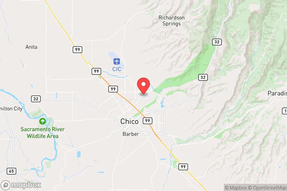
Chico, California, offers a compelling mix of geographic isolation and practical self-sufficiency that makes it a serious contender for relocation-minded individuals and families focused on resilience. Situated in the northern Sacramento Valley, roughly 90 miles north of Sacramento and 150 miles from the Bay Area, Chico provides a buffer from the densest population centers while still maintaining access to critical infrastructure. Its position at the base of the Sierra Nevada foothills, near the confluence of Big Chico Creek and the Sacramento River, gives it a distinct strategic advantage: abundant fresh water, fertile soil, and a climate that supports year-round food production, all within a community that has historically weathered economic and environmental shocks.
Geographic position and natural advantages for long-term stability
Chico’s location is its strongest card. The city sits on the eastern edge of the Sacramento Valley, with the Sierra Nevada rising to the east and the Coast Range to the west. This creates a natural funnel for weather patterns but also a defensible position: the mountains to the east limit overland access from that direction, while the valley floor to the west offers open agricultural land. The Sacramento River flows just west of town, providing a reliable surface water source that is less vulnerable to drought than many California communities reliant on distant aqueducts. The local groundwater basin, the Chico Subbasin, is managed by the Butte County Groundwater Sustainability Agency and has historically shown good recharge rates, though it is not immune to overdraft during multi-year droughts. For a relocator, this means water security is above average for the state, especially compared to Southern California or the Central Coast. The Mediterranean climate—hot, dry summers and cool, wet winters—supports a long growing season, with over 250 frost-free days annually. This allows for diverse crops, from almonds and walnuts to vegetables and grains, making local food production a realistic goal for those with land access.
Risks, exposures, and proximity to fallout-relevant landmarks
No location is without vulnerabilities, and Chico has several that a strategic relocator must weigh. The most immediate natural risk is wildfire. The 2018 Camp Fire, which destroyed the town of Paradise just 15 miles east, demonstrated how quickly a firestorm can threaten the region. Chico itself was not directly burned, but it served as a refuge for evacuees and experienced heavy smoke and infrastructure strain. The wildland-urban interface (WUI) along the eastern edge of town—particularly near Upper Bidwell Park and the foothills—is high-risk. Homes in these areas require serious defensible space, fire-resistant construction, and an evacuation plan. Flooding is a secondary concern: the Sacramento River and its tributaries can overtop during heavy rain years, as seen in 2017 and 2023, though most of Chico’s developed areas are outside the 100-year floodplain. Earthquake risk is low compared to coastal California, as the region is not near major fault lines.
From a man-made risk perspective, Chico’s distance from major military and industrial targets is a net positive. The nearest significant fallout-relevant landmarks are Beale Air Force Base (about 50 miles south, near Marysville) and the Sacramento metropolitan area (90 miles south), which includes state government buildings, a major rail hub, and the Port of Sacramento. Neither is close enough to pose a direct blast or fallout threat in most scenarios, but a major event at Beale could deposit fallout in the Chico area depending on wind patterns. The city’s own infrastructure—including the Chico Municipal Airport, which also hosts a small Air National Guard facility—is a minor target but not a high-value one. The Oroville Dam, 25 miles south, is a more tangible risk: its 2017 spillway failure caused mass evacuations downstream, and while the dam has been repaired, a catastrophic failure could flood large portions of the Sacramento Valley, including western Chico. Overall, Chico’s risk profile is moderate, with wildfire as the primary concern and dam failure as a low-probability, high-consequence outlier.
Practical resilience for a relocator: food, water, energy, and defensibility
For someone serious about self-sufficiency, Chico’s practical resilience is strong but requires active preparation. Food production is the standout advantage. Butte County is one of California’s top agricultural producers, with rice, almonds, walnuts, olives, and livestock dominating the landscape. The Chico Farmers Market, one of the oldest in the state, operates year-round and provides direct access to local growers. For those with land, the soil in the valley floor is rich alluvium, and the growing season is long enough for multiple crop cycles. Seed banks, nurseries, and agricultural supply stores are readily available. Water is the critical variable. While the Sacramento River and groundwater are reliable, the city’s municipal supply is treated and distributed via a centralized system vulnerable to power outages or contamination. A relocator should plan for a backup well (if on rural land) or rainwater catchment and storage. The average annual rainfall in Chico is about 27 inches, concentrated from November to March, making cisterns a viable supplement.
Energy is a mixed picture. The grid is served by Pacific Gas & Electric (PG&E), which has a poor track record for reliability, especially during wildfire season when public safety power shutoffs (PSPS) are common. Solar is an excellent investment: Chico averages over 260 sunny days per year, and net metering policies (though evolving) still make rooftop solar economically attractive. Battery storage is highly recommended to ride out PSPS events. Natural gas is available in most urban areas, but rural properties may rely on propane. For defensibility, Chico’s layout is a double-edged sword. The city itself is spread out with multiple egress routes—Highways 99, 32, and 149—but during a major wildfire evacuation, these can become choked. The eastern foothills offer more defensible positions (elevation, clear lines of sight) but at the cost of higher fire risk. The Bidwell Park system, one of the largest municipal parks in the U.S., provides a green buffer and potential foraging ground, but also a fuel load for fire. A relocator should prioritize a property with good access to two or more exit routes, a defensible perimeter, and a community that practices mutual aid—Chico has a strong network of preparedness groups and ham radio operators.
The overall strategic picture for Chico as a relocation destination
Chico presents a balanced strategic option for the resilience-minded relocator. It is not a hardened bunker, nor is it a remote wilderness—it is a functioning small city with a robust agricultural base, a reliable water supply, and a community that has already been tested by disaster. The Camp Fire aftermath revealed both strengths (rapid community organization, resourcefulness) and weaknesses (strained infrastructure, housing shortages). For a family or individual willing to invest in fire-hardening, backup power, and water storage, Chico offers a lifestyle that is both connected and self-sufficient. The proximity to Sacramento and the Bay Area is a double-edged sword: it provides access to specialized medical care and supply chains, but also means the area is not truly isolated. For those who want a balance of rural resilience and urban convenience, with a conservative-leaning culture (Butte County voted +15 for Trump in 2020) and a strong sense of local identity, Chico is a solid bet. The key is to go in with eyes open: prepare for fire, secure your own water and power, and build relationships with the local farming and preparedness communities. Done right, Chico can be a long-term home that weathers most storms.

* Values derived from national, state, county, city and local statistics and may differ in a specific area. Last updated: 2026-10-30T23:50:37.000Z
Narrative content on this page is AI-generated and may contain mistakes. Verify any details that matter before acting on them.
ReloMaps may earn a commission from affiliate links at no extra cost to you.

