Photo: Wikipedia
Strategic Assessment of Carmel-by-the-Sea, CA
Multiple tactical vulnerabilities. Population density, target proximity, or disaster risk are likely compounding. A retreat property and exit planning is required.
What does the Strategic Assessment tell us?
Our Strategic Assessment grades tactical survivability of an area. Major population centers, military targets, fallout zones, natural disasters, and border exposure all drive risk — lower exposure means a more defensible position in a crisis.
This is heavily inspired by Joel Skousen's Strategic Relocation book. Highly recommended you checkout the book ($)What does this tell us?
Our Strategic Assessment grades tactical survivability of an area. Major population centers, military targets, fallout zones, natural disasters, and border exposure all drive risk — lower exposure means a more defensible position in a crisis.
This is heavily inspired by Joel Skousen's Strategic Relocation book. Highly recommended you checkout the book ($)Strategic Pillars

Key Distances
Regional Safe Places
Below is our recommended "safe zones" in California and the surrounding area based on our strategic heuristics. For most people, it's unrealistic to live in a “safe zone” full-time due to work, family or other personal reasons. They tend to be more rural. However, many of these areas are perfect for second homes and retreat properties that double as a vacation home or even a short-term rental.




Important Note: For informational purposes only. This does not mean nothing bad ever happens in the green zones. Please use common sense. This is based on public data and modeled with AI. We tried to take a conservative approach but mistakes happen. We update this regularly as new information becomes available.
Solar Generator Recommendations
Backup power matters more here than in safer locations. We've picked three solar generators across budgets and capacity tiers — start with the budget unit if you only need a few essentials, or step up if you want to run a fridge and HVAC for days at a time.

Jackery Portable Power Station Explorer 300
Budget OptionPower on the Go: Weighing only 11 lbs, it's convenient to set up and store with book-sized foldable solar panels

BLUETTI Portable Power Station AC180
Designed for both indoor and outdoor scenarios, AC180 is highly capable as it has a robost capacity and continuous output power.

EF ECOFLOW DELTA Pro Ultra Power Station
Upgraded PickEcoFlow DELTA Pro Ultra is a whole-home energy system designed to grow with your family. Integrated with the Smart Home Panel 2, it scales to meet your evolving energy needs — keeping your home powered, intelligent, and secure through every stage of life.
We earn a commission, at no additional cost to you.
Strategic Assessment Analysis
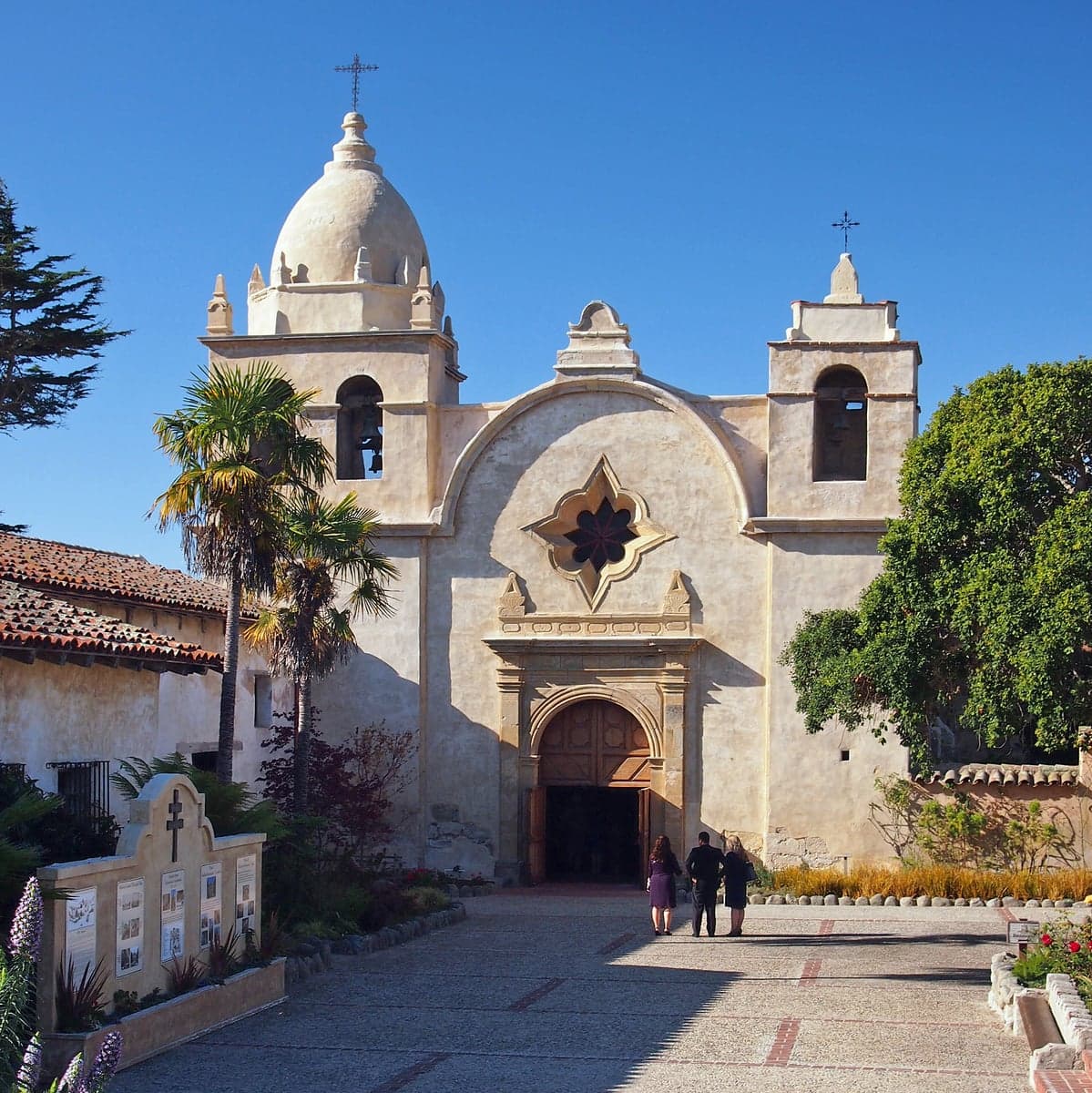
Carmel-by-the-Sea presents a mixed strategic picture for the disaster-conscious relocator: its coastal isolation offers genuine geographic advantages, but those same features create significant exposure to natural hazards and proximity to high-value man-made targets. The town’s small footprint—roughly one square mile with a permanent population under 4,000—means limited internal resources, yet its location on the Monterey Peninsula provides a degree of natural buffering from the densest population centers of California. For a single individual or family weighing self-sufficiency and long-term preparedness, Carmel demands a clear-eyed assessment of trade-offs rather than a simple thumbs-up or thumbs-down.
Geographic position and natural advantages for disaster readiness
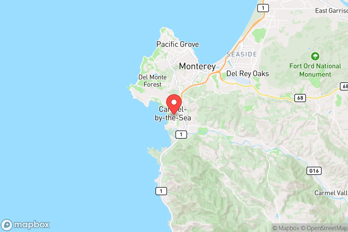
Carmel’s primary strategic asset is its position on the Monterey Peninsula, a landform that juts into the Pacific Ocean and is separated from the inland Central Valley by the Santa Lucia Range. This geography creates a natural choke point: the only road access to the peninsula is via California State Route 1, which hugs the coast, or through the narrow Carmel Valley corridor. In a scenario where inland areas face gridlock or contamination, this isolation can work in a resident’s favor—fewer escape routes mean fewer people passing through, and the peninsula’s limited entry points could be more easily monitored or controlled by those who remain. The surrounding Los Padres National Forest and Ventana Wilderness provide a vast, sparsely populated buffer to the south and east, offering potential retreat or resource-gathering zones for those with backcountry skills. The marine layer and coastal fog moderate temperatures year-round, reducing the risk of extreme heat events that plague inland California, and the area’s Mediterranean climate means minimal snow or ice that could complicate movement or infrastructure. For a relocator prioritizing natural defensibility, Carmel’s combination of ocean on three sides and rugged mountains on the fourth creates a fortress-like geography—but only if one accepts the trade-offs that come with that isolation.
Risks, exposures, and proximity to fallout-relevant landmarks
The same geography that provides isolation also creates acute vulnerabilities. Carmel sits directly on the San Andreas Fault system—the nearby San Gregorio Fault runs offshore, and the town experienced significant shaking in the 1989 Loma Prieta earthquake (magnitude 6.9, epicenter roughly 30 miles northeast). A major rupture on the San Andreas could sever all road access to the peninsula, as Highway 1 is notoriously landslide-prone and has collapsed multiple times in recent years (most notably at Mud Creek in 2017, which buried the road under 40 feet of debris). The town’s water supply comes from the Carmel River and the Seaside Basin, both of which are vulnerable to seismic disruption and saltwater intrusion. For the disaster-conscious relocator, the most concerning exposure is proximity to high-value man-made targets: the Monterey Peninsula is home to the Naval Postgraduate School in Monterey, the Defense Language Institute in Presidio of Monterey, and the former Fort Ord (now a mix of university and commercial uses, but still a former military superbase). These installations make the area a plausible secondary target in a conflict scenario, particularly given the region’s role in intelligence and language training. Additionally, the Diablo Canyon Nuclear Power Plant sits 90 miles south near San Luis Obispo—within the 50-mile emergency planning zone that would be affected by a major release. While the plant is slated for decommissioning by 2030, its spent fuel remains on-site indefinitely. For a relocator weighing fallout risks, Carmel’s coastal position offers some protection from prevailing onshore winds that would push inland contamination seaward, but a direct plume from Diablo Canyon or a strike on the military installations would put the town in a hazardous zone. Wildfire risk is also elevated: the 2020 Carmel Fire burned 6,905 acres just east of town, and the 2021 River Fire threatened the same corridor. The combination of steep, chaparral-covered hillsides and frequent drought conditions means that a major fire could cut off evacuation routes before residents can react.
Practical resilience for a relocator: food, water, energy, and defensibility
For a relocator serious about self-sufficiency, Carmel’s practical resilience is a mixed bag. Food security is a genuine strength: the Monterey Peninsula is one of the most productive agricultural regions in the world, with the Salinas Valley (the “Salad Bowl of the World”) just 20 miles inland. Local farmers’ markets operate year-round, and the area’s mild climate allows for home gardening of vegetables, herbs, and fruit trees. However, the town itself has no significant agricultural land—most of Carmel’s acreage is residential or commercial, meaning residents depend on supply chains that could be disrupted. Water is the critical vulnerability. Carmel’s municipal water comes from the Carmel River and the Seaside Basin, both of which are over-allocated and subject to state-mandated cutbacks. The California American Water Company has imposed strict conservation measures for years, and new connections are effectively frozen. A relocator would need to install rainwater catchment systems (average annual rainfall is only 18 inches) or drill a private well—but well permits are difficult to obtain and groundwater levels are dropping. Energy is moderately reliable: Pacific Gas & Electric (PG&E) serves the area, and the utility has a history of public safety power shutoffs during high-wind events (the 2021 PSPS affected over 50,000 customers on the peninsula). Solar adoption is feasible given the area’s 260+ sunny days per year, but coastal fog can reduce panel efficiency, and battery storage is essential for nighttime and grid-down scenarios. Defensibility is the strongest card Carmel holds. The town’s layout—narrow, winding streets, limited through-roads, and a compact downtown—makes it difficult for large groups to move through quickly. The surrounding hills provide natural observation points, and the ocean offers a secure western boundary. However, the same features that make the town defensible also make evacuation difficult: there are only two primary routes out of the peninsula (Highway 1 north and Highway 68 east), both of which can be blocked by landslides, accidents, or fire. For a family with a vehicle and a plan, Carmel offers a defensible redoubt; for those without mobility or a pre-established network, it could become a trap.
The overall strategic picture for Carmel-by-the-Sea is one of high potential paired with high stakes. The town’s natural isolation, agricultural proximity, and defensible terrain make it a strong candidate for a relocator who values self-sufficiency and is willing to invest in water independence, solar energy, and a robust emergency plan. But the same geography that provides those advantages also creates acute exposure to earthquakes, wildfire, and proximity to military and nuclear targets. For a conservative-leaning audience weighing disaster readiness, Carmel is not a safe harbor in the sense of being low-risk—it is a calculated bet that the benefits of isolation and local resources outweigh the vulnerabilities of a coastal peninsula with limited egress. The relocator who succeeds here will be the one who treats the town as a base camp, not a fortress: someone who builds relationships with local farmers, installs redundant water and power systems, and maintains a vehicle capable of navigating the single road out. For those willing to do that work, Carmel offers a rare combination of beauty and strategic depth. For those looking for a turnkey solution, the trade-offs are likely too steep.

* Values derived from national, state, county, city and local statistics and may differ in a specific area. Last updated: 2026-09-02T22:09:17.000Z
Narrative content on this page is AI-generated and may contain mistakes. Verify any details that matter before acting on them.
ReloMaps may earn a commission from affiliate links at no extra cost to you.

