Photo: Wikipedia
Strategic Assessment of Siskiyou County
Strong survivability profile. Good buffer from population centers, with manageable environmental and tactical risks.
What does the Strategic Assessment tell us?
Our Strategic Assessment grades tactical survivability of an area. Major population centers, military targets, fallout zones, natural disasters, and border exposure all drive risk — lower exposure means a more defensible position in a crisis.
This is heavily inspired by Joel Skousen's Strategic Relocation book. Highly recommended you checkout the book ($)What does this tell us?
Our Strategic Assessment grades tactical survivability of an area. Major population centers, military targets, fallout zones, natural disasters, and border exposure all drive risk — lower exposure means a more defensible position in a crisis.
This is heavily inspired by Joel Skousen's Strategic Relocation book. Highly recommended you checkout the book ($)Strategic Pillars

Key Distances
Strategic Assessment Analysis
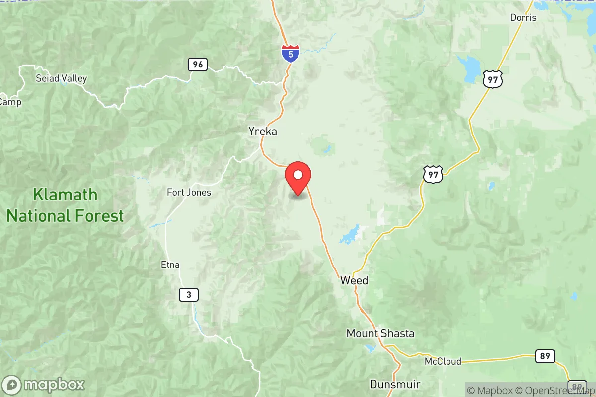
Siskiyou County offers one of the strongest strategic positions in California for a relocator prioritizing resilience and self-sufficiency, primarily because it sits at the far northern tip of the state, roughly 60 miles from the Oregon border and far removed from the state’s major population centers. The county’s defining feature is its isolation: the nearest metropolitan area of any consequence is Redding, about 90 minutes south, while Medford, Oregon, lies just across the border and serves as a practical hub for medical and commercial needs. For a conservative-leaning reader weighing disaster preparedness, this distance from Sacramento (roughly 250 miles) and the Bay Area (over 300 miles) is a genuine asset, as it places the county well outside the immediate fallout zones and secondary disruption rings of California’s primary strategic targets. The trade-off is a hard reliance on two main arterial highways—Interstate 5 and State Route 97—which are both lifelines and single points of failure in a major event.
Geographic position and natural advantages for long-term security
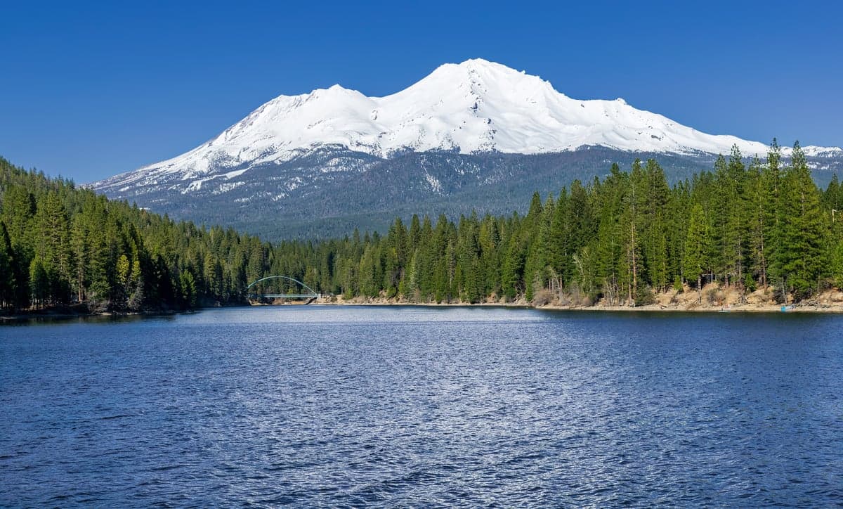
Siskiyou County’s geography is defined by the Klamath Mountains, the Cascade Range, and the Scott and Shasta Valleys, creating a topography that naturally limits access and provides inherent defensibility. The county seat, Yreka, sits at roughly 2,600 feet elevation, while Mount Shasta—the region’s iconic 14,179-foot peak—anchors the southeastern portion of the county and serves as a permanent, visible landmark for navigation and situational awareness. This mountainous terrain means that most of the county’s roughly 44,000 residents live in small, dispersed communities: Yreka, Weed, Mount Shasta City, Dorris, and Fort Jones, none of which exceed 5,000 people. The practical effect is a low population density of about 7 people per square mile, which dramatically reduces the risk of civil unrest, resource competition, and disease transmission that would plague denser areas in a crisis. The county also holds the headwaters of the Klamath River and the Shasta River, giving it a hydrological advantage that most of drought-prone California lacks; surface water is comparatively abundant, and the region’s snowpack acts as a natural reservoir that releases water well into the dry summer months.
Risk profile: wildfire, seismic activity, and proximity to critical infrastructure
The most significant natural risk in Siskiyou County is wildfire, and it is not hypothetical. The 2021 Antelope Fire and the 2022 McKinney Fire—the latter burning over 60,000 acres near the Klamath River and destroying homes in the community of Klamath River—demonstrated that the county’s forested, dry summers create a genuine fire hazard that requires active mitigation. The 2023 and 2024 seasons were comparatively mild, but the underlying fuel load remains. Seismic risk is moderate; the county sits near the Cascadia Subduction Zone’s southern extent, and the region experiences occasional small earthquakes, but it is not in the same risk class as the San Andreas system. For a relocator, the more relevant concern is proximity to man-made targets. The county contains no military bases, no refineries, and no major industrial complexes, which is a positive. However, it is bisected by Interstate 5, a critical national logistics corridor that runs from Mexico to Canada, and the Union Pacific railroad mainline follows the same route through the Shasta Valley. In a conflict scenario, these transportation arteries could be targets for disruption, and their closure would severely hamper resupply. The nearest significant military installation is Kingsley Field Air National Guard Base in Klamath Falls, Oregon, roughly 70 miles northeast, which is a minor facility but still a potential secondary target. The county’s distance from major ports—over 300 miles from the Port of Oakland and over 200 miles from the Port of Coos Bay—means it is insulated from the immediate effects of a port disruption, but it also means that imported goods take longer to arrive under normal conditions.
Practical resilience: food, water, energy, and defensibility for a relocator
For a family or individual serious about self-sufficiency, Siskiyou County’s practical resilience is strong but requires deliberate preparation. Water is the county’s clearest advantage: the Klamath River, Scott River, and Shasta River systems provide surface water, and most rural properties rely on private wells that tap into the region’s substantial groundwater aquifers. Unlike much of the Central Valley, Siskiyou County is not experiencing critical groundwater depletion, and the water table in the Scott Valley and Shasta Valley remains stable. Food security is moderate. The county has a working agricultural sector—cattle ranching, hay production, and some small-scale vegetable farming—but it is not a breadbasket. Local farmers’ markets in Yreka and Mount Shasta City provide seasonal produce, but a relocator should plan for a significant home garden and food storage program, as the growing season is short (roughly 90–120 days) due to elevation and cold winters. Energy is a mixed picture. Pacific Power and Siskiyou Electric Cooperative serve the region, but rural outages are common during winter storms, and the county has experienced Public Safety Power Shutoffs during high-fire-risk periods. Solar is viable—the region gets over 200 sunny days per year—but winter cloud cover and snow can reduce generation for weeks at a time, so a battery bank and a backup generator (propane or diesel) are essential rather than optional. Defensibility is excellent by virtue of terrain: the county’s mountain passes, narrow valleys, and limited road networks mean that a small number of chokepoints—such as the I-5 corridor through the Siskiyou Summit and State Route 96 along the Klamath River—can be monitored or controlled with relative ease. The county’s dispersed settlement pattern also means that no single community is a high-value target, and the strong hunting and fishing culture (deer, elk, salmon, and steelhead) provides a baseline of outdoor competency among the local population that a newcomer would do well to tap into.
The overall strategic picture for Siskiyou County is one of high isolation, moderate natural risk, and strong baseline resources, with the caveat that its resilience is contingent on personal preparation. It is not a place where a relocator can simply arrive and expect the infrastructure to carry them; the county’s small population and rural character mean that services are limited, and the nearest Level II trauma center is in Redding, over 90 minutes from Yreka. But for a reader who is willing to invest in a well, solar panels, a wood stove, and a serious food storage program, the county offers a combination of water abundance, low population density, and geographic defensibility that is hard to match anywhere else in California. The key vulnerabilities—wildfire, winter isolation, and dependence on I-5—are manageable with planning, and the absence of major strategic targets within the county is a meaningful advantage in an increasingly uncertain world. For a conservative-leaning family or individual looking to step off the grid without leaving civilization entirely, Siskiyou County represents one of the most rational choices on the West Coast.

* Values derived from national, state, county, city and local statistics and may differ in a specific area. Last updated: 2026-10-29T07:30:52.000Z
Narrative content on this page is AI-generated and may contain mistakes. Verify any details that matter before acting on them.
ReloMaps may earn a commission from affiliate links at no extra cost to you.

