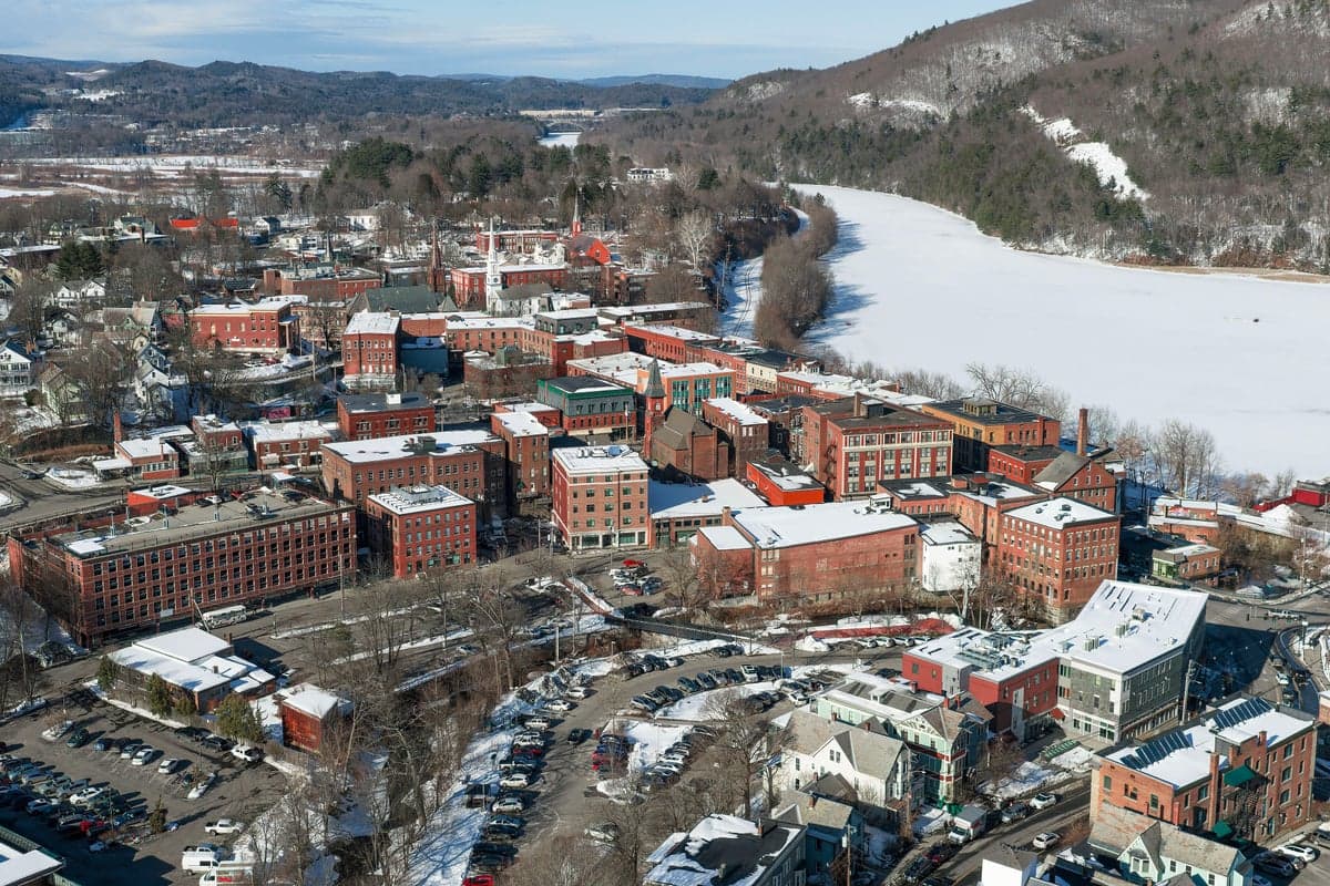
Photo: Wikipedia
Strategic Assessment of Brattleboro, VT
Workable tactical position. Some exposure to population density or targets, but generally defensible in a crisis.
What does the Strategic Assessment tell us?
Our Strategic Assessment grades tactical survivability of an area. Major population centers, military targets, fallout zones, natural disasters, and border exposure all drive risk — lower exposure means a more defensible position in a crisis.
This is heavily inspired by Joel Skousen's Strategic Relocation book. Highly recommended you checkout the book ($)What does this tell us?
Our Strategic Assessment grades tactical survivability of an area. Major population centers, military targets, fallout zones, natural disasters, and border exposure all drive risk — lower exposure means a more defensible position in a crisis.
This is heavily inspired by Joel Skousen's Strategic Relocation book. Highly recommended you checkout the book ($)Strategic Pillars

Key Distances
Regional Safe Places
Below is our recommended "safe zones" in Vermont and the surrounding area based on our strategic heuristics. For most people, it's unrealistic to live in a “safe zone” full-time due to work, family or other personal reasons. They tend to be more rural. However, many of these areas are perfect for second homes and retreat properties that double as a vacation home or even a short-term rental.




Important Note: For informational purposes only. This does not mean nothing bad ever happens in the green zones. Please use common sense. This is based on public data and modeled with AI. We tried to take a conservative approach but mistakes happen. We update this regularly as new information becomes available.
Solar Generator Recommendations
Backup power matters more here than in safer locations. We've picked three solar generators across budgets and capacity tiers — start with the budget unit if you only need a few essentials, or step up if you want to run a fridge and HVAC for days at a time.

Jackery Portable Power Station Explorer 300
Budget OptionPower on the Go: Weighing only 11 lbs, it's convenient to set up and store with book-sized foldable solar panels

BLUETTI Portable Power Station AC180
Designed for both indoor and outdoor scenarios, AC180 is highly capable as it has a robost capacity and continuous output power.

EF ECOFLOW DELTA Pro Ultra Power Station
Upgraded PickEcoFlow DELTA Pro Ultra is a whole-home energy system designed to grow with your family. Integrated with the Smart Home Panel 2, it scales to meet your evolving energy needs — keeping your home powered, intelligent, and secure through every stage of life.
We earn a commission, at no additional cost to you.
Strategic Assessment Analysis
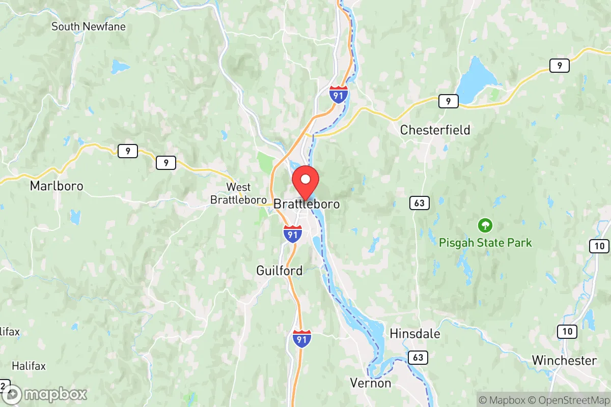
Brattleboro, Vermont, occupies a strategic position that balances genuine resilience advantages with notable exposure risks, making it a location that demands careful trade-off analysis for the disaster-conscious relocator. Situated in the Connecticut River Valley along the I-91 corridor, the town benefits from a mix of rural buffer and regional access, but its proximity to the Vermont Yankee nuclear site and its location within a broader northeastern corridor introduce vulnerabilities that cannot be ignored. For a single individual or family weighing self-sufficiency and preparedness, Brattleboro offers a credible but not unqualified base of operations.
Geographic position and natural advantages for long-term resilience
Brattleboro’s geography provides several inherent resilience strengths. The town sits at the confluence of the Connecticut and West Rivers, offering abundant surface water—a critical resource for independent water supply. The surrounding landscape is characterized by the Green Mountains to the west and rolling hills to the east, creating natural barriers that limit easy access from major population centers. This terrain also supports diverse microclimates and fertile valley soils, which are favorable for small-scale agriculture and food production. The area’s elevation, generally between 200 and 500 feet in the valley, reduces flood risk compared to lower-lying sections of the Connecticut River, though localized flooding remains a concern. Winters are cold and snowy, which can be a hardship but also provides natural refrigeration and water storage. The region’s low population density—Windham County has roughly 44,000 residents spread over 800 square miles—means less competition for resources in a crisis scenario. For a relocator, the ability to access multiple water sources, grow food in valley plots, and leverage the insulating effect of surrounding mountains are concrete advantages that support a long-term resilience strategy.
Risks, exposures, and proximity to fallout-relevant landmarks
The most significant risk factor for Brattleboro is its proximity to the Vermont Yankee nuclear power plant, located just 10 miles south in Vernon, Vermont. Though the plant ceased power generation in 2014, it remains in decommissioning, with spent nuclear fuel stored on site in dry casks. This creates a persistent, if low-probability, hazard: a security breach, natural disaster, or accident at the storage facility could release radioactive material. The prevailing wind patterns in the Connecticut River Valley would carry any plume directly through the Brattleboro area. Additionally, the town lies roughly 60 miles from the Seabrook Station nuclear plant in New Hampshire and about 90 miles from the Pilgrim Nuclear Power Station in Massachusetts (also in decommissioning), meaning Brattleboro sits within the potential fallout zone of multiple nuclear facilities. Beyond nuclear risks, the I-91 corridor is a major north-south transportation artery that could become a target or a chokepoint during a crisis. The town’s location near the Massachusetts border also places it within a two-hour drive of the Boston metropolitan area, meaning that in a major disaster, Brattleboro could see a significant influx of refugees from the south, straining local resources. Natural hazards include ice storms, nor’easters, and occasional flooding from the Connecticut River, though the town’s elevation mitigates the worst of the latter. For a relocator, the nuclear proximity is the single most concerning factor, and it should be weighed heavily against the area’s other advantages.
Practical resilience for a relocator: food, water, energy, and defensibility
On the practical side, Brattleboro offers a mixed but workable picture for self-sufficiency. Water access is excellent: the Connecticut River provides a year-round surface water source, and the region’s high annual precipitation (roughly 45 inches) supports rainwater catchment and well water. Many rural properties in the surrounding towns of Dummerston, Putney, and Guilford have private wells, which are a major resilience asset. Food production potential is strong: the Connecticut River Valley has some of Vermont’s most fertile agricultural land, and the area supports a robust local food system, including the Brattleboro Farmers’ Market, numerous CSAs, and small-scale farms. A relocator with land could reasonably establish a productive garden and small orchard within a season or two. However, the growing season is short (roughly 120–140 frost-free days), so cold-hardy crops and season extension techniques are necessary. Energy resilience is a challenge: the region is heavily dependent on the grid, and winter storms frequently cause power outages that can last days. Wood heat is common and practical—Vermont has abundant forestland—and solar potential is moderate, though the area’s frequent cloud cover reduces efficiency compared to sunnier regions. A backup generator or off-grid solar system with battery storage is advisable. Defensibility is moderate: the town itself is not easily defensible due to its valley location and multiple road access points (I-91, Route 9, Route 5, and Route 30). However, the surrounding hill towns offer far better defensive positions, with narrow, winding roads and limited entry points. A relocator seeking true defensibility would likely want to look at properties in the hills west of town, such as in Marlboro or Newfane, rather than in the valley floor. The local population is generally self-reliant and community-oriented, which can be a double-edged sword—helpful in a crisis but potentially insular toward newcomers. For a family, the presence of a hospital (Brattleboro Memorial Hospital) and a regional airport (Dillant-Hopkins in nearby Keene, NH) adds practical value, though these also represent potential targets or resource drains in a major event.
The overall strategic picture for Brattleboro is one of qualified viability. Its water abundance, agricultural potential, and low population density are genuine resilience assets that are hard to find in more urbanized regions. However, the proximity to multiple nuclear facilities, the risk of refugee influx from the Boston corridor, and the challenges of winter weather and grid dependence create a risk profile that is higher than more remote locations in northern New England or the interior West. For a relocator who is willing to invest in off-grid energy, secure a property in the hill towns, and maintain a robust food storage and water filtration system, Brattleboro can work as a base. But it is not a bug-out location—it is a compromise between accessibility and resilience. Those who prioritize absolute isolation and minimal man-made risk should look farther north or west. For those who want a balance of community, resources, and strategic depth, Brattleboro deserves serious consideration, provided the nuclear risk is accepted as part of the equation.

* Values derived from national, state, county, city and local statistics and may differ in a specific area. Last updated: 2026-10-17T00:31:53.000Z
Narrative content on this page is AI-generated and may contain mistakes. Verify any details that matter before acting on them.
ReloMaps may earn a commission from affiliate links at no extra cost to you.

