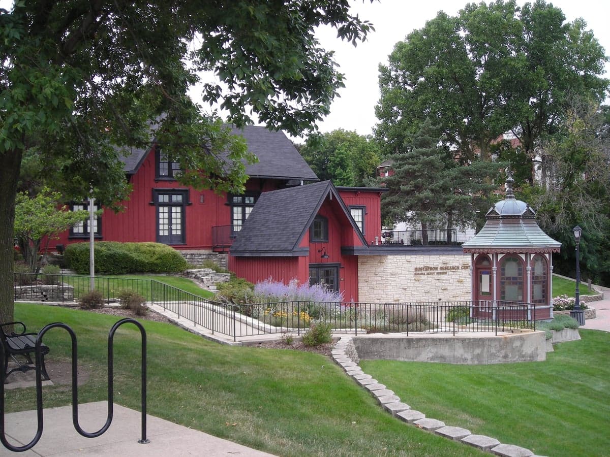
Photo: Wikipedia
Strategic Assessment of Batavia, IL
Multiple tactical vulnerabilities. Population density, target proximity, or disaster risk are likely compounding. A retreat property and exit planning is required.
What does the Strategic Assessment tell us?
Our Strategic Assessment grades tactical survivability of an area. Major population centers, military targets, fallout zones, natural disasters, and border exposure all drive risk — lower exposure means a more defensible position in a crisis.
This is heavily inspired by Joel Skousen's Strategic Relocation book. Highly recommended you checkout the book ($)What does this tell us?
Our Strategic Assessment grades tactical survivability of an area. Major population centers, military targets, fallout zones, natural disasters, and border exposure all drive risk — lower exposure means a more defensible position in a crisis.
This is heavily inspired by Joel Skousen's Strategic Relocation book. Highly recommended you checkout the book ($)Strategic Pillars

Key Distances
Regional Safe Places
Below is our recommended "safe zones" in Illinois and the surrounding area based on our strategic heuristics. For most people, it's unrealistic to live in a “safe zone” full-time due to work, family or other personal reasons. They tend to be more rural. However, many of these areas are perfect for second homes and retreat properties that double as a vacation home or even a short-term rental.
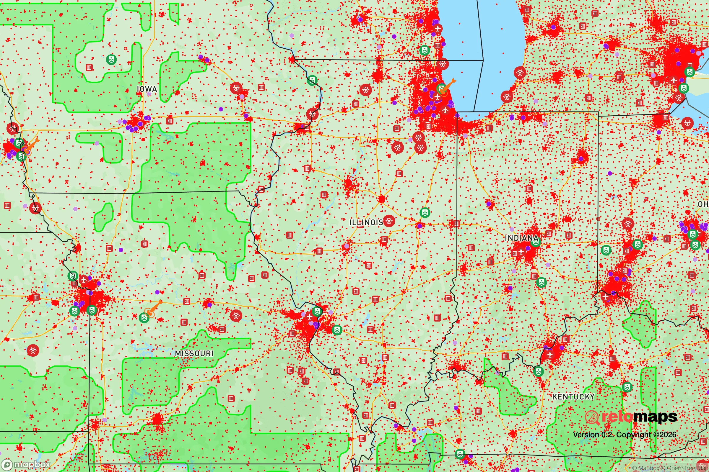
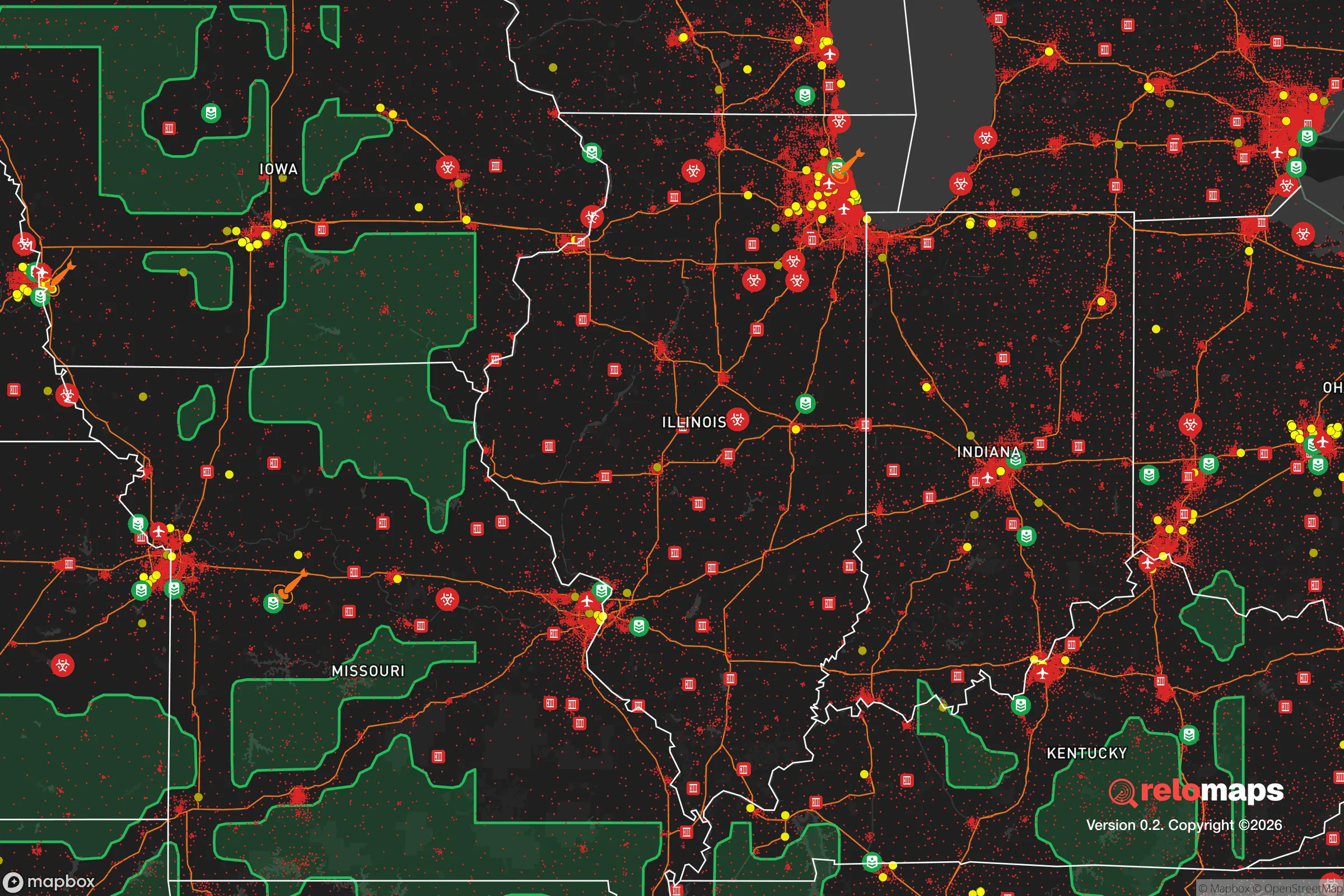


Important Note: For informational purposes only. This does not mean nothing bad ever happens in the green zones. Please use common sense. This is based on public data and modeled with AI. We tried to take a conservative approach but mistakes happen. We update this regularly as new information becomes available.
Solar Generator Recommendations
Backup power matters more here than in safer locations. We've picked three solar generators across budgets and capacity tiers — start with the budget unit if you only need a few essentials, or step up if you want to run a fridge and HVAC for days at a time.

Jackery Portable Power Station Explorer 300
Budget OptionPower on the Go: Weighing only 11 lbs, it's convenient to set up and store with book-sized foldable solar panels

BLUETTI Portable Power Station AC180
Designed for both indoor and outdoor scenarios, AC180 is highly capable as it has a robost capacity and continuous output power.

EF ECOFLOW DELTA Pro Ultra Power Station
Upgraded PickEcoFlow DELTA Pro Ultra is a whole-home energy system designed to grow with your family. Integrated with the Smart Home Panel 2, it scales to meet your evolving energy needs — keeping your home powered, intelligent, and secure through every stage of life.
We earn a commission, at no additional cost to you.
Strategic Assessment Analysis
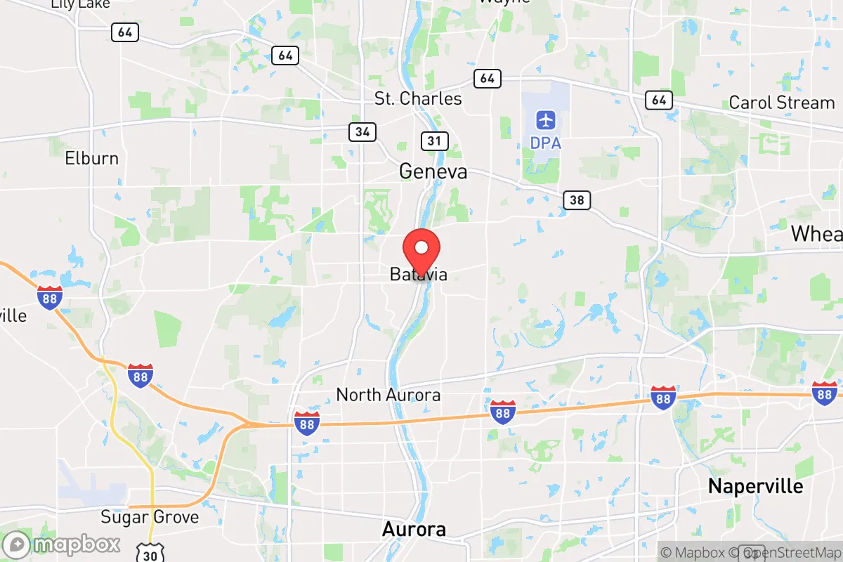
Batavia, Illinois, offers a strategic balance of Midwestern stability and practical resilience that appeals to relocation-minded individuals and families who value preparedness without isolation. Situated along the Fox River in Kane County, roughly 40 miles west of Chicago, Batavia benefits from being far enough from the urban core to avoid the worst fallout risks of a major metropolitan area, yet close enough to access critical infrastructure and supply chains. The city’s historic downtown, established industrial base, and strong community networks provide a foundation for self-sufficiency that many suburban locales lack, making it a viable option for those weighing disaster readiness alongside everyday livability.
Geographic position and natural advantages for long-term stability
Batavia’s location in the Fox River Valley gives it a distinct geographic edge. The Fox River itself is a reliable freshwater source, flowing north-south through the city and feeding into the Illinois River system. This waterway is not only a recreational asset but also a potential resource for emergency water collection and irrigation, should municipal systems be compromised. The surrounding terrain is gently rolling, with pockets of forest preserves—such as the 1,200-acre Fermilab grounds just east and the 3,000-acre Kane County Forest Preserve system—that offer natural buffers against wind, noise, and visual intrusion from major highways. The area sits on relatively stable bedrock, with low seismic risk and no significant floodplain issues in most residential neighborhoods, though some low-lying areas near the river require flood insurance. Batavia’s elevation, averaging around 700 feet above sea level, provides modest vantage points for observation without the exposure of hilltop living. The region’s continental climate means cold winters and hot summers, but the lack of hurricane, wildfire, or earthquake threats reduces the frequency of natural disasters compared to coastal or mountain states. For a relocator prioritizing long-term stability, Batavia’s position in the Midwest’s “tornado alley” fringe is a manageable risk—tornadoes are possible but not frequent, and the city’s building codes are generally modern enough to withstand EF-2 events.
Risks, exposures, and proximity to fallout-relevant landmarks
The most significant risk for Batavia is its proximity to Chicago, a Tier 1 metropolitan target in any major conflict or terrorist scenario. At roughly 40 miles from the Loop, Batavia sits outside the likely blast radius of a nuclear detonation in the city center, but it falls within the moderate-to-heavy fallout zone depending on wind patterns. The prevailing westerlies mean that fallout from a Chicago strike would likely drift eastward, sparing Batavia the worst particulate contamination, but a shift in wind direction could change that calculus. Additionally, Batavia is only 10 miles from the Fermi National Accelerator Laboratory (Fermilab) in Batavia’s own backyard—a high-energy physics facility that, while not a nuclear reactor, contains significant quantities of radioactive materials and cryogenic hazards. A deliberate attack or catastrophic accident at Fermilab could release hazardous materials, though the lab’s security protocols are robust. Other nearby infrastructure includes the DuPage Airport (15 miles east), a general aviation hub that could be a target for sabotage, and the extensive rail lines running through the Fox Valley, which carry hazardous materials including crude oil and chemicals. The city’s own industrial base, including the former FermiLab site and several manufacturing plants, presents localized chemical spill risks. For a relocator, the key takeaway is that Batavia is not a remote safe haven—it is a suburban community with real exposure to man-made risks tied to its proximity to Chicago and critical infrastructure. However, its distance from the urban core and lack of high-value military or government targets make it a lower-priority location than Naperville or Aurora, which sit closer to major highways and rail hubs.
Practical resilience for a relocator: food, water, energy, and defensibility
Batavia’s practical resilience is a mixed bag, but the fundamentals are solid for a suburb of its size. The Fox River provides a year-round surface water source, though treatment would be necessary for drinking—boiling or portable filters are sufficient for most pathogens. Groundwater wells are common in rural parts of Kane County, but most Batavia homes rely on municipal water from Lake Michigan via the Chicago water system, which is vulnerable to disruption. A backup well or rainwater catchment system would be a wise investment for a serious prepper. Food security is bolstered by the surrounding agricultural land: Kane County is one of Illinois’s top corn and soybean producers, and local farmers’ markets operate seasonally. Batavia itself has a handful of community gardens and a growing interest in backyard food production, but the city is not a food-producing hub. For long-term self-sufficiency, a relocator would need to establish relationships with local farms or invest in their own growing space—typical suburban lots of 0.25–0.5 acres can support a substantial vegetable garden and small livestock with proper zoning. Energy reliability is average: ComEd provides grid power with occasional outages during storms, but natural gas is widely available for heating and cooking. Solar potential is moderate—the region gets about 4.5 peak sun hours per day—and net metering is available, making rooftop solar a viable option for reducing grid dependence. Defensibility is where Batavia falls short. The city is a typical suburban grid, with multiple entry points via Illinois Route 25, Route 31, and the I-88 tollway corridor. There are no natural chokepoints, and the flat terrain offers little cover. A determined group could secure a single neighborhood or cul-de-sac, but the broader city is not defensible against organized threats. The local police department is professional but small—around 40 sworn officers—and would be overwhelmed in a widespread crisis. For a relocator, the practical resilience strategy in Batavia is to build a self-sufficient household within a community that has strong social cohesion, rather than relying on the city itself as a fortress.
The overall strategic picture for Batavia is one of calculated trade-offs. It is not a remote bunker or a rural homestead, but it offers a realistic middle ground for someone who wants to stay connected to urban resources while maintaining a baseline of preparedness. The Fox River, agricultural surroundings, and stable Midwestern climate provide natural advantages that many suburbs lack. The risks—proximity to Chicago, Fermilab, and industrial infrastructure—are real but manageable with proper planning, such as maintaining a 72-hour bug-out kit, establishing a neighborhood communication network, and investing in water filtration and solar backup. For a family or individual who values community, schools, and a lower cost of living than the Chicago suburbs, Batavia represents a defensible choice in an uncertain future—provided they treat resilience as an active practice, not a passive assumption.

* Values derived from national, state, county, city and local statistics and may differ in a specific area. Last updated: 2026-09-21T21:43:05.000Z
Narrative content on this page is AI-generated and may contain mistakes. Verify any details that matter before acting on them.
ReloMaps may earn a commission from affiliate links at no extra cost to you.

