
Photo: Wikipedia
Strategic Assessment of Johnson County
Strong survivability profile. Good buffer from population centers, with manageable environmental and tactical risks.
What does the Strategic Assessment tell us?
Our Strategic Assessment grades tactical survivability of an area. Major population centers, military targets, fallout zones, natural disasters, and border exposure all drive risk — lower exposure means a more defensible position in a crisis.
This is heavily inspired by Joel Skousen's Strategic Relocation book. Highly recommended you checkout the book ($)What does this tell us?
Our Strategic Assessment grades tactical survivability of an area. Major population centers, military targets, fallout zones, natural disasters, and border exposure all drive risk — lower exposure means a more defensible position in a crisis.
This is heavily inspired by Joel Skousen's Strategic Relocation book. Highly recommended you checkout the book ($)Strategic Pillars

Key Distances
Strategic Assessment Analysis
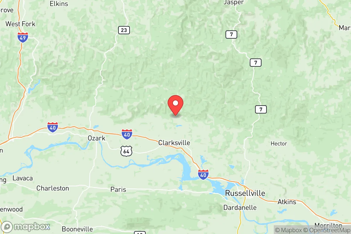
Johnson County, Arkansas, offers a compelling mix of geographic isolation and practical self-sufficiency that appeals to relocation-minded individuals and families who prioritize resilience. Located in the Arkansas River Valley between the Ozark and Ouachita mountain ranges, the county provides natural buffers against many of the risks that plague more densely populated regions. With a population of roughly 26,000 spread across towns like Clarksville, Lamar, and Knoxville, the area maintains a low-density profile that supports both privacy and preparedness. Its position roughly 100 miles northwest of Little Rock and 90 miles east of Fort Smith places it outside the immediate blast or fallout zones of major metropolitan targets while still offering access to regional supply chains and medical facilities.
Geographic position and natural advantages for long-term security
Johnson County sits at the southern edge of the Boston Mountains, part of the Ozark Plateau, which provides significant topographical diversity. Elevations range from around 400 feet in the river valleys to over 2,000 feet in the northern reaches near Mount Magazine, the highest point in Arkansas. This varied terrain offers numerous options for dispersed settlement, natural water catchment, and defensible positions. The county is bisected by the Arkansas River and intersected by several tributaries including the Big Piney Creek and Illinois Bayou, both of which are spring-fed and maintain flow even during dry periods. The region's karst geology, with its limestone bedrock and numerous springs, provides reliable groundwater access for those who know how to tap it. The climate is temperate with four distinct seasons, annual rainfall averaging 45-50 inches, and a growing season of roughly 200 days — sufficient for substantial food production. The county's position in the Arkansas River Valley also places it within a natural transportation corridor, but one that is far enough from the Interstate 40 corridor's busiest segments to avoid the congestion and vulnerability associated with major highway chokepoints.
Risk exposure, natural hazards, and proximity to strategic targets
Johnson County's risk profile is moderate compared to coastal or metropolitan areas. The primary natural hazards are severe thunderstorms, tornadoes, flash flooding, and occasional ice storms. The county lies within Tornado Alley's eastern fringe; the March 2022 tornado outbreak that struck nearby Winslow and Springdale demonstrated that significant events can occur, though Johnson County itself typically sees lower tornado frequency than areas further west in Oklahoma or north in Missouri. Flooding is a localized concern along the Arkansas River and its tributaries, particularly in low-lying areas around Clarksville and Coal Hill, but most residential development sits on higher ground. Ice storms, while disruptive, are manageable with proper preparation and backup heating. From a man-made risk perspective, Johnson County's primary advantage is its distance from high-value targets. The nearest major military installation is Fort Chaffee near Fort Smith, roughly 70 miles west, which is a training center rather than a strategic nuclear target. The Arkansas Nuclear One plant near Russellville is approximately 40 miles southeast — close enough to warrant awareness but far enough that a worst-case event would not directly impact the county. No major refineries, ports, or defense contractors operate within the county. The primary infrastructure vulnerability is the Interstate 40 bridge over the Arkansas River near Clarksville, which could become a chokepoint during evacuation scenarios or supply disruptions.
Practical resilience for relocators: food, water, energy, and defensibility
For those serious about self-sufficiency, Johnson County offers strong fundamentals. Water availability is excellent by regional standards: the county's numerous springs, creeks, and rivers provide surface water, while the underlying Ozark aquifer yields reliable well water at depths of 100-300 feet in most areas. The Piney Bay and Lake Dardanelle areas offer additional surface water reserves. Agricultural land is concentrated in the river bottoms near Clarksville and Hartman, with fertile alluvial soils suitable for row crops, orchards, and pasture. The county is already home to a significant agricultural base — poultry, cattle, hay, and timber are the primary outputs — meaning local food production infrastructure exists and can be tapped. The Johnson County Farmers Market in Clarksville provides a distribution point for local growers. Energy resilience is moderate: the county is served by Arkansas Valley Electric Cooperative, a member-owned utility that has invested in grid hardening, but rural areas still experience outages during storms. Solar potential is good, with roughly 4.5-5 peak sun hours per day, and off-grid setups are feasible given the county's lax permitting environment. Wood heating is practical given the extensive timber resources in the Ozark National Forest, which covers the northern third of the county. Defensibility is a mixed picture: the terrain offers natural chokepoints and observation points, but the county's dispersed settlement pattern means that no single location can control access. The Ozark National Forest provides both cover and resources for those who know how to use them, but also creates potential avenues for unwanted movement. The county's low population density — roughly 35 people per square mile — means that most properties offer significant standoff distance from neighbors, a key factor in maintaining operational security during disruptions.
The overall strategic picture for Johnson County is one of balanced resilience with manageable trade-offs. It avoids the extreme risks of coastal hurricane zones, seismic regions, and metropolitan target areas while still providing access to regional infrastructure and supply chains. The county's natural water resources, agricultural capacity, and temperate climate support long-term self-sufficiency for prepared families. The primary weaknesses are the tornado risk, which is real but manageable with proper shelter, and the potential for ice storms to disrupt power and transportation. For the relocator who values isolation without complete remoteness, Johnson County offers a middle path: close enough to Clarksville's hospitals, schools, and hardware stores for practical needs, but far enough from the Interstate 40 corridor's vulnerabilities and the target-rich environments of Little Rock, Fort Smith, or Fayetteville. The county's position in the Arkansas River Valley, with its combination of defensible terrain, reliable water, and productive soil, makes it a strong candidate for those building a resilient lifestyle in the central United States.

* Values derived from national, state, county, city and local statistics and may differ in a specific area. Last updated: 2026-07-15T15:51:37.000Z
Narrative content on this page is AI-generated and may contain mistakes. Verify any details that matter before acting on them.
ReloMaps may earn a commission from affiliate links at no extra cost to you.

