
Photo: Wikipedia
Strategic Assessment of Yavapai County
Workable tactical position. Some exposure to population density or targets, but generally defensible in a crisis.
What does the Strategic Assessment tell us?
Our Strategic Assessment grades tactical survivability of an area. Major population centers, military targets, fallout zones, natural disasters, and border exposure all drive risk — lower exposure means a more defensible position in a crisis.
This is heavily inspired by Joel Skousen's Strategic Relocation book. Highly recommended you checkout the book ($)What does this tell us?
Our Strategic Assessment grades tactical survivability of an area. Major population centers, military targets, fallout zones, natural disasters, and border exposure all drive risk — lower exposure means a more defensible position in a crisis.
This is heavily inspired by Joel Skousen's Strategic Relocation book. Highly recommended you checkout the book ($)Strategic Pillars

Key Distances
Strategic Assessment Analysis
Yavapai County offers a compelling strategic position for relocators prioritizing resilience and self-sufficiency, combining high-altitude terrain, low population density, and distance from major metropolitan fallout zones. The county's geography—straddling the transition from Sonoran Desert to Colorado Plateau—provides natural buffers against both coastal and urban cascade failures. For a conservative-leaning audience evaluating long-term security, this region presents a balanced mix of defensible topography, resource access, and community preparedness culture that is increasingly rare in the modern Southwest.
Geographic position and natural advantages for long-term security
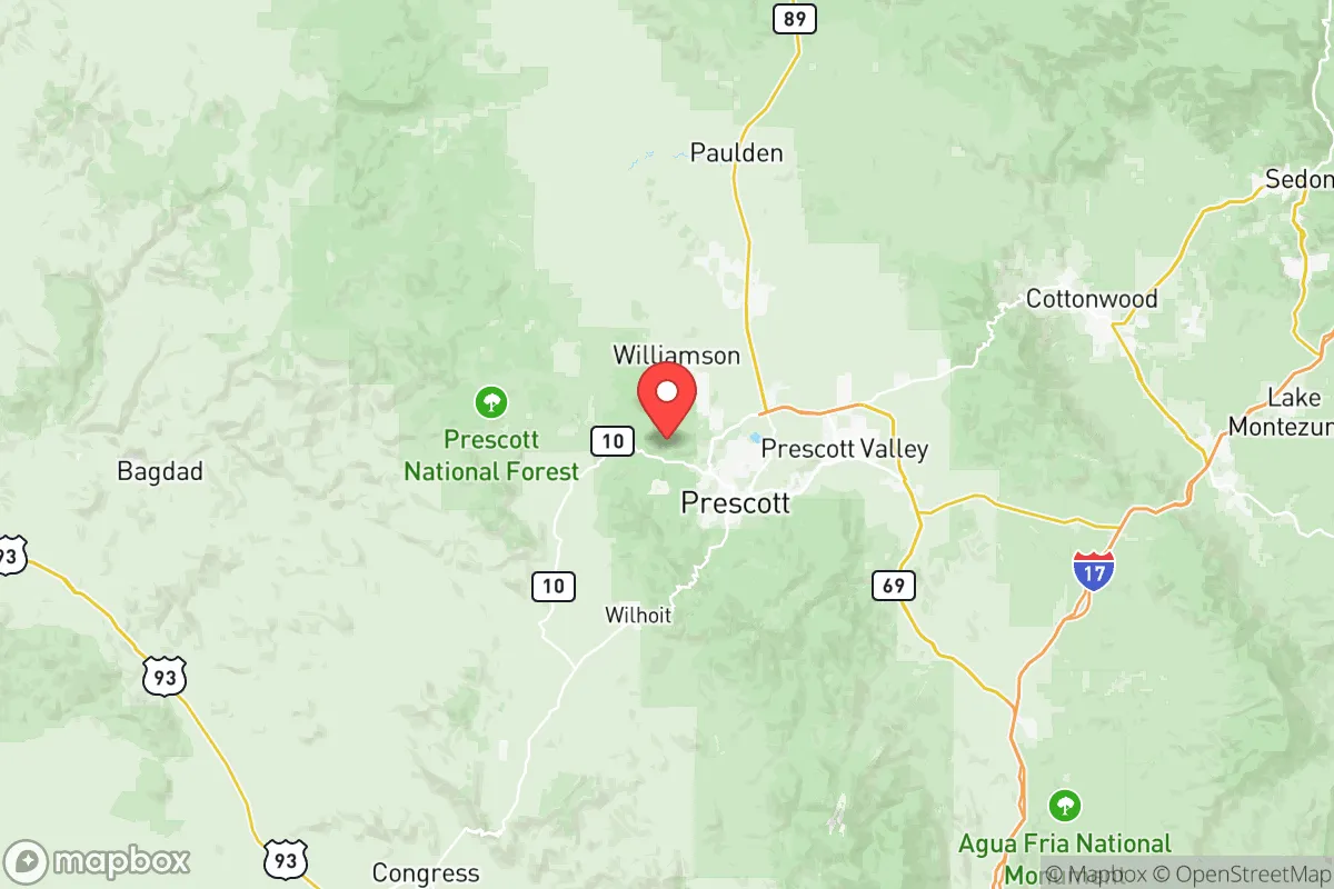
Yavapai County sits at a strategic elevation advantage, with most population centers ranging from 3,500 to 6,500 feet above sea level. This altitude provides a natural climate buffer against the extreme heat waves that increasingly threaten lower-elevation Arizona communities like Phoenix and Yuma. The county's position along the Mogollon Rim creates a natural defensive barrier to the north and east, while the Bradshaw Mountains and Mingus Mountain range offer additional terrain-based security for interior communities. Prescott, the county seat, sits in a bowl valley surrounded by national forest land, providing both natural insulation and abundant timber resources. The area's location roughly 100 miles north of Phoenix places it outside the immediate blast and fallout zones of a major metropolitan target, while still being close enough for supply runs in stable times. The Verde River and its tributaries, including Granite Creek and Lynx Creek, provide surface water sources that are increasingly valuable in an arid region where groundwater depletion is a growing concern.
Risks, exposures, and proximity to fallout-relevant landmarks
While Yavapai County benefits from distance to primary targets, several risk factors require honest assessment. The county lies approximately 150 miles from Luke Air Force Base near Phoenix, a potential high-value target in a conflict scenario, though prevailing winds typically carry fallout eastward rather than northward. Davis-Monthan Air Force Base near Tucson is roughly 200 miles southeast, placing the county at the outer edge of secondary contamination zones. More immediate concerns include the county's own infrastructure vulnerabilities: the Prescott Regional Airport serves as a general aviation hub and could become a secondary target or congestion point during evacuation. The county's reliance on the Central Arizona Project canal system for a portion of its water supply creates a single-point-of-failure risk, as the canal runs through exposed desert terrain for hundreds of miles. Wildfire risk is the most immediate natural threat, with the 2021 Rafael Fire and 2022 Crooks Fire burning tens of thousands of acres within county boundaries. The county's mountainous terrain also creates flash flood risks in narrow canyons, particularly during monsoon season, which can isolate communities like Jerome and Bagdad for days at a time.
Practical resilience for a relocator: food, water, energy, and defensibility
Yavapai County's practical resilience profile is mixed but generally favorable for prepared relocators. Water access varies dramatically by location: Prescott and Prescott Valley have secured renewable water supplies through the Prescott Active Management Area, but rural properties often rely on wells that can run 300 to 800 feet deep, with drilling costs ranging from $15,000 to $30,000. The Verde River watershed provides reliable surface water for properties with water rights, though legal access is increasingly contested. Agricultural potential is limited by elevation and growing season—most of the county sits in USDA hardiness zones 7a to 8a, supporting cool-season crops and some stone fruits, but not the year-round growing possible in lower elevations. The county's energy infrastructure is relatively robust, with APS (Arizona Public Service) maintaining a modernized grid that has performed well during recent wildfire seasons, though rural areas experience more frequent outages. Solar potential is excellent, with the county averaging 280+ sunny days per year, making off-grid photovoltaic systems highly viable for prepared households. Defensibility is a strong point: the county's dispersed population centers—Prescott Valley, Chino Valley, Dewey-Humboldt, and Cottonwood—are separated by open terrain and forest, making area denial more practical than in suburban sprawl environments. The strong local gun culture and established sheriff's office presence, including Sheriff David Rhodes' community-oriented approach, contribute to a security environment that many relocators find reassuring. Local food production is growing, with the Prescott Farmers Market operating year-round and the county's agricultural extension service offering active support for small-scale farming and livestock operations.
The overall strategic picture for Yavapai County is one of calculated advantage with acknowledged trade-offs. For a relocator serious about disaster readiness and self-sufficiency, the county offers a rare combination of defensible terrain, established community infrastructure, and genuine distance from primary target zones—all within a cultural environment that values preparedness and mutual aid. The trade-offs are real: wildfire risk requires active mitigation, water access demands careful due diligence, and the county's popularity means land prices have risen significantly since 2020, with improved lots near Prescott now commanding $100,000 to $300,000. However, for those willing to invest in proper site selection—prioritizing properties with documented water rights, defensible space, and access to multiple evacuation routes—Yavapai County represents one of the more balanced resilience options in the Intermountain West. The county's combination of natural resources, community capability, and strategic positioning makes it a serious contender for anyone building a long-term security strategy in an uncertain future.

* Values derived from national, state, county, city and local statistics and may differ in a specific area. Last updated: 2026-06-21T00:18:44.000Z
Narrative content on this page is AI-generated and may contain mistakes. Verify any details that matter before acting on them.
ReloMaps may earn a commission from affiliate links at no extra cost to you.

